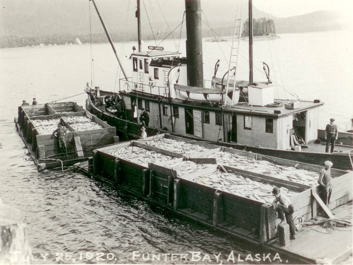
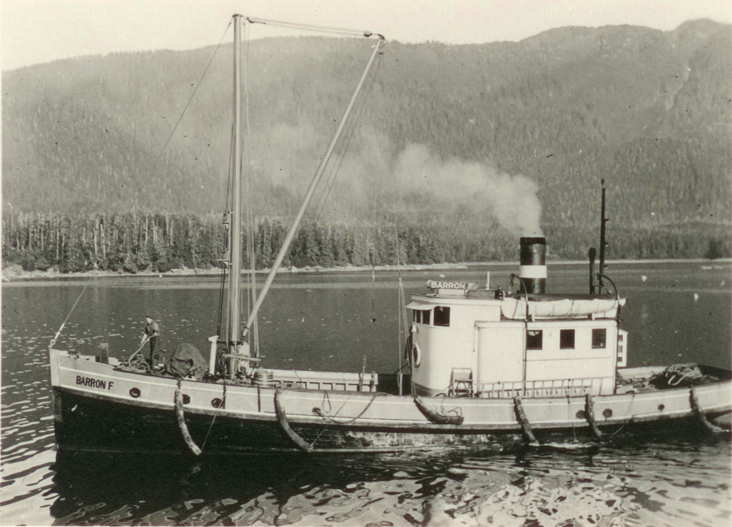
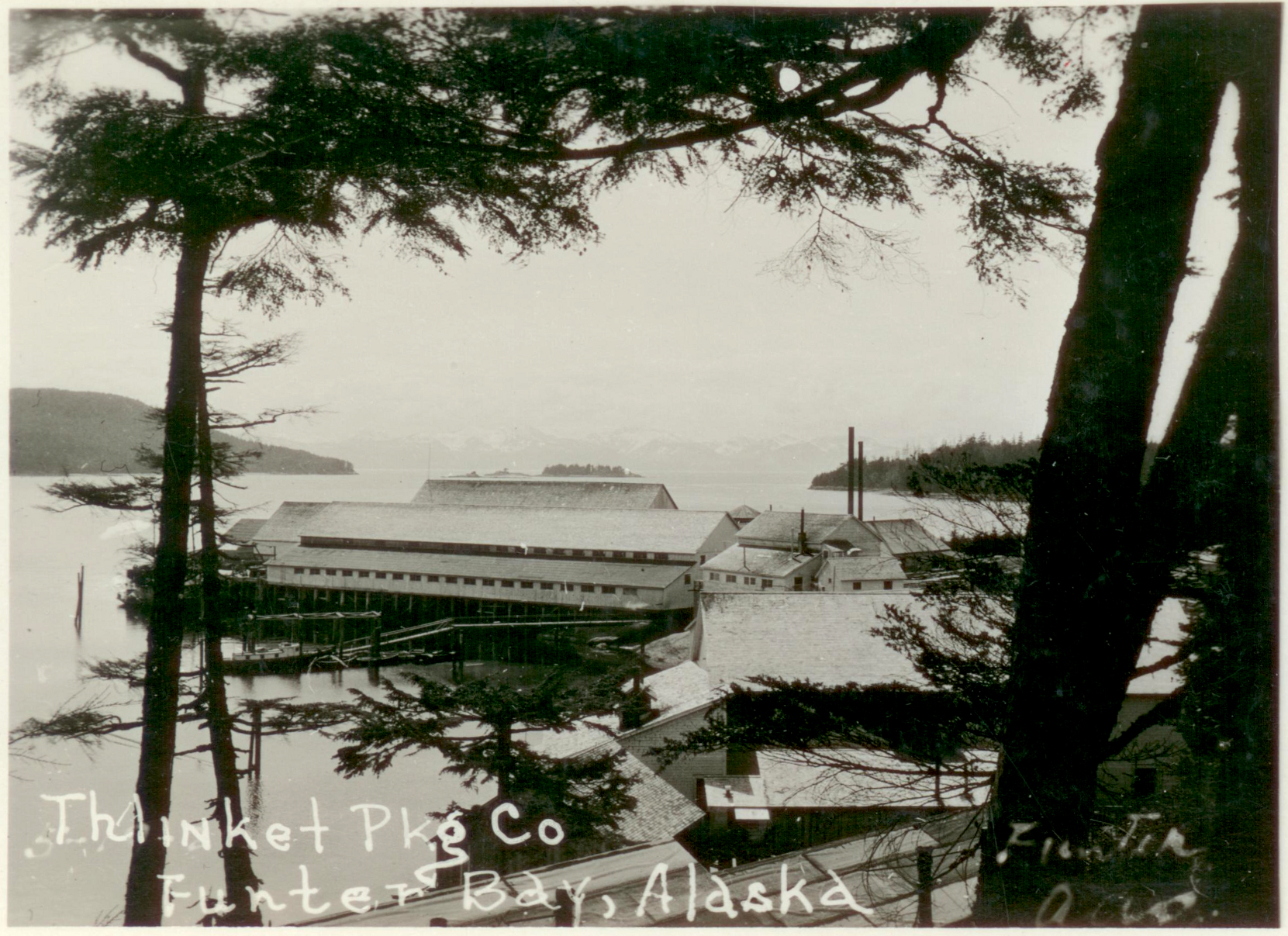
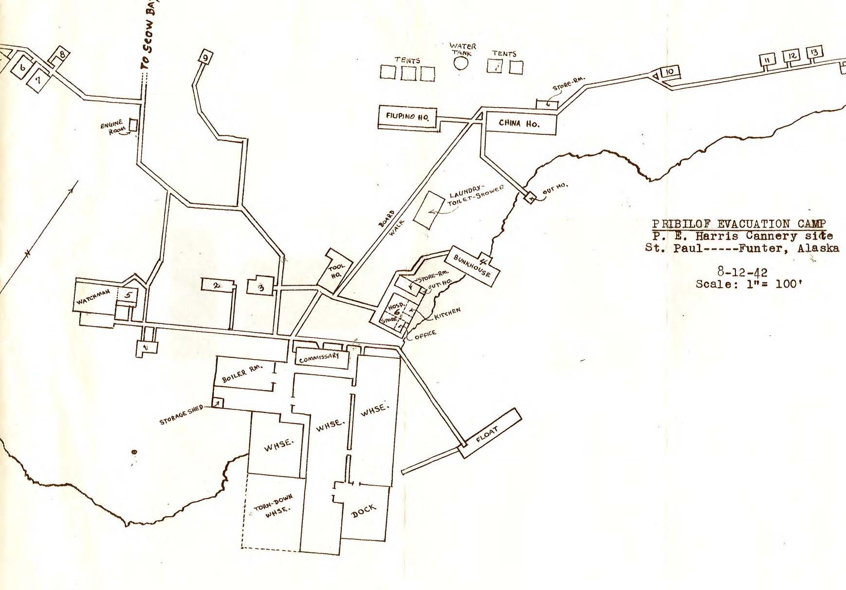
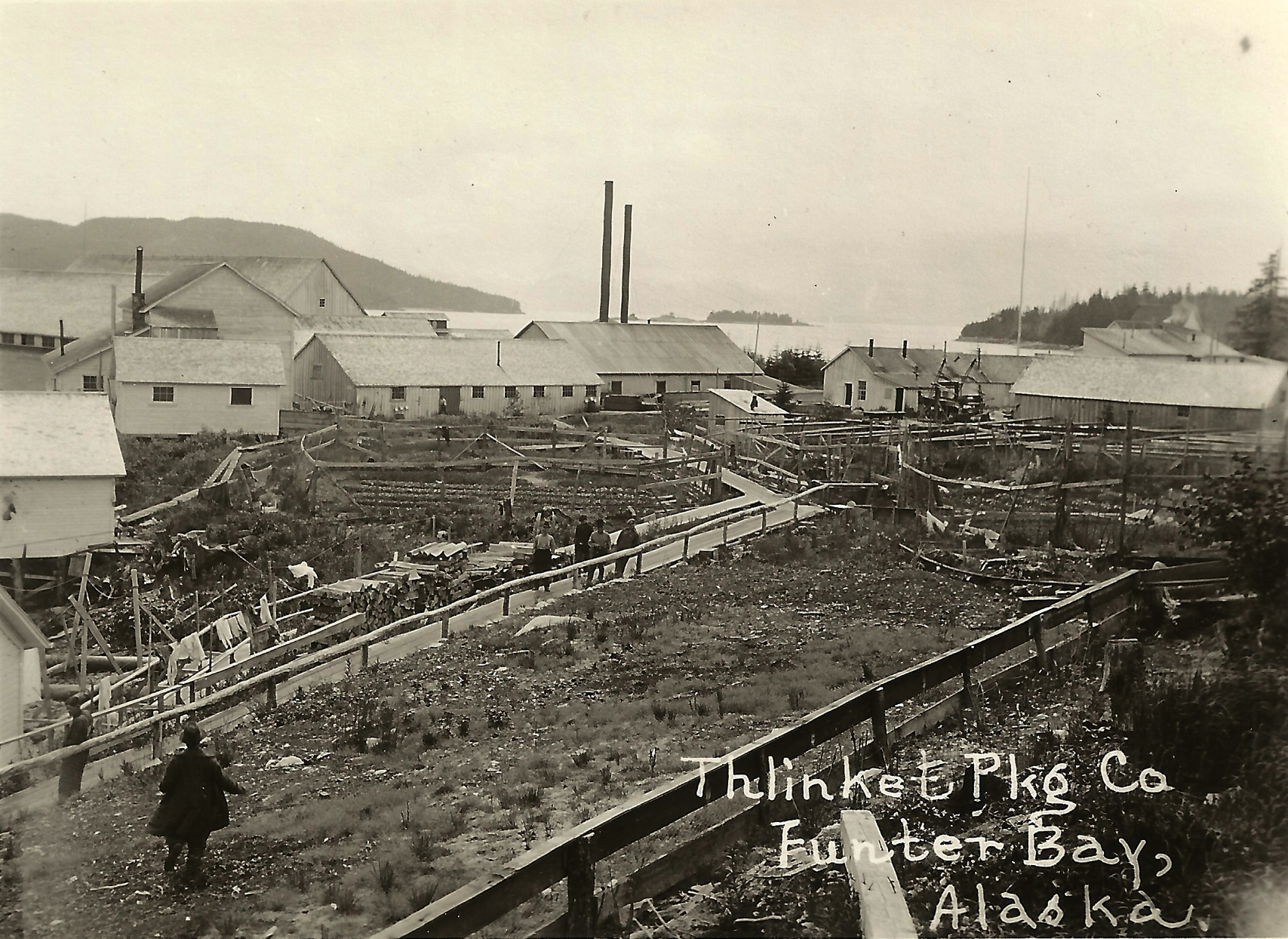
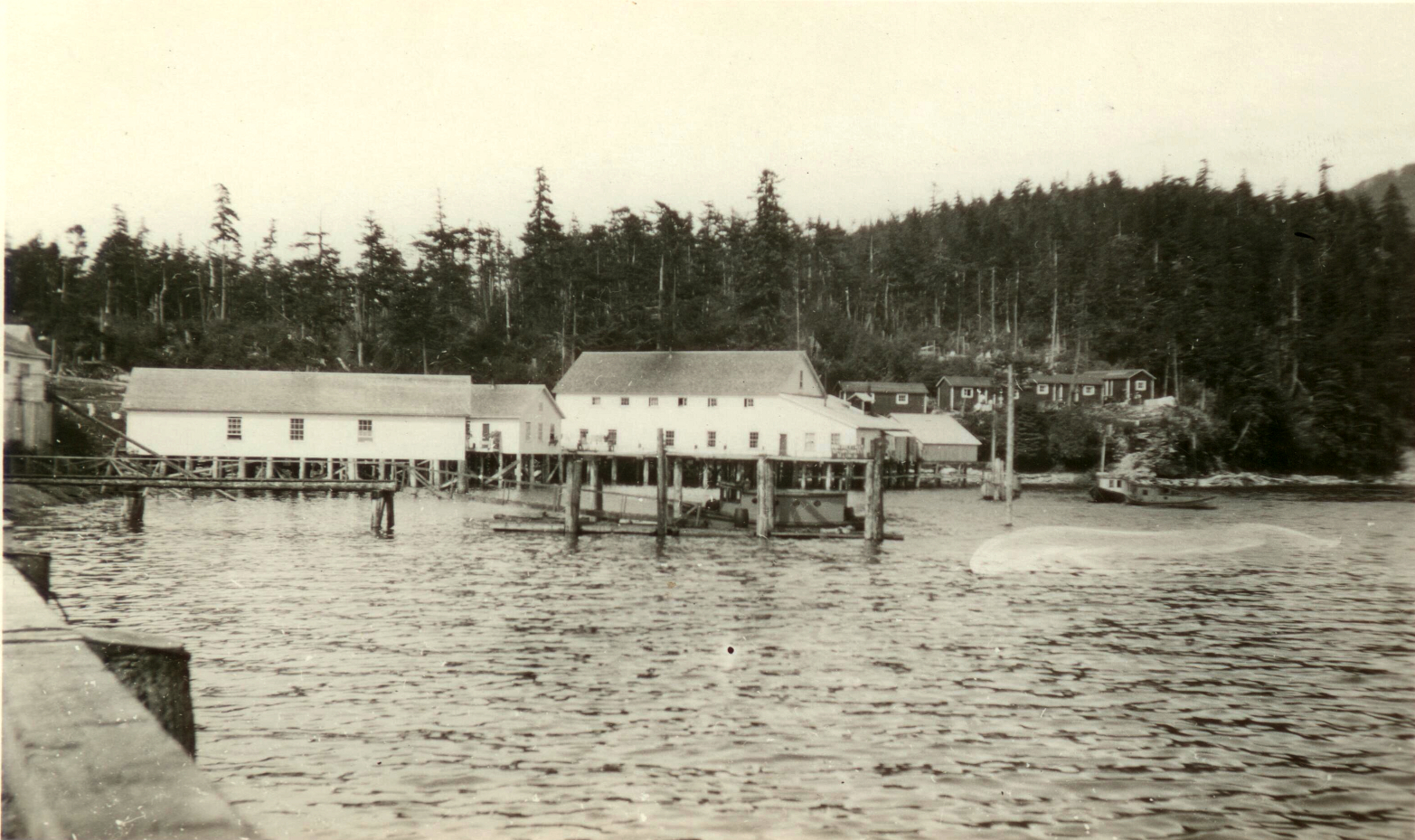
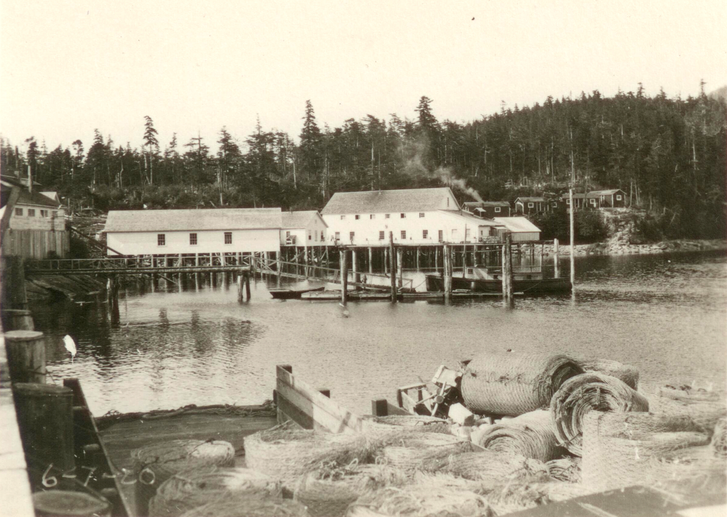
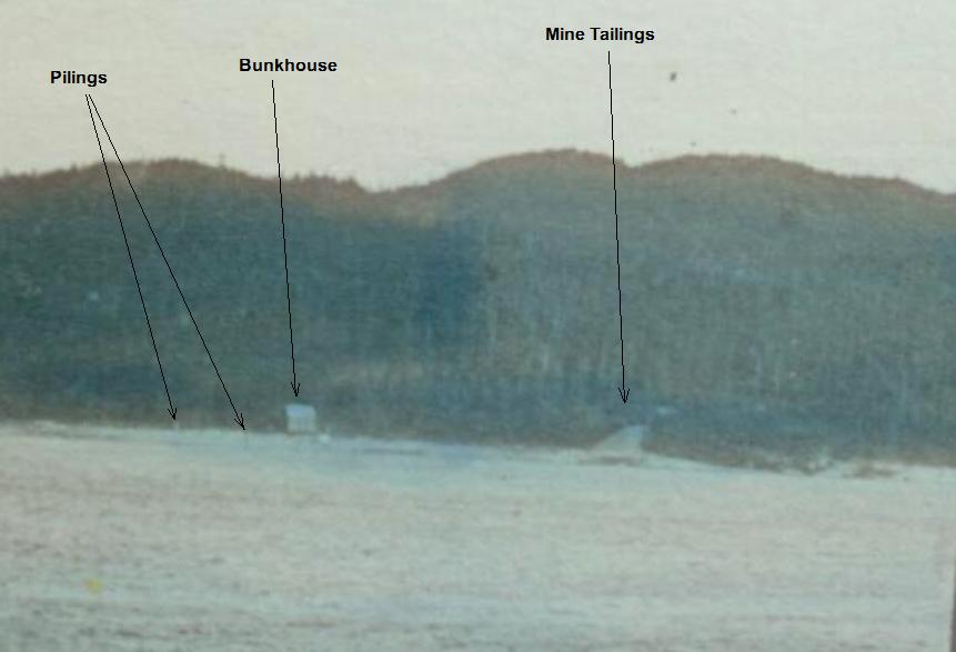
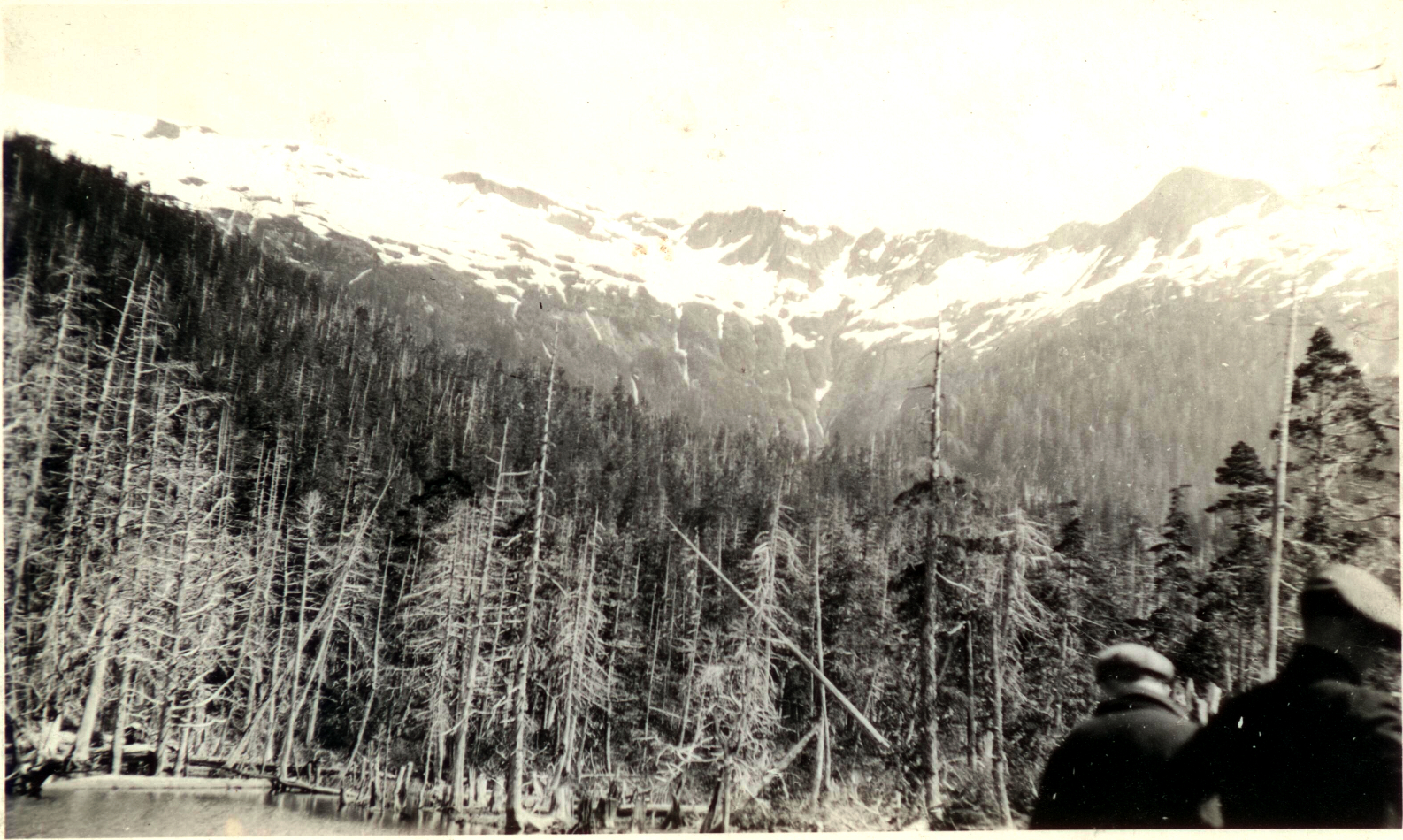
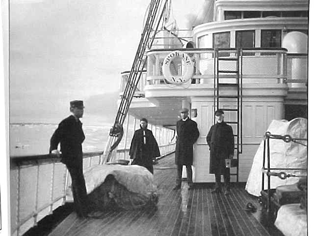
I previously discussed the Aleut Internment of WWII, in which many Native Alaskans were relocated to Funter Bay to “protect” them from the Japanese invasion of the Aleutian islands. Evacuees were shuffled out of the combat theater for the military’s convenience, and left in hastily-organized camps at disused cannery and mine sites. Conditions at the internment camps were poor, with unreliable water, heat, and medical care. Approximately 30-40 people died in the two Funter Bay camps, with more deaths at Juneau hospitals. The Funter Bay cemetery holds approximately 23 recognizable grave sites, although the list below indicates 35 burials there.
This list is from a 1980 report by the Commission on Wartime Relocation and Internment of Civilians, in hearings before the Subcommittee on Administrative Law Relations, regarding establishment of said commission and payment to victims of forcible relocation by the government.


The full text is available via the Library of Congress here, in scanned and OCR’d form. I have copied the OCR version below. Obvious scanning and text recognition errors have been cleaned up, but there may be a few errors remaining. Full lists of evacuees transported on the Delarof to Funter Bay (the St. Paul and St. George Island lists) are at the bottom of this page.
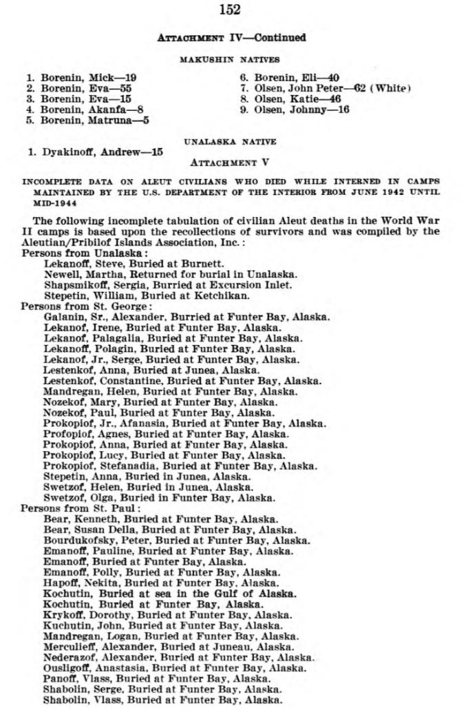
ATTACHMENT V INCOMPLETE DATA ON ALEUT CIVILIANS WHO DIED WHILE INTERNED IN CAMPS MAINTAINED RY THE U.S. DEPARTMENT OF THE INTERIOR FROM JUNE 1942 UNTIL MID-1944
The following incomplete tabulation of civilian Aleut deaths in the World War II camps is based upon the recollections of survivors and was compiled by the Aleutian/Pribilof Islands Association, Inc.:
Persons from St. George:
Galanin, Sr., Alexander. Buried at Funter Bay, Alaska.
Lekanof, Irene, Buried at Funter Bay, Alaska.
Lekanof, Palagalia, Buried at Funter Bay, Alaska.
Lekanoff, Polagin, Buried at Funter Bay, Alaska.
Lekanof, Jr., Serge, Buried at Funter Bay, Alaska.
Lestenkof, Constantine, Buried at Funter Bay, Alaska.
Mandregan, Helen, Buried at Funter Bay, Alaska.
Nozekof, Mary, Buried at Funter Bay, Alaska.
Nozekof, Paul, Buried at Funter Bay, Alaska.
Prokopiof, Jr., Afanasia, Buried at Funter Bay, Alaska.
Profopiof, Agnes, Buried at Funter Bay, Alaska.
Prokopiof, Anna, Buried at Funter Bay, Alaska.
Prokopiof, Lucy, Buried at Funter Bay, Alaska.
Prokopiof, Stefanadia, Buried at Funter Bay, Alaska.
Swetzof, Olga, Buried in Funter Bay, Alaska.
Persons from St. Paul:
Bear, Kenneth, Buried at Funter Bay, Alaska.
Bear, Susan Delia, Buried at Funter Bay, Alaska.
Bourdukofsky, Peter, Buried at Funter Bay, Alaska.
Emanoff, Pauline, Buried at Funter Bay, Alaska.
Emanoff, Buried at Funter Bay, Alaska.
Emanoff, Polly, Buried at Funter Bay, Alaska.
Hapoff, N’ekita, Buried at Funter Bay. Alaska.
Kochutin, Buried at Funter Bay, Alaska.
Krykoff, Dorothy, Buried at Funter Bay, Alaska.
Kuchutin, John, Buried at Funter Bay, Alaska.
Mandregan, Logan, Buried at Funter Bay, Alaska.
Nederazof, Alexander, Buried at Funter Bay, Alaska.
Ousligoff, Anastasia, Buried at Funter Bay, Alaska.
Panoff. Vlass, Buried at Funter Bay, Alaska.
Shabolin, Serge, Buried at Funter Bay, Alaska.
Shabolin, Vlass, Buried at Funter Bay, Alaska.
Stepetin, Dorafey, Burled at Funter Bay, Alaska.
Swetzof, Helena, Burled at Funter Bay, Alaska.
Swetzoff, Julia, Burled at Funter Bay, Alaska.
Tetof, Doria, Buried at Funter Bay, Alaska.
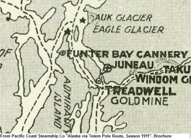
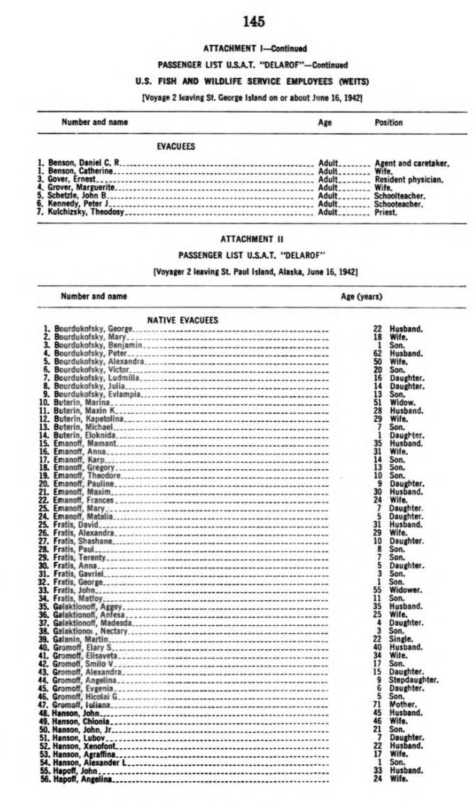
Below are some of the passenger lists from the USAT Delarof. Most “Native Evacuees” from St. Paul and St. George islands (about 477 people) were left at Funter Bay. Other communities were taken to Ward Lake, Burnett Inlet, Wrangell, and Killisnoo. Non-native or white government employees from the islands were given passage out of state, although a few stayed to help organize the internment camps.

Passenger List USAT Delarof, Native Evacuees from St George Island to Funter Bay, Alaska. June 16, 1942.

Passenger List USAT Delarof, Native Evacuees from St George Island to Funter Bay, Alaska. June 16, 1942.

Passenger List USAT Delarof, Native Evacuees from St George Island to Funter Bay, Alaska. June 16, 1942.

Passenger List USAT Delarof, Native Evacuees from St Paul Island and Government Employees to Funter Bay, Alaska. June 16, 1942.

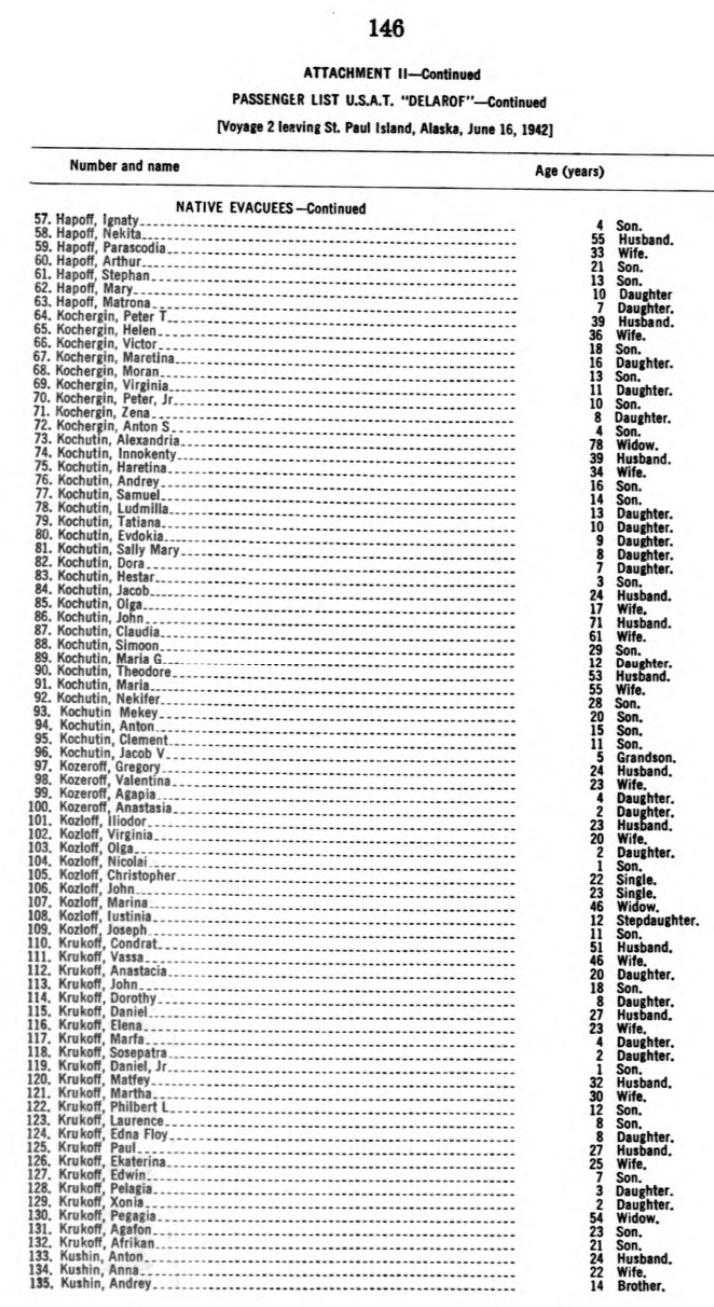
Passenger List USAT Delarof, Native Evacuees from St Paul Island to Funter Bay, Alaska. June 16, 1942.

Passenger List USAT Delarof, Native Evacuees from St Paul Island to Funter Bay, Alaska. June 16, 1942.

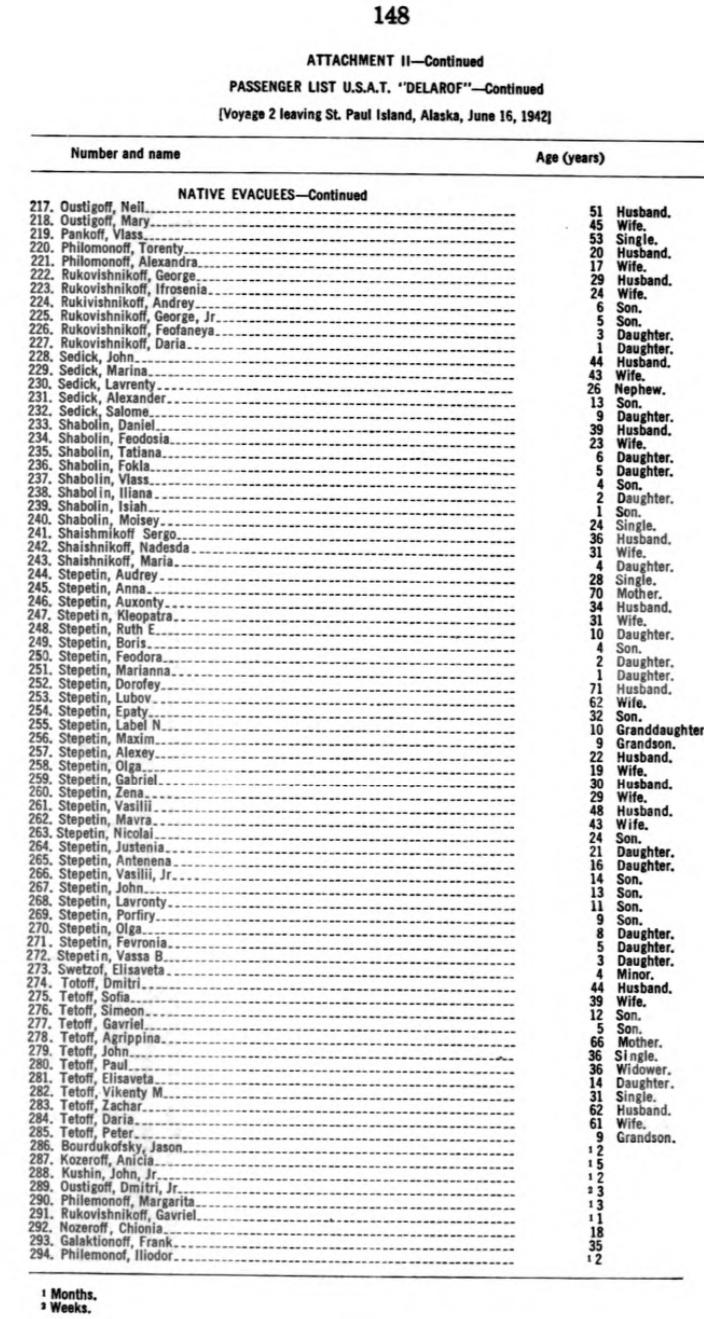
Passenger List USAT Delarof, Native Evacuees from St Paul Island to Funter Bay, Alaska. June 16, 1942.

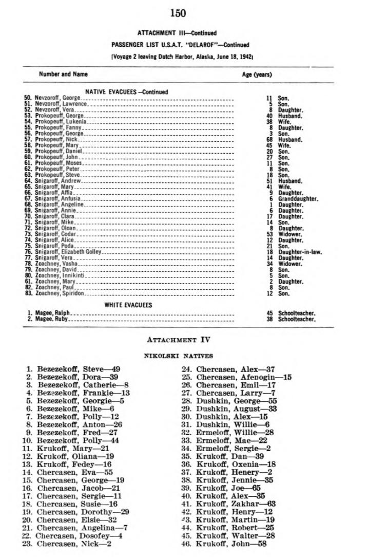
Passenger List USAT Delarof, Native Evacuees from Dutch Harbor and Government Employees from St Paul Island, Alaska. June 16, 1942.

Passenger List USAT Delarof, Native Evacuees from Dutch Harbor and Nikolski, Alaska. June 16, 1942.
Further information is also available at:
Aleut Story. Video DVD with online bibliography of source material.
Evacuation and Internment, 1942-1945. National Park Service page and archeological report by Charles Mobley.
Agony of the Aleutians: The forgotten internment. A recent (November 2014) article.
The Aleut Internments of WWII. Another recent (2014) print book.


 Posted by saveitforparts


