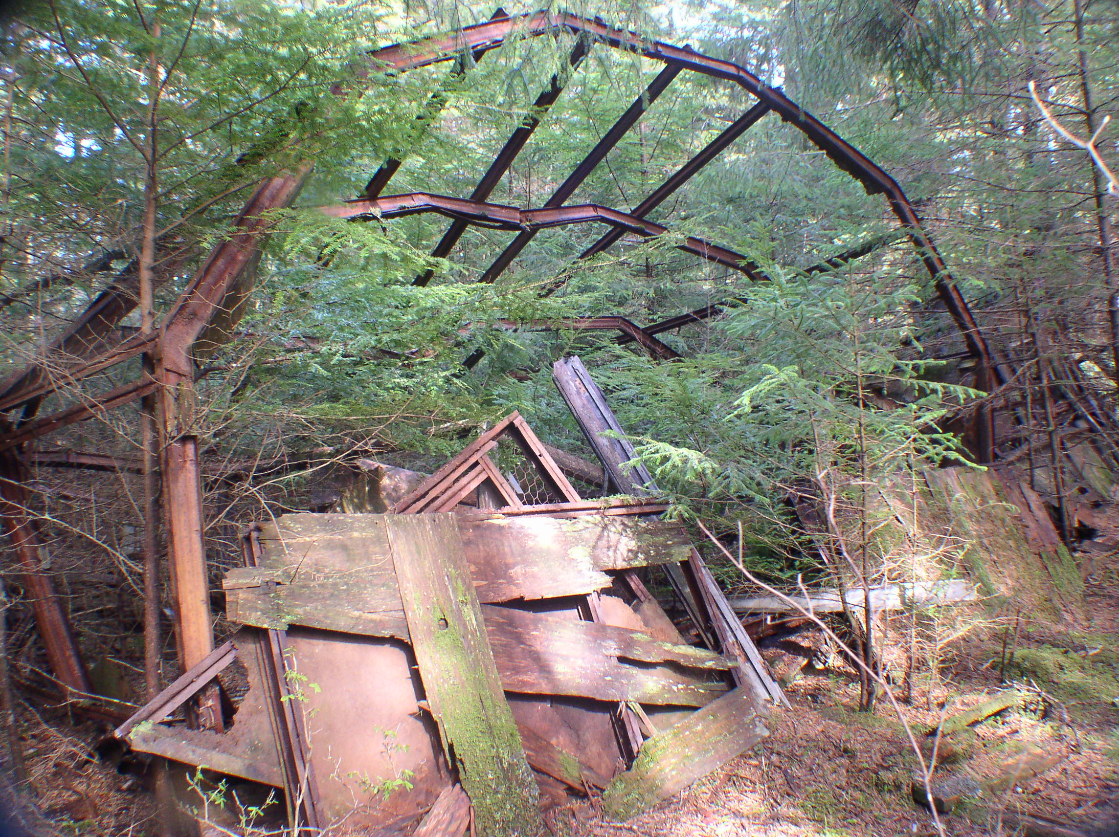
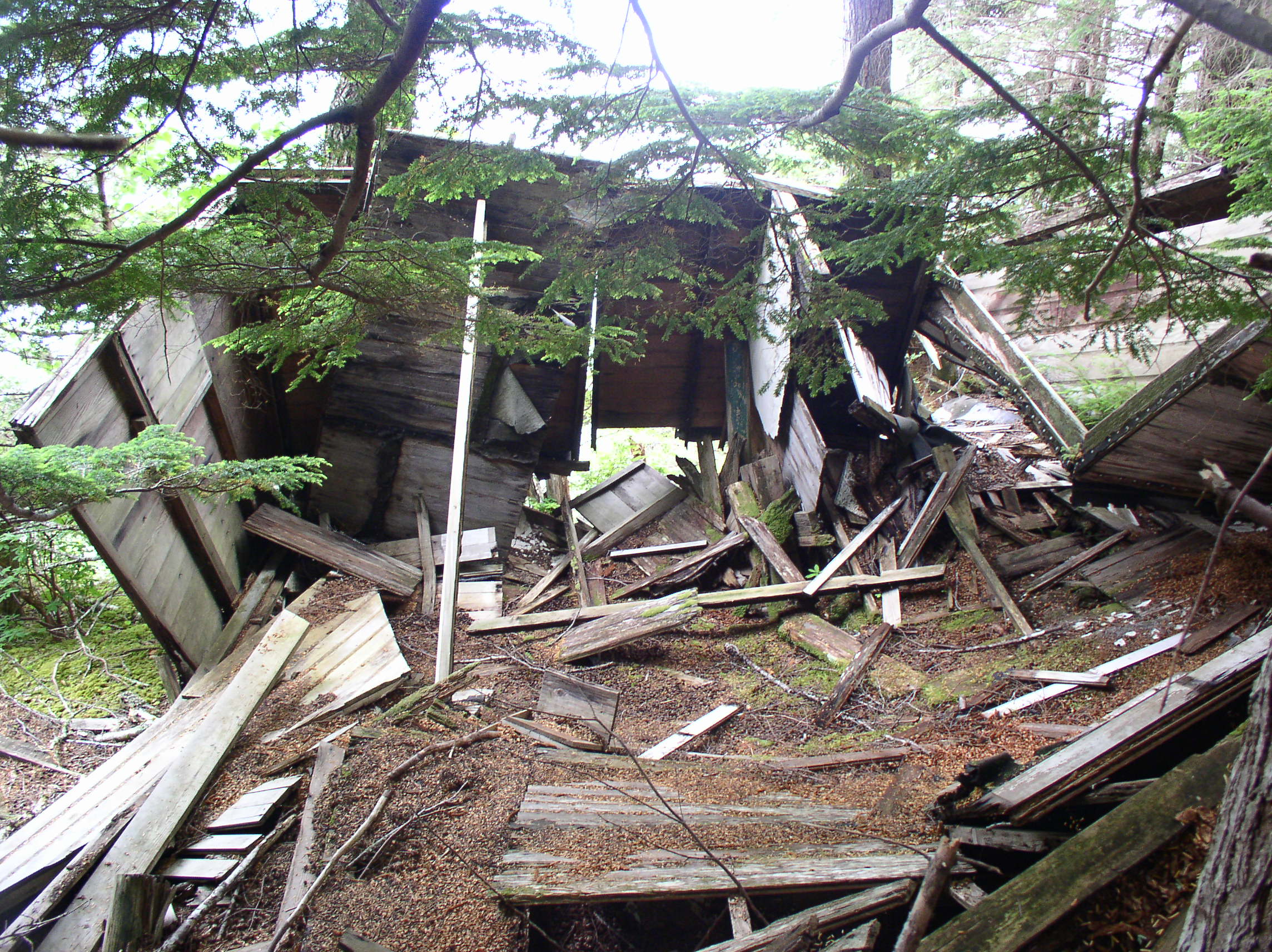
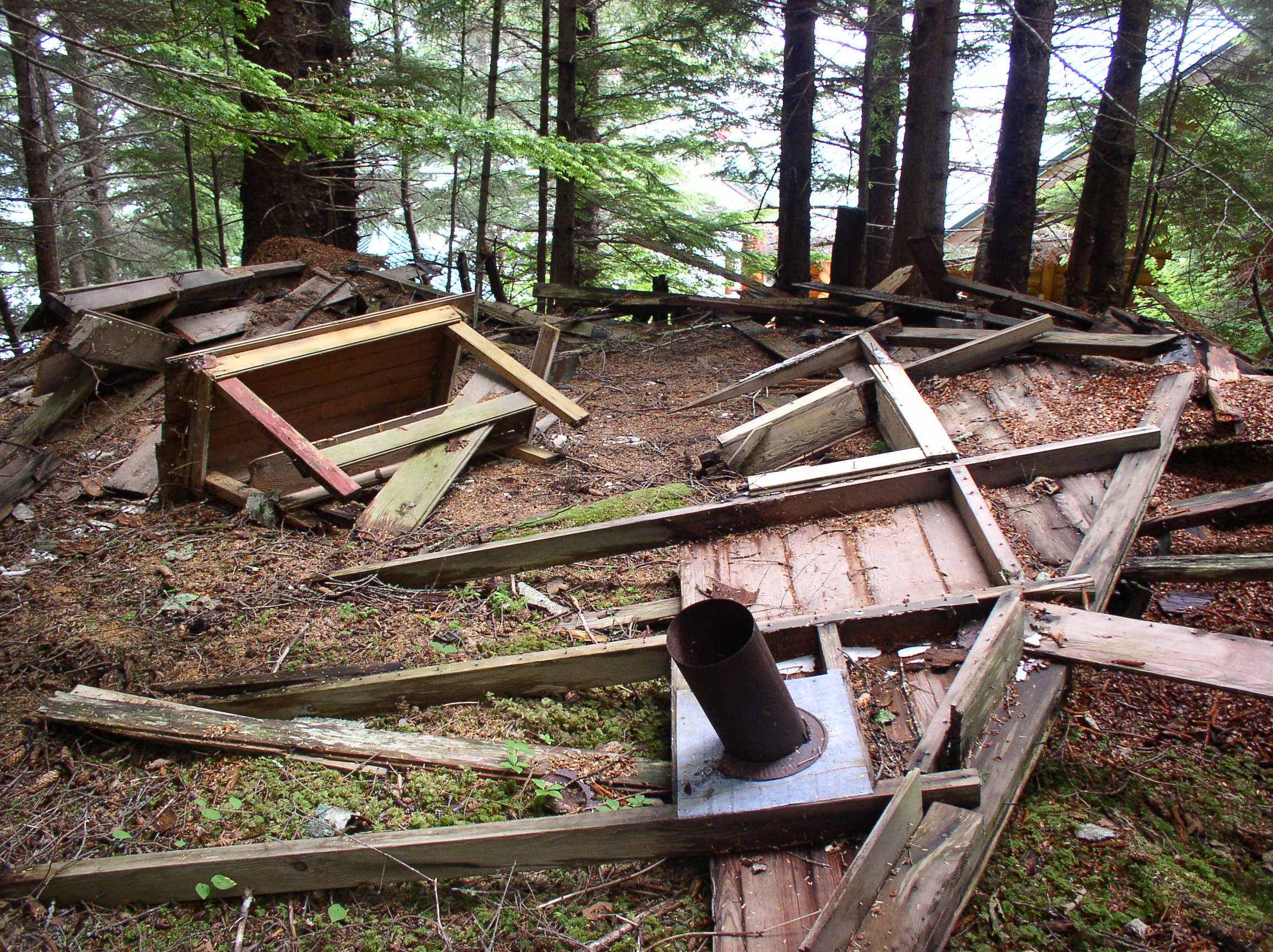
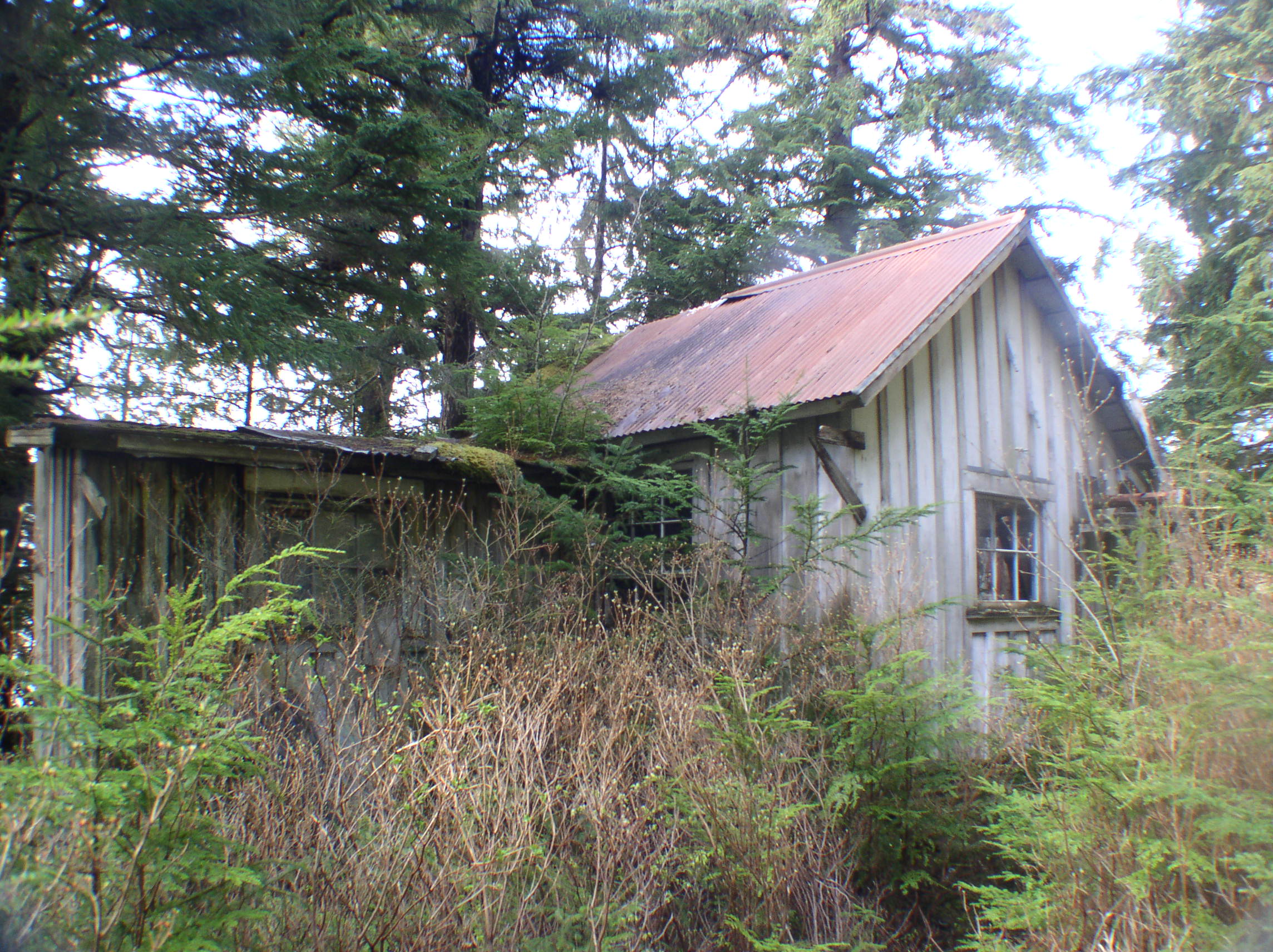
Funter Bay History – More Fish Traps & Fish Pirates

May 8, 2013

This began as a dry discussion of trap types, and ended up with gun fights, legal battles, piracy, and everything else that goes with Alaskan fishing!

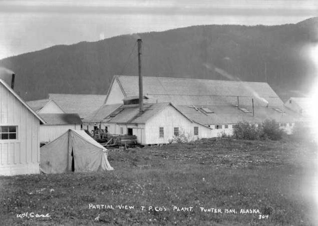
As mentioned before, the Funter Bay cannery operated mainly with fish traps (vs fishing boats). These traps were designed to intercept salmon as they returned to spawning streams, penning them in large fixed nets until they could be scooped out.

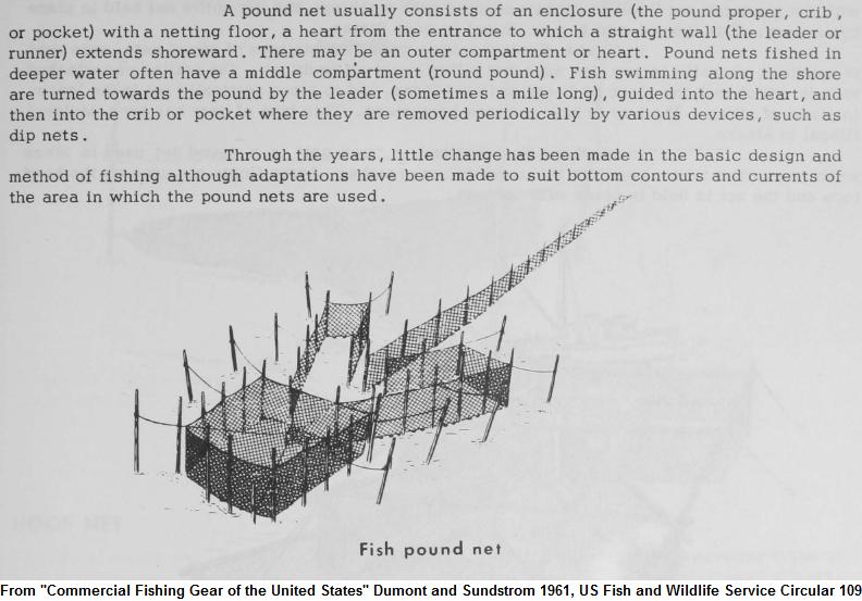
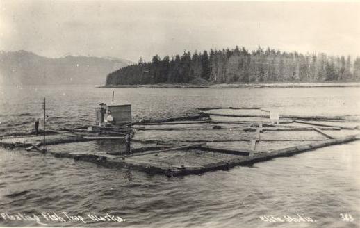
There were two types of fish trap used in the Funter Bay area. “Pound Nets” hung from fixed pilings driven into the sea bottom. Many of these pilings had to be replaced each season, as the winter storms would knock them loose. “Floating Traps” had nets hung from a latticework of floating logs, and were used in deeper water or locations with rocky bottoms. These traps were towed into protected coves for winter storage. Both types of trap would be located a few hundred feet offshore, with a “leader” strung towards the beach (and sometimes a “Jigger” extending seaward) to intercept passing salmon. This page has some more explanation and diagrams.

Pound Net:
pound trap

Floating Trap:
floating trap

These images show one of the Thlinket Packing Co’s pound-type traps near Funter Bay (Trap #7):

Trap 7 trap 7-2

My first post on Funter Bay History shows Trap #6 at the Kittens (islands), also of the pound type.

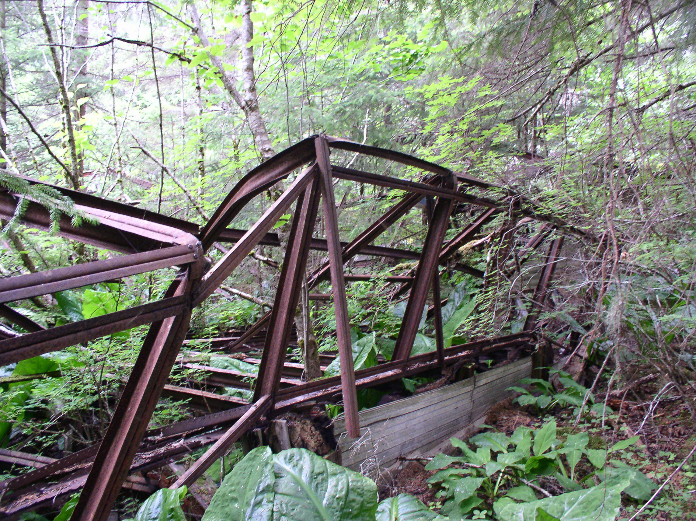
Here is an example of a floating trap. The structure on top is the watchman’s shack:floating trap 2

As mentioned, watchmen on the traps were an attempt to prevent trap robbing or “Fish Piracy” at remote traps, which was quite common. Independent fishermen hated traps, which they (correctly) felt were taking too many salmon. Many fishermen felt that fish in a trap were fair game, and that trap robbing did not “cost” anything to the trap owner. In fact, the pirates would often sell the stolen fish to the same company that owned the traps! The problem became so bad that the governor of Alaska dispatched surplus navy boats to combat pirates, and the Thlinket Packing Co hired WWI veterans to serve as armed guards.

pirates2

In July of 1919, the Weathers brothers, Al and Ike, along with Ernest Stage, were charged with assault and attempted robbery in a fish piracy case. The trio were accused of using the gas boat Diana to attack Hoonah Packing co’s tender Forrester near Funter Bay. Captain Alfred Knutson testified that his boat came under fire by the trio. Thlinket Packing Co trap watchman Ted Likeness was a witness. Earnest Stage was initially arrested for stealing $10 worth of fish from Funter Bay. Al Weathers was found guilty and given 4 years in jail, with the jury recommending clemency due to his young age.

pirates3

Info on the USS Marblehead.

Photo of a WWI sub chaser in Alaska.

Fish piracy was reduced by 1925 after several canning companies joined together to patrol the area.

“Fish piracy, or the robbery of fish traps, which in previous seasons was bitterly complained of by salmon canners in southeastern Alaska, was reduced to a minimum during the season of 1925. This was accomplished chiefly through the maintenance of a patrol organized by the larger canners and operated under the supervision of deputy United States marshals. A number of cruising boats were engaged in this patrol and covered waters in the vicinity of Icy Strait, Niblack, Street Island, Behm Canal, Kanagunut, Rose Inlet, Dall Head, Hidden Inlet, Union Bay, and the west coast of Prince of Wales Island.” From Bureau of Fisheries report, 1926.

Some more information on fish piracy can be found here (restoring a patrol boat), here (the story of a miner turned pirate), and here (mentioning the piratical family history of Ketchikan’s mayor).

In addition to battling pirates, salmon packing companies were also fiercely competitive with eachother, vying for the same salmon runs, the most desirable trap locations, and the best land for canneries. An extreme example of this was “trap jumping”, similar to the phenomenon of mine claim jumping where one prospector would steal the land or resources of another. More details shortly…

Pound net traps often had a watchman on shore, vs floating traps with their onboard housing. As I previously noted, the Thlinket Packing Co acquired land via the homestead act from which to base their traps (although the person filing for the homestead would usually not be the one living there!). I showed a survey of cannery owner J.T. Barron’s “homestead” in this post. Below is a survey of the “homestead” at a trap site south of Funter:
Robertson Homestead

This homestead (located at Lizard Head point just South of Funter) was fairly openly a front for cannery development, being transferred very quickly to T.P.Co owner James Barron. Barron had previously held a lease from the Alaska Packers Association for a trap they installed in 1908 at Lizard Head, and was moving to acquire the shore and upland to support this site.

“…On or about the first day of March, A. D. 1911, for value received, the said V. A. Robertson conveyed by good and sufficient deed in writing the above-described tract, lot or parcel of land embraced within said U. S. Nonmineral Survey No. 804 aforesaid to James T. Barron.”

However, before the Thlinket Packing Co could finish building their trap, Clarence J. Alexander, AKA “Claire Alexander” of the Tee Harbor Packing Co swooped in and installed his own, thus “corking off” Barron. He had previously worked on the pile-driving crew for the Alaska Packers Association, and knew exactly where the trap should go. Alexander even used some of the pilings that Barron had already driven! Barron sued, and some of the court documents are online (part 1 and part 2).

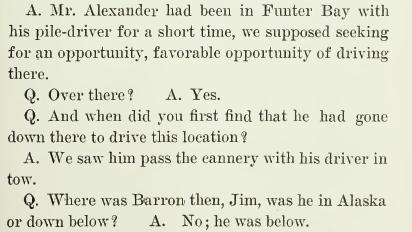
Perhaps Mr. Alexander’s “opportunity” was when Barron left the state?:
pile driver

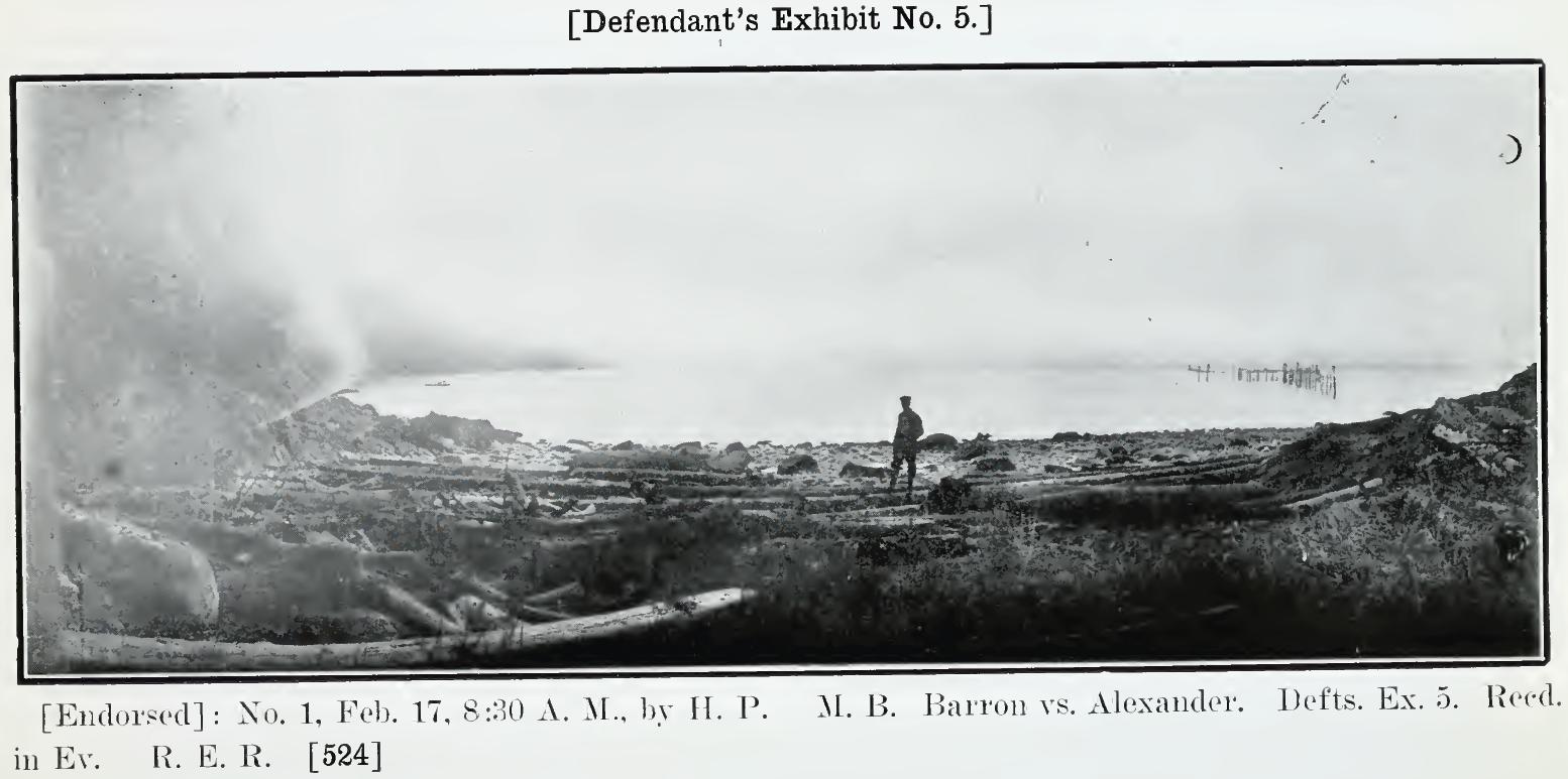
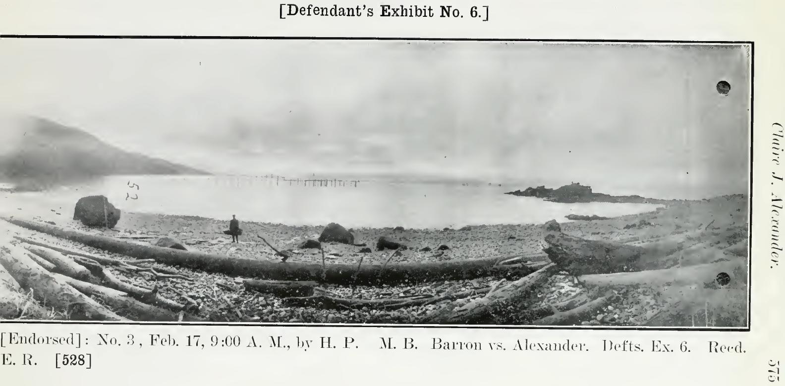
Claire Alexander’s fish trap shown in front of Barron’s Lizard Head property, from court documents:
Alexander's trap

Barron’s initial letter to Alexander:
Trap Jumping

In the court case, Barron testified not that he planned a trap (as indicated by his letter and other testimony), but that he wanted to use the site as a temporary mooring for boats. He mentioned that it was too hard to tow loaded scows to Funter Bay against a North wind. He complains that Alexander’s trap blocks his water access. Alexander claimed he had no knowledge of Barron’s so-called homestead and didn’t notice any development at the site (despite incorporating Barron’s pilings into his trap). The court found against Barron and ruled that Alexander’s trap did not block Barron’s access to his property.

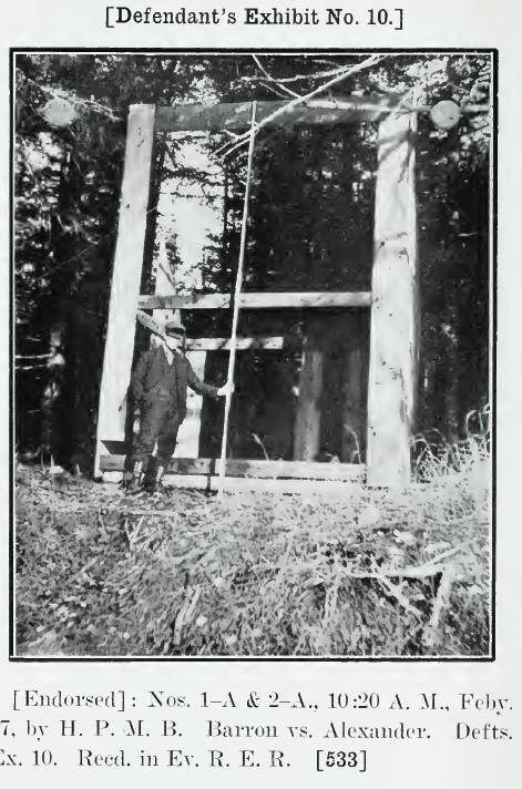
Some 1911 photos from the Lizard Head trap site, including the beginnings of the T.P. Co. watchman’s cabin:
Lizard Head 1911 1 Lizard Head 1911 2

Barron's cabin at Lizard Head 1911

Claire Alexander would go on to found the Hoonah Packing Co a few years later, and his trap at Lizard Head was still in place, in the same configuration, in 1948.

Laws regarding fish traps tended to fluctuate. Traps were originally fairly unregulated, and canneries would often place them directly in stream mouths, intercepting the entire spawning population until the “run” of salmon was destroyed. Later regulations placed limits on where traps could be located, when they could operate, how long the jiggers could be, etc. By the 1940s, the salmon population had declined so much that trap catches were fairly low, but the price of salmon had risen enough to keep traps cost-effective. When Alaska became a state in 1959, traps were outlawed entirely, leading to the closure of many canneries (other methods of fishing were not efficient enough for the size and type of these operations).

The Thlinket Packing Co (and later owners of the cannery) occasionally ran afoul of fish and game regulations.

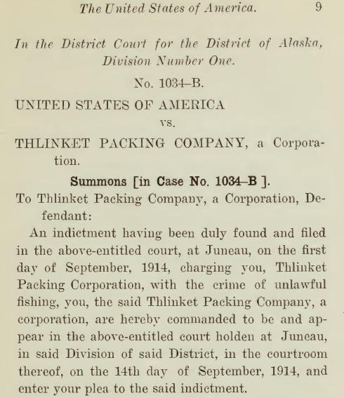
TP Co Unlawful Fishing Summons

TP Co Unlawful Fishing Count 1

“During the season of 1926, four salmon traps were seized in south-eastern Alaska for illegal fishing during the weekly closed period. … A trap of P. E. Harris & Co., near Hawk Inlet, and one of the Alaska Pacific Fisheries, near Funter Bay. were seized on July 11. On trial the watchmen were found not guilty, but the traps were still in the custody of the United States marshal at the end of the season.” Bureau of Fisheries report, 1927.

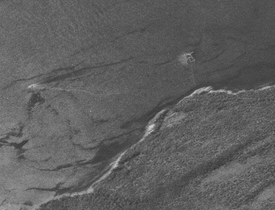
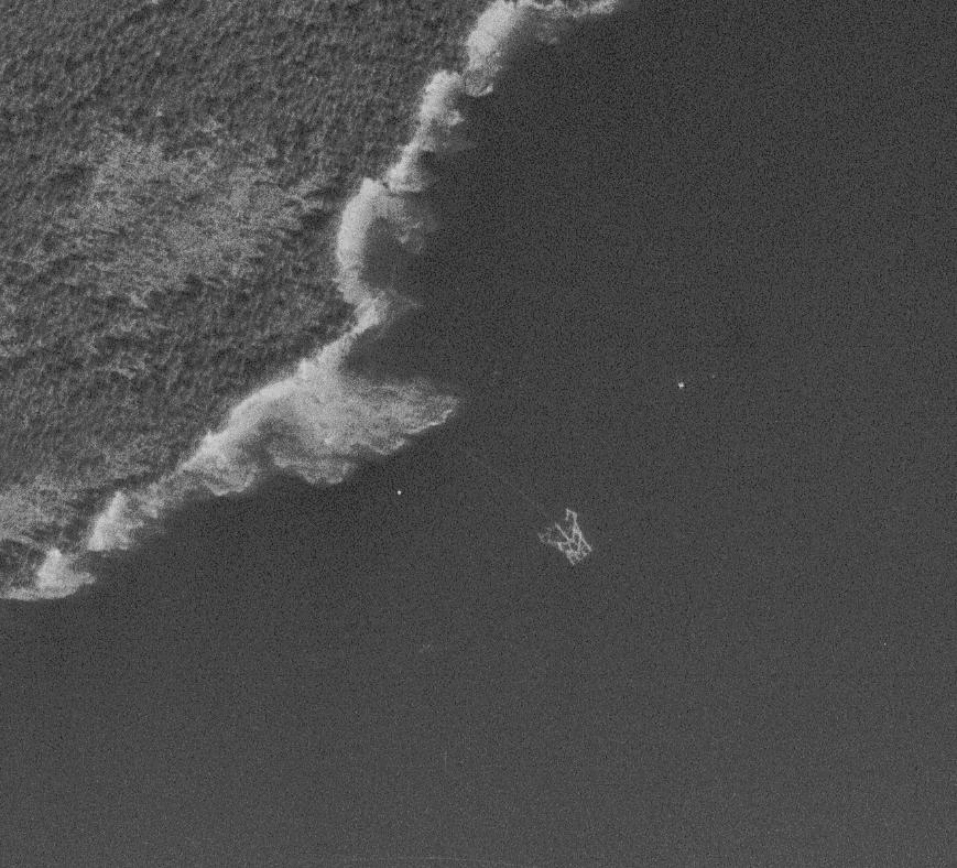
I came across a set of 1948 aerial photos of Funter Bay while looking for another map (from http://earthexplorer.usgs.gov/). The original is linked in my post on Funter Bay maps, below are a few excerpts showing fish traps around the bay in 1948.

A trap outside the south shore of Funter Bay (possibly pound net trap #7) Note the wake of the boat, possibly a cannery tender, leaving the trap:
trap aerial 1

C.J Alexander’s pound net style trap at Lizard Head in 1948, looking a little worse for wear. The trap has the same approximate layout as shown in the 1911 diagram (inset), but the line of pilings for the lead going to shore has vanished.
alexander 1948

A number of traps seem to have been abandoned by the Thlinket Packing Co at this point. There is no sign of Trap #6 at the Kittens in the 1948 aerials. Several of the floating-style traps are also sitting on the beach or drawn up in shallow coves where they would go dry at low tide. More traps are visible operating and in place along the shore between Funter and Hawk Inlet, but I’m not sure which companies were operating these.

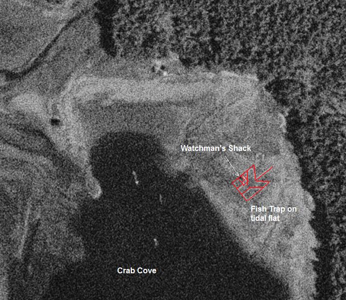
Fish trap on the beach in Crab Cove:
trap1

Crab Cove trap logs outlined to be more visible:
trap2

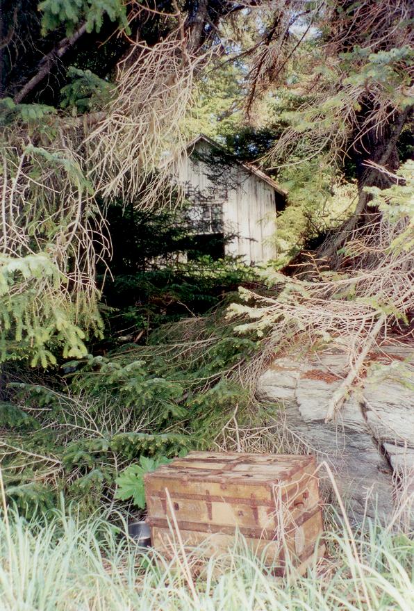
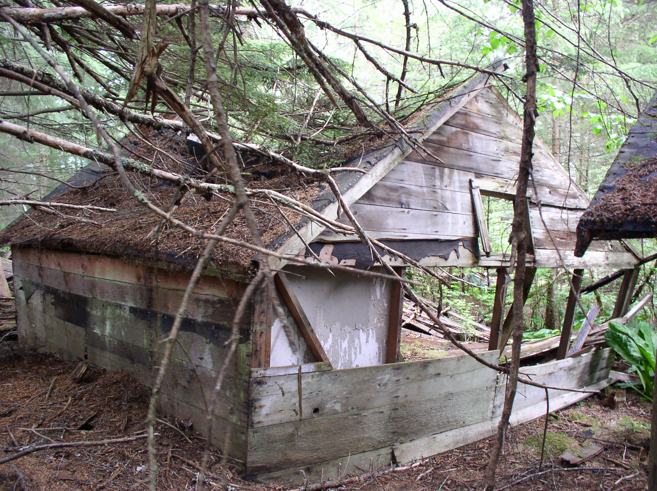
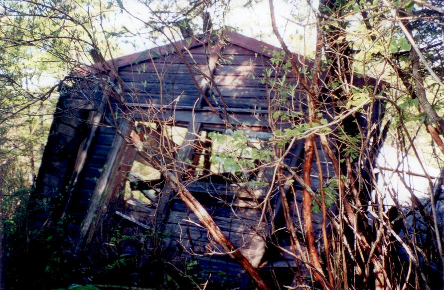
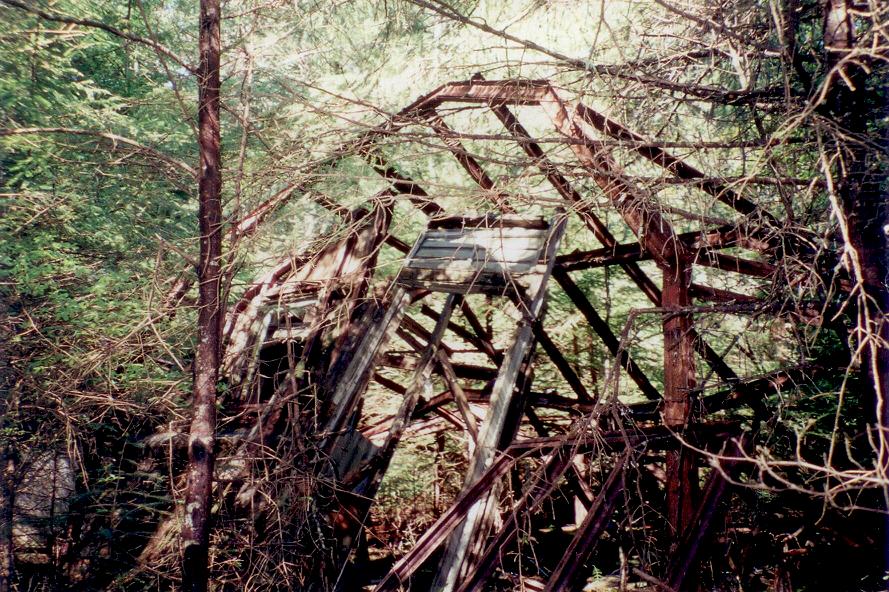
You can see the shadow of the watchman’s shack, this might have been the shack that became the entry of our house, as mentioned in an earlier post. Our neighbor Harvey Smith also had a few sheds that were the right size to be trap watchman’s shacks, I might detail those later on.

Floating trap in place along the Admiralty Island shore south of Funter Bay, with buoyed lead net going to shore:
floating trap 3

Down at the other end of the bay, we can see a jumble of pickup sticks on the estuary between Ottesen and Dano creeks, near the sandy beach. A few hints of the outline of a trap are visible, this might be one or more damaged or disintegrating traps:
trap aerial 2

Here is the cannery site and Scow Bay with the scows visible on slipways:
cannery aerial 1948

And finally, back to the present day: here’s a trap log washed up at the sandy beach, probably from one of the traps seen above. You can see various bolts and hardware that connected the trap logs together:
OLYMPUS DIGITAL CAMERA


Funter Bay History: Trails and Boardwalks

May 7, 2013

Before outboard motors, walking and rowing were the two main ways to get around Funter Bay. You got to choose between an upper body or lower body workout! I’ve already shown a few remaining rowboats (at the end of this page), so now I’ll talk about some of the walking trails around the bay (Translation: get ready to see a lot of brown and green, the official colors of the coastal rainforest!)

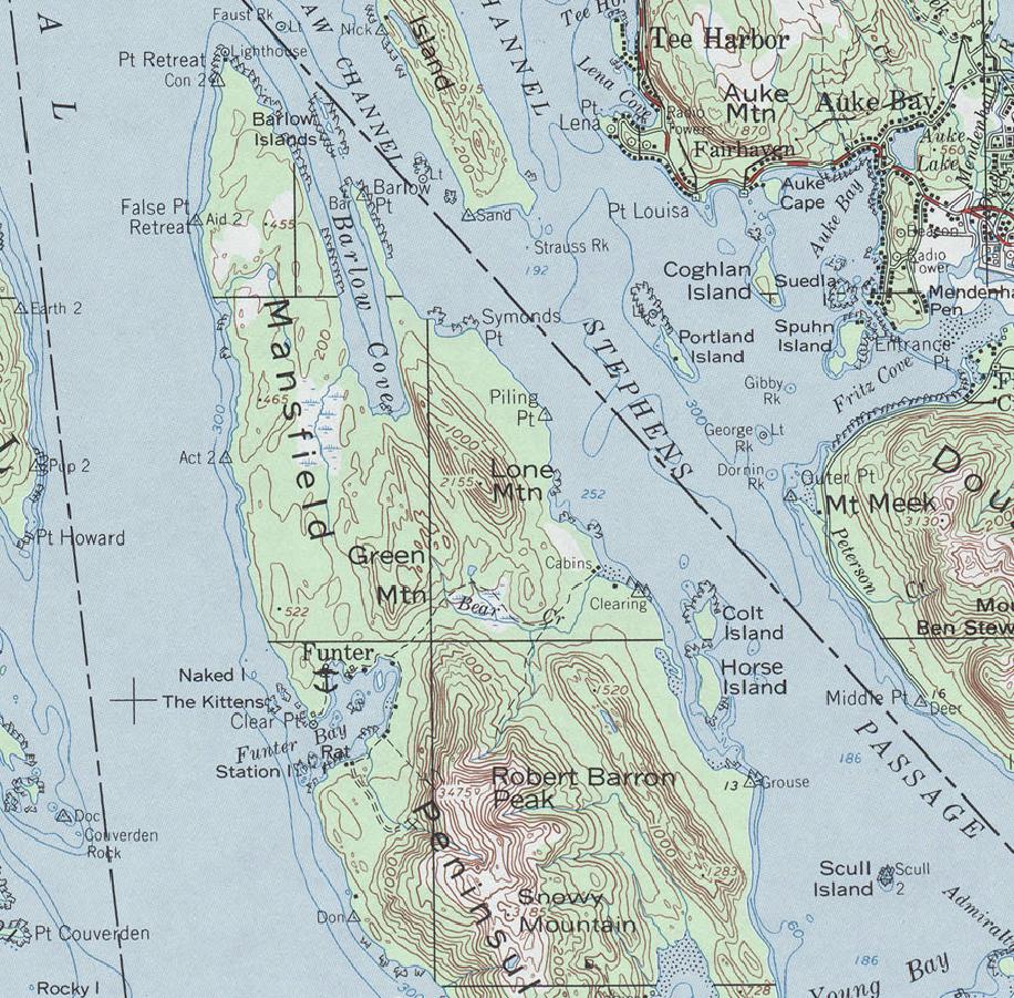
Maps of Funter Bay are a bit of an inside joke to locals. When we wanted to walk anywhere, we usually used the beach at anything but high tide. Mapping companies have long been perpetuating old historic trails and marking them as if they’re still maintained. Some online maps even go so far as to show some of these abandoned trails as roads. Occasionally some hapless tourist would show up looking for the Bear Creek trail, or a lost hunter would stumble out of the woods thinking he was on the Juneau side of Admiralty Island.

Trying to follow or even find any trail on this map is wishful thinking:

Topo

Funter Bay did have an extensive trail system in the early 20th century. A trail reached all the way around the bay, from Clear Point and the Keeler cabin at the North entrance to the sandy beach and the Dana Mine at the South shore. One would think that rowing a boat across the bay would be faster, but winter weather could be nasty, and walking was sometimes preferable. Trails were usually in the woods, near but not on the beach (beach walking is easy at low tide, but high tide eliminates much of the flat ground on the shore). Keeping trails marked and cleared was an ongoing battle against nature. If nature abhors a vacumm, then Southeast Alaska abhors open ground in the woods… opportunistic ground cover, fast-growing bushes, and 2nd-growth trees will rapidly colonize any clearing made by man or nature.

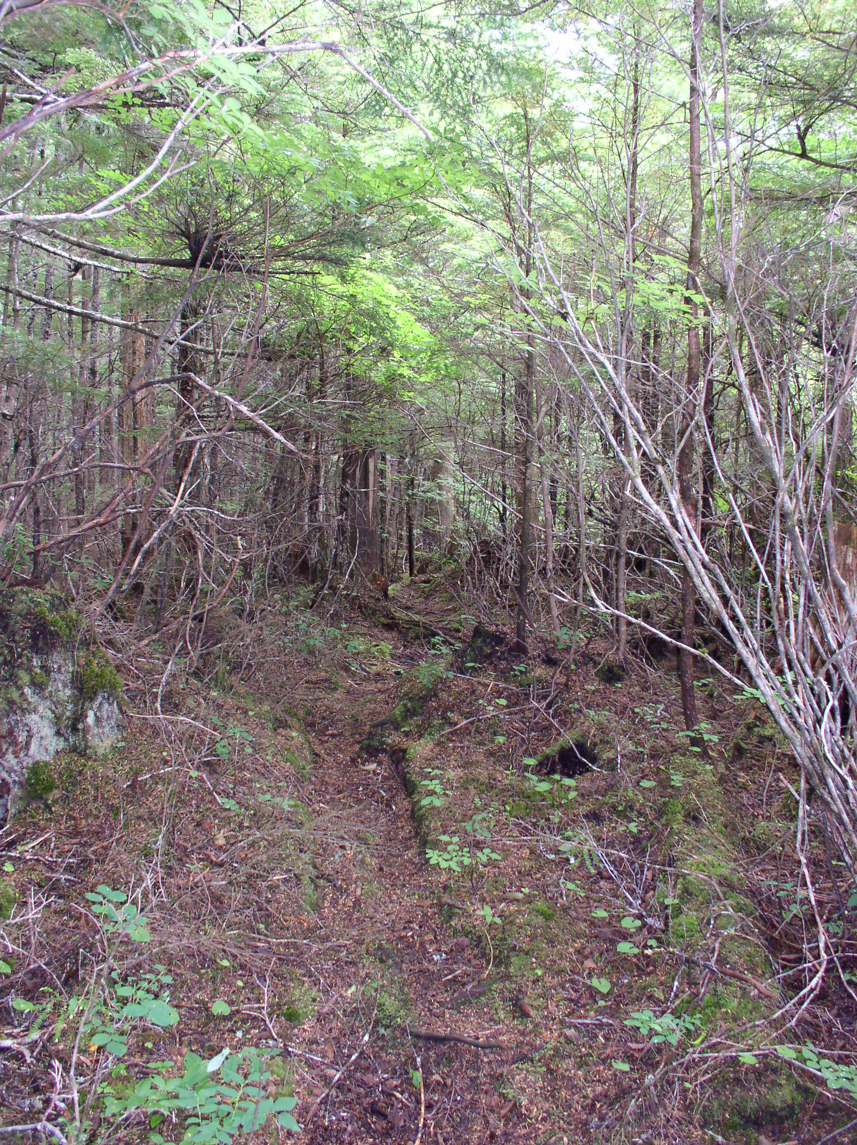
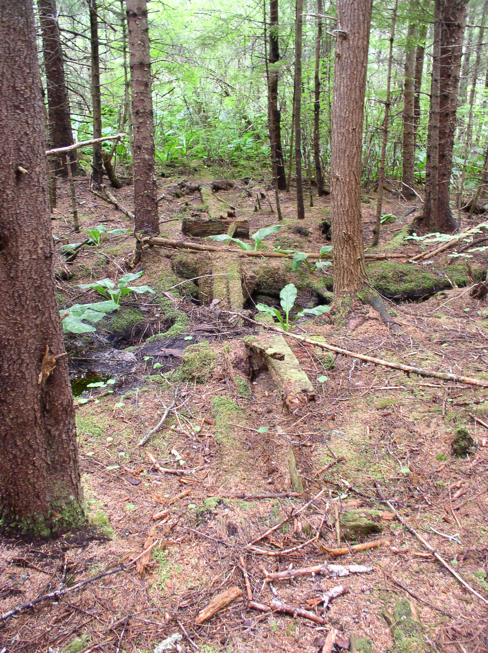
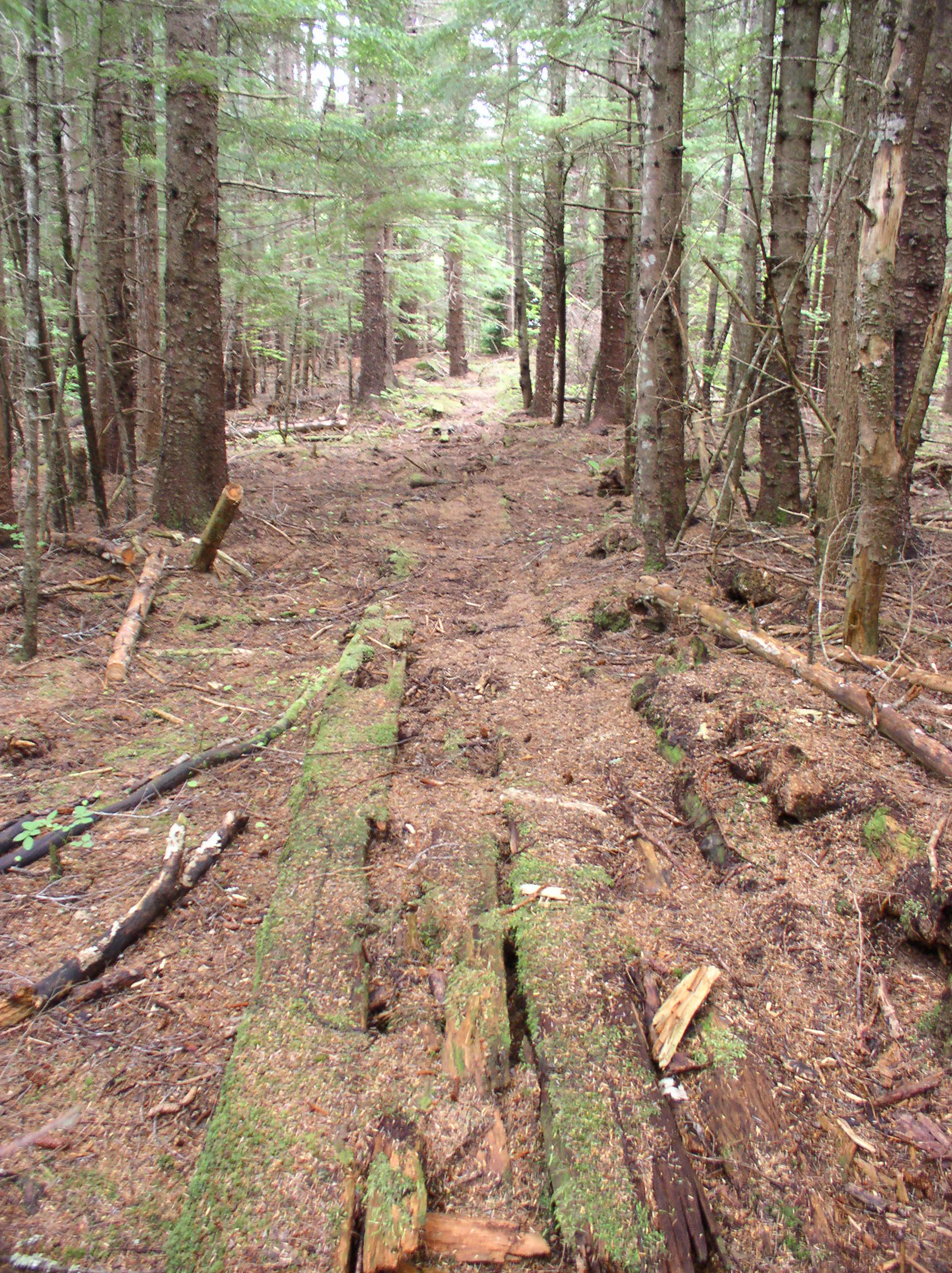
Here comes the green and brown! Below is a well-defined historic trail (meaning not overgrown with berry bushes!). This may not look like much to an outsider, but to a local this is an efficient road through the woods!

OLYMPUS DIGITAL CAMERA

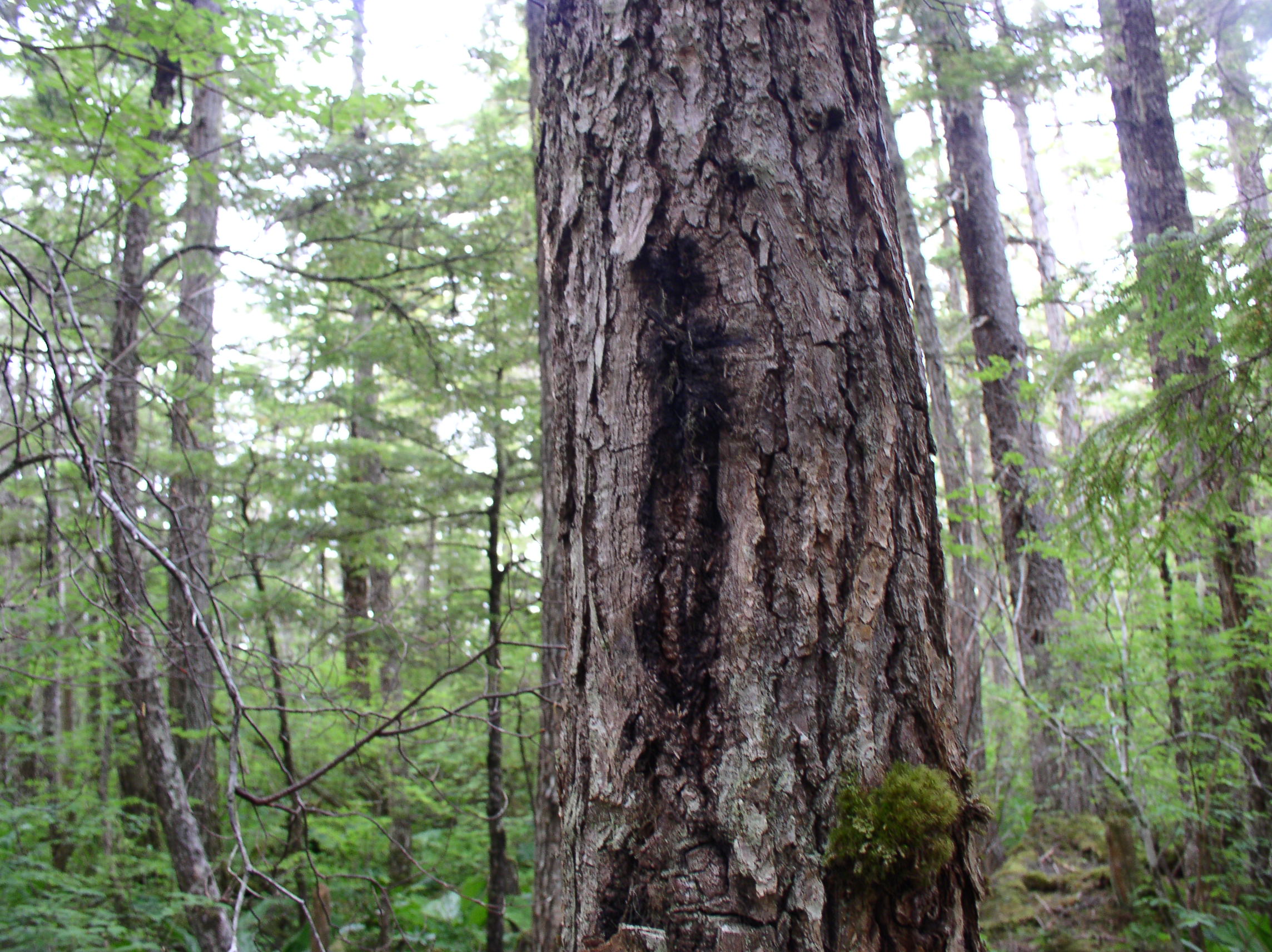
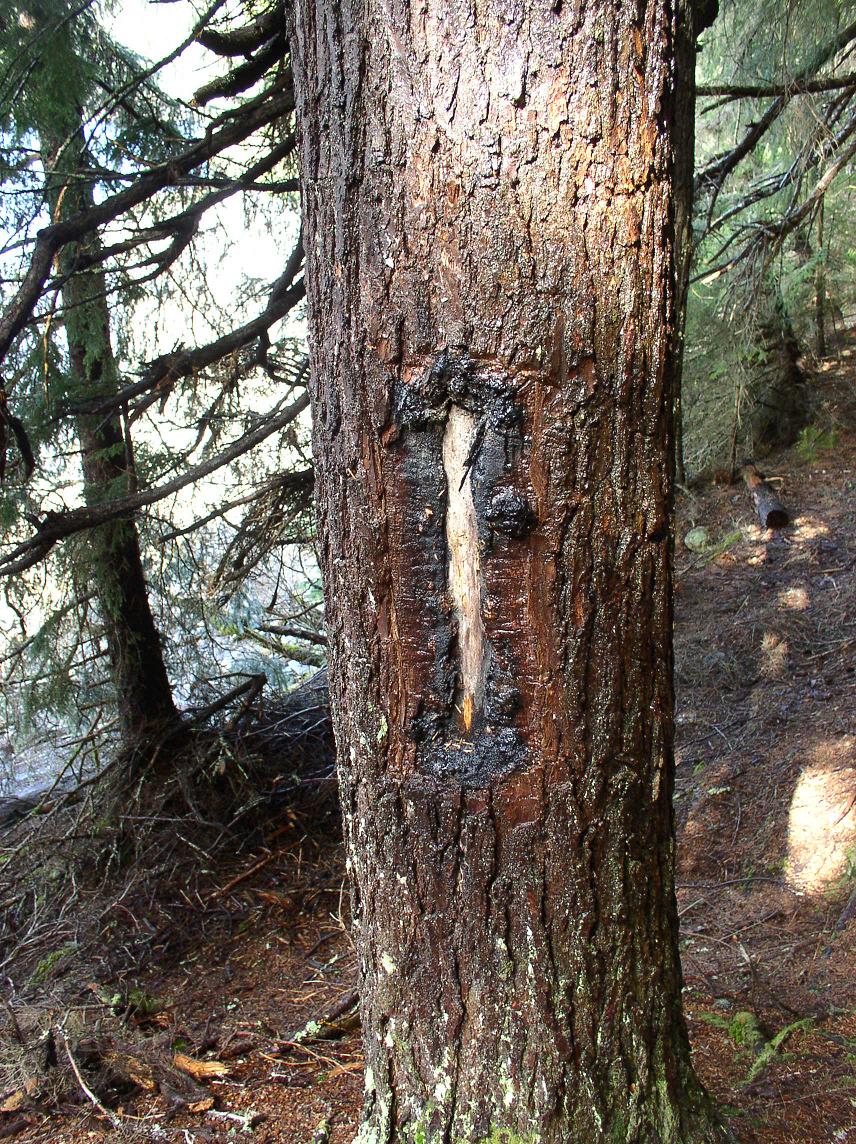
Trails were marked with blazes, vertical slashes cut into trees. These also had to be maintained, as they would scar over and become less visible with time. Some blazes were painted a bright color to make them more obvious. Here are a few examples of blazes that can still be seen:

OLYMPUS DIGITAL CAMERA

OLYMPUS DIGITAL CAMERA

OLYMPUS DIGITAL CAMERA

Another sign of an old trail: downed trees across the route have been cut through:

OLYMPUS DIGITAL CAMERA

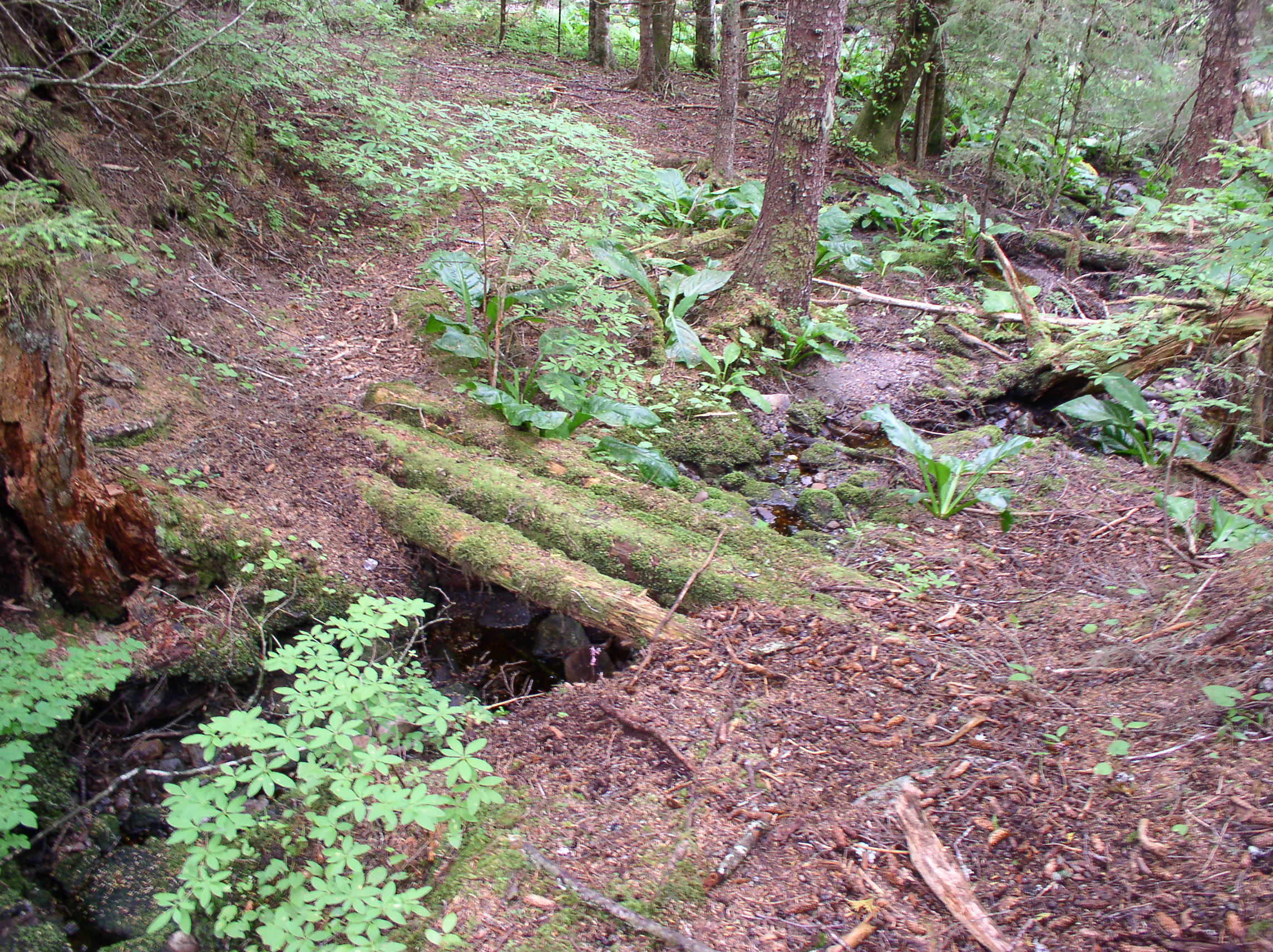
Small log footbridges over streams were common along the trails, but it’s rare to find much sign of them now:

OLYMPUS DIGITAL CAMERA

OLYMPUS DIGITAL CAMERA

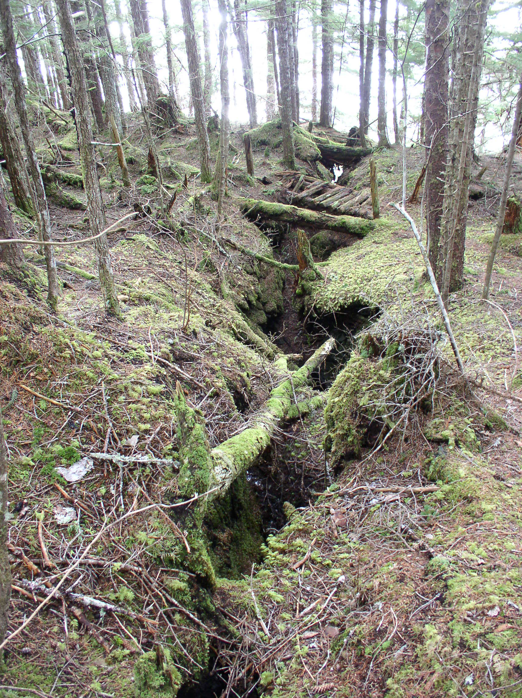
Even more unique, this is a bridge over a vertical crevice in the ground left by a mining operation. This one actually had railings so pedestrians wouldn’t fall 30ft down a hole, you can see the uprights still in place at each end:

OLYMPUS DIGITAL CAMERA

OLYMPUS DIGITAL CAMERA

And here is the deluxe version of a trail, a boardwalk! If a trail is the Southeast Alaskan’s road, the boardwalk is their highway! You can do all kinds of city-style stuff with a boardwalk, like ride bikes! My sister and I had bikes when we were growing up, but we could usually only ride them when the tide was out, and only on certain mixes of not-too-squishy, not-too-rocky ground.

OLYMPUS DIGITAL CAMERA

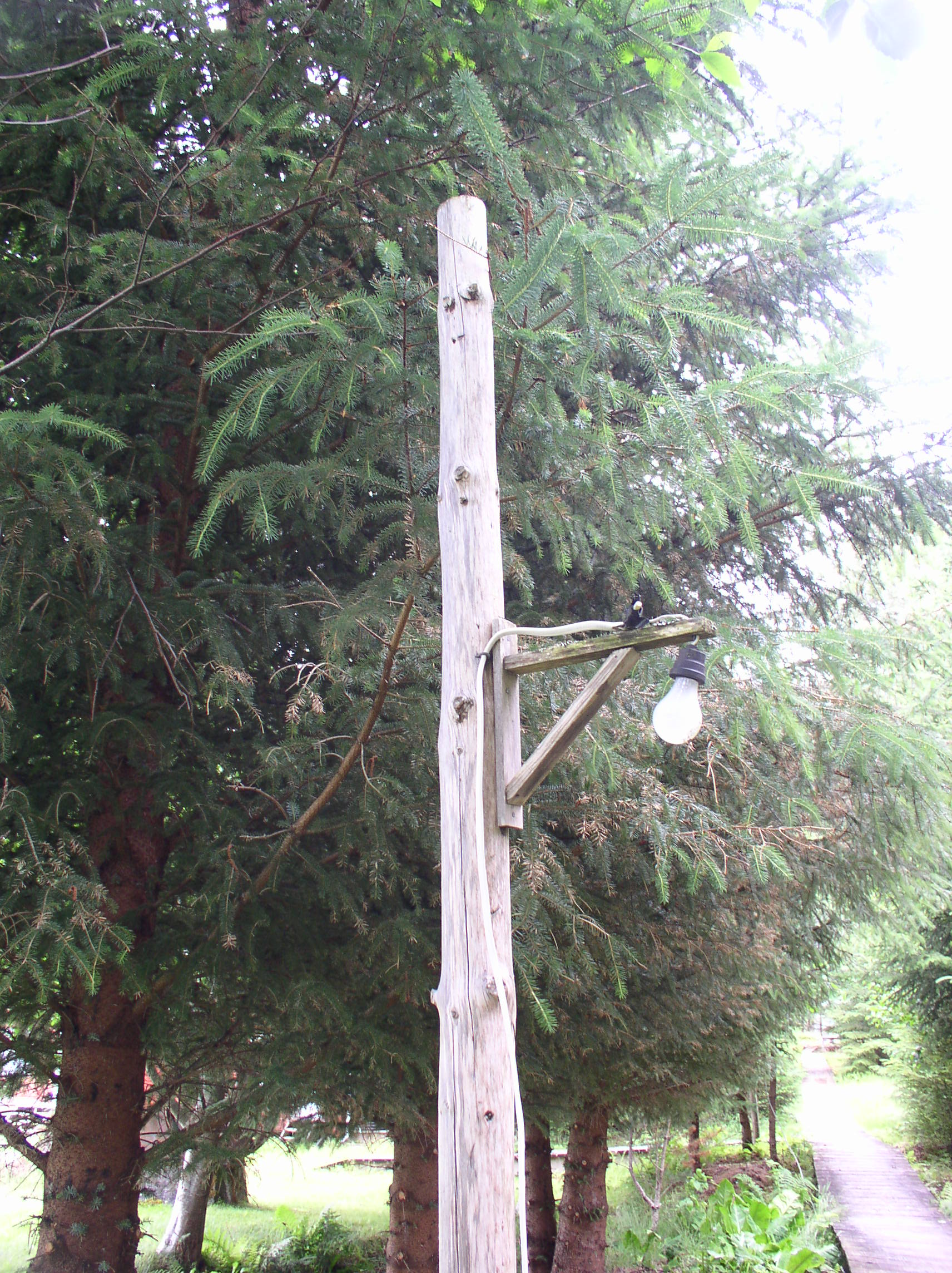
Some boardwalks at the cannery had electric lights along the path:

OLYMPUS DIGITAL CAMERA

An older boardwalk, like anything else made of wood in Southeast Alaska, these need occasional repair or replacement…

OLYMPUS DIGITAL CAMERA

…Or they start to look like this:

OLYMPUS DIGITAL CAMERA   OLYMPUS DIGITAL CAMERA    OLYMPUS DIGITAL CAMERA

Bear Creek Trail:

The Bear Creek Trail, also known as National Forest 452, is the “big one”, crossing the pass towards Juneau. This was a shortcut to get to Funter, instead of traveling around Point Retreat, you could take a boat from Juneau to the mouth of Bear Creek, then hike across Admiralty Island in a few hours. Not much remains of this trail any more, there are a few blazes visible, and the remains of a few footbridges, but trying to follow it is an exercise in futility. As soon as you are forced to divert from the former path by a downed tree, thick brush, or other obstacle, re-finding the route of the trail is nearly impossible.

The Bear Creek Trail was made “official” and improved in the 1930s by the Civilian Conservation Corps, a government program to reduce unemployment. The CCC also built several trails and recreational cabins on southern Admiralty Island starting in 1934 (per Roderick). This document mentions that the Admiralty Island division had 130 men in 1934, and 245 in 1936. CCC work ended when the US entered WWII.

“Bear Creek … (28 miles) Offers fine trout fishing, good hunting. Brown bear. Trail leads 5.8 miles along stream to headwaters, then over low divide down to Funter Way on west side Admiralty Island.”

From “Juneau:a study of the Gastineau Channel area” by Juan Munoz, 1956.

The Bear Creek trail was mentioned in a 1989 land transfer, when the federal government deeded lands on Mansfield Peninsula to the State of Alaska. The BLM retained a right-of way 15 feet wide along the Bear Creek Trail. No one has bothered to do any work on it in the last 50 years or so, and it’s doubtful the BLM could even find or identify where their easement is supposed to be.


Funter Bay in Maps

May 6, 2013

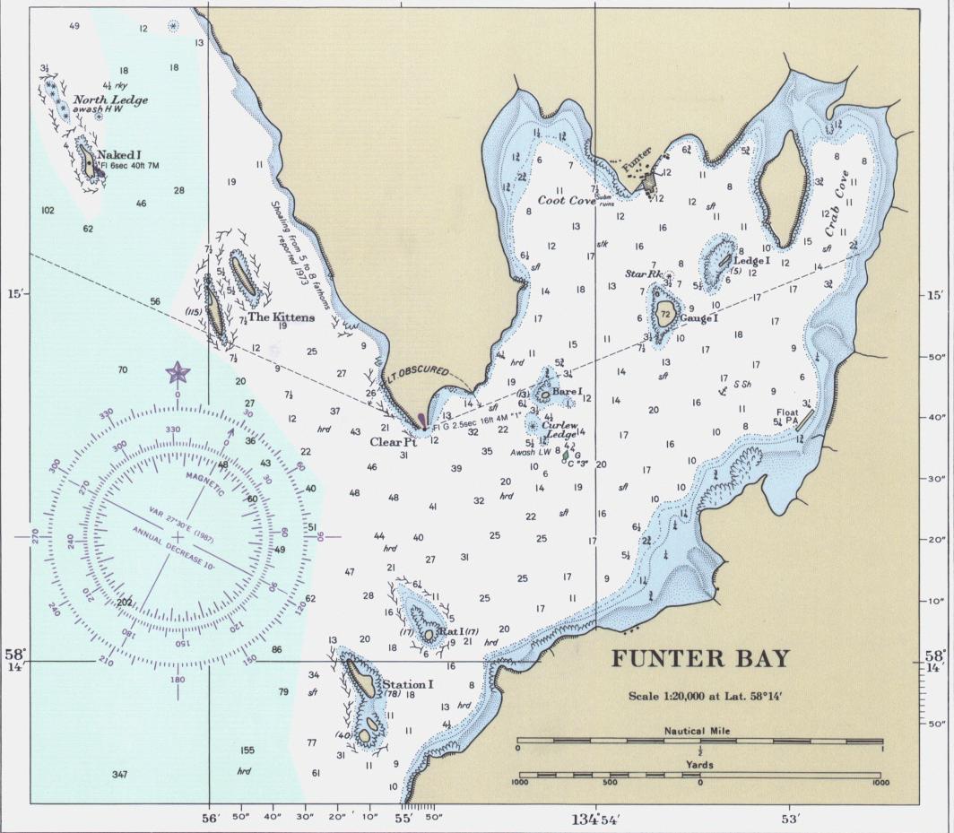
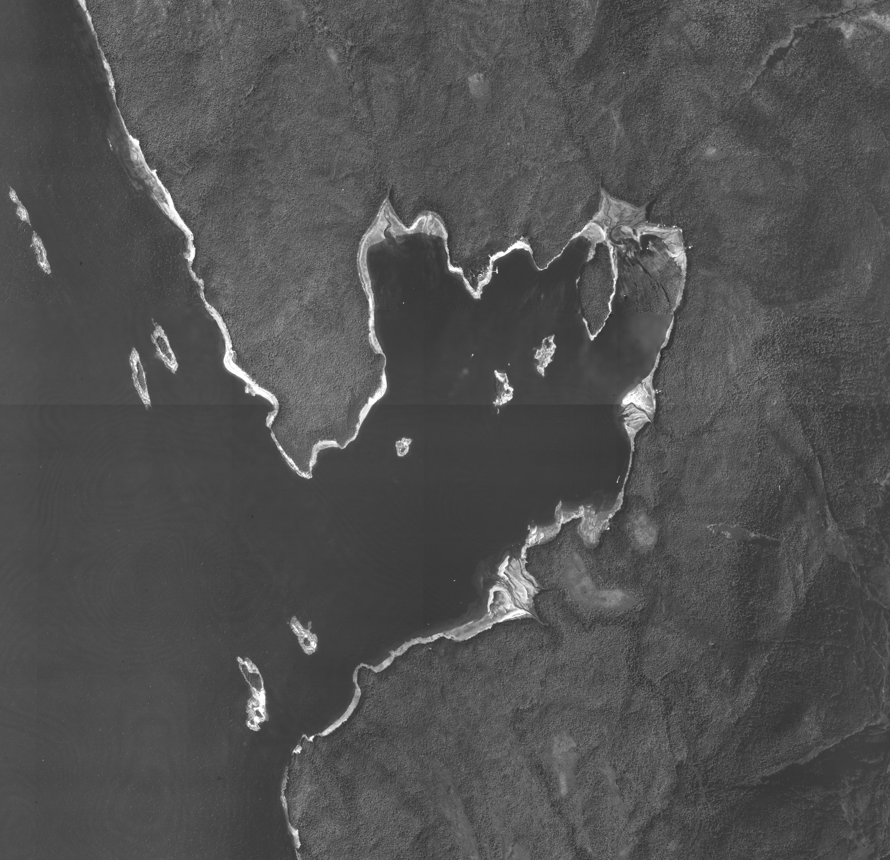
Here is a compilation of maps and aerial photos showing Funter Bay over more than 100 years. I wish I’d had this collection when I was a kid! They are great for seeing the rise and fall of development around the bay. The difference between high and low tide is also striking. If you’re a boater thinking of visiting Funter, take a look at some of the low-tide images before you take a short-cut, or you may be the next boat that someone has to pull off the sandbar! (Also think of the wind direction and bottom type, the anchors shown as moorage locations on the nautical charts are kind of another local joke… people end up dragging anchor if they use those spots in the wrong winds).

Some of the aerials are very large files, click them if you’d like to view the originals, but give them a few seconds to fully load (they may look grainy or pixelated at first).

I have collected these from several sources. The aerial photos are public domain data, produced by the Department of the Interior / United States Geological Survey. Many of these can be found at http://earthexplorer.usgs.gov/

Most of the topographic maps are products of the USGS, and can be found at http://nationalmap.gov/historical/

Nautical Charts were produced by the US Coast and Geodetic Survey (later NOAA), and some can be found at http://www.nauticalcharts.noaa.gov/csdl/ctp/abstract.htm

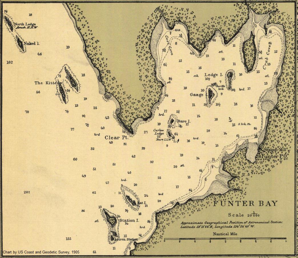
Funter Bay in 1905 (Nautical Chart):
1905 chart

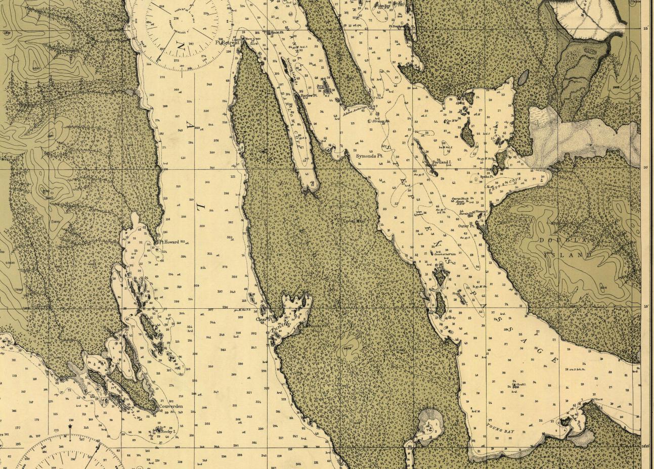
1905 vicinity chart:
1905 vicinity chart

1914 nautical chart (essentially the same as the 1905 edition):
1914 chart

1921 USGS map showing some of the mining claims on the South Shore:Funter claims 1921

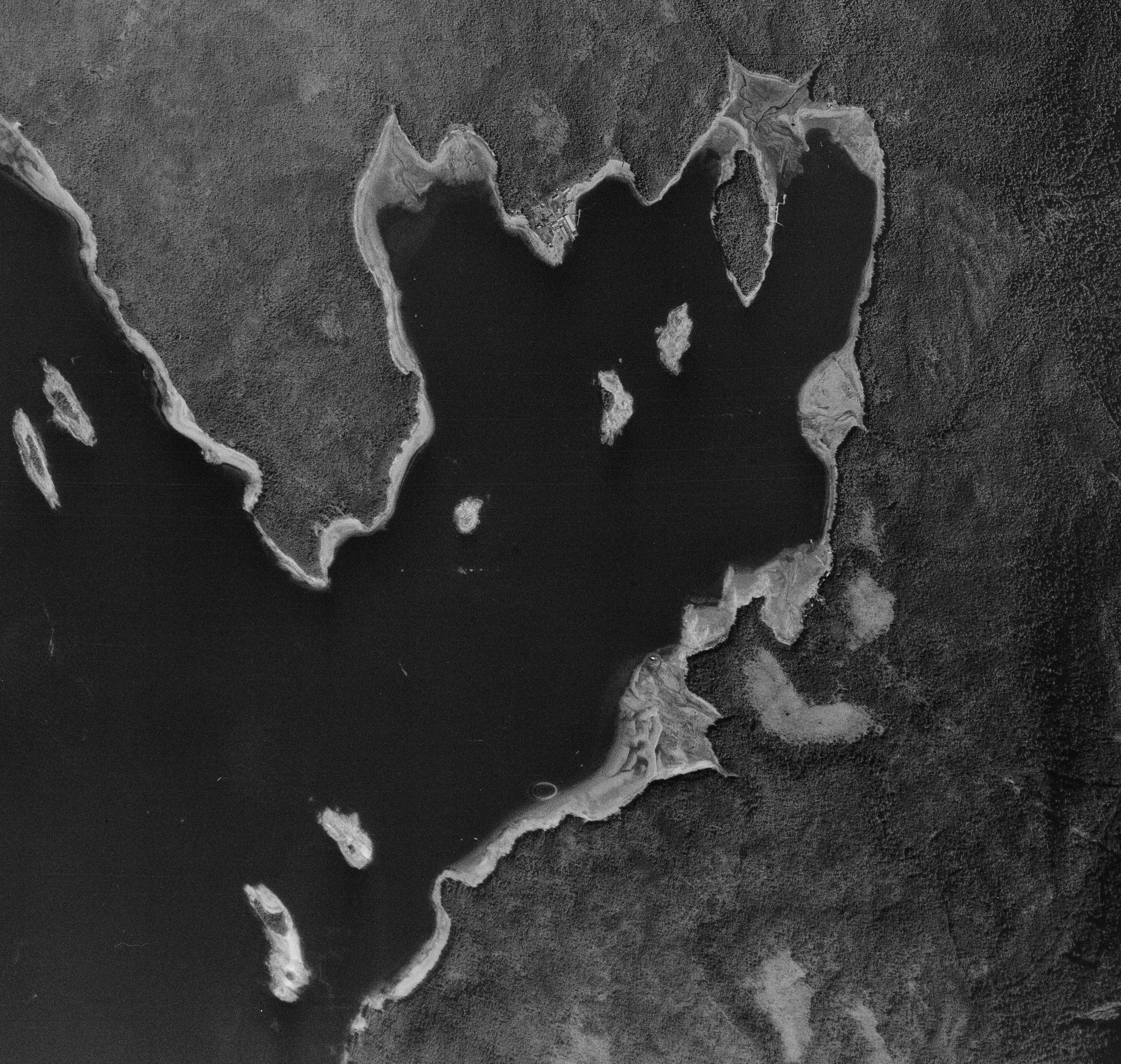
1948 aerial photo (click to open detailed original scale):
1948 Funter Bay

The 1948 aerial above is cool because it shows many of the old docks and waterfront structures that are now gone. I’ll try to highlight a few of these in a later post.

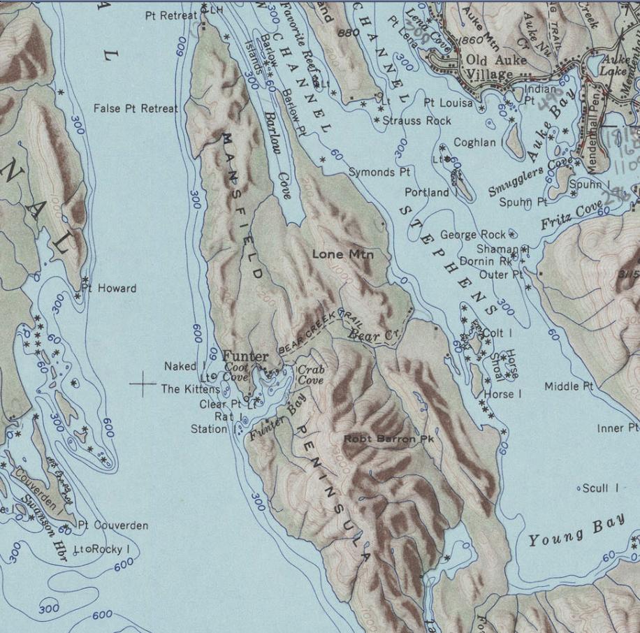
1951 vicinity map (USGS terrain-shaded topo):
1951 topo

1962 map by the Overseas Mineral Cooperation Association (a Japanese mineral investment group):1962 OMCA Map

I have highlighted structures shown on the OMCA map in red. I find it interesting that they show the cabins near Clear Point as well as the cabin between the creeks at Crab Cove.

1979 CIR aerial, taken from a NASA U-2 Spyplane as part of the Alaska High Altitude Aerial Photo project:
1979 Funter Bay

We did have a framed copy of the image above when I was a kid. This is in Color Infrared or CIR, meaning vegetation is shown in false-color red, and you can discern different types of vegetation from the different shades of red (so clearcuts and patches of different trees stand out from the predominant spruce):

1982 aerial photo (Color Infrared, click to open very large original):
1982 Funter Bay

1985 topo map of Mansfield Peninsula:
1985 topo

1987 nautical chart:
1987 chart

1990s topo map:
Topo

1996 or 1998 aerial photo (current residents may be able to pick out their houses and cabins in this one!):
1998 Funter Bay

2004 satellite image (sorry, not as high-res):
2004 Funter Bay

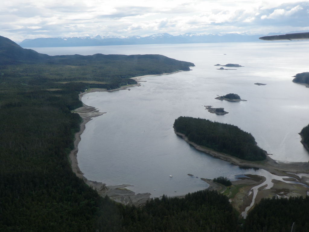
And just for fun, here are a few of my own photos from various aircraft passing over Funter.

2010 oblique aerial looking South-ish over Crab Cove, coming through the pass from Juneau:
0-aerial-2

2011 oblique of Funter Bay as seen looking NW-ish, from an Alaska Airlines jet:
0-aerial-3

With commercial satellite maps, most companies have yet to include much coverage of Funter Bay. However, if you zoom all the way in on Bing Maps, you’ll get some decently high-resolution imagery (although the light balance is bad).

This site is also really cool: http://alaskafisheries.noaa.gov/shorezone/

Similar to the old California Coastline project (but hopefully with less Barbra Streisand), the Alaska Shorezone Viewer allows you to pull up images (and video) of almost the entire Alaska coast! The interface is a little clunky and takes some getting used to, but the images are amazing!

That’s all I’ve got for now. If I come across any more interesting maps of Funter Bay, I will try to post them here!


Funter Bay History: Cannery Buildings in the 1970s

May 2, 2013

Before detailing the remaining structures at Funter Bay, I would like to note that these are almost all private property. While visitors on yachts are sometimes known for poking through old buildings, this is frowned on by the owners and local residents. Any structures you see from the water are private cabins or residences (even if they look quaint or abandoned). The ramp and boardwalks at the old cannery all lead to private cabins. Residents keep a watchful eye on eachother’s properties, and are naturally curious (some Down South visitors have called us nosy) about any activity in the bay. Any unrecognized boat entering the bay becomes the immediate focus of everyone’s binoculars. If you are visiting Funter Bay, please respect private property and do not trespass on people’s yards or in old buildings. (If you want a place to poke around “old stuff”, I would suggest Scow Bay with its wrecks and steam engines).

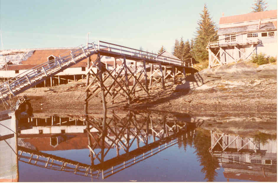
That said, here are a few photos documenting the remaining structures at the cannery site. I’m cheating a bit, because the first photos are all my Dad’s from the 1970s, and many of the buildings shown are not, in fact, “remaining” any more. Dad came to Funter Bay on the mail boat Forester in 1972. I’ll further document more of the present-day remains in a future post.

An overview of the cannery in the early 70s, taken from the peak of Mount Robert Barron:

0-web-cannery

And a view from the water (compare with this photo from 1907 from almost the same angle):

Dad-cannery-2

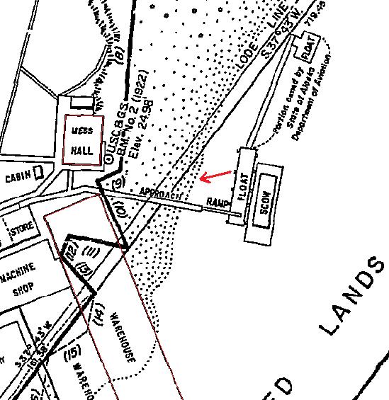
The cannery dock with inset map showing photo location (red arrow). The mess hall is on the right, warehouse on the left:

Dad-cannery-4

mess

A closer view of the mess hall, taken from the dock approach ramp:

0-web-fnb2

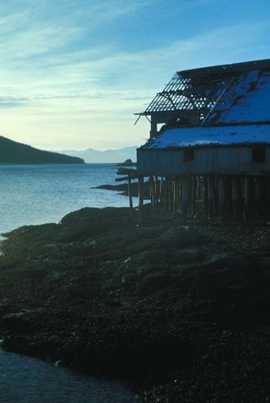
A few views of the main warehouse buildings, which used to extend out on pilings over the bay to form a wharf:

0-web-fnb1  0-web-fnb4 Dad-canneryDad-cannery-1

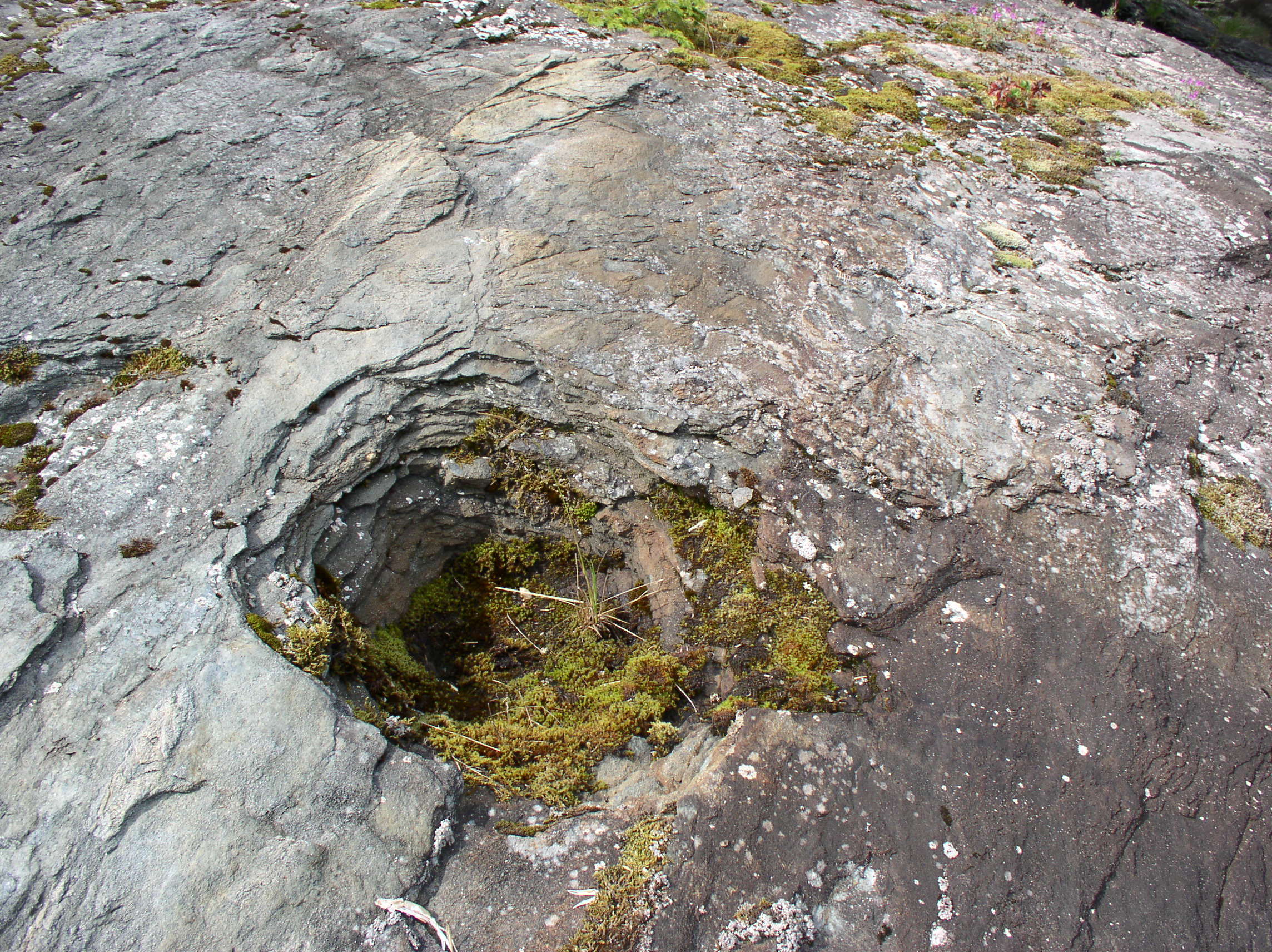
As you can see, the parts extending over the water had suffered a lack of maintenance! The wharf and cannery were built over solid rock outcroppings, which were not good places to drive pilings. In some places you can still see shallow depressions in the rock where workers blasted out sockets to set the pilings into. These pilings were basically resting on top of the rock, held in place by the weight of the structures on top. After a few winter storms, they began coming loose. Constant maintenance would have been required to re-seat them and shore up the buildings, and as soon as that stopped happening, things started falling apart.

Shallow piling socket blasted into rock:

OLYMPUS DIGITAL CAMERA

Next are a couple photos looking back East at the main cannery building, with the marine way next to it occupied by an old wooden boat. Mount Robert Barron is in the distance.

0-web-fnb30-web-fnb5 cannery

The boat on the marine railroad seems to have reg # 314791 marked on the bow. Unfortunately, the online copies of the Merchant Vessel Registry only go through 1965, when ID numbers were just hitting the 29xxxx range. The current USCG documentation search doesn’t have a record for that number or for any likely derivatives (swapping 7s and 1s, etc).

Here is a view from 1907 similar to the one above, looking towards the cannery from the vicinity of the Watchman’s house:

Cannery view 1907

This is another view of the power house, from the early 1980s:

Dad-cannery-5

I’m not entirely sure which building this is, possibly the guest house or one of the managers’ cabins.

0-web-fnb6


Funter Bay History – Even More Ships; Passengers, Mail, & Freight

April 30, 2013

Travel and shipping to Funter Bay in the late 19th and early 20th century required owning a boat, hitching a ride on a boat, or paying for passage on one of the occasional commercial vessels to stop at the bay.

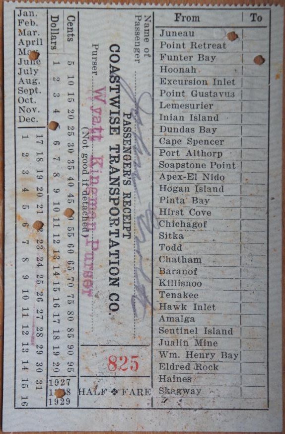
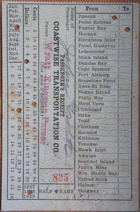
Below is a ticket stub from 1928. Funter Bay is listed as one of many possible destinations, including various small towns, lighthouses, canneries, fox farms, mines, etc. Fare in 1928 from Juneau to Funter was $5.50.
SONY DSC

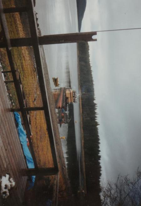
Freight service was irregular, arriving whenever there was a large load of something (lumber, machinery, workers, etc) to deliver. This is the case today as well, freight is often brought in companies such as John Gitkov’s Southeast Alaska Lighterage, using rebuilt military landing craft. Households at Funter Bay would often go together on a load once or twice a year, including fuel, building materials, ATVs, etc.

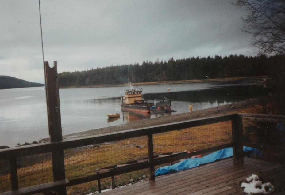
Freight delivery at Funter Bay in the 1990s:
Landing Craft

During the industrial years of canning and mining, Funter Bay had semi-regular mail service (at least during the summer). Cannery owner J.T. Barron occasionally served as Fourth Class Postmaster, although when the cannery started in 1902, James Largan is listed as Postmaster. In 1921, William N Williams is listed as Postmaster. Commonly the storekeeper in a small town would hold this position on the side, although it also included several hundred dollars a year in government salary and sometimes kept very small stores in the black. Although the Rural Free Delivery service eliminated many 4th-class postmaster positions, they persisted in Alaska for some time (Harold Hargrave was Postmaster at Funter Bay in 1954).

Here’s a photo of the Funter Bay post office (date unknown).

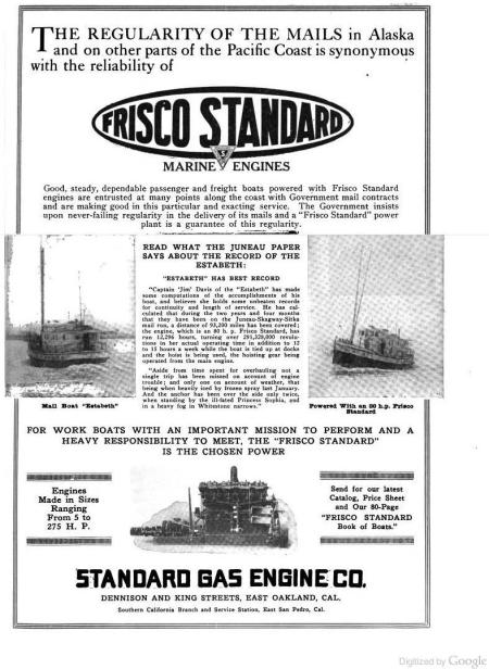
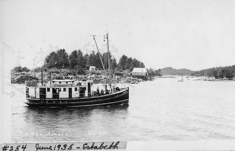
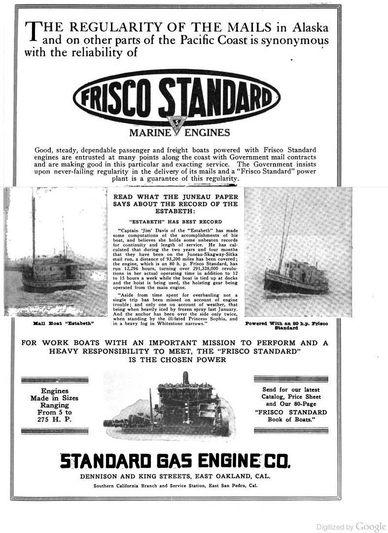
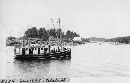
From the early 1920s to late 1940s, mail was delivered by chartered vessels such as the Estebeth (sometimes spelled Estabeth), a 55ft wood diesel boat which made semi-regular mail and passenger runs all over Southeast Alaska. The boat was owned by the Davis Transportation Co under captain James V Davis (who later organized Marine Airways and served as a state legislator).

The Estebeth at Sitka, courtesy of Jim Dangel, used with permission:
Estabeth2

Estabeth
Above ad from the 1920 Issue of Pacific Motorboat. In 1920 the Estebeth had a crew of 3.

A few more photos of the Estebeth.

The Estebeth (Reg # 216559) is indeed listed in 1920 as having an 80hp gas engine, but despite the “Reliability of Frisco Standard Gas engines” described above, the boat is listed in 1925 as having switched to a 90hp diesel engine. By 1945 the boat had upgraded to a 100hp diesel, added a radio (call sign WNOL) , and had a crew of 5.

According to various wreck reports, the Estebeth either went aground near Swanson Harbor, or burned near Point Couverden on March 31, 1948. A local resident recalls that the Estabeth burned in Crab Cove at Funter Bay. I’m trying to verify which was which. Either way, this was not the first accident the boat had suffered, BOEM Shipwreck lists mention that she hit a shoal near Kosciusko island in 1927, stranded twice in 1929 at Zimovia Strait and Port Alexander, and scraped a rock in Tabenkof Bay in 1929 (I wonder if they fired the 1929 crew!). The boat is also mentioned in various history texts as being present to rescue various stranded mariners and assist disabled vessels all over Southeast.

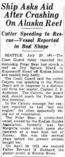
Another vessel used for mail and freight service in Southeast Alaska was the Margnita, operated by the Coastwise Transportation Co of Alaska (there was also a Coastwise Transportation Co of Maine). The Margnita was an 83ft boat built in 1926, with a 200hp gas engine and a crew of 8. The boat was sold in 1931 and renamed the Polar Bear, and the Coastwise Transportation Co of Alaska seems to have vanished, one record mentions that captain H.M. Peterson was arrested for fraud relating to some mining claims in the Nome area, and an article mentions that the vessel sat idle for several years before being purchased by the Kodiak Guides Association.

“WOLD COMMANDS “POLAR BEAR” Capt. Peter Wold… in August assumed command of the yacht “Polar Bear“. This vessel, as the “Margnita”, was long well known as a passenger and freight boat in Alaska waters.” (From Pacific Fisherman Journal, 1931)

The Polar Bear sank near Kodiak in 1935, and was raised for salvage by divers in 1937.
Polar Bear
(From New York Post, July 20 1935)

Another mail boat serving the area after the 1940s was the Forester, (Reg 209556). Owned by Lloyd “Kinky” Bayers and later by James Colo, the Forester was a 63′ boat built in 1912 in Seattle. In 1945 it had a 60hp diesel engine and a crew of 2. By 1965 it was listed as having a 200hp diesel and owned by John Gallagher. The vessel was still active as of 1989, owned by Bluewater Farms, a fish farm in Port Townsend. It is no longer listed as an active vessel with the USCG.

By the 1930s, reliable aircraft service began supplementing mail boats (although there was still mail boat service through the ’70s for larger items). In the 1980s – early 2000s, Funter Bay had weekly year-round mail delivery by seaplane, paid for by a federal mail contract. Ward Air of Juneau, known for their safety and punctuality, had a long-running contract for mail delivery. Ward Air was much more dependable than the Postal Service itself, the feds were constantly trying to cut service to small towns, and at various times Funter Bay’s “delivery location” included a box under someone’s desk at the Juneau post office, which would get dumped at Ward Air if and when the post office happened to remember. We also frequently got mail for other small Southeast towns, as they got our mail. It was usually a good bet that anything mailed or mail-ordered would be a few weeks or a month to show up (next-day and two-day letter delivery in the Lower 48 still weirds me out).

Much of rural Alaska shared the 5-digit 99850, Funter Bay’s full zip code was 99850-0140.
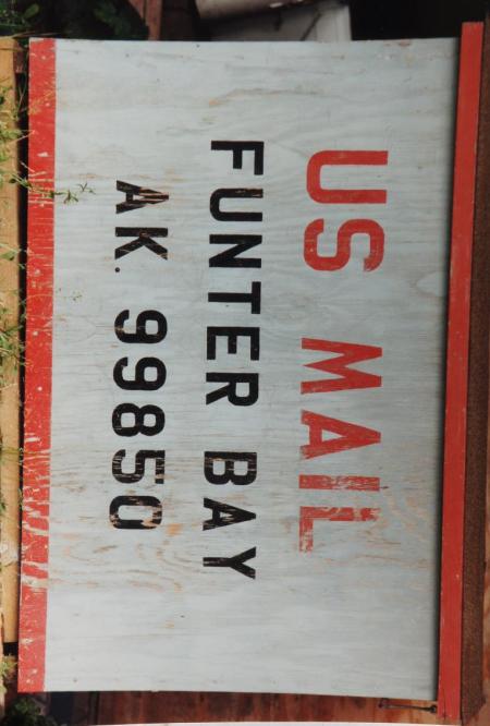
The mail box at Funter Bay. Mail came once a week via seaplane when I was growing up.

The mail box at Funter Bay. Mail came once a week via seaplane when I was growing up.

As mentioned in a previous post, the number and variety of commercial vessels calling at Funter Bay would make for a very extensive list. Further confusing the issue is that many of the shipping companies mentioned here were merged, consolidated, or otherwise interwoven to some extent during the mid 20th century. I’ll try to document a few that I’ve been able to find references to.

In 1904, Funter Bay was designated by the US Treasury Dept. as a “Special Landing Place” for vessels to be under the supervision of a customs inspector. This was “for landing coal, salt, railroad iron, and other like articles in bulk”.

Steamship service was on the flag stop principle. Steamers regularly passed Funter Bay on the way to and from Juneau and Skagway, and companies could request that a ship make a stop at Funter along the way. Irregular stops like Funter were not listed on the larger companies’ official route maps and were not typically factored into the printed timetables, although an 1896 timetable from the Pacific Steamship Co notes that

“These dates so far as they relate to ports in Alaska, are purely approximate. In case of steamers calling at other ports (which they are liable to) or in case of fogs or other unfavorable weather, tides, etc, these dates cannot be relied on. “

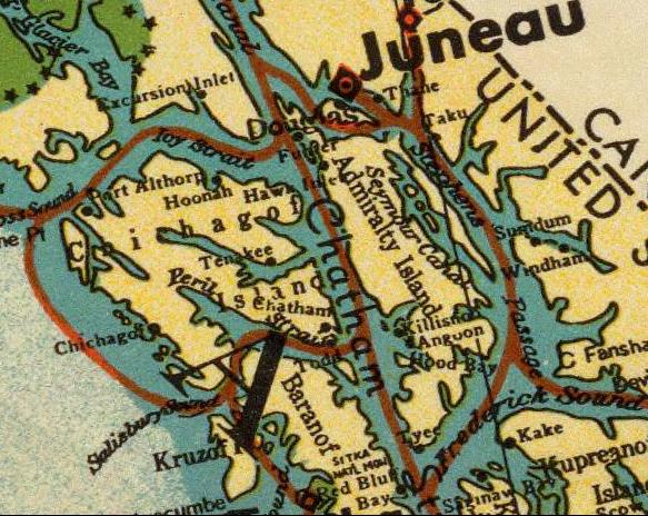
Alaska Steamship Co route map, 1936. Funter Bay is visible just to the SW of Juneau:
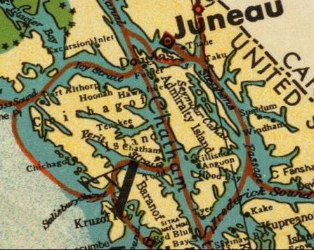
routes

A reference in Barry Roderick’s Preliminary History of Admiralty Island mentions the Steamer Al-Ki delivering materials and workmen to Funter Bay in 1895. There were several vessels with this name in the Pacific Northwest, but I believe this was the 200ft steamship out of San Francisco which called at many small towns, mines, and canneries in Southeast Alaska. The Al-Ki was wrecked at Point Agusta in 1917. More information on the wreck is available here (scroll down).
Al - Ki, a passenger steamer, wrecked on Point Augusta, Alaska, November 1, 1917

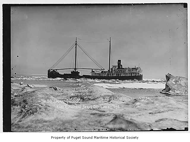
The Admiral Goodrich is listed as delivering sawmill equipment to Funter in 1918. This was a cargo vessel owned by the Pacific Steamship Company. Formerly the SS Aroline, and later the Noyo, this ship was wrecked at Point Arena, CA in 1935.

Admiral Goodrich in 1918:
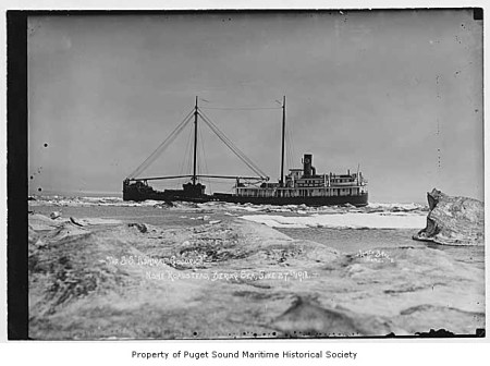
Admiral Goodrich

The vessel Driva, owned by Juneau Lumber mills (and previously mentioned as assisting the burning Buster at Funter Bay in 1926) occasionally called at Funter to deliver lumber for construction (and possibly to pick up cut logs). Driva was a 56ft gas towboat. It seems to have been wrecked near Douglas Island sometime between 1935 (when it is listed in the Merchant Vessel Registry) and 1937, when the wreck was photographed.

Juneau Lumber Mills also had a vessel called the Virginia IV. Here’s a photo of it at the dock in Juneau, along with the ferry Teddy, probably the same Teddy which was reported abandoned at Funter Bay in 1959. The Virginia IV is seen on the right in the above link, in it was a 97′ boat built in Tacoma in 1904 as the steam vessel Tyrus, registry 200681. By the 1920s it had a diesel engine and had additional superstructure added aft of the wheelhouse.
Virginia IV

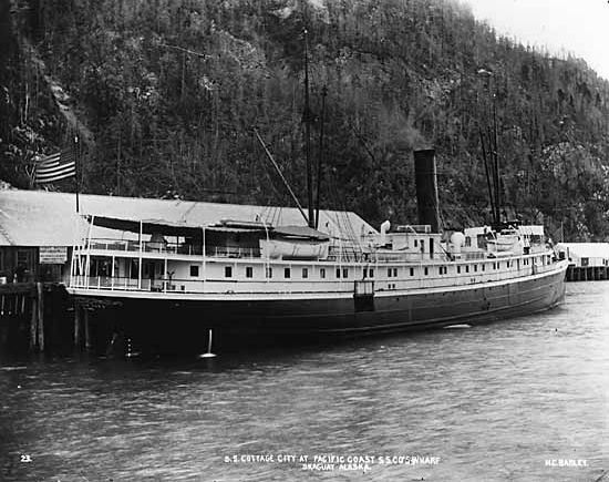
The 1905 book “A Trip to Alaska” mentions the Steamship Cottage City (233ft long, built 1890) stopping at Funter Bay on the way north to deliver salt for the cannery (described in the book as the largest in Alaska), and then again on the southbound trip to pick up six thousand cases of canned salmon (each case holding 48 2-pound cans).
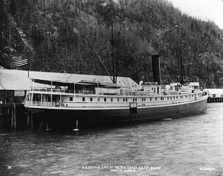
Cottage City

More information on the Cottage City. and what became of the ship.

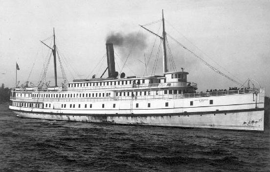
A 1915 issue of The Timberman magazine reports the steamship City of Seattle bound for Funter Bay with a cargo of 3,000 wood shingles.
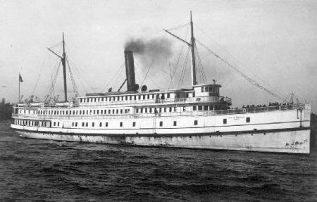
City_of_Seattle_(steamship)_1890s

More on the City of Seattle.

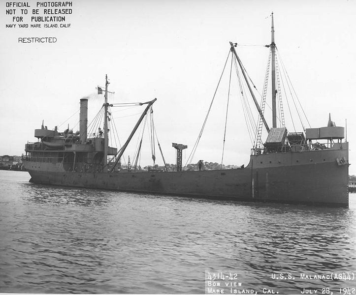
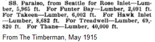
And another 1915 sailing mentioned in the Timberman is the freighter SS Paraiso:
Timberman

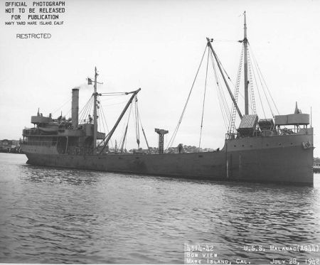
The Paraiso was later used by the US Navy and renamed the USS Malanao.
723px-Malanao_(AG-44)

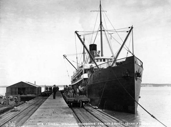
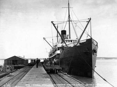
A 1917 issue of Western Canner and Packer reported that the steamer Admiral Watson arrived in Seattle with 40,000 cases of salmon from various canneries, including Funter Bay.
Admiral Watson

While the Admiral Watson occasionally ran aground,  or even sank, (it was rammed by the Paraiso) it survived into the 1930s when it was sold to Japanese scrappers.
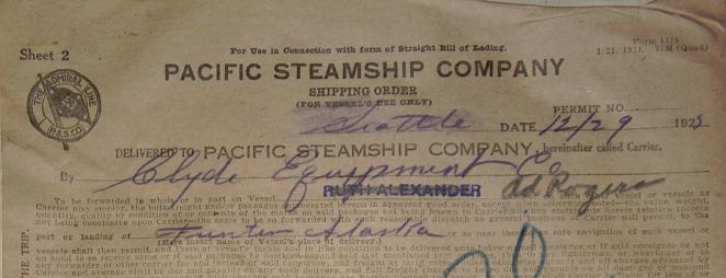
Packing slip

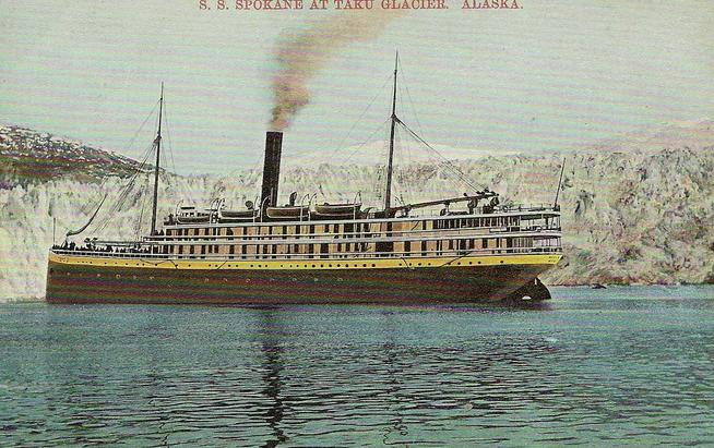
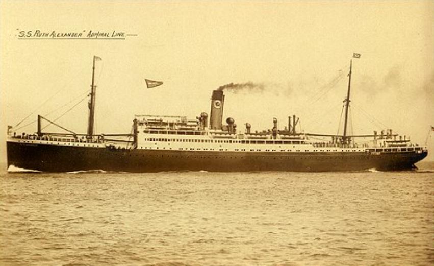
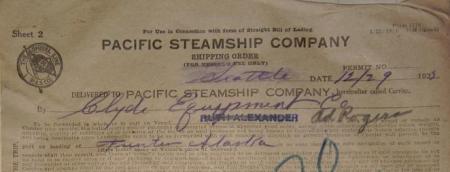
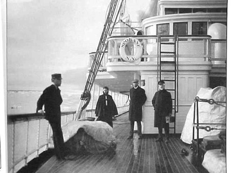
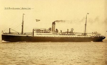
The Admiral Rogers visited Funter several times. In 1925, filling in for the Ruth Alexander, which had originally been scheduled. Both were ships of the Pacific Steamship Co / Admiral Line. The Rogers was formerly known as the SS Spokane.
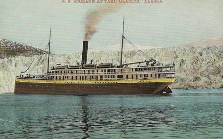
SS Spokane

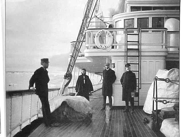
I have this photo floating around my hard drive with the note “SS Spokane at Funter Bay, 1905″. I’m not sure where it came from:
ssspokane_at_funter_1905

More info on the Admiral Rogers (scroll down or search).

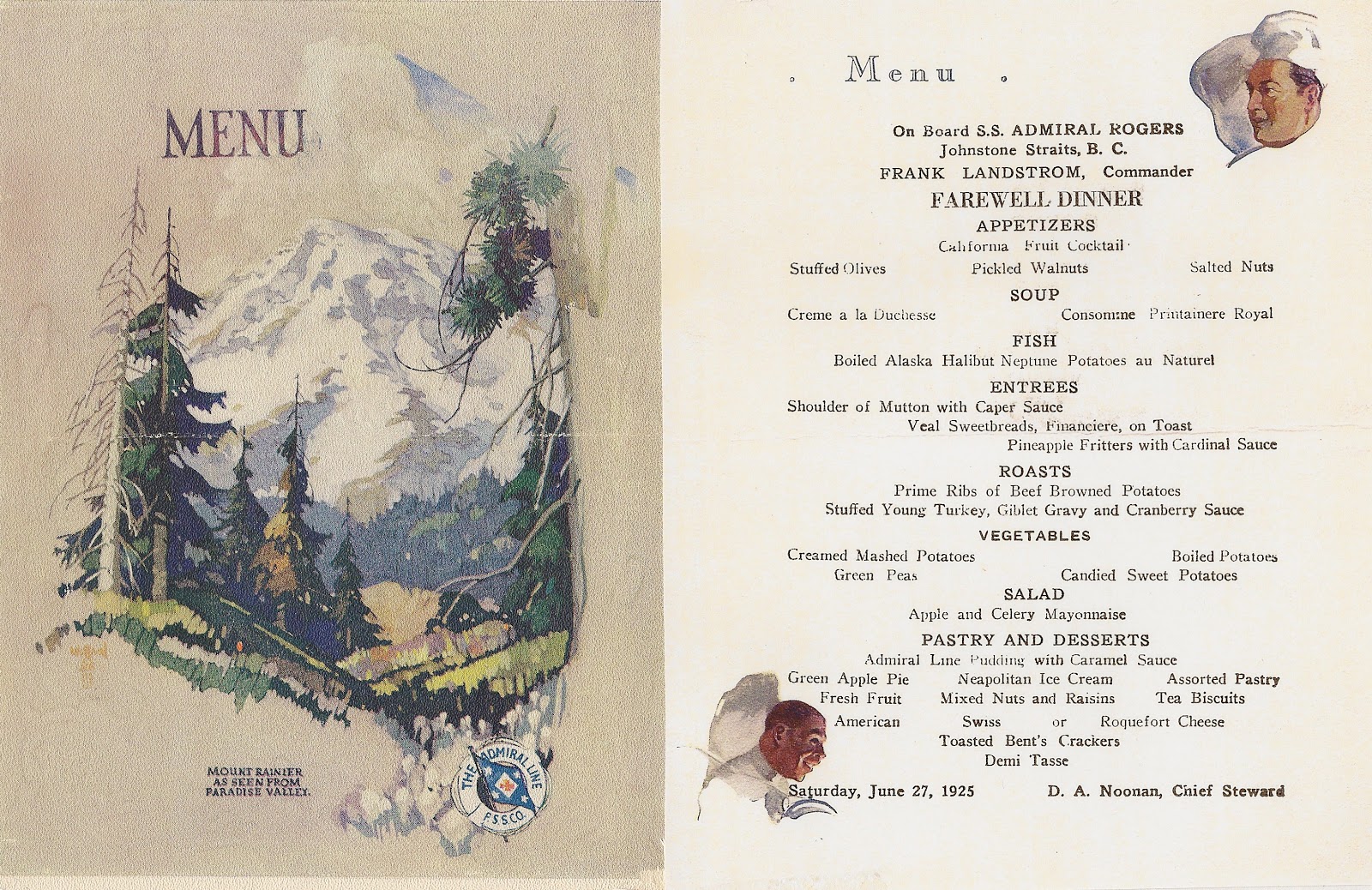
Here’s a menu from the Admiral Rodgers from that same year.

The Ruth Alexander:
ruth alexander

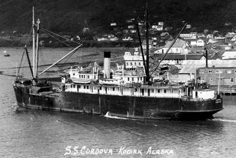
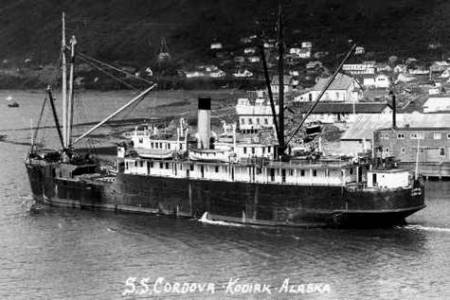
The SS Cordova was another Pacific Steamship Co / Alaska Steamship Co vessel to visit Funter Bay. Here is an excellent website about another small town where the Cordova regularly called.

Photo of the SS Cordova by the Helsel Photo Co of Kodiak, courtesy of tanignak.com:
CordovaKodDepart

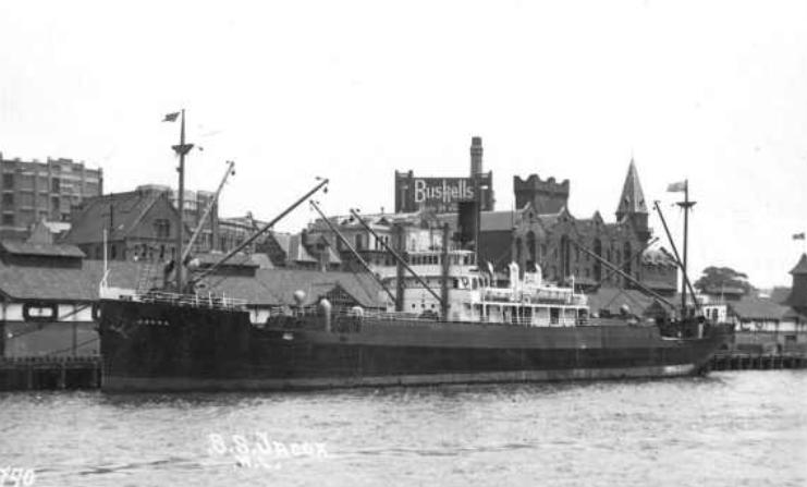
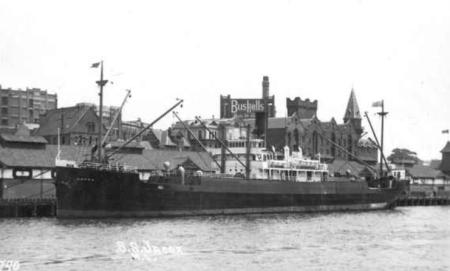
The Nelson Steamship Co of San Francisco owned a 298ft freight steamer named the Jacox, based out of Portland OR. This vessel dropped off supplies and materials at Funter Bay.

I believe this is the same Jacox, which also saw service across the Pacific to Asia and Australia:
Jacox

It seems odd today to think of such large steamships calling at Funter Bay. The largest vessels we usually saw in the bay were yachts and the occasional research vessel, the present-day docks are more suited for small fishing boats and cruisers. I have heard that some of these larger steamships used the cannery dock to discharge freight; probably the wharf on which cannery buildings were constructed out over the bay. It’s also possible that they would lower freight into barges or scows to be taken ashore to operations lacking a dock (like the Dano mine). I’ve also heard from recreational divers that such steamships would sometimes have lazy kitchen crews, who would throw dirty plates out the window instead of washing them. The intact china plates being recovered from under the cannery dock by these divers certainly seems to support that story!

And while we’re at it, here are a few more Funter Bay shipwrecks I’ve come across (I should try to make a comprehensive list of these!)

10:22/1928: The Anna Helen, a gas yacht used as a floating dental office, burned after an engine backfire caused a gasoline explosion. Vessel sank 2 miles from entrance to Funter Bay.

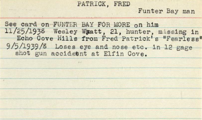
10/14/1938: An unnamed troller belonging to Geo. Ford was found sunk in Funter Bay, with no sign of him around. Fred Patrick was also missing. Both were found at Funter three days later (From Juneau newspaper via Kinky Bayers note cards). (I was able to devote an entire post to the adventures of Fred Patrick).


Funter Bay History: The misadventures of Fred Patrick

April 30, 2013

This guy seems to have lived an “interesting” life… I came across his name several times in old newspaper archives and notes on local history. The Kinky Bayers note cards mention him several times. Fred Patrick owned the fishing vessel Fearless and resided in or fished out of Funter Bay in the 1930s.

As previously mentioned, in October of 1938: Geo. Ford’s troller was found sunk in Funter Bay, he and Fred Patrick were missing for three days but turned up at Funter.

fred2

He seems to have had bad luck with guns: In October of 1931, Fred Patrick shot Harold Tipton in the foot during a drinking bout at Funter. In September 1939, Fred Patrick lost an eye and his nose when a shotgun went off in his face at Elfin Cove (also from Kinky Bayers notes).

fred3

fred1

Iin 1934, Fred Patrick was part of a march of unemployed men on the federal building in Juneau, demanding food benefits.

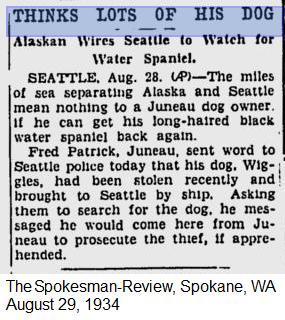
Fred’s dog Wiggles was stolen in 1934.

dog

Fred’s boat was disabled in Echo Cove in 1938, and a hunter who was on board went ashore, never to be seen again.

The Fearless was a 33ft fishing boat built in 1916 at Berkely, CA. It had a 60hp gas engine and a crew of one. Reg. # 237891. Owner in 1942 was Fred R. Patrick of Juneau. In 1945 the boat is listed as abandoned.

That’s all I’ve been able to find so far on the (mis)adventures of Fred, if anything more turns up I will update this!


Funter Bay History – Barron Family

April 26, 2013

Here are a few more details on the Barron Family, who started the cannery at Funter Bay.

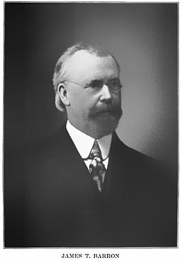
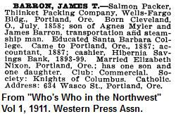
Thlinket Packing co founder James T Barron of Portland was born in Cleaveland OH July 8, 1858. Parents were James Barron of Clonmel, Ireland (1828-1890) and Agnes Myler of Ireland (ca 1831-1910). Agnes’ father was Andrew Myler. Both James’ and Agnes’ families immigrated to the US when they were young children. James Sr. owned and operated barges on the Erie canal and moved to the Pacific coast in the 1860s, where he owned steamships, warehouses, and other transportation properties. (source 1) (source 2)

JT Barron

James T Barron attended St. Mary’s and Santa Clara colleges, then worked as an accountant (with sidelines in beekeeping) until becoming secretary of the Hibernia Savings Bank in 1893. In 1899 he started the Thlinket Packing Co. He quickly sold his first two canneries to finance the new cannery at Funter Bay in 1902, but then bought back some of the interest in the earlier canneries when they went bankrupt (mentioned previously). He remained involved in the Hibernia Savings bank. He was described as a member of various professional and social clubs and organizations around Portland.

Whos who

J.T. Barron married Elizabeth Nixon in 1890. Her parents were Robert Nixon and Anna (Hogan) Nixon, both natives of Ireland. Robert Nixon was killed during the Civil War while serving in New Hampshire’s volunteer regiment.

James and Elizabeth seem to have had a comfortable household in Portland, living at 634 Wasco St (near downtown). They were occasionally mentioned in the local paper for such notable things as parties and car ownership, and they could apparently afford two maids in 1916.

help wanted

James and Elizabeth’s children were Robert J. Barron (1896-1917), Anna Maria Barron (b 1894), and Agnes Elizabeth Barron (1897-1898). Both Robert and Anna had cannery boats named after them.

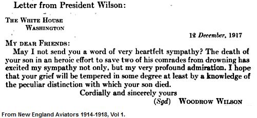
As previously mentioned, Robert Barron entered the Army Aviation Training Corps on June 3rd,  1917. At Age 22 he had already become Vice President of the Thlinket Packing Co under his father. Shortly after his enlistment, on August 21 or 22 (records conflict) of that year, Robert was killed while attempting to save fellow cadets from an aircraft accident. During landing practice near Chandler Field, two cadets had been thrown from a Hydroplane (an early type of floatplane) into the rough water of the Delaware River (ref). Robert attempted to swim to their aid, but was overcome by the current and drowned. He was applauded as a hero and given a full military funeral of a ranking officer. Everman Field at Fort Worth Texas was renamed “Barron Field”, and the mountain above Funter Bay in Alaska was named Mount Robert Barron in his honor. Woodrow Wilson sent a letter of condolence to James and Elizabeth.

Wilson

Robert Barron’s Grave

Robert’s Funeral notice.

Anna Barron married Thomas Martin Fitzpatrick (1882-1948) in 1914, and had 5 children including James Barron Fitzpatrick (1916-1992), Adrian Thomas Fitzpatrick(1926-1977), and Robert Barron Fitzpatrick (1921-1979).

James Barron Fitzpatrick seems to have been the chairman of the Portland City club in 1952. He was married to Elizabeth Rae Lansworth (1924-1988) and had 9 children.

Here is J.T. Barron’s gravestone. and Elizabeth Barron’s.

I ran out of steam on tracking the Barron family farther, this became one of those recursive research topics where one thing leads to another, and suddenly I have half the family history of someone who was previously just a name. If I happen across more information I’ll see about updating this.


Funter Bay History IV – More Boat Details

April 25, 2013

Here are a few more details of the marine and boating history of Funter Bay. With the number of steamships, fishing boats, tugs, barges, etc that have used Funter Bay, posts on this topic could likely continue for a while!

To follow up on the cannery tenders, I’ve tracked down the Thlinket Packing’ Co’s Barron F (seen in a previous post).In the 1940s and 50s it was owned by the Nakat Packing Corp. out of Ketchikan. In was renamed the Frank F (same registry number) sometime between 1950 and 1965, and became a fishing vessel based out of Oregon. Currently it is listed in the USCG database as based in San Diego. Here’s a photo of the boat from 2007 compared to the 1919 photo:

ShipSpotting.com
Barron F 2
© John Kohnen Barron F in 1919

Another photo from 2007.

And this appears to be the same boat in 2010, described as a squid boat from San Pedro CA. It’s looking somewhat modified with trolling poles and a new paint job:

Frank's Fishing Boat

Another photo from 2010.

The Frank F seems to be a popular boat with local artists as well!

Frank F Painting #1, by Tony Podue.

Frank F Painting #2, by Gina McLagan.

And to be extra stalkerish (can one stalk a boat?) Here is the Frank F viewed on Google and Bing maps (as of spring 2013… imagery may change over time).

The former Barron F looks a lot like the Morzhovoi, which I believe is the wreck at Coot Cove. Both were built in Seattle in 1917, probably by the same company (date on photo below is wrong):

Morzhovoi

Another cannery tender, the Robert Barron, was listed as belonging to Albert Kookesk (Kookesh) of Killisnoo (Angoon) in 1925, and by Matthew Kookesh of Juneau in 1950. As of April 10, 1950 it is listed as abandoned in Angoon.

In addition to boats named after the Barron family, other cannery tenders previously alluded to include some named after the Thlinket Packing Co’s product lines, the Tepee, Peasant, and Sea Rose, and the previously mentioned Buster. I could not find a record of a boat named after the Arctic Belle brand. None of these seem large enough to be the wreck on Highwater Island.

Peasant, a 46ft 60hp gas boat built in 1926, crew of 6, registry 225554. Owned by Alaska Pacific Salmon Corp in 1930. Owned by PE Harris Co in 1945. Listed as callsign WD5837, owned by Van Baker of Blaine WA in 1965.

Tepee, a 29′, 12hp gas boat, registry 210208. Owned by Alaska Pacific Salmon Corp in 1930. Owned by PE Harris in 1945. In 1965 it was listed as owned by the US govt. in trust for the village of Kake, and used for freight.

Sea Rose, registry 213376, 7 tons, 29′ gas fishing boat, built 1915 in Seattle. listed as abandoned in 1925.

And coming back to the Nimrod, the wreck at Nimrod Creek, here is some information on that vessel. According to the Merchant Vessel registry, the Nimrod was a 53ft wood-hulled tugboat, built in 1903 in Chuckanut Washington. It is listed at various times as having either a diesel or gas engine, of around 135hp.

OLYMPUS DIGITAL CAMERA OLYMPUS DIGITAL CAMERA OLYMPUS DIGITAL CAMERA
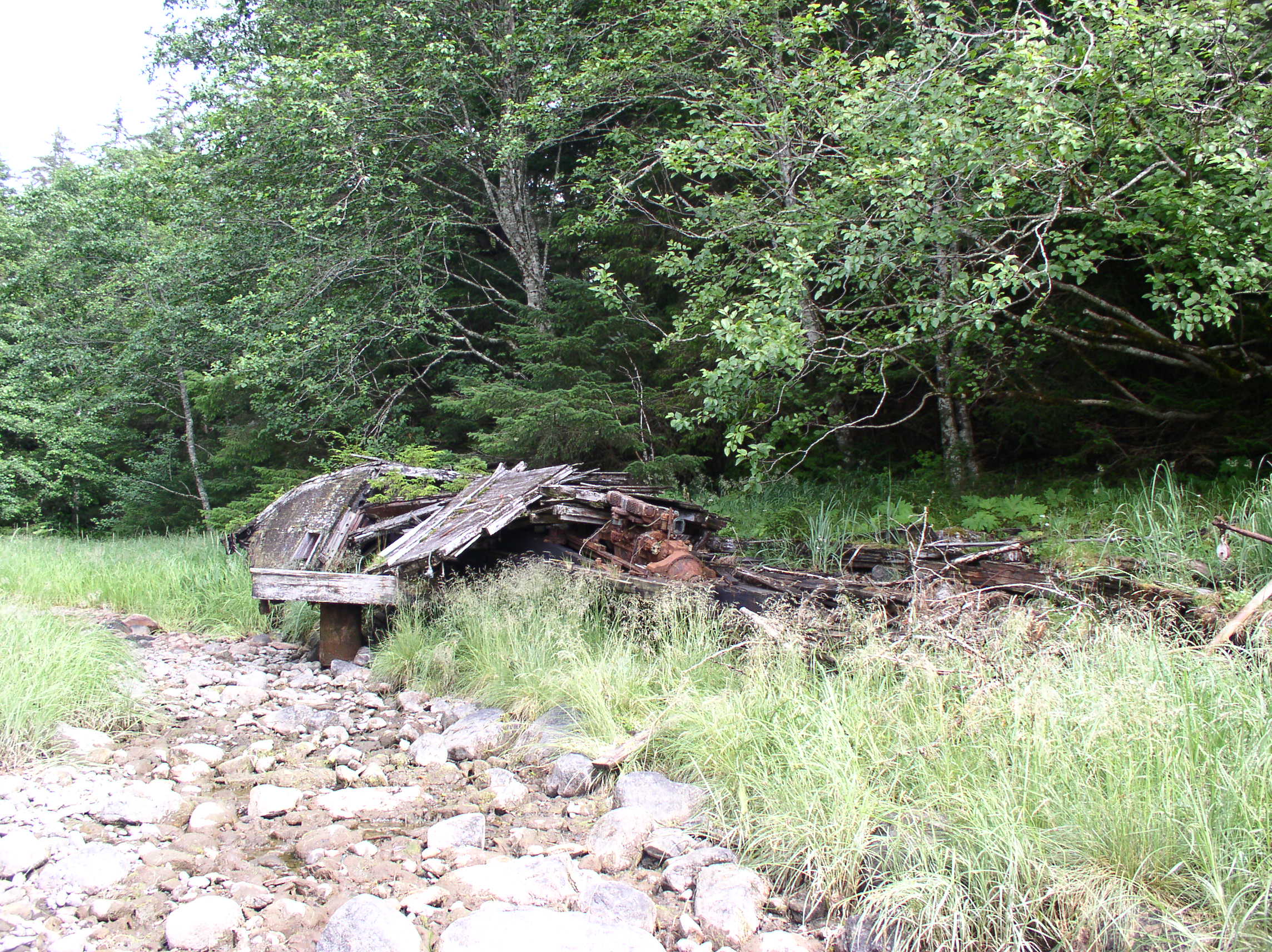
Remains of the Nimrod at Funter Bay.

The H.W. McCurdy Marine History of the Pacific Northwest mentions the Nimrod: “At Seattle, Capt. C.W. Waterman…. later adding the 53-foot gas tug Nimrod of 1903, and forming the Waterman towing Co, which also remained active on Puget Sound for some years”

Here’s a classified ad run in the June 2, 1918 Sunday Oregonian by Capt. Waterman:

“WANTED Gas tow boat about 50 to 65 ft.. with 40 to 75 H. P.; would consider pleasure boat if power enough and boat could be converted to suit; price must be right. Address C. W. Waterman, 2210 47th av s. S. W.. Seattle, Wash.”

The Nimrod is listed in the 1963 registry as being “dismantled”.  Owner Elmer P. Loose Jr. was listed as a Funter Bay resident in 1965, and also owned the Sally Ann. An Elmer Palm Loose is recorded as having passed away March 1962 at Funter Bay (some of these dates would appear to be inaccurate).

When I show people the Nimrod, they ask, “who would name their boat that?” Lots of people, it turns out! The British navy had six ships with that name, and Ernest Shackelton had a ship named the Nimrod. The USCG documentation database lists 9 boats currently with that name. Several others are listed in the historic Merchant Vessel registry.

Here is another local wreck:

-Feb 15, 1959, a 42 foot, 14 ton, 91hp gas boat, the Teddy, was abandoned at Funter. Registry 207218, built 1910 in Astoria OR and listed as a passenger boat in 1911. Listed as a fishing boat owned by Teddy Preston Childers of Funter Bay in 1958, callsign WB7995. (per Merchant Vessels of the United States: Vessels Lost). According to this document, The Teddy was being used as a ferry, and had engine trouble near Pt. Retreat in 1953. The boat was abandoned at the AAGMC mine at Funter (across the bay from the cannery).

I’m still working on tracking down the Highwater Island wreck, and I also have some commercial steamship history to investigate, so stay tuned for more boat-related posts!


Funter Bay History – Steam Power & Internal Combustion

April 23, 2013

Most of the industry in Funter Bay required power of some kind, steam was the major power source prior to cheap and reliable internal combustion engines, but early gas and diesel engines began arriving around the turn of the century.

You would think that in the middle of a forest, the best fuel for steam engines would be locally-cut wood, but coal seems to have been used instead (you can still find chunks of coal on the beach in a few places). Whether this was due to the design of the boilers, the thermal properties of spruce, or due to lumber harvesting restrictions, I’m not sure. Oil was also an option for fueling boilers (there was a whale oil plant at Tyee, and early petroleum wells in Southcentral Alaska). One document from the 1920s mentions that Killisnoo coal was preferable to oil as a fuel for steam boilers at Funter Bay. Coal was mined at Harkrader on southern Admiralty Island, near the fish processing plant at Killisnoo (now part of the village of Angoon). Discovered by Russian explorers, used by early Russian and American steam vessels, and mined intermittently until 1929 , this deposit was planned to supply Inside Passage steamships, but seems mostly to have been sold in local communities.

Edit: The main engines at the cannery appear to be gasoline, rather than steam, see below.

Large operations like the Funter Bay cannery had a large central boiler which provided steam for cooking and sterilizing, as well as heat and hot water for the sites.

Cannery power house in the 1980s:

Cannery 4

Some close-ups of the two horizontal stationary gas engines at the cannery. The name plates have wandered away, so I don’t know much about these (Update: Local resident Gordon Harrison has informed me these were Fairbanks-Morse gasoline engines, an early type of low-horsepower (5-10hp) internal combustion engine. These seem to resemble the 1898 designs, so it’s likely that they were original equipment for the cannery when it started in 1902. Some diagrams of similar engines can be seen here):

OLYMPUS DIGITAL CAMERA

OLYMPUS DIGITAL CAMERA

OLYMPUS DIGITAL CAMERA

The two engines would have been located in the machine shop, with the boiler located in the power house.

closeup1

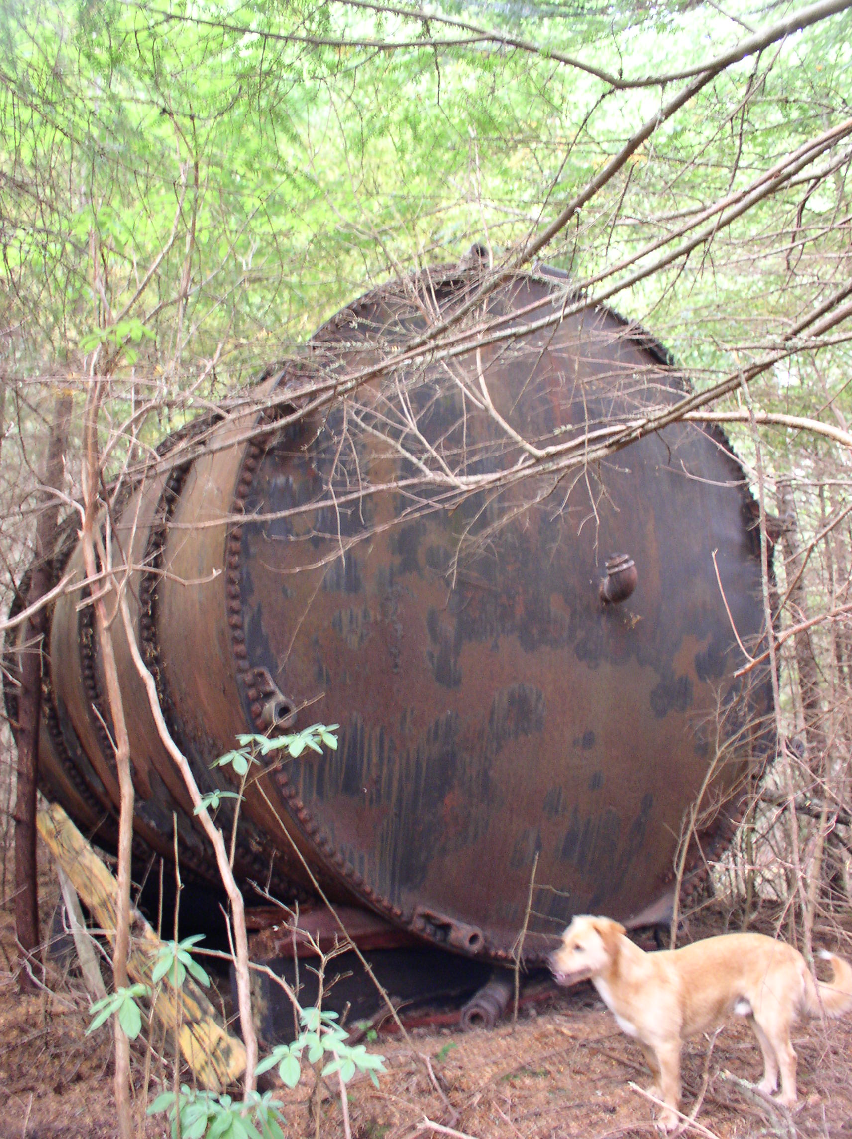
Two large tanks such as this held water for the boiler. On the map above, you can see the tanks located behind the power house. Update: The tank below is in fact the one located behind the pump house on the above map, and was used for oil. The two tanks behind the power house were nearly identical in design.

OLYMPUS DIGITAL CAMERA

Mechanical power from the Fairbanks-Morse engines would be transferred via belts from the engine flywheels to overhead pulleys and shafts (rods), which distributed the power out to various machines (run from other pulleys and belts with a clutch system). Below is a surviving example of some of this overhead equipment in the carpentry shop attic, as viewed from above:

OLYMPUS DIGITAL CAMERA

And below is some of the equipment which would have been operated by this arrangement (I’m not sure specifically what the devices below were, they’re rusted pretty badly and missing a lot of parts):

OLYMPUS DIGITAL CAMERA

OLYMPUS DIGITAL CAMERA

OLYMPUS DIGITAL CAMERA

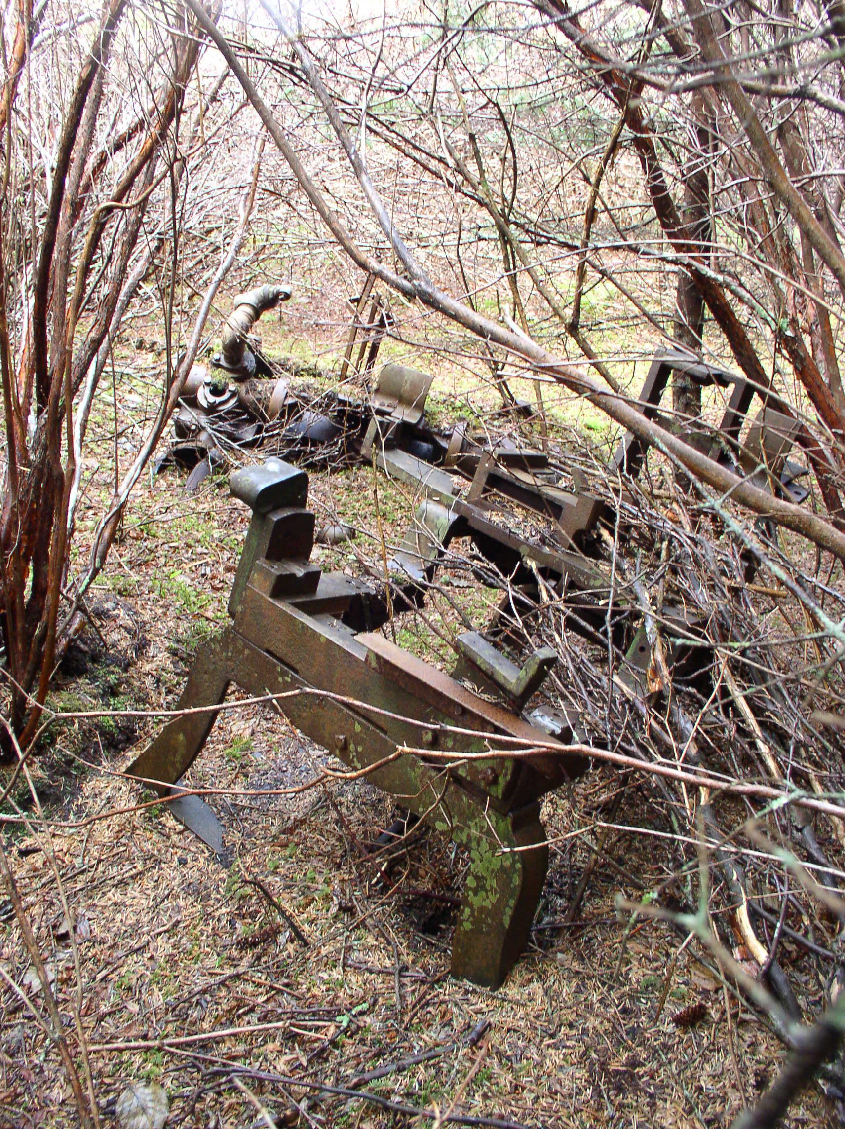
Away from the main site, there would be smaller gas, diesel, or steam engines with “portable” boilers set up to operate things like winches, hoists, and tools. In this case, “Portable” means something like “You can drag it to a new location in about a week with 20 men and a team of mules”. (I’ll try to come back to the mules in a later post). The following shows a boiler for one of these smaller steam plants:

OLYMPUS DIGITAL CAMERA

And a winch with small steam piston:

OLYMPUS DIGITAL CAMERA

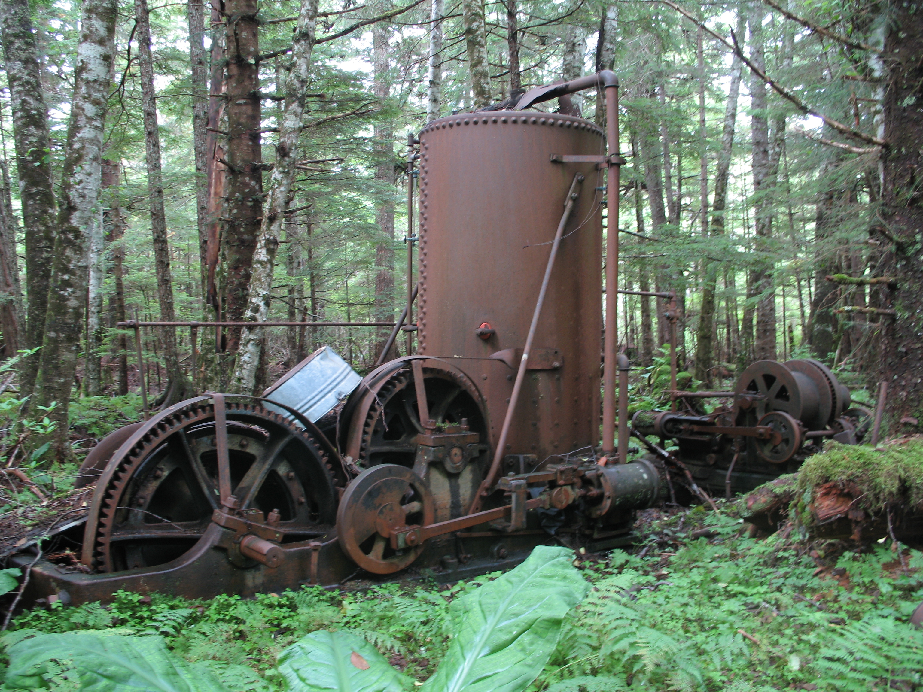
A more packaged power unit was the “Steam Donkey“, a somewhat standardized portable boiler, steam engine, and winch on skids. These could be moved by clearing a road or trail, hauling a cable to a tree or other anchor, and then letting the unit winch itself towards the anchor. Here is a steam donkey that ran a mine tramway:

IMG_1334

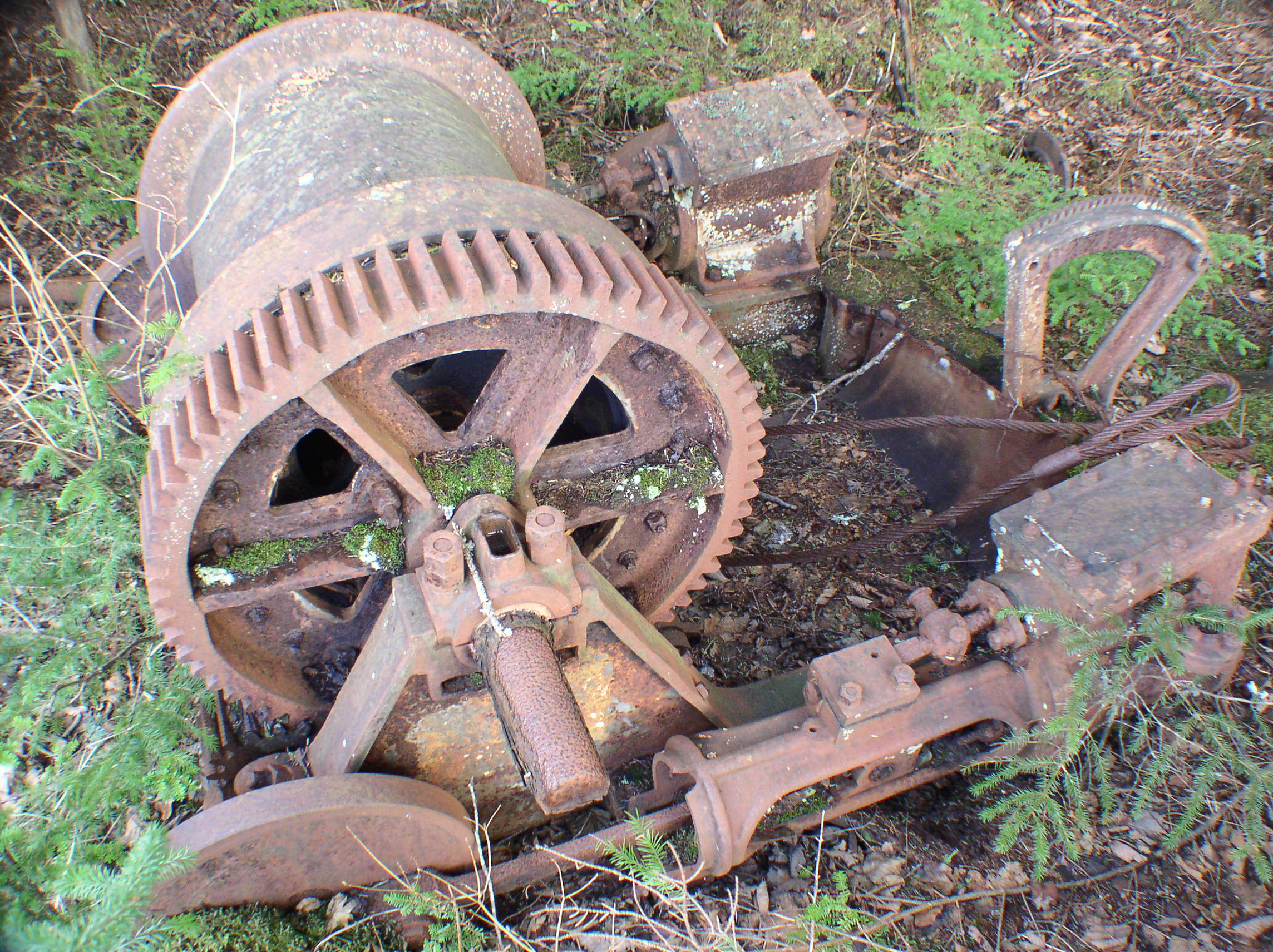
Note that there seem to be two piston units associated with this donkey, the heavily-geared one at front, and another unit with a large cable winding drum at the rear. Below is a closeup of the rear unit, which had a steam piston on each side of the central drum:

IMG_1329-2

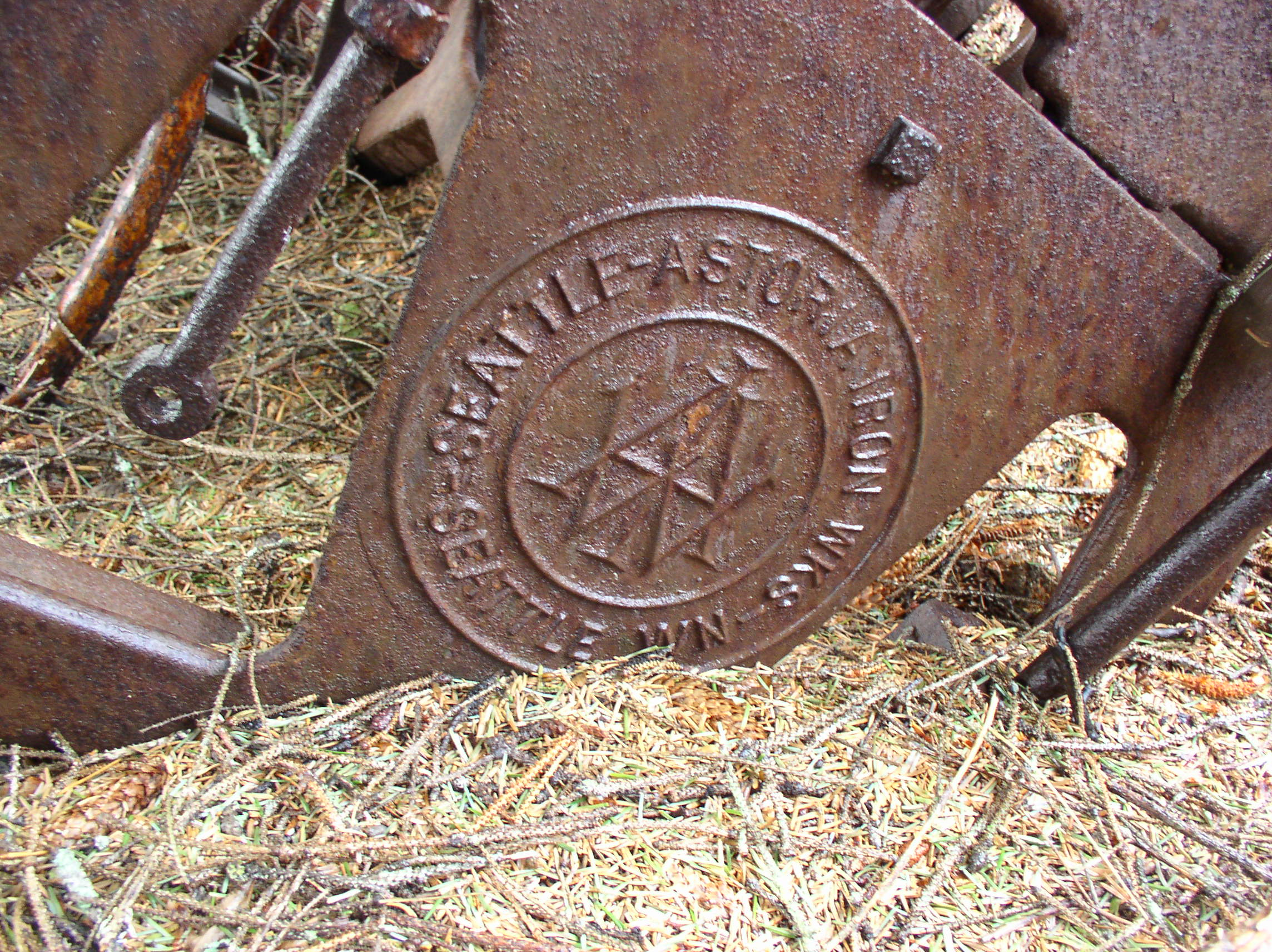
Update: after looking closely at my photos, I can make out what appears to be “Vulcan Iron Works” of Seattle. Here are some photos of a very similar Vulcan steam donkey, built in 1901.

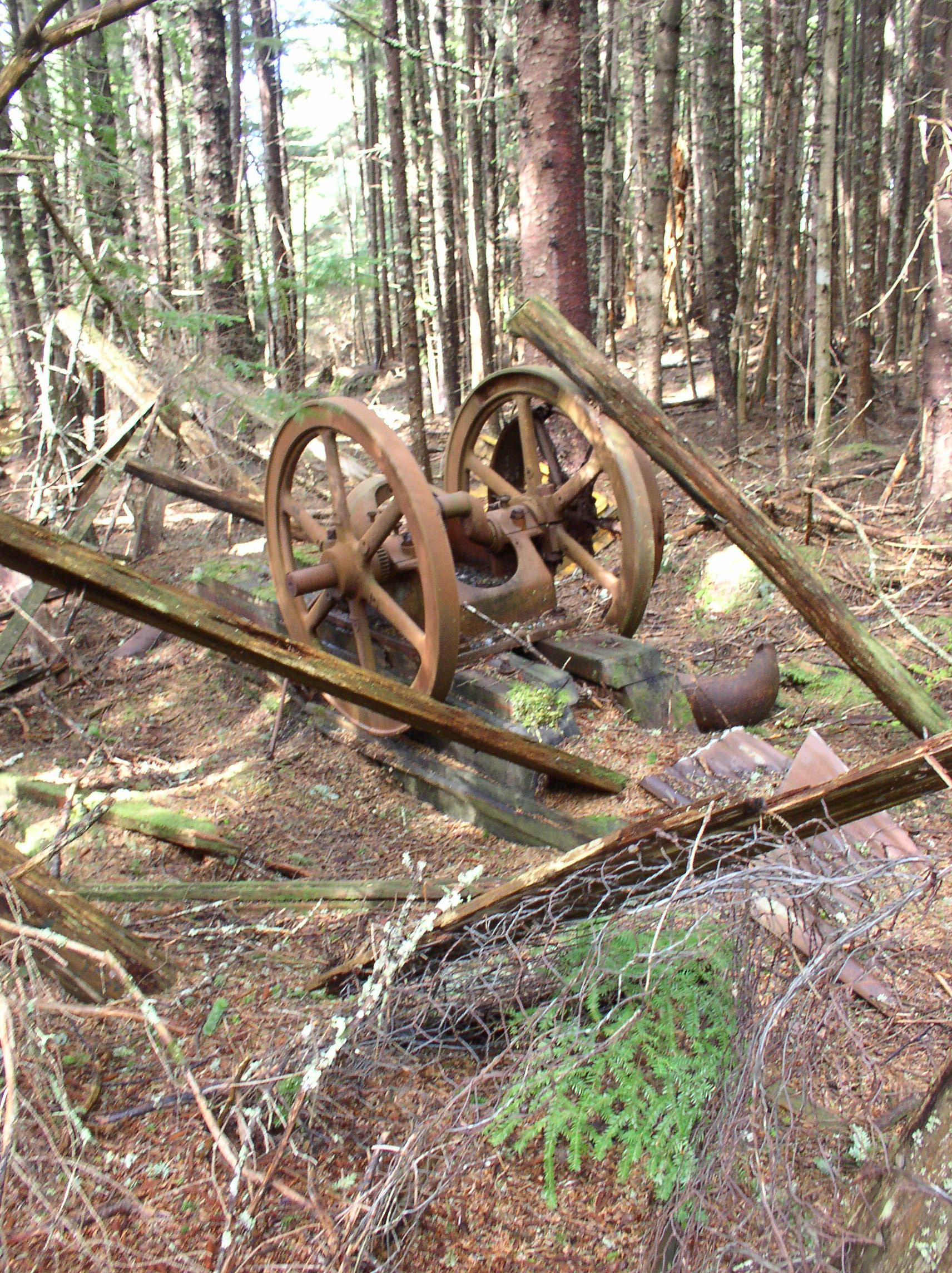
Here is an early low-horsepower gas engine in the woods near the cannery:

OLYMPUS DIGITAL CAMERA

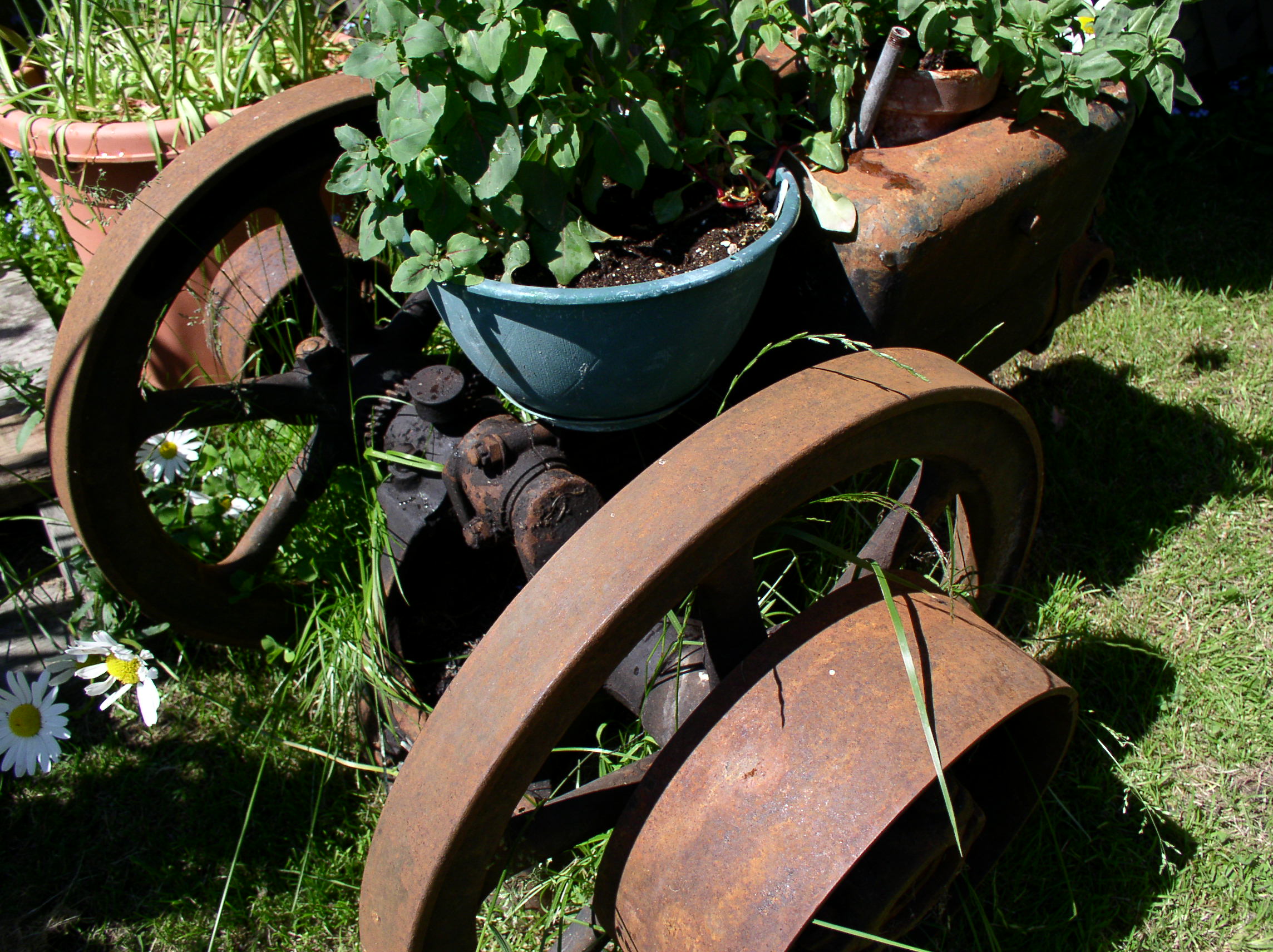
A smaller and slightly newer (3hp?) gas engine, similar to the ones shown here.

OLYMPUS DIGITAL CAMERA

Thanks to Gordon Harrison for providing some additional details!


Funter Bay History – Mansfield Mine & Other Small Mines

April 17, 2013

OLYMPUS DIGITAL CAMERA

The Mansfield mine (also listed as the Seattle mine) is located at 500ft elevation about 3/4 of a mile from the head of Funter Bay. Discovered in 1908, the claim showed promise of gold, copper, zinc, and lead. A beach camp at the head of the bay still has some barely-visible cabin foundations, locally known as a blacksmith and/or mule-skinner’s cabin. A blazed trail leads up through the woods to the mine site and the ruins of another log cabin.

The prospect has two short tunnels (less than 100′ long), a small amount of railroad track, and one ore car. Transporting the ore car up to the site probably involved disassembling it and using mules to pack the parts to the mine. Inside the cart you can still find an intact pick and drill steels, it’s almost like a history exhibit! More rusty tools were found inside the mine adits. Several open cuts were also in the same area, a narrow ridge of granite with quartz veins cutting through it.
Apparently the claim was promising enough to pack in equipment, but not profitable enough to mechanize or exploit it beyond the small workings.

John at the upper cabin site, one of the cut logs is barely identifiable.:

OLYMPUS DIGITAL CAMERA

The ore cart outside the first adit:OLYMPUS DIGITAL CAMERA

Inside the ore cart, a collection of mining tools:OLYMPUS DIGITAL CAMERA

The first, and longest, adit. The tunnel featured rails along most of its length, and was flooded with about a foot of water:

OLYMPUS DIGITAL CAMERA

OLYMPUS DIGITAL CAMERA

Chris poses at the end of the tunnel. We suspected it might be flooded and didn’t feel like packing waders along, so we used the latest in Alaska fashion accessories: Trash bags and duct tape:

OLYMPUS DIGITAL CAMERA

Iron and calcium deposits on the floor, and the exposed quartz vein in the granite tunnel:

OLYMPUS DIGITAL CAMERA

OLYMPUS DIGITAL CAMERA

The second adit was partly collapsed and much shorter (about 20ft, probably dug around 1916 according to USGS data). This one featured an intact pickaxe (shown in the top photo), and some kind of clamping or plier tool, seen below:  OLYMPUS DIGITAL CAMERA

The mine claim was marked with corners like this: A metal can containing paper with claim information, jammed into a blaze in a tree. The can was pretty well stuck in there, the tree had grown around it a little since it was placed.

OLYMPUS DIGITAL CAMERA

Finding this mine was pretty interesting. Despite having hiked and hunted around the area extensively, I’d never stumbled across it. The trails are overgrown and the tunnels and mine cart are covered with thick brush, so there’s not much to see until you get right on top of it. I first heard of this mine while perusing some old survey documents relating to claims. I was able to locate the original USGS survey monument and derive GPS coordinats for the claim site based on the surveys. We then set out with a PDA running digital topo maps to try to locate the mine. Even with coordinates, it took us some time to find the two tunnels, and we still missed finding some of the open cuts. The GPS also required an external antenna to get a signal through the thick tree coverage.

OLYMPUS DIGITAL CAMERA

Some scenery on the way to the mine:

OLYMPUS DIGITAL CAMERA

View out over Funter Bay from the mine site:

OLYMPUS DIGITAL CAMERA

There were several other small mines near the head of the bay. The Portage prospect, across Bear Breek, was started in 1900 and had a small shaft, tunnel, and trenches, but did not reach profitable ore. I have heard there is some machinery still visible at this site. The “Bear Creek” placer claim of 1967 was just downstream of this, and was probably a local resident’s gold-panning spot.

On the back side of the pass, facing Juneau, was another “Bear Creek” claim, this one for Tremolite asbestos. Around 1928, a Juneau resident named Augustus DeRoux discovered asbestos while searching for gold and copper. The Alaska Asbestos Co built a road from the beach around 1930 and apparently started a “rail tram”, but abandoned it when the USGS found the deposit not worthwhile.

asbestos asbestos2