Funter Bay History: Logging

May 23, 2013

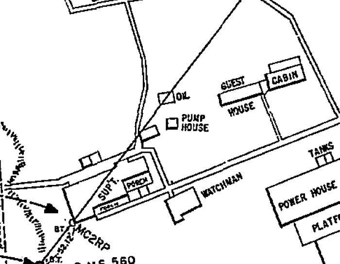
While Northern Admiralty Island was never clearcut on an industrial scale the way the central section was, there have been occasional timber harvests in the Funter Bay area. Industrial logging was both helped and hindered by regulatory issues; creation of the Tongass National Forest in 1907 added some forest protections, but the Forest Service also earmarked large parts of National Forest to become foreign pulp exports. Private landowners had a few more options for local-use and some export harvests. General information and statistics on Alaskan logging is available here and here. A basic timeline of logging and timber regulation in Southeast Alaska in the 20th century is available here.

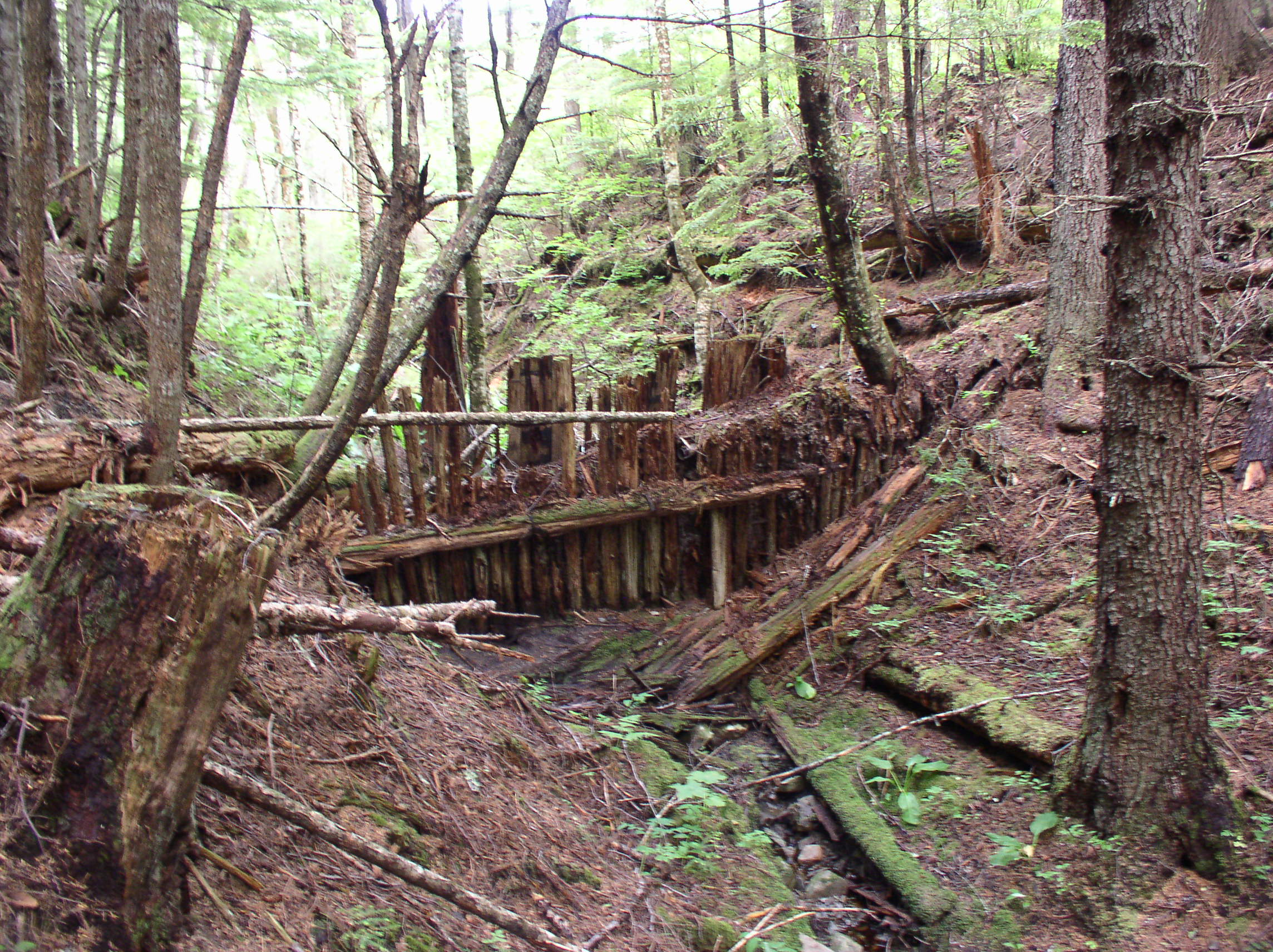
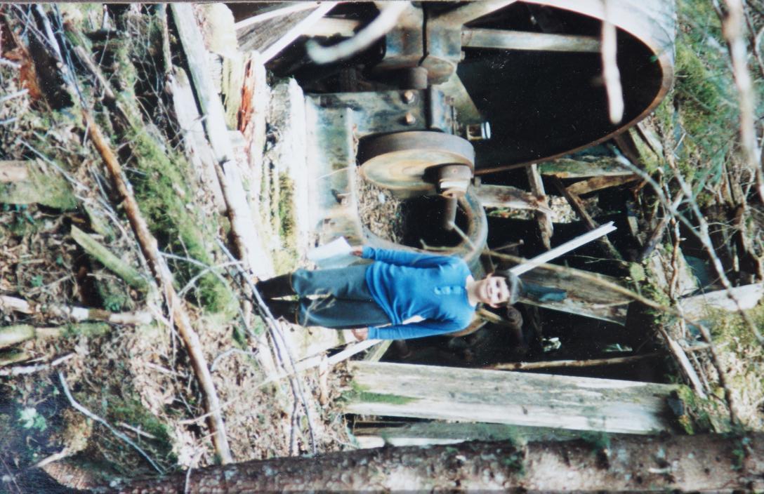
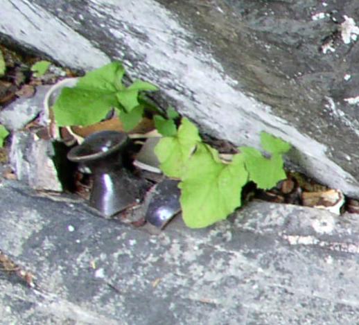
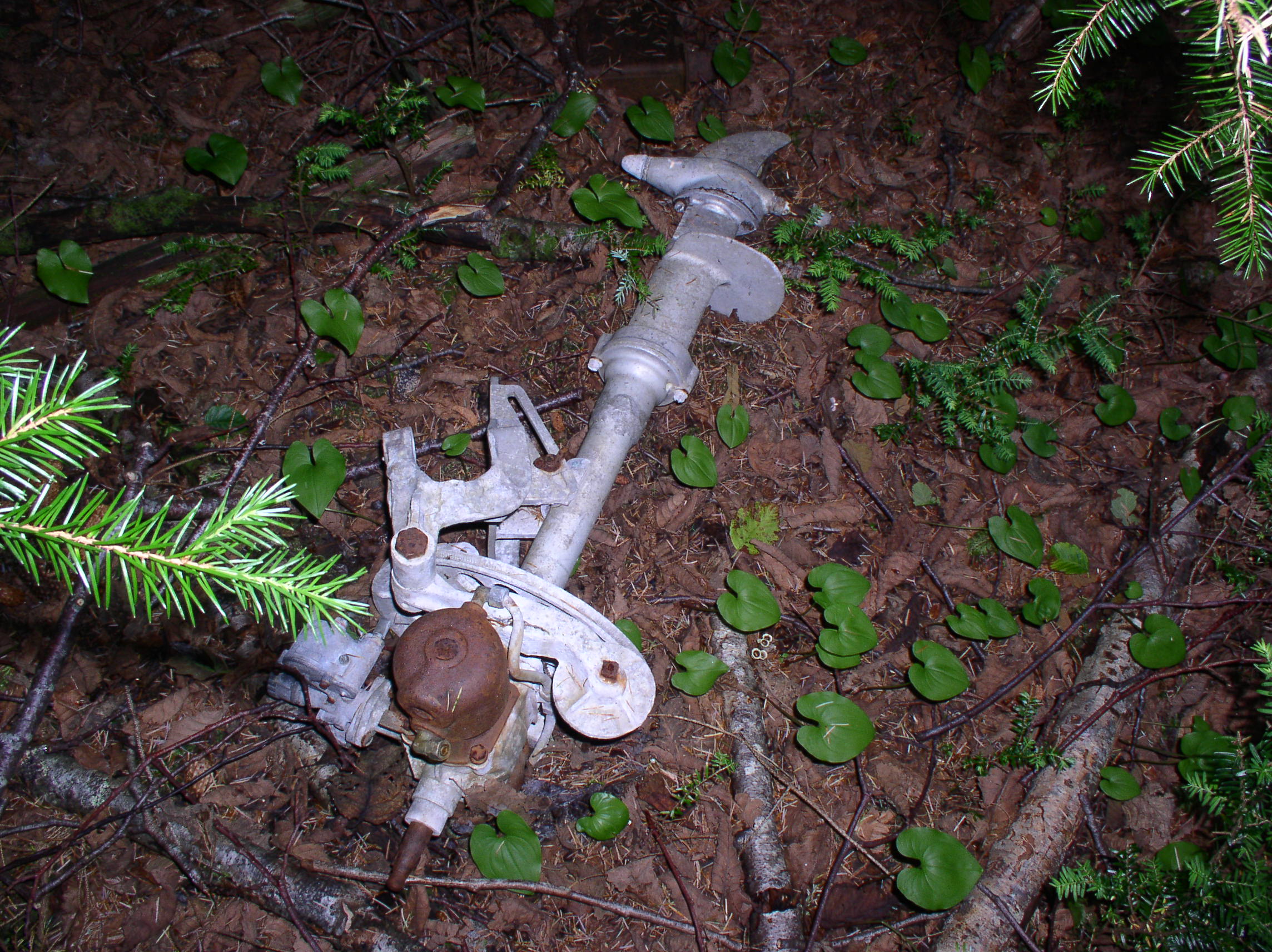
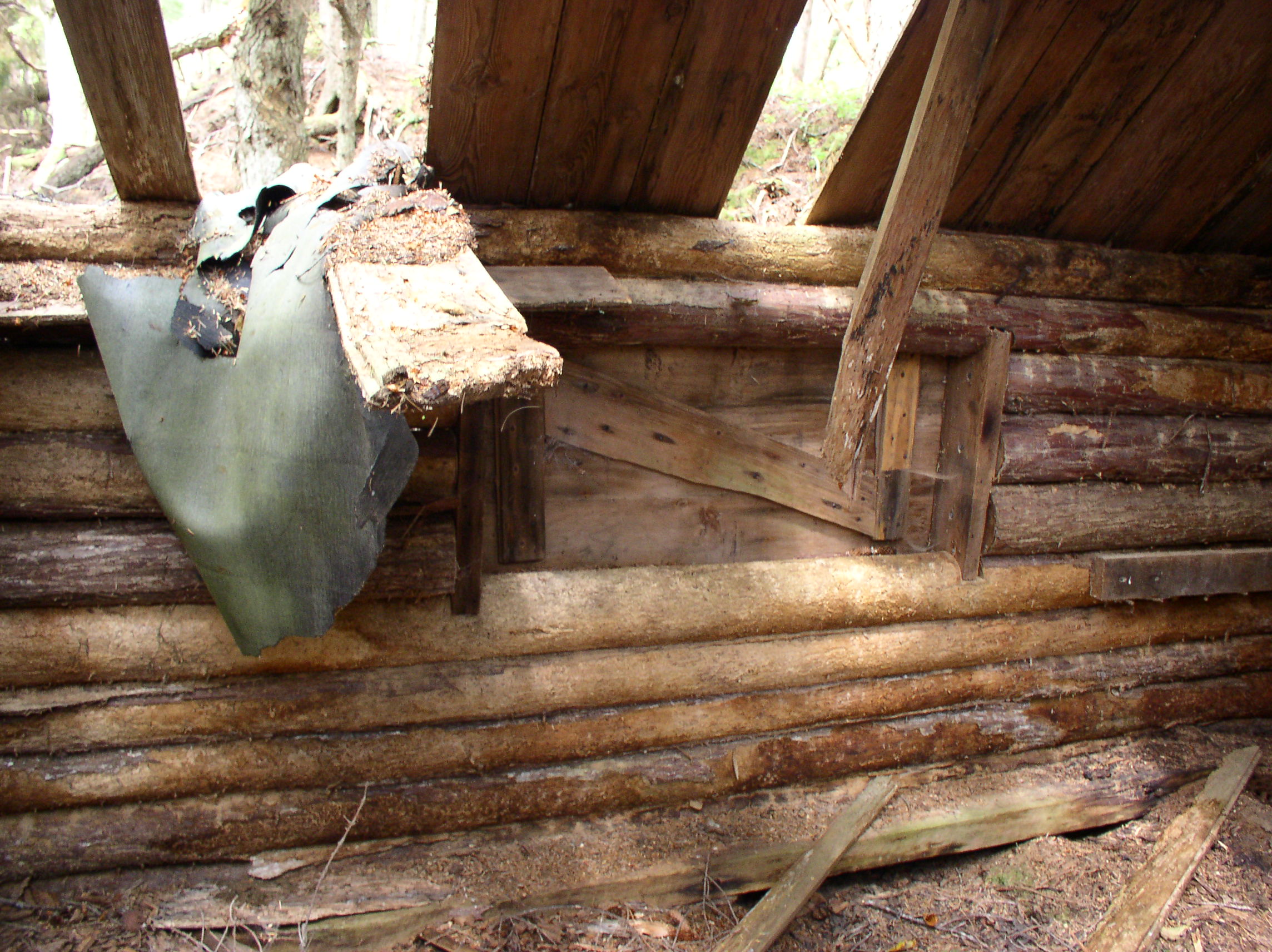
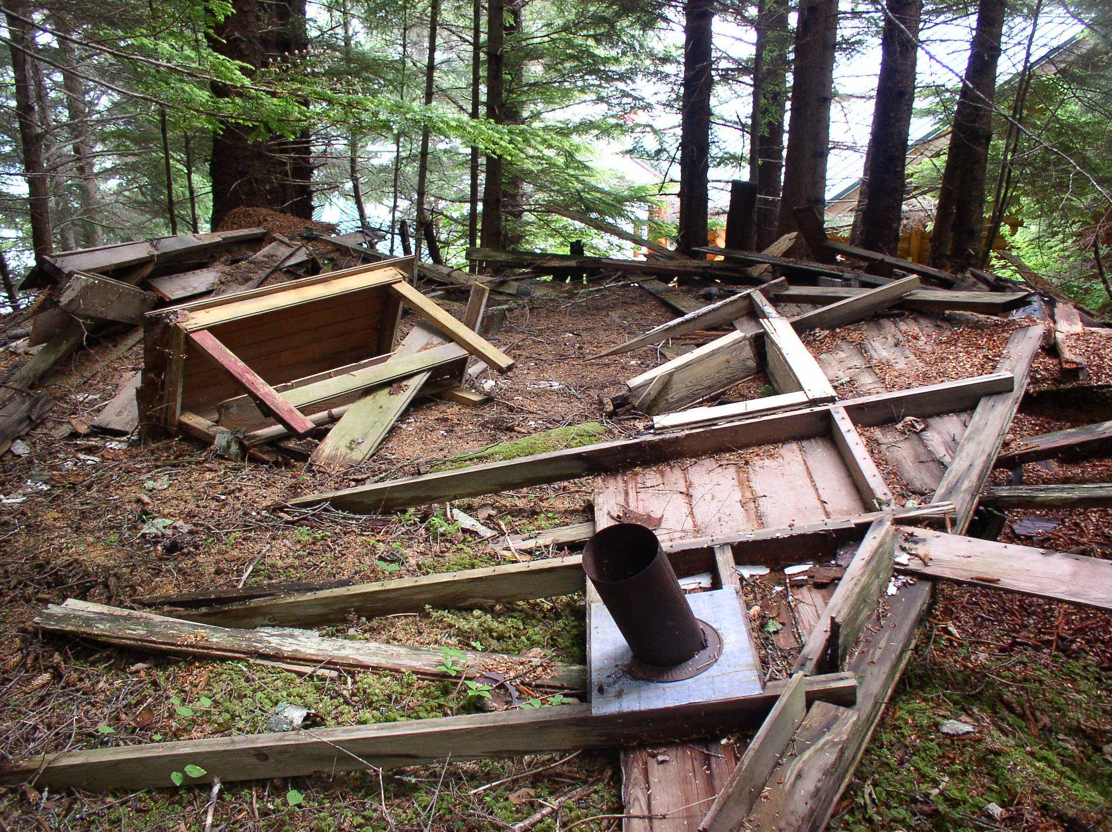
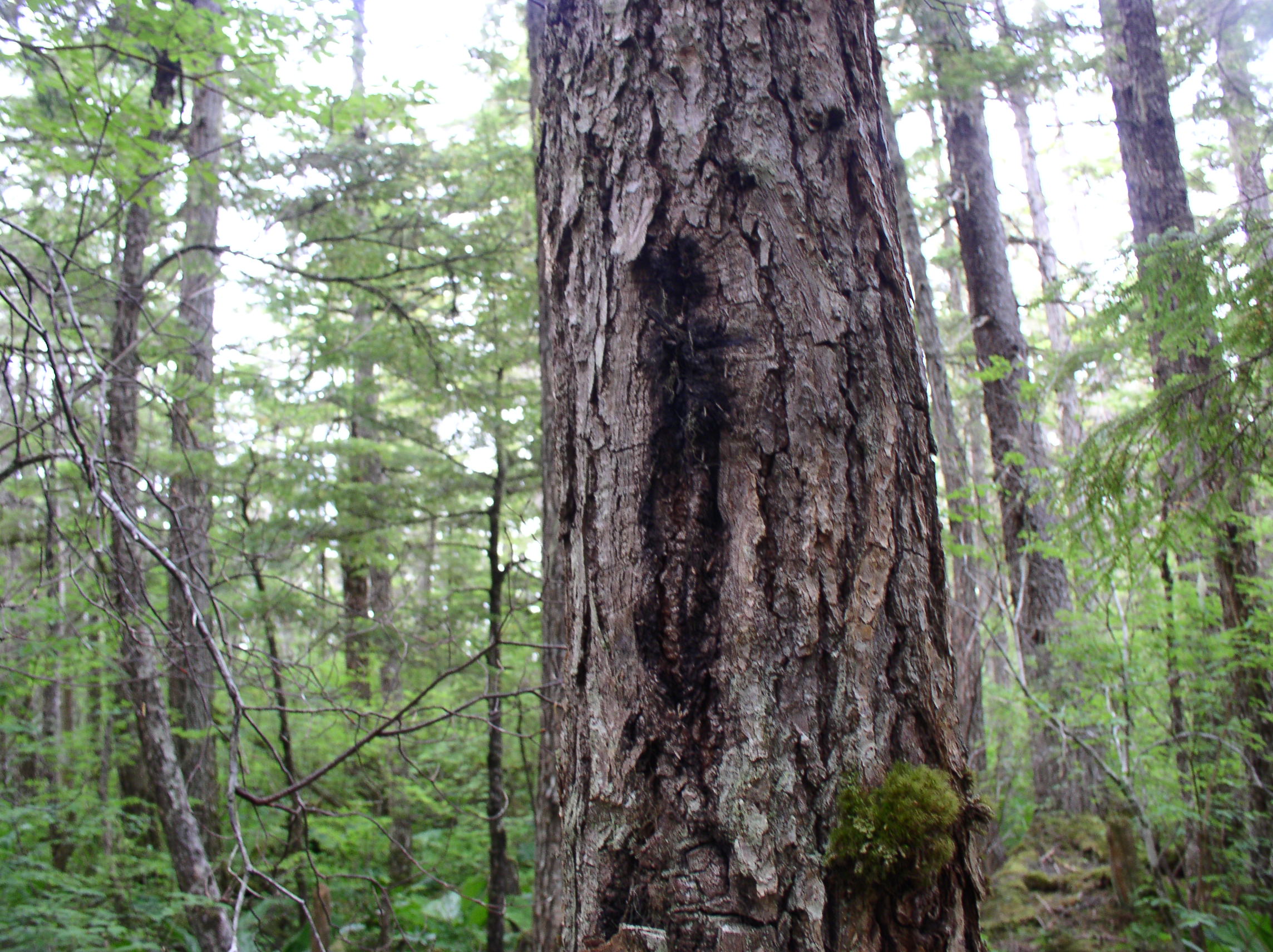
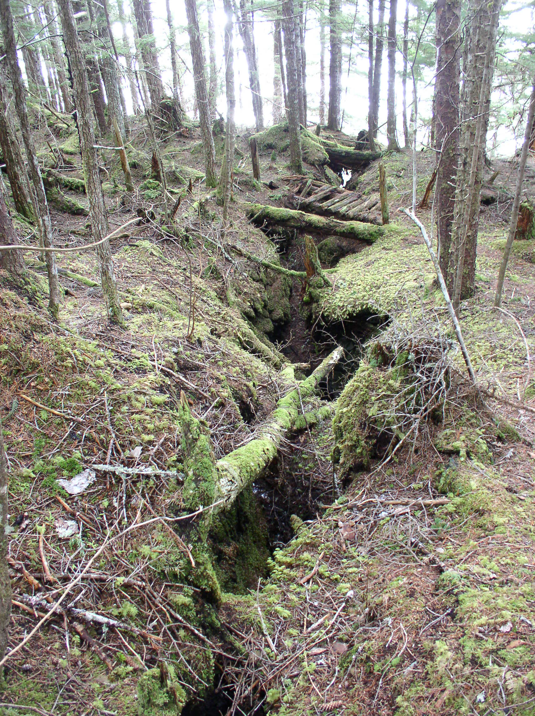
Handlogging tools at Funter Bay:
IMG_2159

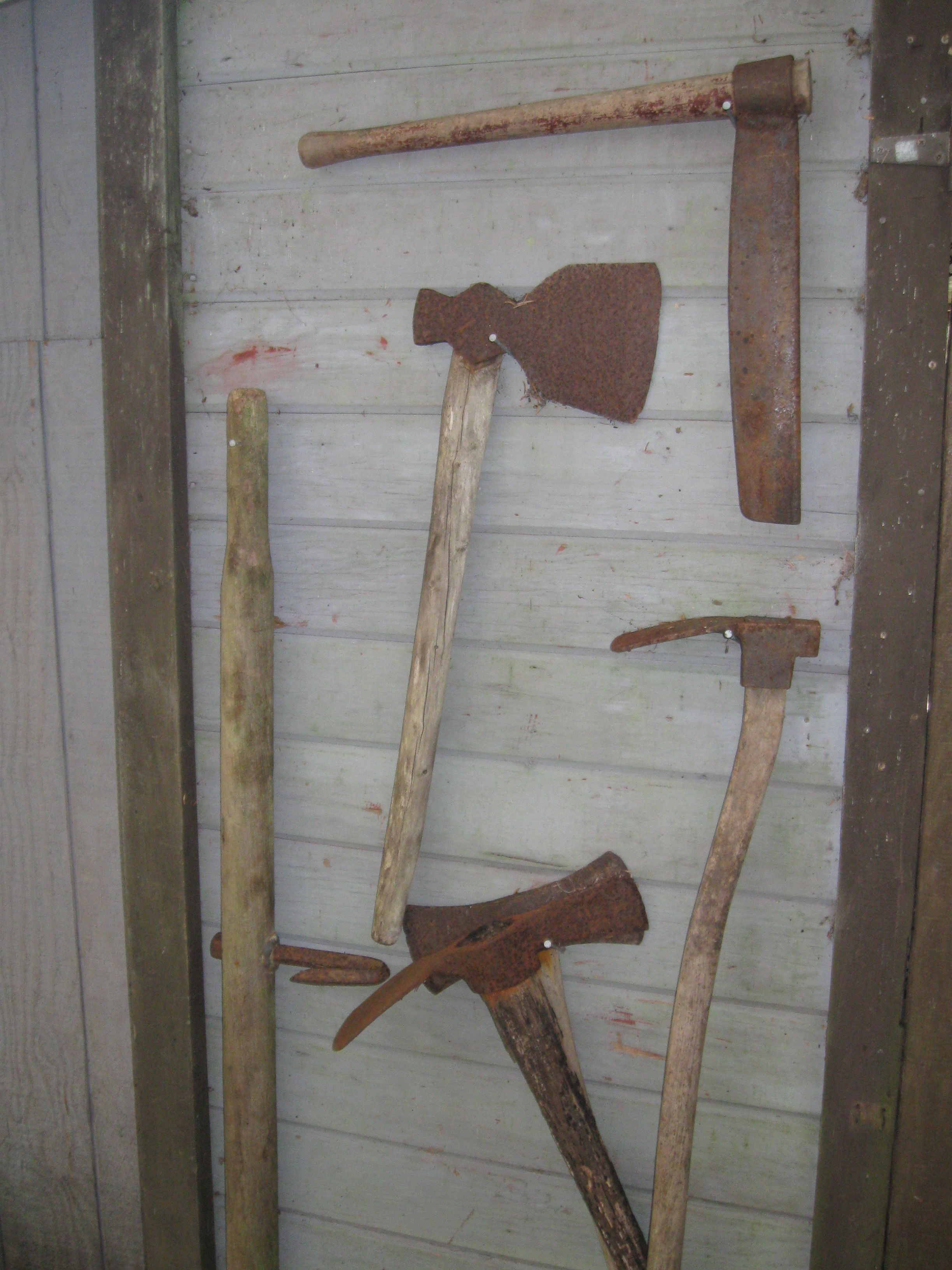
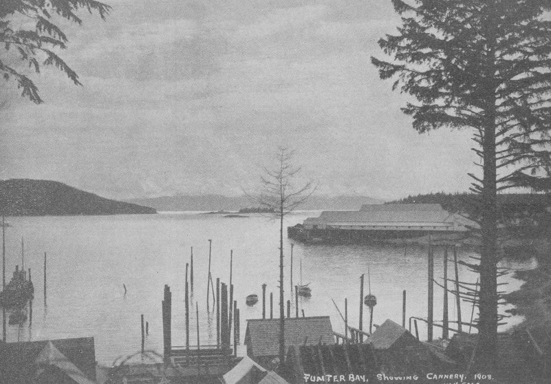
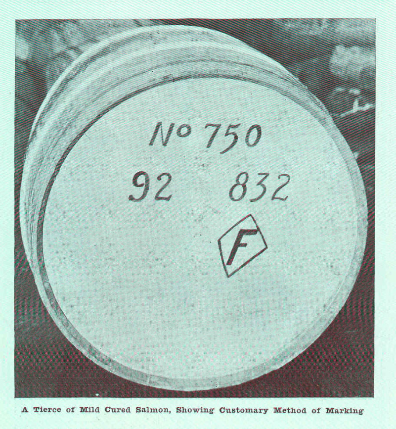
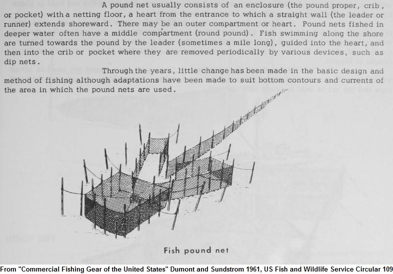
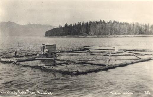
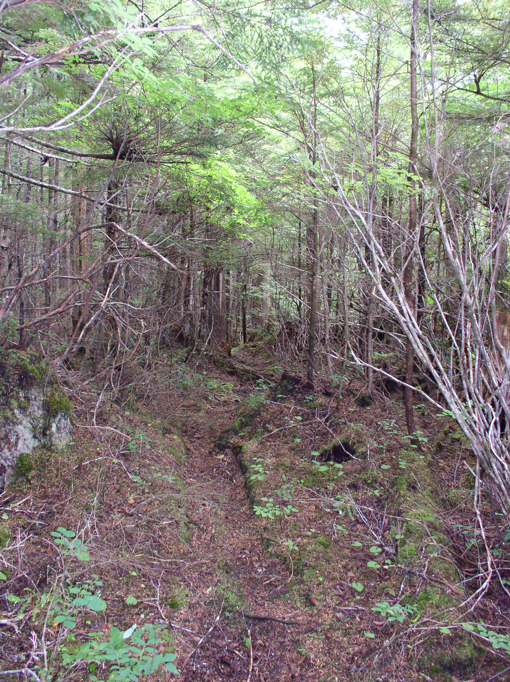
Early hand-logging operations in the 19th and early 20th century supplied logs for fish traps and pilings, shipping crates for canned salmon, wood for cannery and mine construction, and possibly fuel (although coal was more common as a fuel for steam boilers, possibly due to the high sap content of local spruce adversely affecting machinery). Most hand-logging operations were based from boats, the loggers would cut trees very close to the shoreline where they would fall into the water, then they would be tied into rafts and towed to lumber mills at Juneau and Douglas. Today there would not be much evidence of this forest-edge harvesting, but the practice probably explains why photos from the early 20th century show very few trees on the small islands in Funter Bay. These islands are heavily re-forested today, they would have been convenient places to cut old-growth spruce and float it away.

station

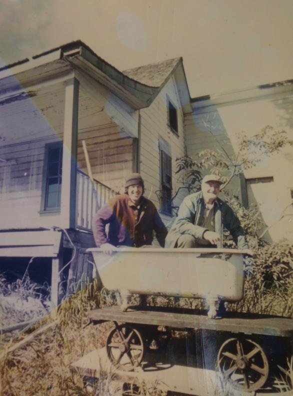
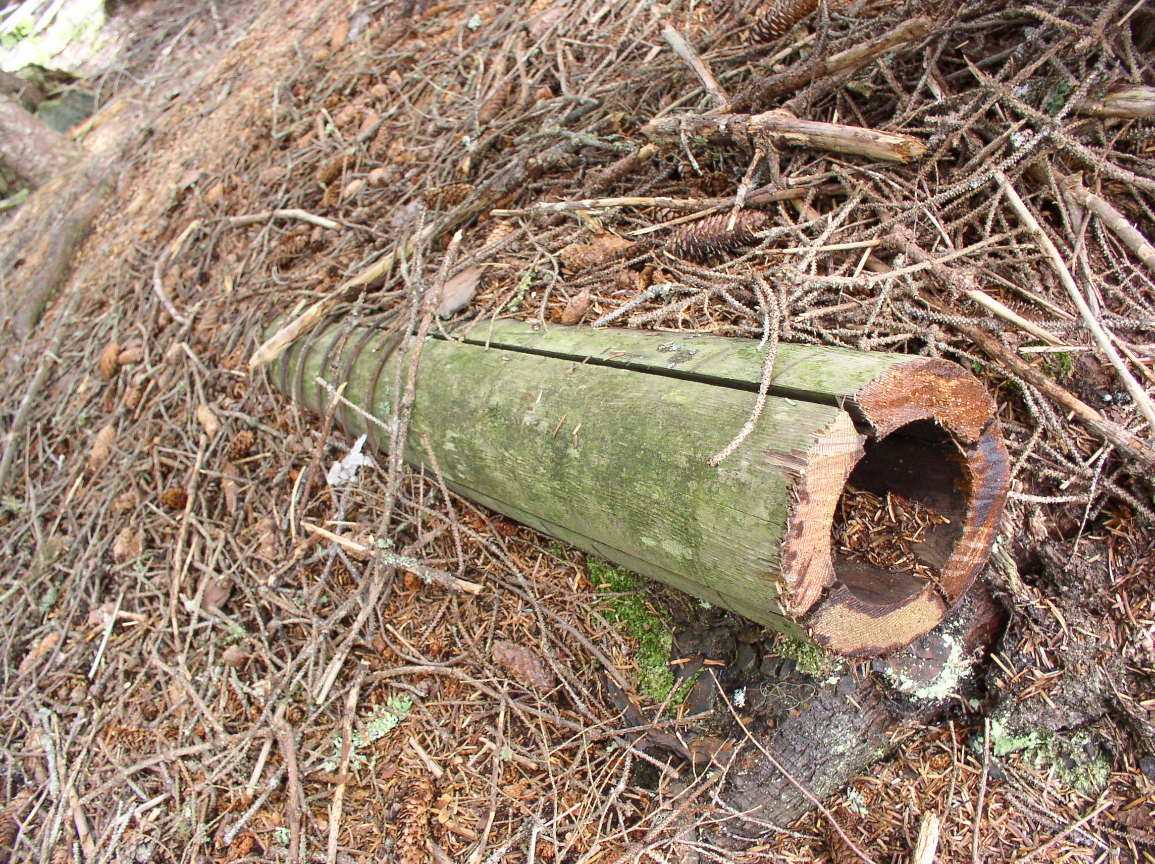
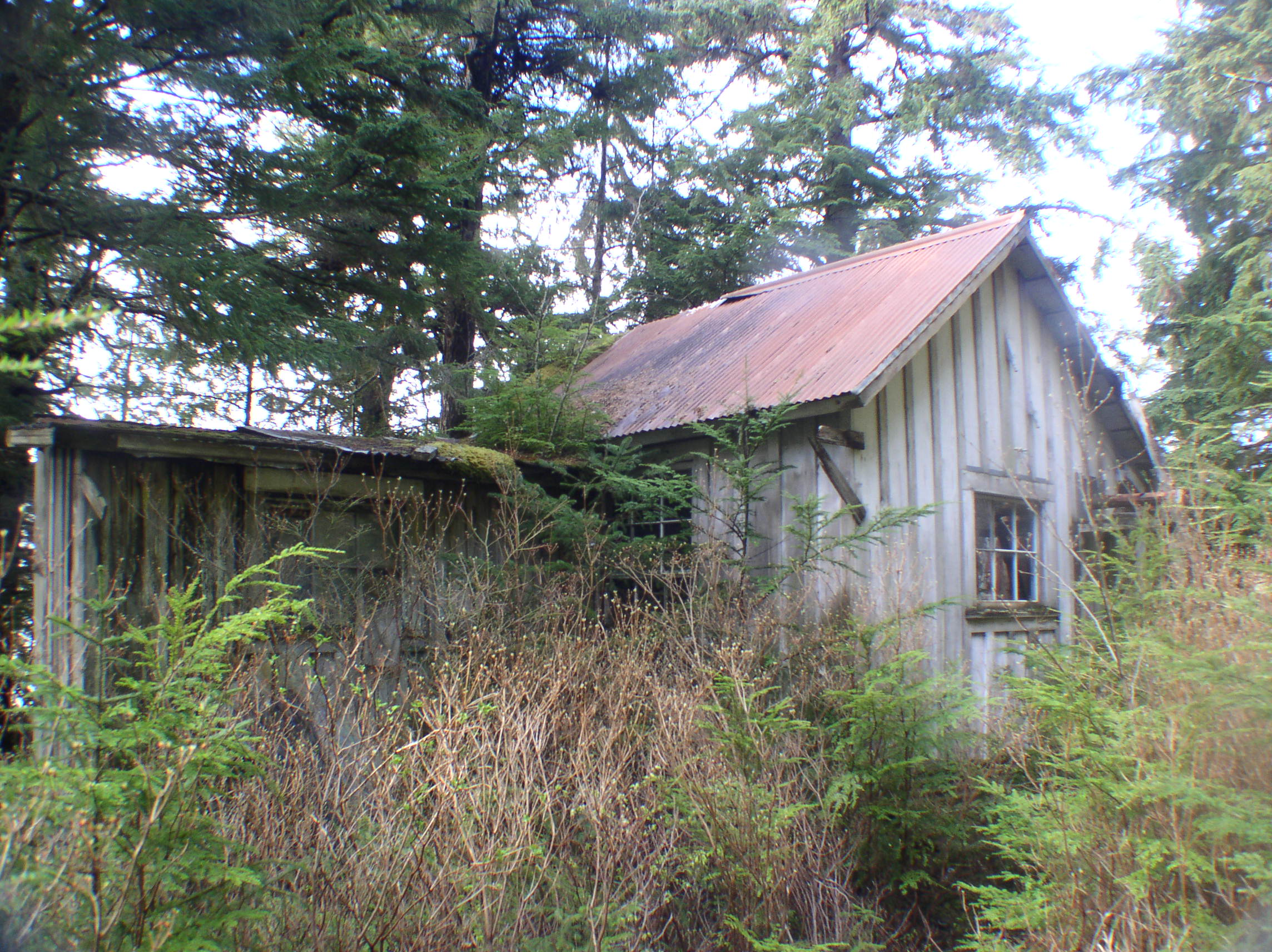
Despite the abundance of timber, some businesses imported lumber for construction, including the Funter Bay cannery (which brought in California Redwood beams), and other local buildings which were pre-fabricated and shipped up as packages. Certain woods like pine, and especially redwood, are more rot-resistant than the local spruce, and buildings made out of such woods have lasted longer in the damp environment. Spruce pilings driven near the shore or used as building footings were often soaked in tar to make them last longer.

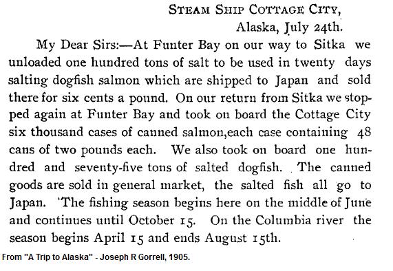
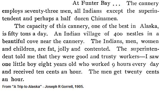
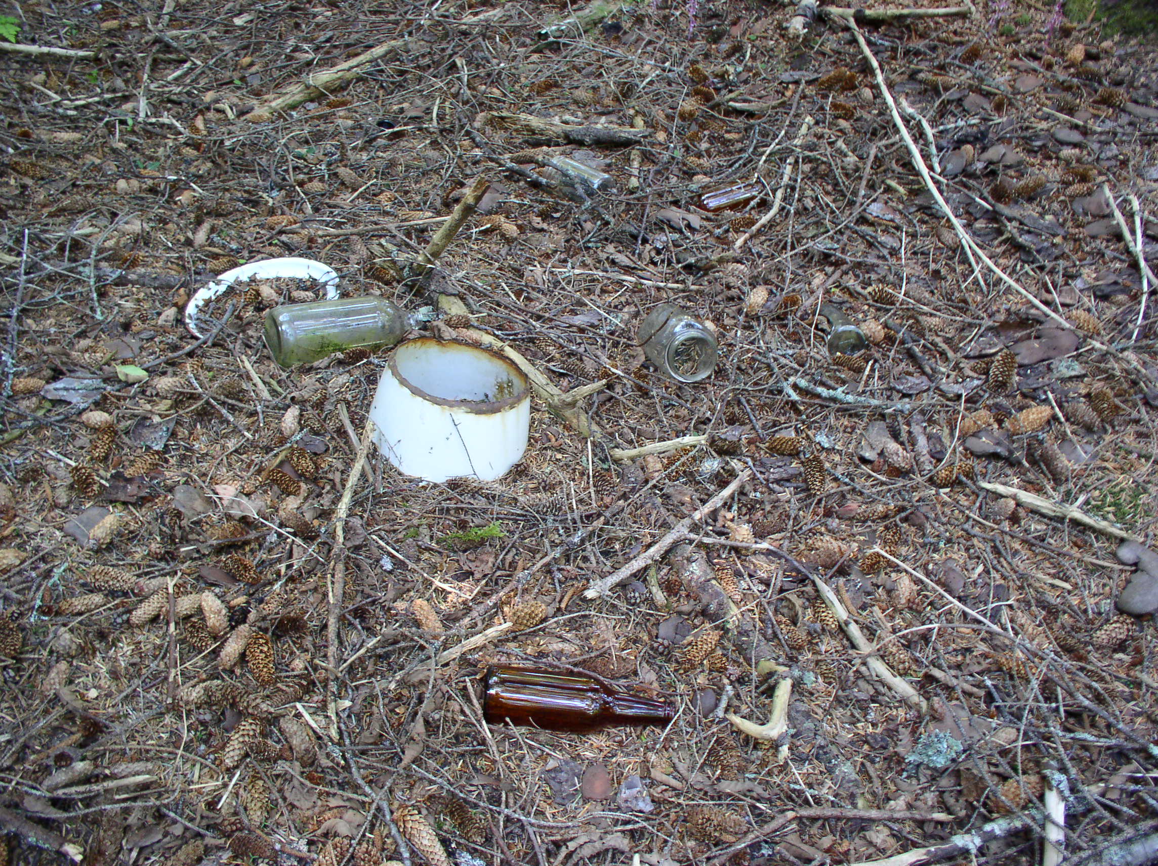
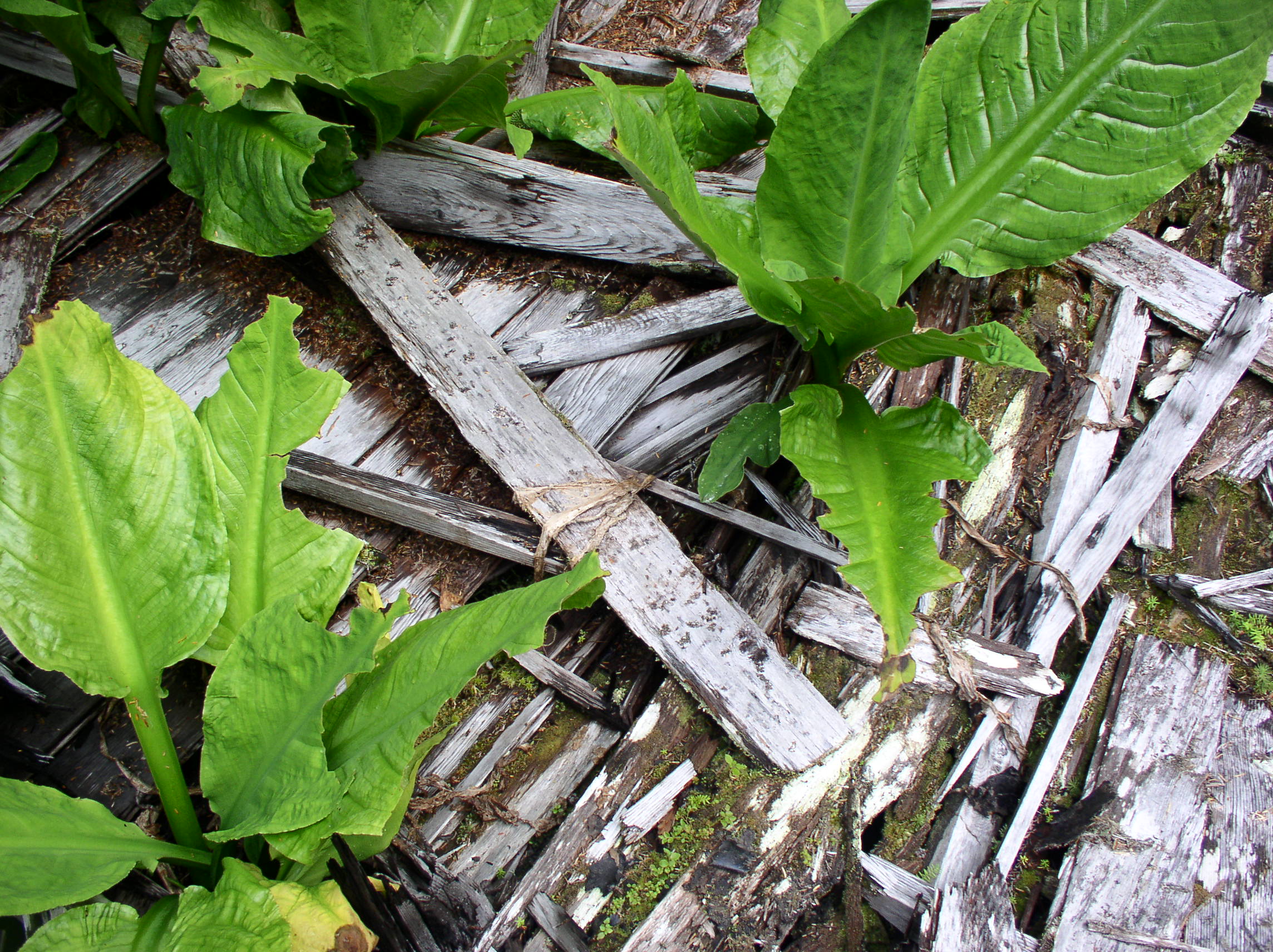
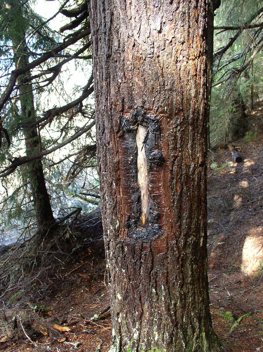
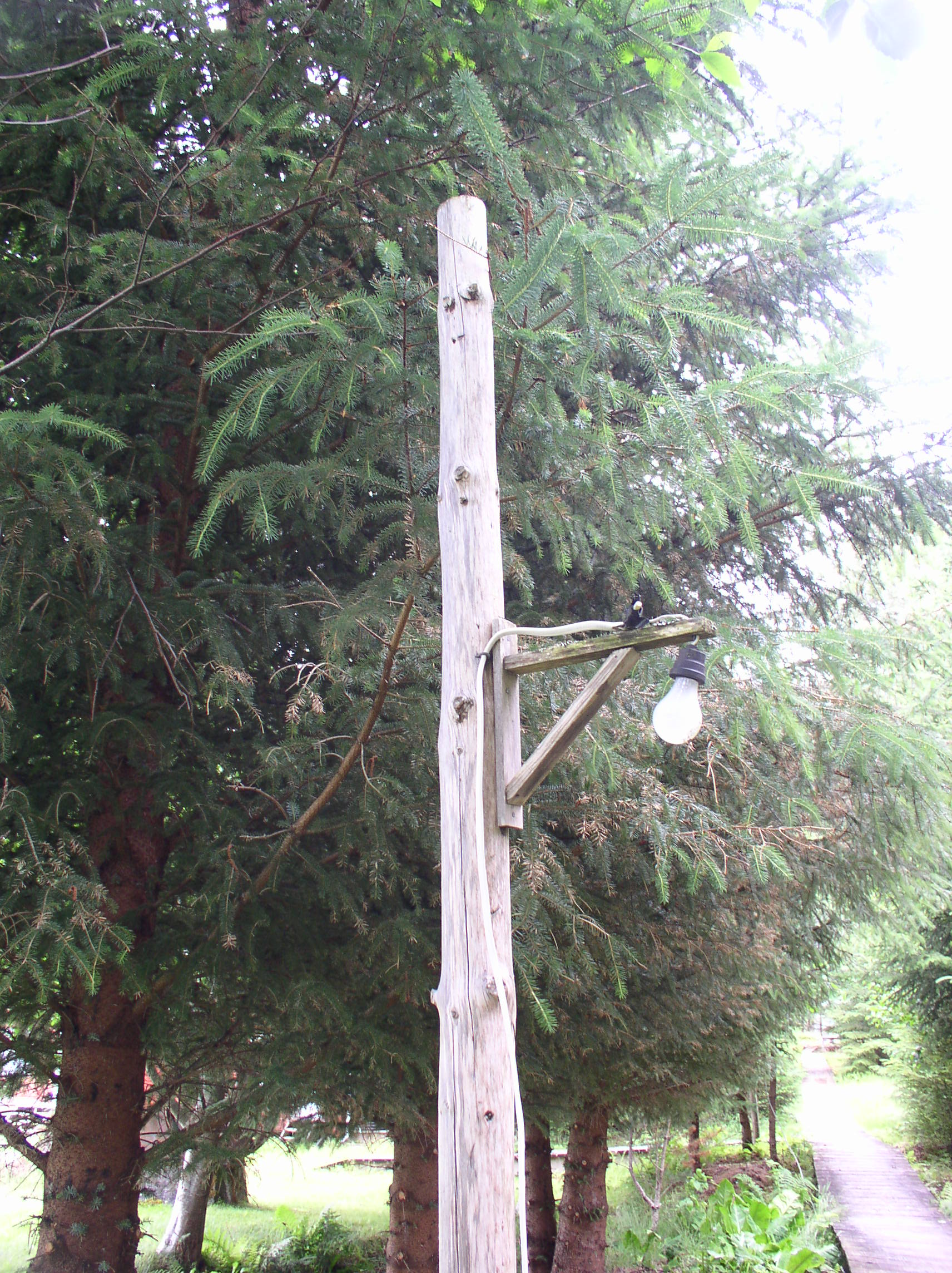
Part of a shipping address stamped on lumber brought in from down south in the early 20th century:
OLYMPUS DIGITAL CAMERA

Barry Roderick’s “Preliminary History of Admiralty Island” mentions a single cable-logging operation on the island in 1905 (where logs would be hooked to a cable and pulled or zip-lined to the beach). Later operations would have been more mechanized, with tractors and engines used to haul logs from stands of timber deeper in the woods. Of special interest were the old-growth cedar trees, prized for their rot resistance.

In 1911, the US Forest Service decided that clearcutting (AKA “Clean Cutting”) was the best method, supposedly it would allow sunlight to reach the forest floor and make new trees grow faster (in reality, clearcutting just creates big jungles of berry bushes, destroys wildlife habitat, and leaves the soil unprotected to wash away into salmon streams).

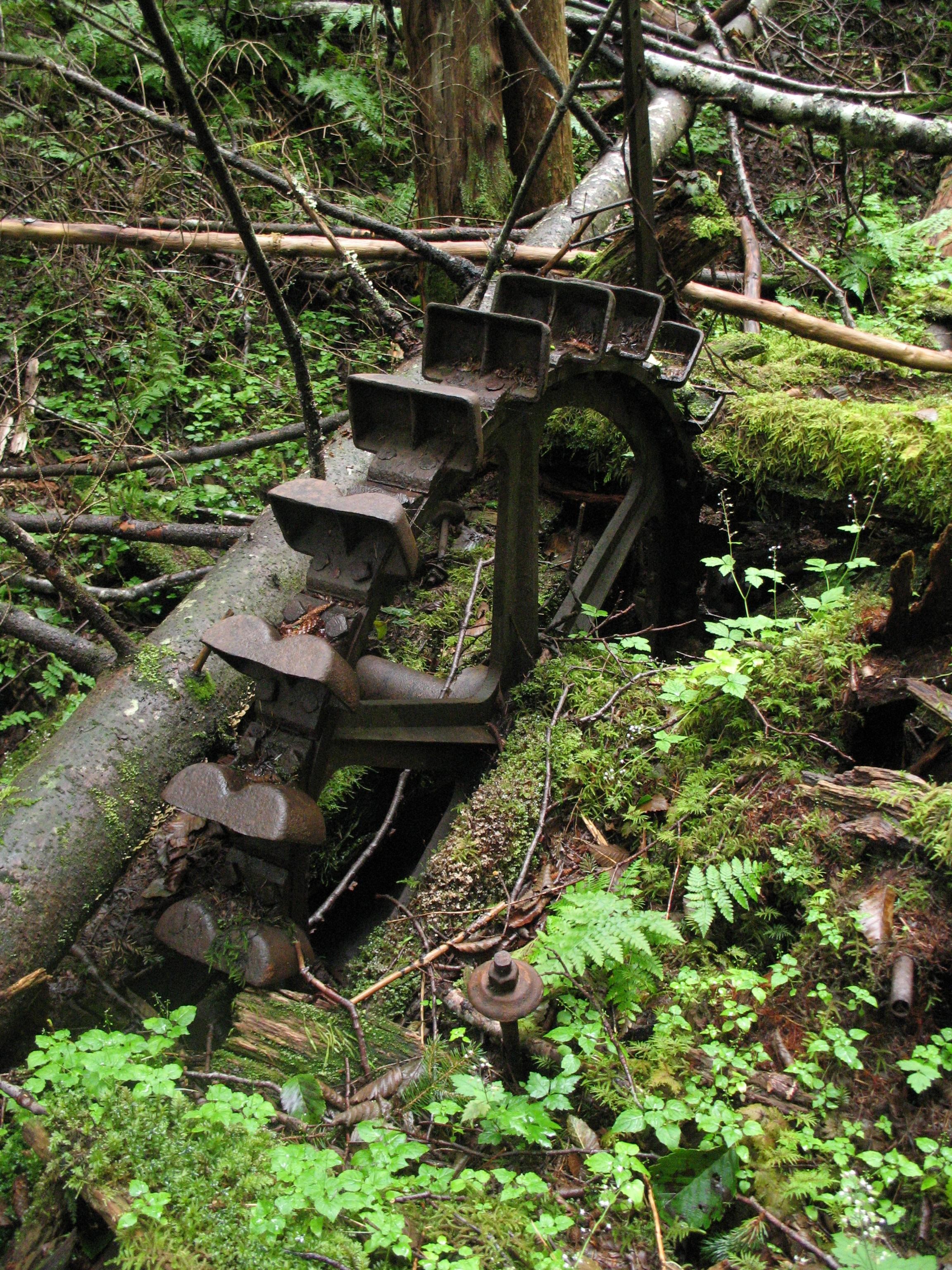
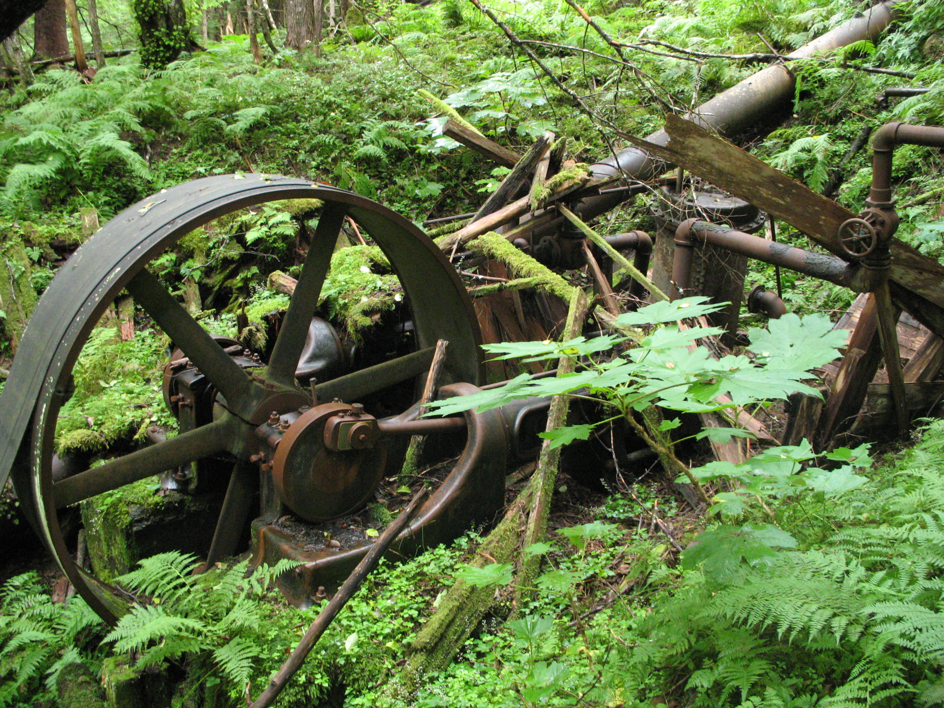
Sawmill equipment was delivered to Funter Bay in 1918 by the steamer Admiral Goodrich, probably for one of the mines. A 40hp steam-powered sawmill was reported in 1920.

In 1922 the Alaska Gastineau mine in Juneau purchased timber rights on Admiralty Island, but the sale was cancelled due to financing issues.

logging

After WWII, the Forest Service attempted to entice pulp mill operations to Southeast Alaska. There were also some attempts to cut spruce for plywood and export full logs overseas, but most development seems to be devoted to grinding up the trees for pulp. These operations were heavily subsidized by the government, and still claimed to be operating at a loss. Local rumor has it that Japanese investors are stockpiling logs to sell back to the US once we’ve clearcut everything.

The Keelers who had a cabin near Clear Point (and possibly one at Hawk Inlet?) did some logging. The uncle-nephew team purchased a large two-man chainsaw. Unfortunately, the younger man was killed when one of the first trees they cut tree fell on him.

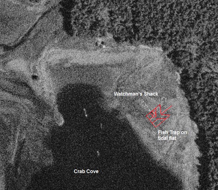
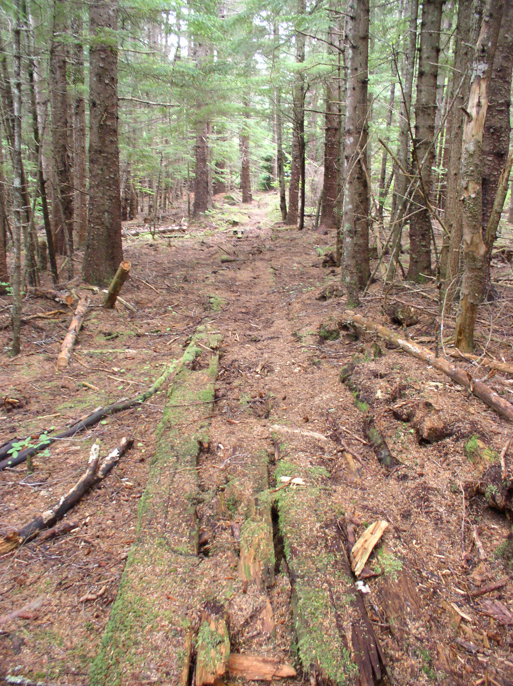
In the 1960s, local resident Ray Martin had a plan to log old-growth cedar from between the creeks at Crab Cove. His idea involved building a railroad from a dock at “The Point” up to the old-growth cedar stands between the creeks. The cedars would have been used for telephone poles. Ray apparently had many “get rich” schemes that never took off, and the logging operation was no different. He eventually landed in some legal trouble due to a shady stock deal with a company in Juneau.

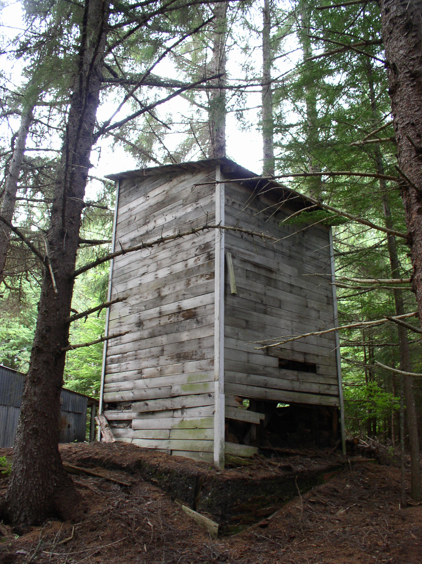
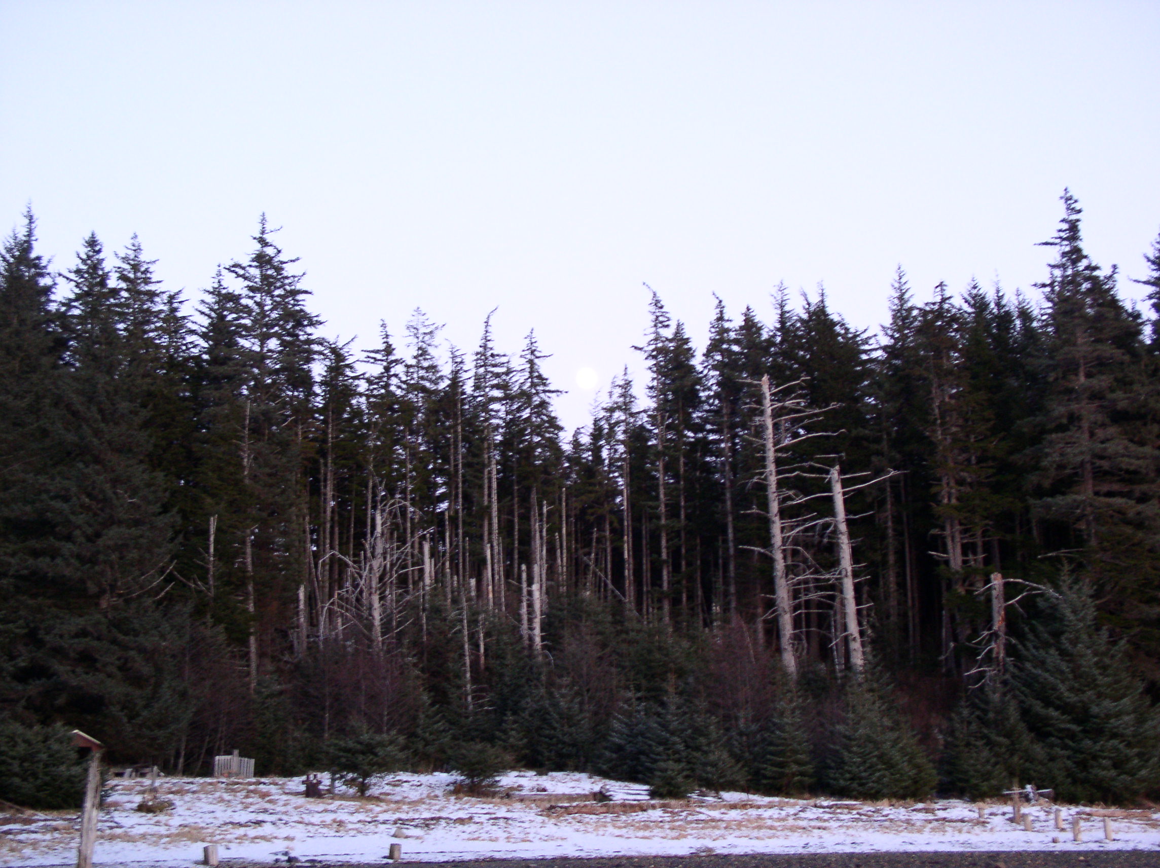
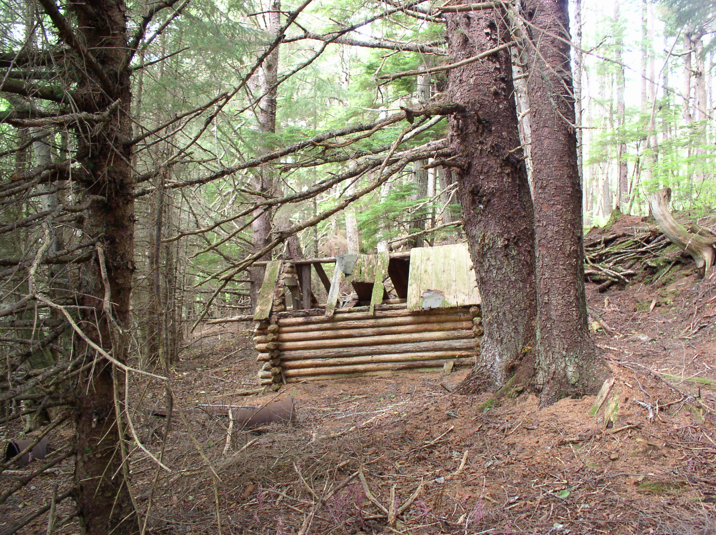
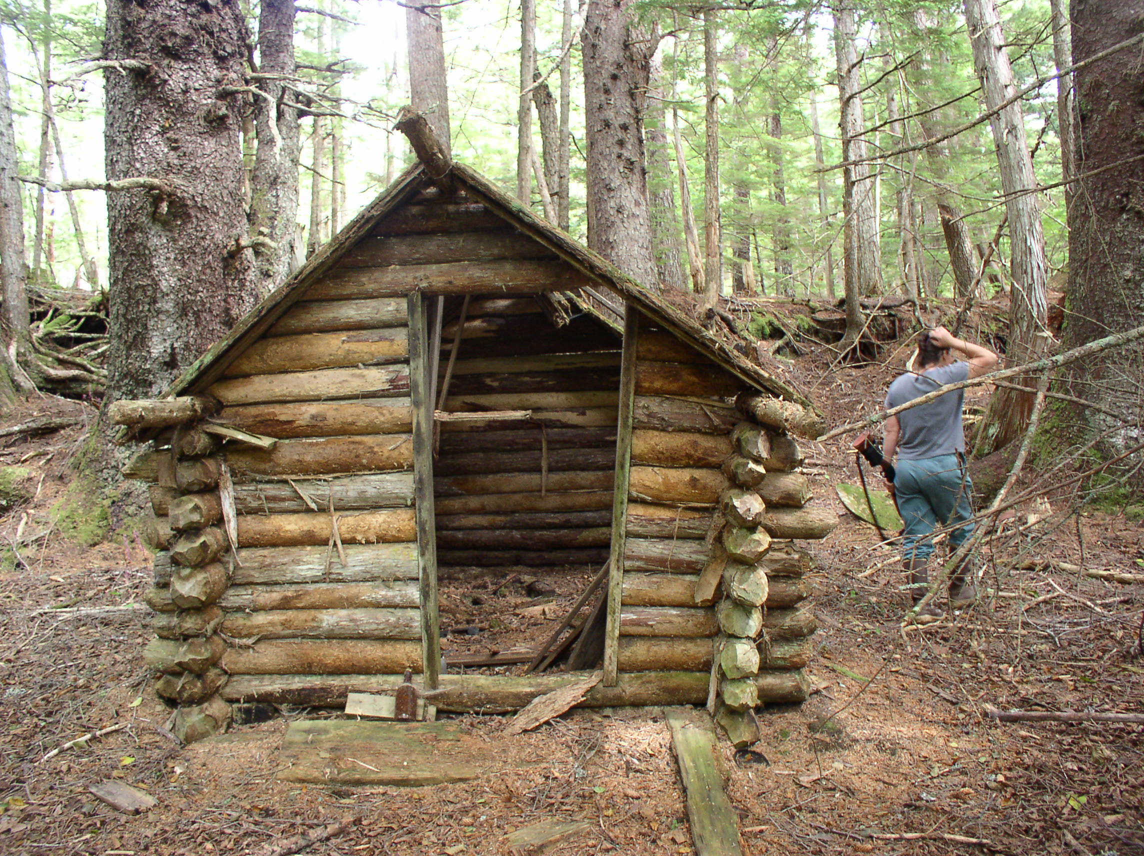
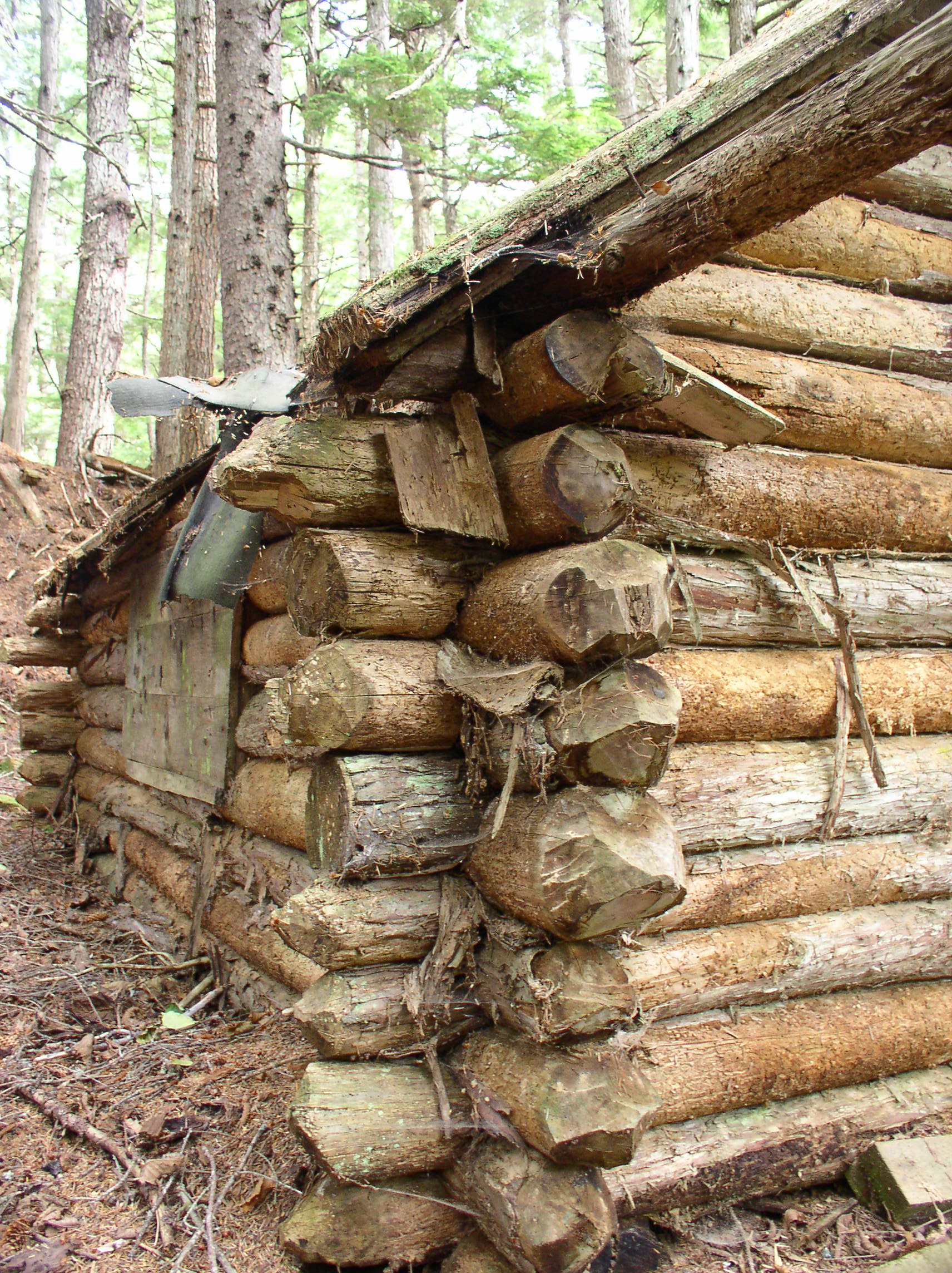
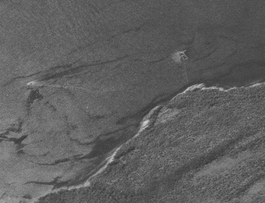
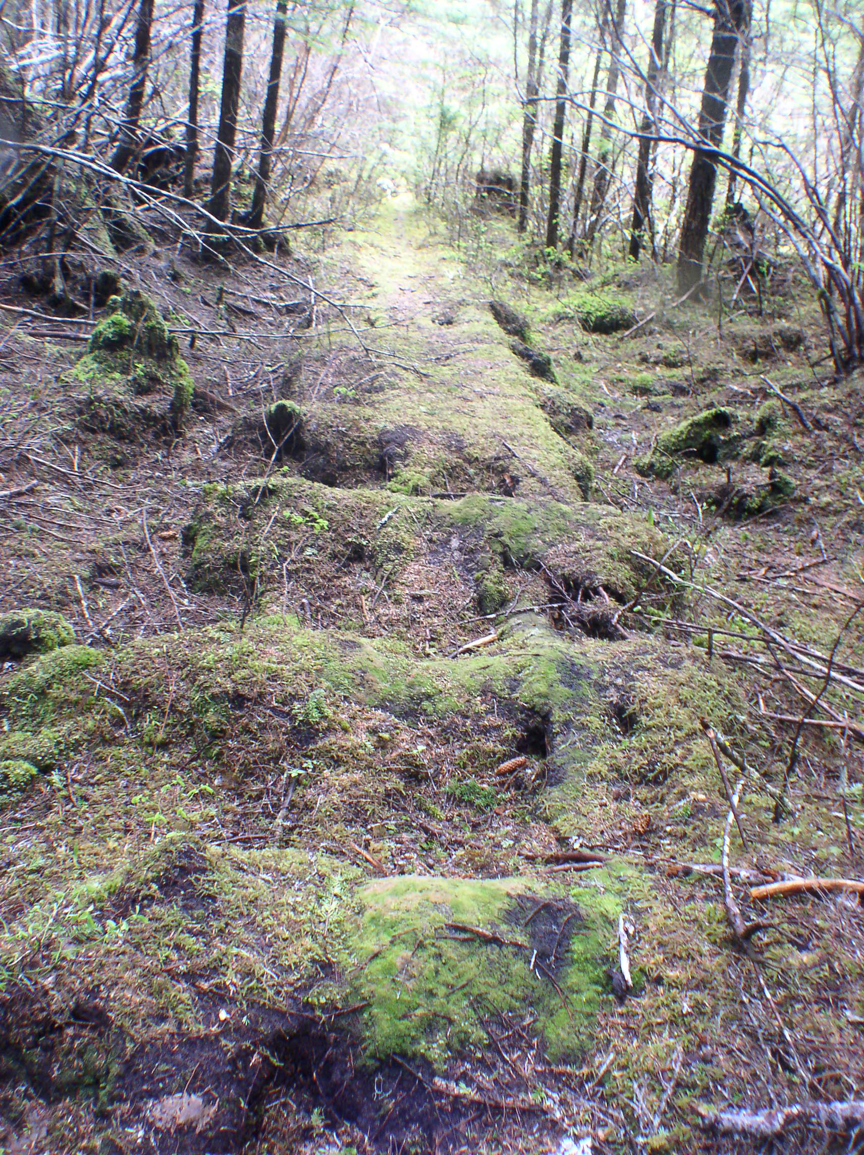
The biggest logging project at Funter Bay was run by the Alaska Dano Mining Co in conjunction with Gary Lumber Co of Juneau. Spruce (and some Hemlock) was harvested from approximately 30-35 acres on and near Dano’s mining claims around 1969. Sources indicate that it was around 1.8 million board feet, mainly for export.  In 1971, the US BLM transferred 33 acres to the state in the section which was logged, this could have been related to Dano’s operation, but I am not sure.  The clearing resulting from Dano’s logging is still visible in satellite imagery, although its a much smaller scar than those left by the bigger industrial logging operations elsewhere on Admiralty Island.

Dano clearcut and logging road, 10 years after the timber harvest (color infrared image showing different vegetation types):
clearcut

A Forest Service memo notes a timber sale of 222mbf (million board feet) in the Funter Bay area in 1969. That volume of timber would indicate an area of roughly 500 acres, much larger than the Dano clearcut. The appraisal price was 3 times higher than the average for Southeast Alaska, which could mean that cedar was the target rather than spruce. This could be related to Ray Martin’s plan, or to a late-60s plan to bring a large pulp mill to Juneau and clearcut the surrounding forests.

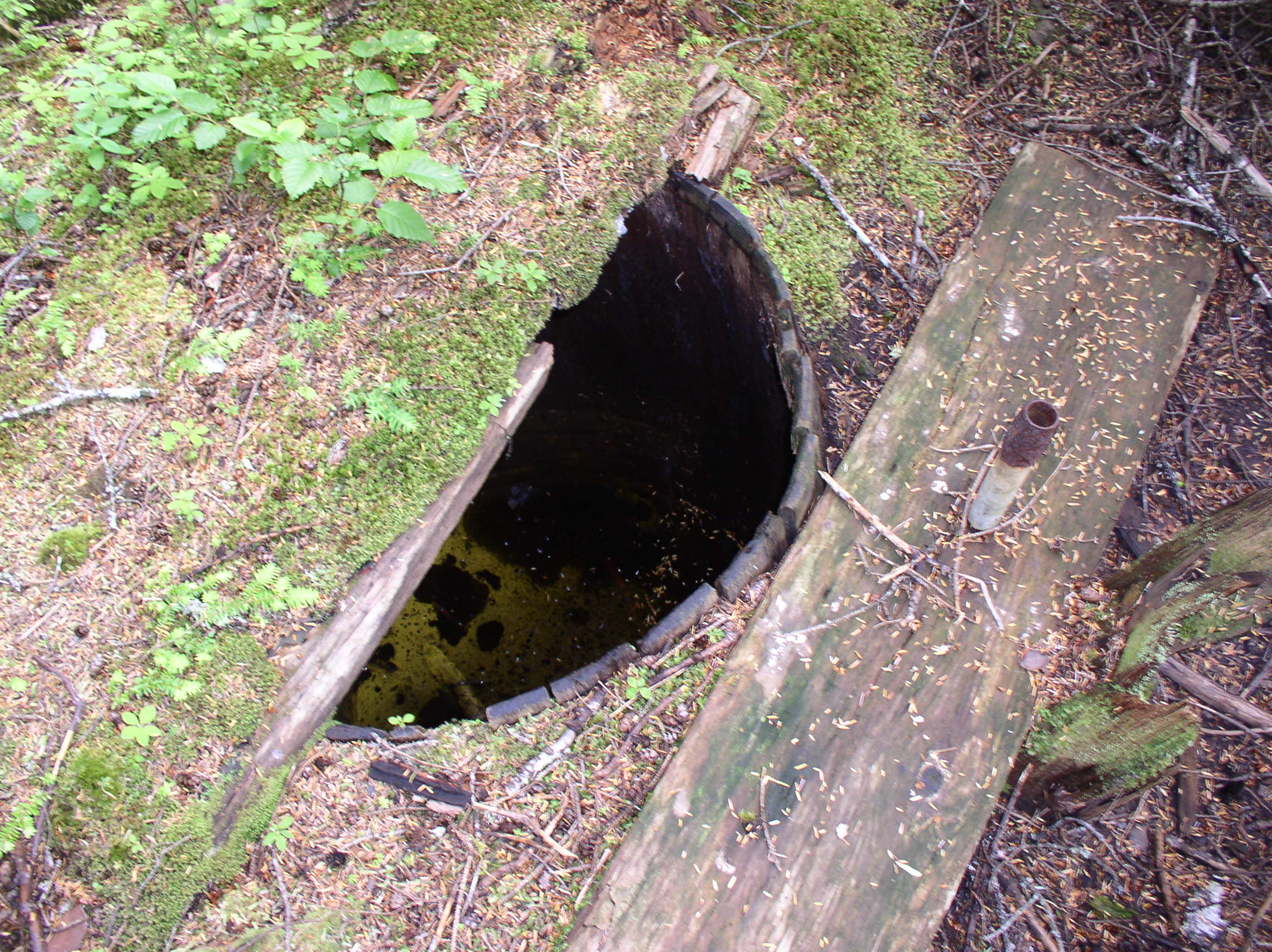
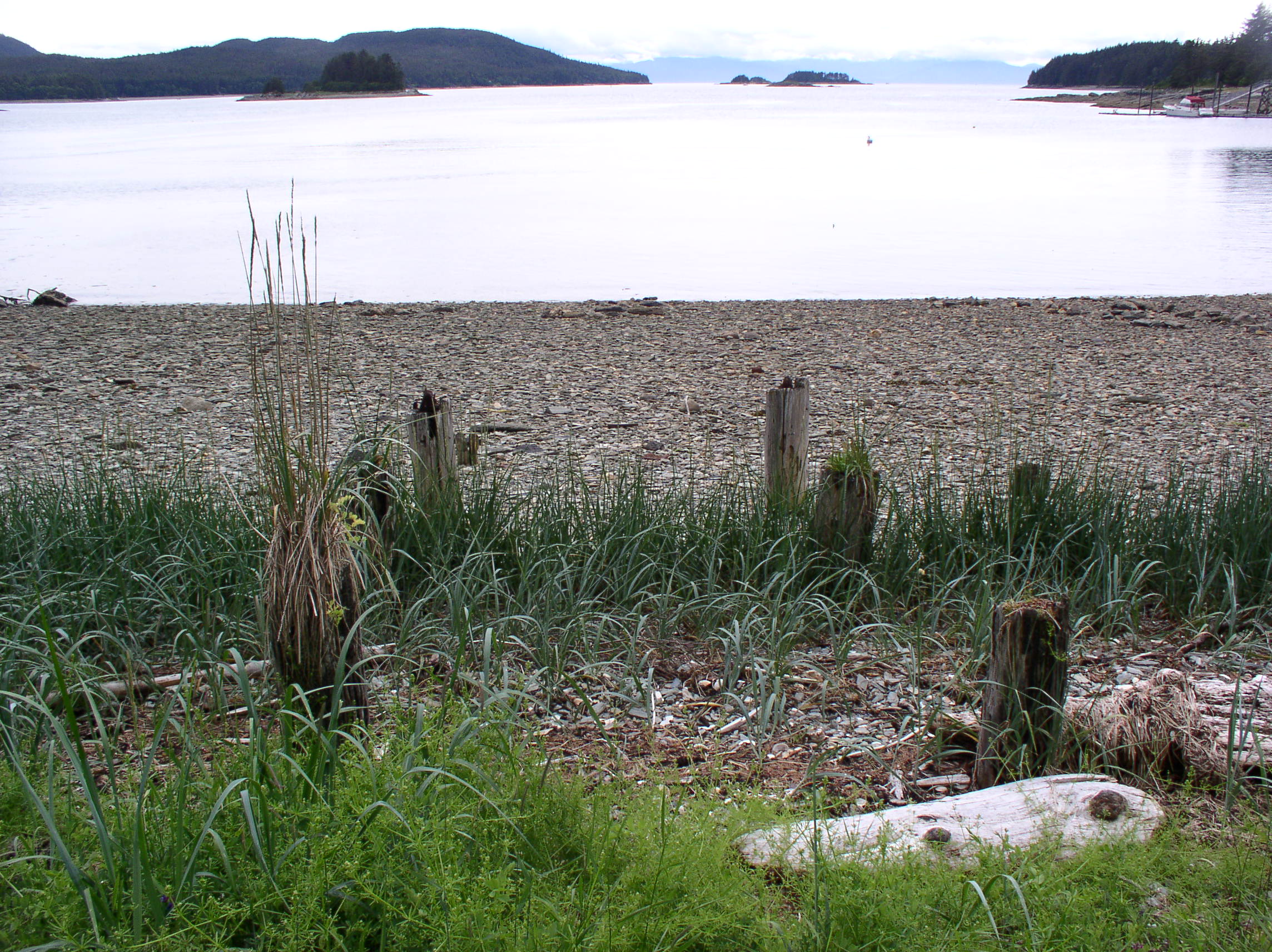
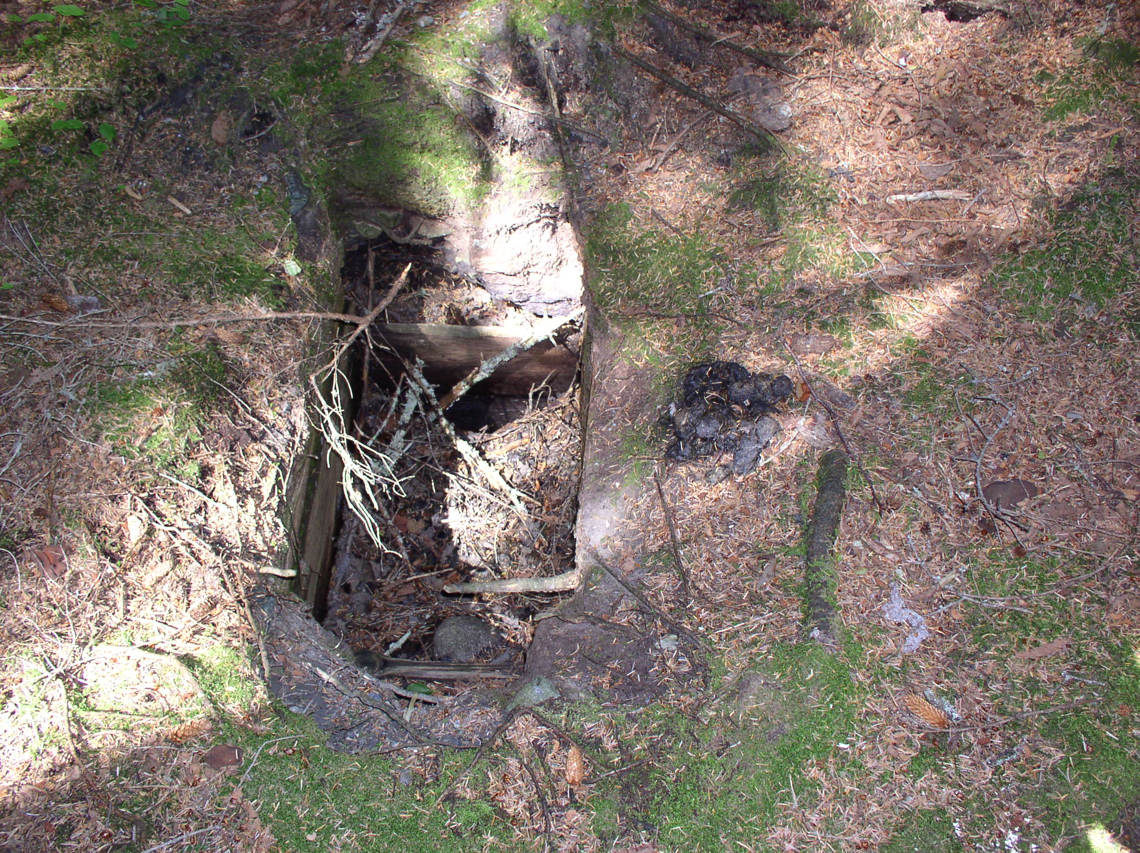
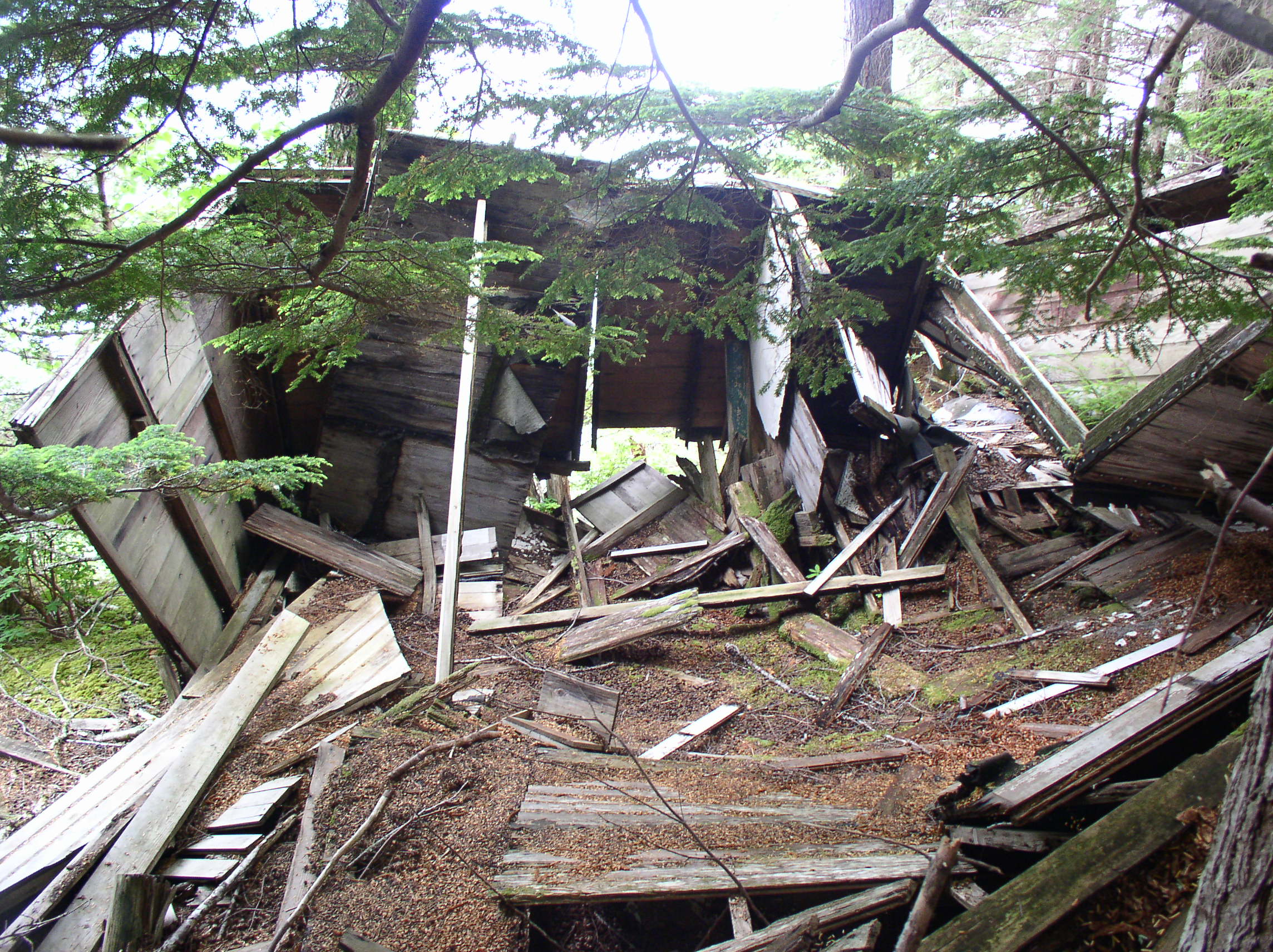
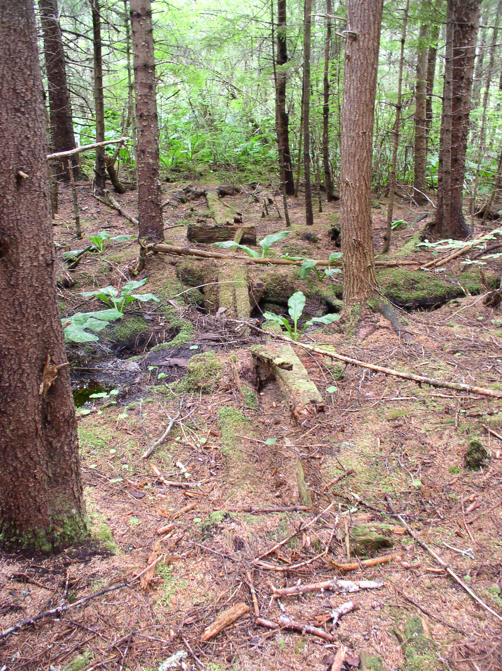
Today there are the remains of a piledriver at The Point, but I am not sure if this is specifically related to Ray Martin’s logging scheme, or simply left over from something else.

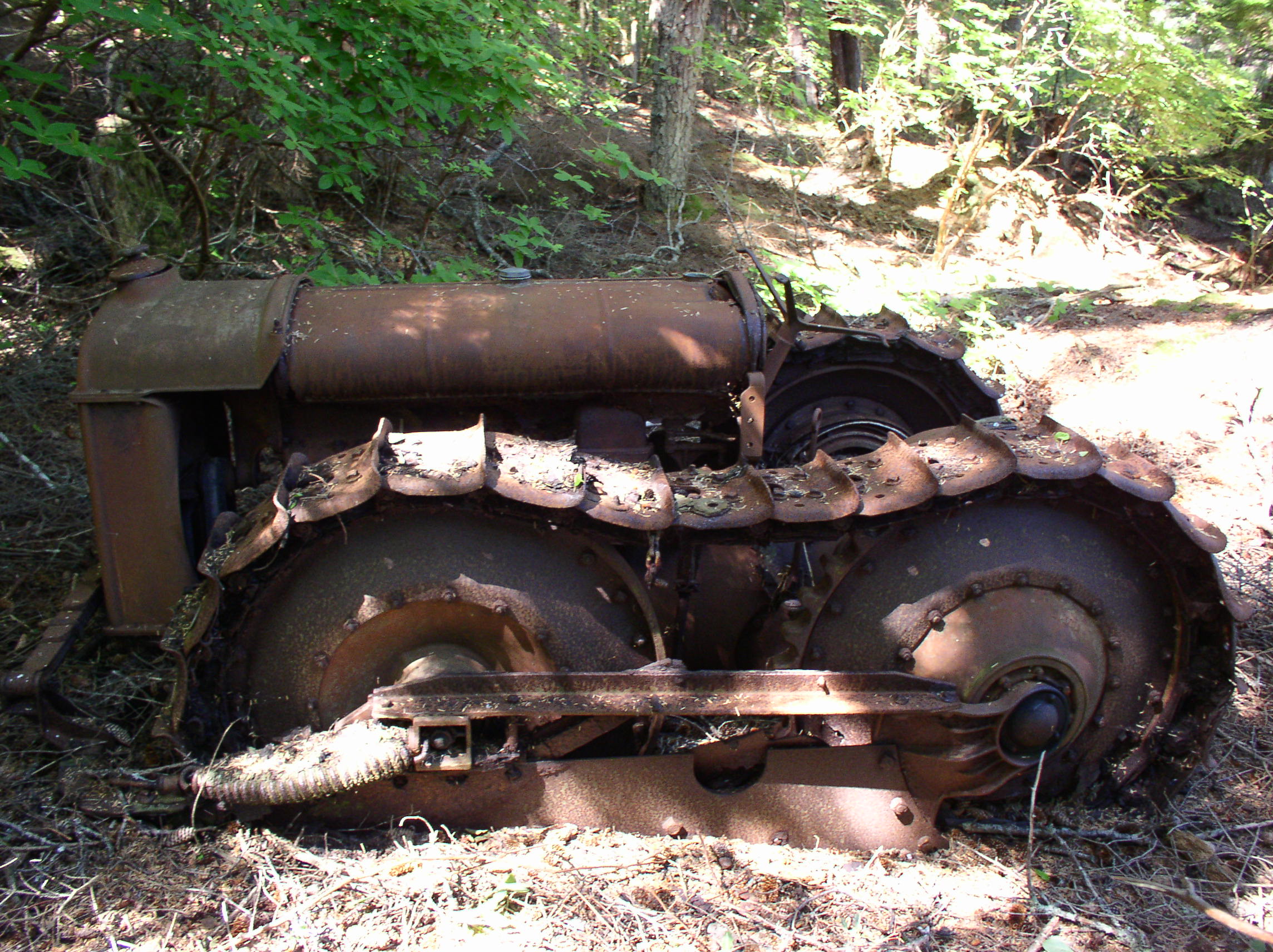
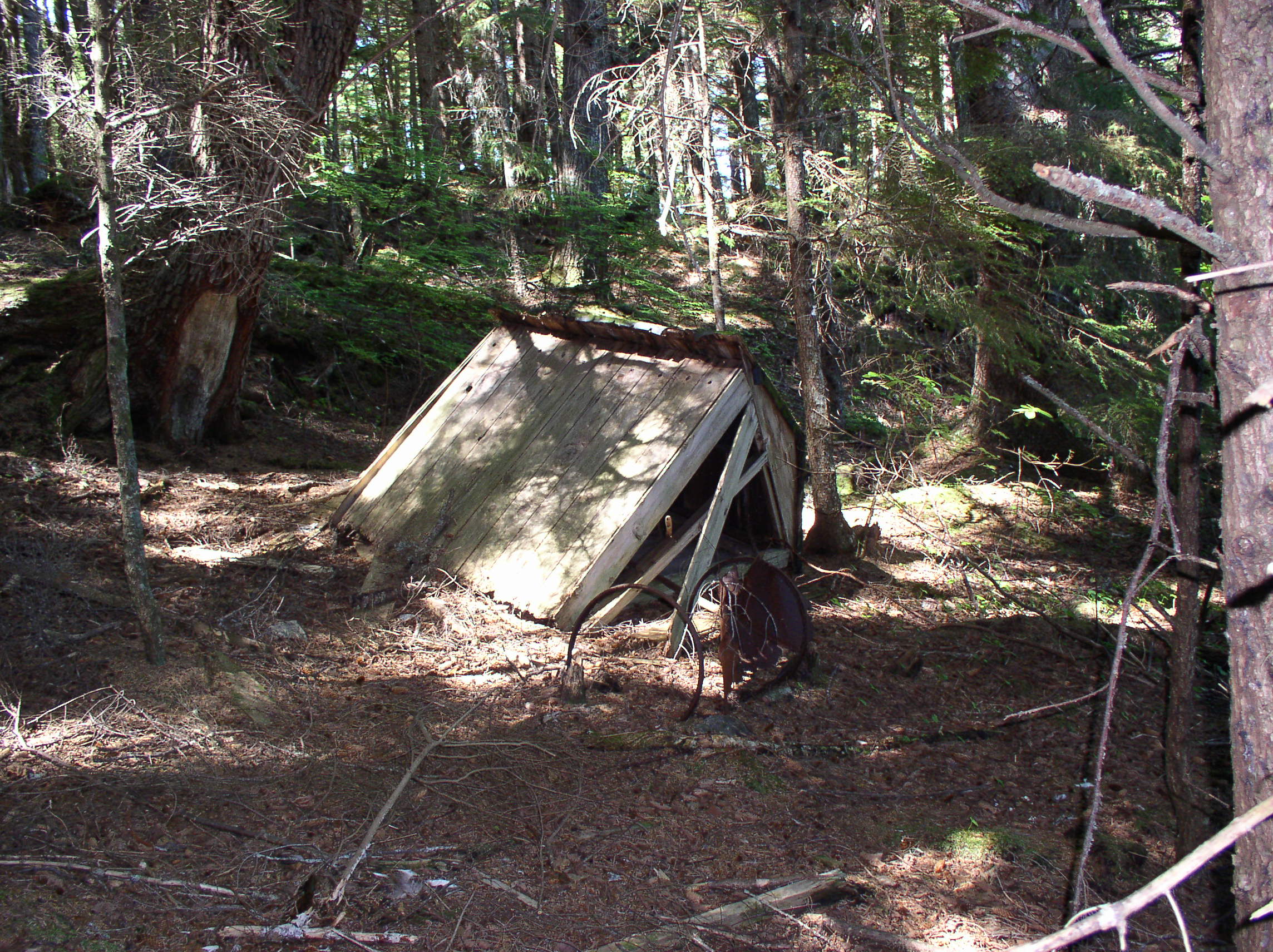
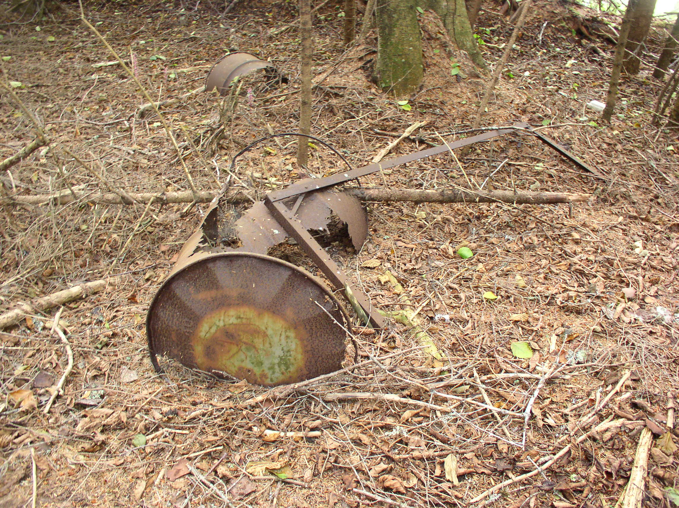
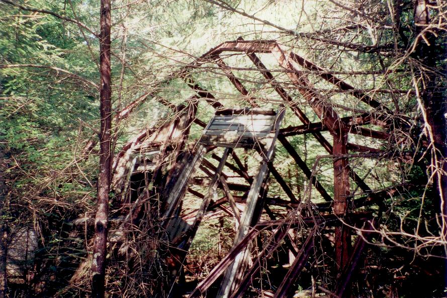
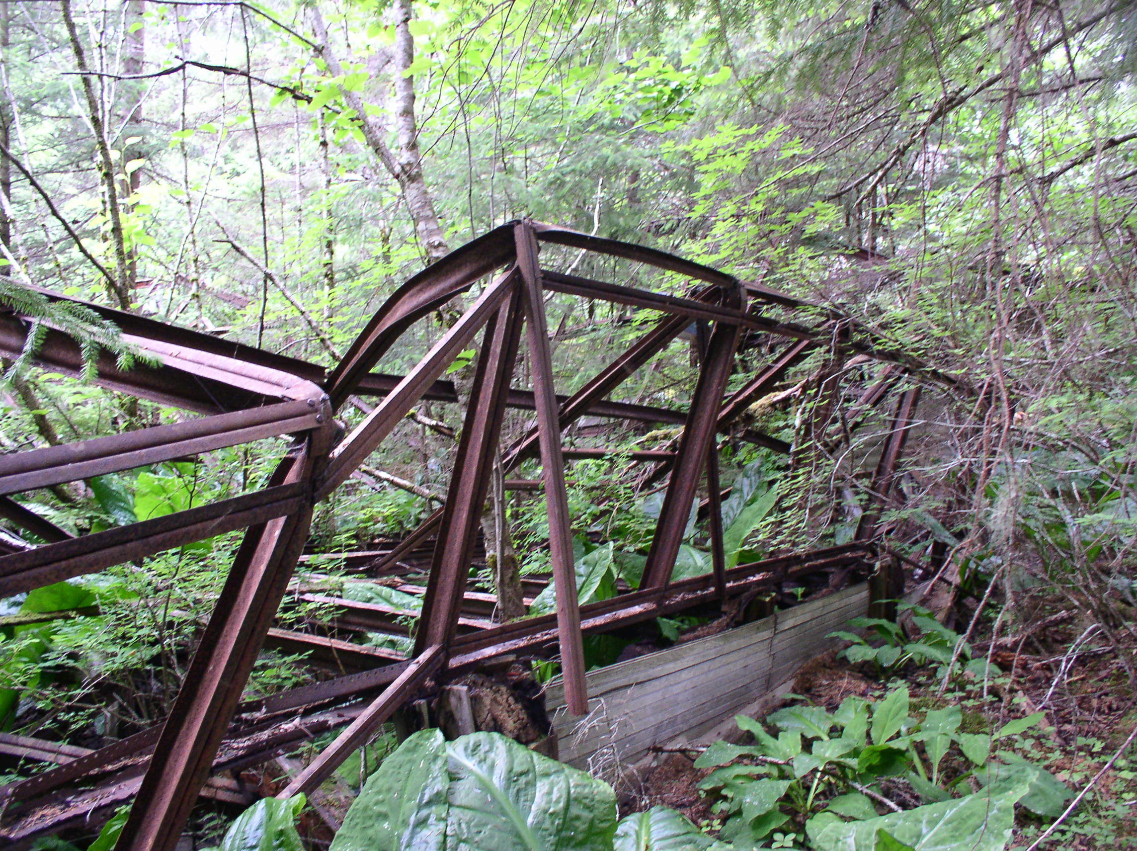
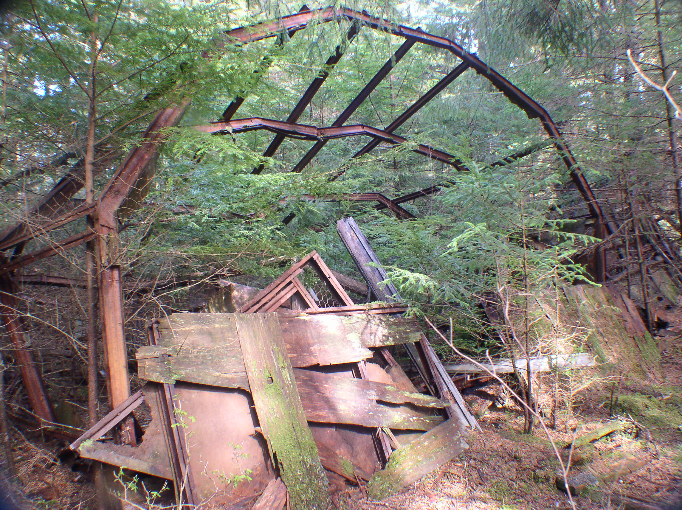
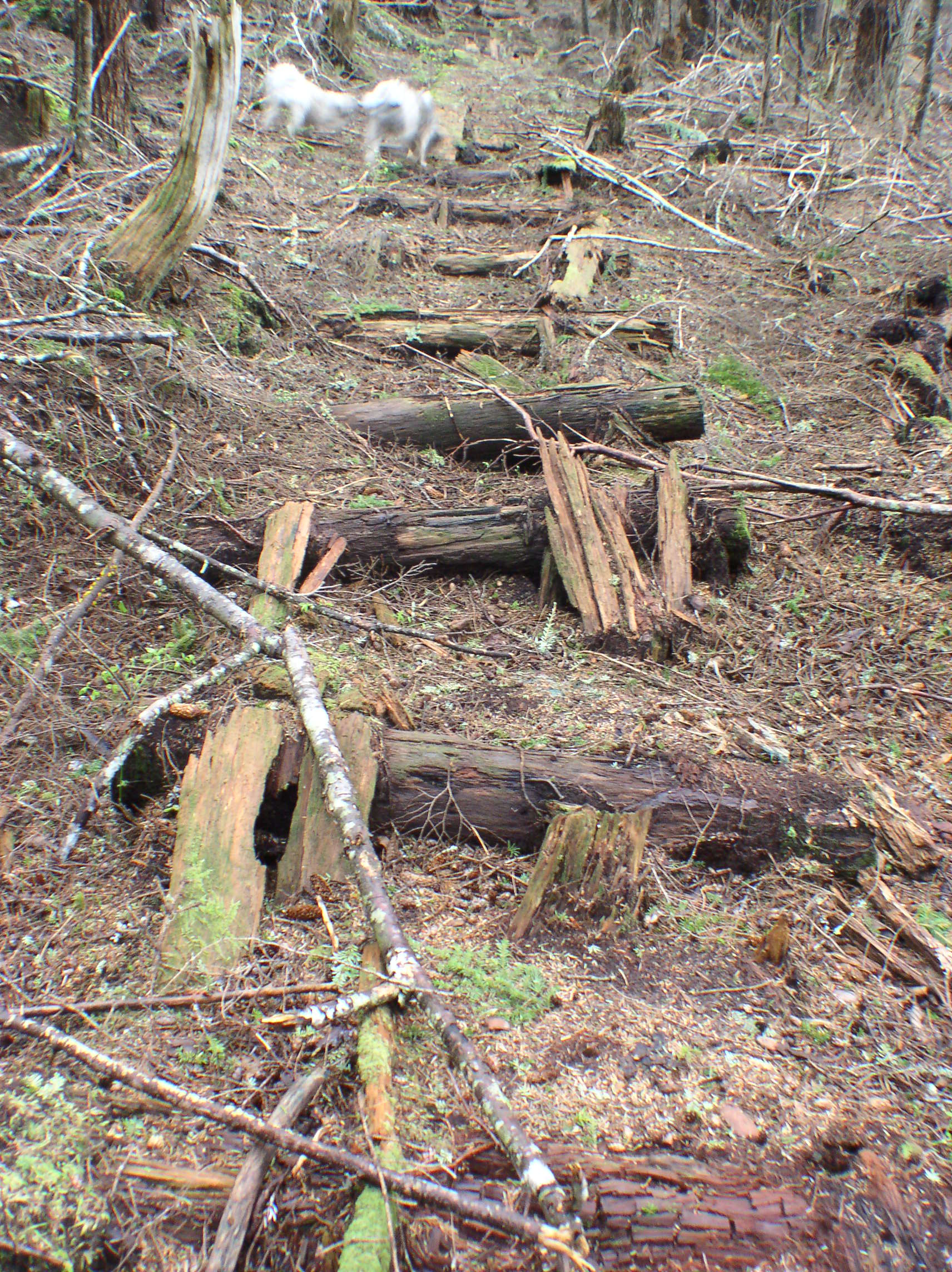
The other remains of Ray’s logging scheme include a mobile logging arch left on his property (which became our home). When my parents expanded our house, the arch was too heavy to move, so Dad incorporated it into the foundation of the deck!

OLYMPUS DIGITAL CAMERA OLYMPUS DIGITAL CAMERA

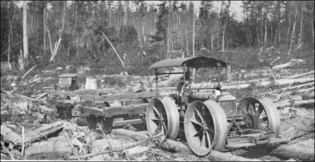
A logging arch would be used in conjunction with a tractor, to raise one end of a log and then drag it somewhere for loading. Here’s a model of one. Here is a page showing logging arches in use. Here is a photo of a logging arch being used to assemble a log raft on an Alaskan beach.

Dad believes this was Ray’s tractor, a Fordson made by the Ford Motor Company in Detroit:

OLYMPUS DIGITAL CAMERA

OLYMPUS DIGITAL CAMERA OLYMPUS DIGITAL CAMERA OLYMPUS DIGITAL CAMERA

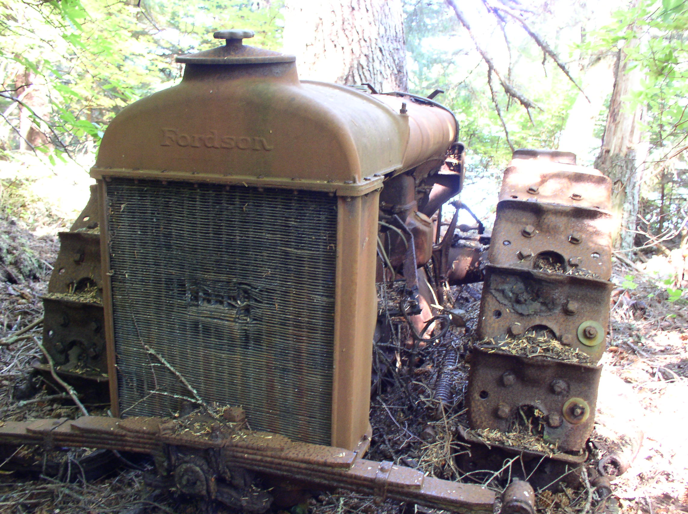
Fordson tractors were quite popular in Alaska. It also seems to have been somewhat common to turn them into small railway locomotives, everywhere from Nome to New Zealand.

Here’s a Fordson-based locomotive in Nome, AK:
Nome Alaska, Iron

Here’s the low-budget model, with the rail made of logs (a “pole road”) and the wheels apparently just big flanged rims. And here’s a whole bunch more. A salt mining company once built a monorail using Fordson tractor motors!

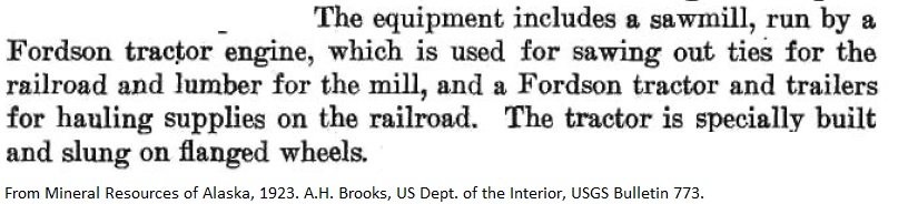
Here is a mention of another small railroad in Southeast Alaska, with a Fordson locomotive. That site also had a Fordson-powered sawmill:
fordson

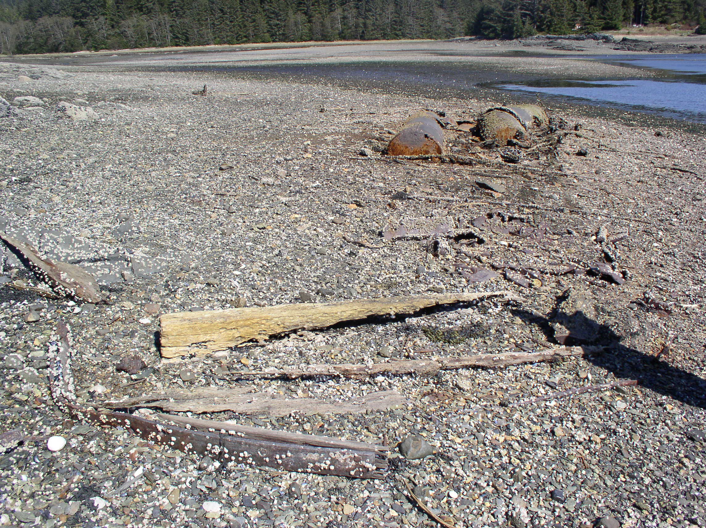
Ray Martin had a marine railway at the property, which included some tracks leading from the beach up to the house, and some wheels and axles. This would have been used to haul his boat out for storage and repairs, but maybe he planned to build his own logging railroad using some of this equipment as a starting point? By the 1950s, mines in Southeast Alaska were switching from railways and tramways to gravel roads, and surplus rail equipment would probably have been available cheaply.


Funter Bay History – Water & Hydropower

May 22, 2013

The availability of water often determined where an industry (such as a mill or cannery) was located. It also determined when the industry could operate. If streams were frozen, the boilers and water turbines could not run. Canneries needed large amounts of water for the packing and cleaning processes. Mines needed water for milling operations. In an era of wood buildings and few safety regulations, water was vital for fire protection. Fortunately for these industries, Southeast Alaska has a more than adequate supply of “liquid sunshine”, and water is usually plentiful year-round (it rains more than it snows in the winter). Storage of water ensured that supplies were consistent during the few dry periods. Several sources mention that the Funter Bay cannery closed around 1931 due to a lack of water. Photos and documents show operations at the cannery into the mid-1950s, but these could have been non-packing activities like trap maintenance.

Below is the base of a large wooden water tank at the cannery:

OLYMPUS DIGITAL CAMERA

Another water tank, this one elevated in a wooden tower to provide pressure. I believe this tower was for tap water at cannery residences, it was located between the Superintendent’s house, the Watchman’s house, and the Guest house (I’ve also heard the Guest House referred to as a school).

OLYMPUS DIGITAL CAMERA

OLYMPUS DIGITAL CAMERA

I remember when the front of the tower still had stairs on it, that you could walk up without falling through… I’m actually wondering how much is left of the tower today, it’s been a few years since these photos were taken.

The tank is labeled as “Pump House” on the 1964 map. It probably had a pump to raise water into the tank.

closeup2

Probably one of the first bathtubs in Funter Bay! Salvaged from the Superintendent’s house (which was half-collapsed by the 1970s), this found a new life in our bathroom:

Bathtub

A smaller cistern (basically a buried wooden barrel). In swampy muskeg these could be (and still are) used as collection points and filters, just bury a drum with some holes in it, and run a pipe out:

OLYMPUS DIGITAL CAMERA

The cannery was not located directly on a stream, so the tanks were supplied by a network of ditches, small dams, and pipes. Below is an example of a simple wood stave dam near the cannery, made from locally-cut timber:

OLYMPUS DIGITAL CAMERA

A ditch at the cannery. This may actually have been a drainage ditch to get rid of excess water, all the rain could make the ground mushy and damage foundations (note the rusty metal pipe bisecting the ditch):

OLYMPUS DIGITAL CAMERA

Several cannery pipelines were made from redwood staves. Redwood is a naturally rot-resistant timber that was cheaper and held up much better than steel in the rainforest (you can still find salvaged redwood pipes in use for gutters and drains around the bay!). One of these pipelines ran for over a mile, reaching Nimrod Creek near a muskeg known as Pipeline Meadow. The pipes were constructed of four redwood pieces slotted together, and banded with steel wire to hold them together. You can find these pipes all through the woods, in many cases the steel banding has rusted away, but the pipes are still watertight! Apparently this type of pipe is still made, and in all sizes. Until I started researching it, I had assumed it was a historical curiosity.

OLYMPUS DIGITAL CAMERA

A cutaway section of redwood pipe. Note how there is some slight surface rot, but the interior of the pipe looks brand new:

OLYMPUS DIGITAL CAMERA

Water Power:

In addition to supplying boilers, canning systems, kitchens, baths, etc, water was also used directly to generate power in several places. At the base of Mount Robert Barron is a large Pelton wheel, driving an air compressor and electric generator to charge battery-powered mine locomotives. Water was collected in ditches from a bench partway up the mountain, and funneled into a pipeline dropping steeply down the side.

The 1917 Territorial Mine Inspector’s Report states that the compressor house was constructed between July and December of that year. 307 feet of 22-inch steel pipe, 185 feet of 10-inch, 300 feet of 8-inch, and 300 feet of 6-inch pipe were laid to furnish power to the compressor, a 24x18x14 Chicago Pneumatic unit rated at 1400 cubic feet, with a 5-inch Pelton wheel. In 1919 it was reported that the compressor was powered by a 6-inch stream of water with 500ft of head, and could run 12 pneumatic drills.

Below is the Pelton wheel:

IMG_1369_2

This compressor ran air tools and supplied fresh air to mine workings. Below, you can see the incoming water pipe (upper right), flywheel with belt from the Pelton wheel, compressor piston (lower center), and compressed air pipe (right side).

IMG_1364

Compressor with slightly more of the surrounding building intact, when I was younger:
SONY DSC

Here’s a video of an old Pelton Wheel in action.

Here’s one of the tools powered by compressed air, a jackleg mining drill: IMG_1360

Hydropower is still a very efficient and environmentally friendly way of generating power in Southeast Alaska. Most of Juneau’s electricity comes from several hydropower plants (including a few originally built to serve mines in the area). Small hydro turbines supply power to cabins and homes in the area as well.

There have occasionally been studies to determine a reliable year-round power supply for industry at Funter Bay. In the 1930s there were some proposals to build a hydroelectric plant at Lake Kathleen, 30 miles south of Funter Bay, and run powerlines to the mines at Funter (Philip Smith, Metal Industry of Alaska in 1933)

A 1979 study by the Army Corps of Engineers examined Funter Bay and several other SE communities for hydroelectric potential. The study does not seem to have been done with much rigor or serious effort, as the authors note they merely “flew over” some of the potential sites, and then apparently drew some maps based on wishful thinking (for example, they seem to hope that the Dano Mine’s long-abandoned road could be re-used for access to a power plant). Actually, this study may have had more thought put into it than Juneau’s water supply, which operates on the technique of “plug up some mine tunnels and drink what leaks out“, and seems to still be planned and designed mainly on bar napkins. Eventually the USACE study got around to realizing that existing diesel generators were cheaper for tiny communities like Funter, compared to the cost of building and maintaining a dam, power plant, and power lines (Funter Bay is listed in the study has having a year-round population of 14, and a seasonal population of 25).

Hydro1


Funter Bay History: Saltery

May 21, 2013

Part of the Thlinket Packing Co’s cannery included a fish saltery. Soaking fish in salt brine or packing them in dry salt was an older preservation method than canning. Although an apparent step backwards in the progress of fish packing, salted fish would have been cheaper to process and package than canned fish, and allowed the cannery to reach other markets at a lower cost (mainly Japan, but possibly Europe as well). Salted fish was also sold to local fox farms for winter feed.

By the time the cannery closed, the saltery was located in a small cove adjacent to the main property. Initially this site was used by Tlingit natives who worked at the cannery and fished in the area. After the rise of imported seasonal labor, employment of local natives seems to have declined.

“Native Fish Camp”  looking towards the cannery, 1905:
Native Camp at Funter
Courtesty of UW Freshwater and Marine Image Bank.

A similar view from 2002:
OLYMPUS DIGITAL CAMERA

View of the same area from the water, 1915. Note the canoes and small boats:
Summer fishing village
Courtesy of Alaska State Library, Clarence L Andrews Collection, P45-0124

The cannery was salting fish as early as 1905, or perhaps sooner, as mentioned in a publication from that year.

salt

Fish were packed into large (~100 gallon) wooden barrels called “tierces” filled with salt, which dessicated them and prevented decay while they were shipped overseas. Apparently a “tierce” was a unit of measurement which varied depending on what you were measuring (a tierce of wine was 42 gallons). This document describes the salting and packing process, which involved pickling 800-1000lbs of fish in a tierce for some time, then removing and re-packing them in a different percentage of salt and brine. Another term for this is “Mild Curing“. Mild cured kings were often shipped to Europe (mainly Germany) and were further processed by smoking when they reached their destination.

tierce
Courtesy of UW Freshwater and Marine Image Bank.

A large wooden barrel, possibly a tierce, can be seen on the right in this 1907 image from inside the Funter Bay cannery:
tierce2
Courtesy of Alaska Digital Archives, Case & Draper Collection, P39-1002

Leftover tierces can occasionally still be found around Funter Bay, some were used as water tanks or septic tanks at local cabins.

A map of the saltery at the site of the former native fishing camp, from the 1964 land survey (The warehouse, wharf, and float):
saltery

After the cannery closed, Harold and Mary Hargrave lived at the house near the old saltery (more on them in a future post). Unfortunately their property was destroyed in a fire in the early 1980s.

The burned and dead trees from the fire are still visible, with younger spruce trees growing up in amongst them:
OLYMPUS DIGITAL CAMERA

A recent aerial photo of the saltery location (red building is a private cabin):
0a-aerial2

Many pilings and stubs of broken off pilings from the docks and grids are still visible today:
OLYMPUS DIGITAL CAMERA


Funter Bay History – Drugs, Labor, & The Company Store

May 18, 2013

Beachcombing the low-tide regions near old canneries will sometimes reveal tiny glass bottles and fragments of masonry jugs. These relics are reminders of some of the darker social issues of cannery development: drugs and alcohol, often provided by employers to keep workers in debt to the company.

SONY DSC

The tiny bottles held opium, and the masonry jugs held rice wine, both available for purchase at the company store. Opium was common in the Western US, where large populations of Asian migrant workers served mines, canneries, and railroads. Although supposedly banned early in the 20th century, in reality it could be readily purchased and distributed with a special tax stamp. Federal prohibition on Opium went into effect until the mid 1920s, but afterward there were still licensed dealers who paid only a small fee.

Retail Dealer in Opium Tax Stamp for the Truman Drug Company, Warren, Ohio, 1932

The opium bottles from the cannery appear to have held small amounts, and are generally unmarked (I’m not sure if they originally had any sort of paper label). The designs vary, including round and square. The glass tends to be very thick, with a small channel in the center which held the drug. Many of the tops are smashed or broken, I have heard that these were often sealed with a blob of glass, and to open them you would simply break the neck of the bottle.

Neck from a rice wine jug:
00-wine

What an intact rice wine bottle would have looked like:

Chinese Wine Bottle

In the early 20th century, drugs and alcohol were part of the typical cannery’s business plan. The cannery owners had a captive market in their seasonal labor, and workers were already on the hook for room and board, and possibly for transport in the case of migrant workers. Drugs and/or alcohol were another way for the company to recover wage expenses. They held a monopoly on the recreational substances, and could sell them to the workers at a high markup. A report from 1924 details some of these labor abuses, including unsanitary transportation, overpriced food, paycheck scams, etc, which could leave employees in debt to the company at the end of the season. The report also mentions other drugs distributed by cannery bosses, including cocaine and marijuana.

Here is a photo of a bunch more opium bottles, similar to the ones found at Funter.

Pat Roppel has a good article on Opium use. She mentions a case where someone attempted to smuggle Opium via the mail boat Estebeth, a boat which called at Funter Bay and which has been mentioned previously.

One of Roppel’s articles reports the following seasonal supply for a cannery with 238 employees (from 1890):
90lbs of opium at $13.50/lb
40lbs of low grade opium at $7.60/lb
20 cases of Chinese wine
38 cases of gin

This article mentions the “medicinal” use of Opium: with 12-16 hour days of heavy manual labor, it was valuable as a painkiller to keep the workers moving.

While opium and rice wine are often associated with Chinese cannery crews, the workers were not always of one nationality. Canneries employed local Tlingit natives in various positions (in fact, native employees dominated this cannery in the early years). Canneries later brought in Asian laborers from the lower 48 (Chinese, Japanese, and sometimes Korean immigrants). By the 1930s, Filipino and sometimes Mexican employees were more prevalent, along with some Puerto Rican and South American immigrants, often with Chinese managers or labor bosses. The casual racism of the period is obvious from reading contemporary documents and wage scales, white (European) employees received the highest pay and were usually in management positions, Asian laborers received less, and Tlingit workers were paid the least.

indian labor

Even after officially-sanctioned drug use declined, room and board at company towns was still costly for employees. Another article by Pat Roppel mentions a large amount of traditional Chinese food shipped to Alaska by canning companies, which was paid for out of workers paychecks (further details in this document).  The expense of company meals could be mitigated somewhat by fishing and hunting. A 1933 report on Admiralty Island bears complained that cannery workers “seem inclined to kill every bird and wild animal they see”. A law, specifically aimed at cannery workers, banned hunting and nonresident gun ownership without a permit, supposedly as a game-protective measure. Companies employing seasonal workers were probably quite happy to support this law.

Despite modern advances in labor laws and workers rights, recently a law was passed allowing canneries to again deduct room and board from employees pay, even if the resulting paycheck falls below minimum wage.


Funter Bay History: Fish Buying Station

May 17, 2013

Independent fishermen in Funter Bay needed a place to sell their catch and buy supplies (fuel, fresh water, and ice). The local cannery would sometimes buy troll-caught fish, but probably paid a low low price since their own traps produced fish nearly free. Trollers were better off selling salmon which would go iced and fresh to Juneau grocery stores and markets. However, the range of the small fishing boats, and the distance from town where the fish were most often found, usually prevented the fishermen from running directly to Juneau to sell.

To support these markets, various fish sellers and middlemen operated buying stations in locations near the fishing grounds. The station at Funter Bay was probably associated with the Juneau Cold Storage, where they brought fish for storage and sale, and procured ice for sale to fishermen. Packers would run the fish in to the cold storage on a regular basis to keep them fresh.

Unloading fish at the Juneau Cold Storage, 1930s:
Juneau Cold Storage
Courtesy of Alaska State Library, Elite Studio collections, P294-020

Another reason for third-party buyers was fish piracy; fishermen would sometimes steal fish from the cannery traps. Canneries banded together to boycott fish from certain “known pirates”, but independent buyers with their own scows and packers quickly sprang up who would take fish from anyone.

Salmon buyers also operated from floating scows (barges). Today, salmon buying stations usually operate (probably with fewer pirates) from scows, packer boats, and occasionally from docks at small communities like Elfin Cove.

Scow (barge with structure on it) and cannery tender at the Thlinket Packing Co dock, 1942:
scow2
Courtesy of Alaska State Library, Butler/Dale collection, P306-1093.

Funter Bay residents Gunner and Lazette Ohman operated a fish buying scow in the area during the 1950s and 60s, buying fish for Art Berthold of the Fern II.

The land-based fish buying station at Funter Bay was located on Highwater Island, which is only an island when high tide covers the sandbar to it (apparently it is called Crab Island in some govt. docs, although I’ve never heard it called that locally). The station had several buildings on the shore, and a long dock with two ramps, circled in the 1948 aerial photo below:
buying station

This location would not have been completely ideal, as it had no streams or running water, but it was in a very sheltered location that protected the dock from most winds. Trollers would fill up on fresh water from a hose running to a stream elsewhere in the bay.

Another aerial from 1948 (on a different date), showing a boat approaching the fish buying dock (the V-shaped wake in the lower right quarter of the image):
wake

More recently, here is a collapsing shed at the station:
OLYMPUS DIGITAL CAMERA

A small outboard motor abandoned in the woods (I always laugh when I go to some yuppie antique store in the Midwest and they’re selling rusty stuff like this for $300, but now I’m a little worried that someone will go nab the thing and stick it on their yuppie wall):
OLYMPUS DIGITAL CAMERA

The outhouse pit, apparently bears think the spot is a great bathroom as well, as seen by the dark pile to the right:
OLYMPUS DIGITAL CAMERA

More “junk” in the woods, bottles and trash from the 40s and 50s:
OLYMPUS DIGITAL CAMERA

As mentioned before, there is a wrecked boat on the island adjacent to where the dock was sited. It’s locally known as a steam tug, assumed to be a cannery tender, although I’ve not yet been able to find any details on it.
OLYMPUS DIGITAL CAMERA

Coil of cable on the beach, either from the wrecked tug or the fish buying dock:OLYMPUS DIGITAL CAMERA


Funter Bay History: Shorty’s Cabin

May 14, 2013

Hiding in the woods near Second Creek is this tiny log cabin, locally known as “Shorty’s Cabin”

OLYMPUS DIGITAL CAMERA

Obviously “Shorty” was a smaller fellow, the cabin is barely 6′ high. It had a single window (now boarded up), a door, a stove, and the remains of a bed. Between the stove and the bed, nearly the entire floor space would have been taken up.

The cabin had a layer of tarpaper over the wooden roof, which helped waterproof it, but tarpaper is easily torn by falling branches or hail, so it would not have been a very permanent solution.  The roof is already half gone.

Window, bedframe (on floor), and tarpaper:
OLYMPUS DIGITAL CAMERA

Some more views of the cabin:OLYMPUS DIGITAL CAMERA OLYMPUS DIGITAL CAMERA OLYMPUS DIGITAL CAMERA

Close-up showing the axe and saw work on the logs:
OLYMPUS DIGITAL CAMERA

Closer close-up showing worm trails in the logs where the bark has fallen off:OLYMPUS DIGITAL CAMERA

As the story goes, Shorty was a cook at Hawk Inlet (either the mine or cannery there), got tired of his job, and quit to become a fisherman. He moved to Funter Bay and built the cabin, then began constructing a boat. He was well along in the boat building, when a visitor stopped by and remarked that the boat had no shaft alley (the trough or groove where the tail shaft would run from the engine to the propeller). Shorty gave up in disgust at his shoddy design, jumped on the next mail boat to Juneau, and was never heard from again.

What appears to be part of a boat hull, perhaps Shorty’s failed project:
OLYMPUS DIGITAL CAMERA

Other artifacts and debris scattered around include some metal drums, one may have been a barrel stove:OLYMPUS DIGITAL CAMERA

Shorty’s kettle:
OLYMPUS DIGITAL CAMERA

Shorty’s boots:   OLYMPUS DIGITAL CAMERA

Here’s Dad in front of Shorty’s cabin in the ’70s, when the roof was in better condition! Shorty's Cabin

I am not sure who “Shorty” really was, there were a number of people with that nickname in the area in the early-mid 20th century, including a dairy farmer, a butcher, and a suspected bank robber. So far I’ve been unable to find anything more on the “Shorty” of Funter Bay.


Funter Bay History: Dick Willoughby’s Exploding Raven

May 13, 2013

Richard “Uncle Dick” Willoughby (1832-1902?) AKA “The Professor”, was apparently quite the local character. Known for various pranks and tall tales, he left a lasting impression on the history and geography of Southeast Alaska (he has both a street and an island named after him).

willoughby

Dick had a cabin at Funter Bay and did some prospecting in the area, locating several claims around the bay in 1887 and even starting a small mining company. An apparently successful prospecting method was to carry a metal rod with a carbon tip. Willoughby would prod through the mossy muskeg layer covering much of Admiralty Island, hoping to find shallow bedrock. After some practice, he claimed to be able to tell the difference between quartz and other rocks by feel. Even after selling many of his mining claims, Dick spent much of his later life at Funter Bay.

Willoughby also prospected and explored around Glacier Bay and other parts of Southeast Alaska. Around 1885, he claimed to have photographed a “phantom city” above Muir Glacier. He made some money selling copies and guiding tours to see this supposed mirage (which no one else ever glimpsed, and was later revealed to look remarkably like Bristol, England). The ever-reliable and never-sensationalist Popular Mechanics magazine swallowed the bait with a full article in 1897, although most people list it as an obvious fake. As late as 1928, cruise ship passengers were still looking for the phantom city!

An 1887 Juneau Free Press article claims that Dick Willoughby had dug up “The Devil’s Skeleton”. Willoughby was occasionally mentioned in the papers as finding “monster bones”, as well as various mammoth skeletons, often around Glacier Bay.  He apparently had a “museum” in Juneau where you could “see the elephant” for 50 cents admission.

To get back to the title of this post, below is an anecdote from his time at Funter which appears (with slightly different details) in several period newspapers:

exploding raven

A slightly different version is mentioned here, in which Dick’s cabin at Funter falls victim to the nefarious bird. Who knows how much, if any, truth this story contains!

Chapter 7 of the 1909 book Through The Yukon and Alaska is devoted to Dick Willoughby.

A fairly comprehensive obituary of Mr. Willoughby is here.


Funter Bay History – Cannery Ruins

May 11, 2013

Again I must mention that most of these buildings (including the tumbledown ones) are privately owned. Locals are watchful and not enthusiastic about trespassing. Please respect private property.

Following are some of my photos of the remains of Funter Bay cannery buildings in the 1990s and 2000s. I sometimes refer to Funter as a ghost town, and the remains certainly have that feel. The cannery was actually large enough to earn a designation as a small town, albeit a company town with mostly seasonal population.

I’ll start out with the overview map of the property, as surveyed in 1964 (large file!):Cannery Detail 1964

Most maps call the cannery “Funter”, as this was the location of the post office through much of the 20th century. I find it odd that the inset location map on the above survey has the name “Funter” moved away from the cannery and towards the area between Nimrod and Second Creeks. There even appears to be a small square marked (which could just be a compression artifact). That spot would be “Shorty’s Cabin” (which I’ll detail in another post). It would be strange to show the location of the town being the smallest building in the bay, unless it’s some kind of surveyor’s joke!

Onward to the photos!

Below is the remains of one of the large two-story bunkhouses at the cannery. This one was the Filipino house shown on the map.
OLYMPUS DIGITAL CAMERA

OLYMPUS DIGITAL CAMERA

A building on the West side of the property. I’m not actually sure what this was originally used for, but it seems to have been lived in at one point (there was a stove and a supply of firewood) and it had become a storage warehouse later on:
0a-cannery6

OLYMPUS DIGITAL CAMERA

Inside the warehouse building is a random collection of “stuff”. Barrels, old fishing gear, etc (no, American Pickers fans, there’s nothing *really* old left…OLYMPUS DIGITAL CAMERA

…Except for the wallpaper, which is old newspapers!
0a-cannery5

These old papers coat the walls and ceiling of this building. The dates are around 1919, and publications include Colliers and The Saturday Evening Post.  The wallpapering was probably done to help keep out drafts, and maybe to make the interior look more interesting?
0a-cannery4OLYMPUS DIGITAL CAMERAOLYMPUS DIGITAL CAMERA

Some of the small houses shown on the map behind the bunkhouses. These were probably for married workers who did not stay in the bunkhouses:0a-cabin1 OLYMPUS DIGITAL CAMERA0a-cannery1 0a-cannery2

OLYMPUS DIGITAL CAMERA

These quonset huts were not original to the cannery, but were put up during WWII by the US Army to house evacuated Pribolof islanders. The quonset huts were of poor quality and have deteriorated faster than the original buildings. 0a-cannery3OLYMPUS DIGITAL CAMERAOLYMPUS DIGITAL CAMERA

The remains of some slightly larger houses farther East. I believe these may have been the “Native Cabins” shown on the 1962 map (these could either be from the WWII Aleut internment, or earlier housing for Tlingit employees).
OLYMPUS DIGITAL CAMERA

OLYMPUS DIGITAL CAMERA

A house that has collapsed flat, leaving a table exposed and showing part of the stovepipe:OLYMPUS DIGITAL CAMERA

This appears to be a chicken coop and fenced pen at one of the houses. Perhaps one of the managers or their family kept chickens? I would be dubious of the survival rate; between the weasels, otters, mink, marten, and all varieties of raptor, chickens would be a tasty snack for much of the local wildlife. We raised ducks when I was younger, and even with the ocean to flee to, they still got picked off frequently by local predators. There are also reports that someone raised fox, mink, or rabbits at the cannery in the 1950s.

OLYMPUS DIGITAL CAMERA   0a-cannery8

A more intact building, not marked on the map: OLYMPUS DIGITAL CAMERA

This one seems to have been larger once, or possibly moved and/or rebuilt from a larger structure. One wall is cut away and re-boarded, and the roof sticks out over a missing piece of building:
OLYMPUS DIGITAL CAMERA

As you can see from the amount of decay and collapse, nature quickly reclaims artificial structures in Southeast Alaska. The high humidity and salinity, heavy  wet snow, and punishing winds will all chip away at a building. Spruce trees drop tons of cones and needles, which soon form a layer of soil on roofs where more plants can grow.  Second-growth trees like Alders grow quickly, with limbs and roots pushing at walls and foundations. Eventually the roof is gone or the walls are breached, and once water gets inside, it’s a quick progression into a pile of moldy wood. Eventually there’s just mound of moss and small plants in the bare outline of a building, with maybe an area of younger trees showing where a clearing once was.

OLYMPUS DIGITAL CAMERA


Funter Bay History – More Fish Traps & Fish Pirates

May 8, 2013

This began as a dry discussion of trap types, and ended up with gun fights, legal battles, piracy, and everything else that goes with Alaskan fishing!

As mentioned before, the Funter Bay cannery operated mainly with fish traps (vs fishing boats). These traps were designed to intercept salmon as they returned to spawning streams, penning them in large fixed nets until they could be scooped out.

There were two types of fish trap used in the Funter Bay area. “Pound Nets” hung from fixed pilings driven into the sea bottom. Many of these pilings had to be replaced each season, as the winter storms would knock them loose. “Floating Traps” had nets hung from a latticework of floating logs, and were used in deeper water or locations with rocky bottoms. These traps were towed into protected coves for winter storage. Both types of trap would be located a few hundred feet offshore, with a “leader” strung towards the beach (and sometimes a “Jigger” extending seaward) to intercept passing salmon. This page has some more explanation and diagrams.

Pound Net:
pound trap

Floating Trap:
floating trap

These images show one of the Thlinket Packing Co’s pound-type traps near Funter Bay (Trap #7):

Trap 7 trap 7-2

My first post on Funter Bay History shows Trap #6 at the Kittens (islands), also of the pound type.

Here is an example of a floating trap. The structure on top is the watchman’s shack:floating trap 2

As mentioned, watchmen on the traps were an attempt to prevent trap robbing or “Fish Piracy” at remote traps, which was quite common. Independent fishermen hated traps, which they (correctly) felt were taking too many salmon. Many fishermen felt that fish in a trap were fair game, and that trap robbing did not “cost” anything to the trap owner. In fact, the pirates would often sell the stolen fish to the same company that owned the traps! The problem became so bad that the governor of Alaska dispatched surplus navy boats to combat pirates, and the Thlinket Packing Co hired WWI veterans to serve as armed guards.

pirates2

In July of 1919, the Weathers brothers, Al and Ike, along with Ernest Stage, were charged with assault and attempted robbery in a fish piracy case. The trio were accused of using the gas boat Diana to attack Hoonah Packing co’s tender Forrester near Funter Bay. Captain Alfred Knutson testified that his boat came under fire by the trio. Thlinket Packing Co trap watchman Ted Likeness was a witness. Earnest Stage was initially arrested for stealing $10 worth of fish from Funter Bay. Al Weathers was found guilty and given 4 years in jail, with the jury recommending clemency due to his young age.

pirates3

Info on the USS Marblehead.

Photo of a WWI sub chaser in Alaska.

Fish piracy was reduced by 1925 after several canning companies joined together to patrol the area.

“Fish piracy, or the robbery of fish traps, which in previous seasons was bitterly complained of by salmon canners in southeastern Alaska, was reduced to a minimum during the season of 1925. This was accomplished chiefly through the maintenance of a patrol organized by the larger canners and operated under the supervision of deputy United States marshals. A number of cruising boats were engaged in this patrol and covered waters in the vicinity of Icy Strait, Niblack, Street Island, Behm Canal, Kanagunut, Rose Inlet, Dall Head, Hidden Inlet, Union Bay, and the west coast of Prince of Wales Island.” From Bureau of Fisheries report, 1926.

Some more information on fish piracy can be found here (restoring a patrol boat), here (the story of a miner turned pirate), and here (mentioning the piratical family history of Ketchikan’s mayor).

In addition to battling pirates, salmon packing companies were also fiercely competitive with eachother, vying for the same salmon runs, the most desirable trap locations, and the best land for canneries. An extreme example of this was “trap jumping”, similar to the phenomenon of mine claim jumping where one prospector would steal the land or resources of another. More details shortly…

Pound net traps often had a watchman on shore, vs floating traps with their onboard housing. As I previously noted, the Thlinket Packing Co acquired land via the homestead act from which to base their traps (although the person filing for the homestead would usually not be the one living there!). I showed a survey of cannery owner J.T. Barron’s “homestead” in this post. Below is a survey of the “homestead” at a trap site south of Funter:
Robertson Homestead

This homestead (located at Lizard Head point just South of Funter) was fairly openly a front for cannery development, being transferred very quickly to T.P.Co owner James Barron. Barron had previously held a lease from the Alaska Packers Association for a trap they installed in 1908 at Lizard Head, and was moving to acquire the shore and upland to support this site.

“…On or about the first day of March, A. D. 1911, for value received, the said V. A. Robertson conveyed by good and sufficient deed in writing the above-described tract, lot or parcel of land embraced within said U. S. Nonmineral Survey No. 804 aforesaid to James T. Barron.”

However, before the Thlinket Packing Co could finish building their trap, Clarence J. Alexander, AKA “Claire Alexander” of the Tee Harbor Packing Co swooped in and installed his own, thus “corking off” Barron. He had previously worked on the pile-driving crew for the Alaska Packers Association, and knew exactly where the trap should go. Alexander even used some of the pilings that Barron had already driven! Barron sued, and some of the court documents are online (part 1 and part 2).

Perhaps Mr. Alexander’s “opportunity” was when Barron left the state?:
pile driver

Claire Alexander’s fish trap shown in front of Barron’s Lizard Head property, from court documents:
Alexander's trap

Barron’s initial letter to Alexander:
Trap Jumping

In the court case, Barron testified not that he planned a trap (as indicated by his letter and other testimony), but that he wanted to use the site as a temporary mooring for boats. He mentioned that it was too hard to tow loaded scows to Funter Bay against a North wind. He complains that Alexander’s trap blocks his water access. Alexander claimed he had no knowledge of Barron’s so-called homestead and didn’t notice any development at the site (despite incorporating Barron’s pilings into his trap). The court found against Barron and ruled that Alexander’s trap did not block Barron’s access to his property.

Some 1911 photos from the Lizard Head trap site, including the beginnings of the T.P. Co. watchman’s cabin:
Lizard Head 1911 1 Lizard Head 1911 2

Barron's cabin at Lizard Head 1911

Claire Alexander would go on to found the Hoonah Packing Co a few years later, and his trap at Lizard Head was still in place, in the same configuration, in 1948.

Laws regarding fish traps tended to fluctuate. Traps were originally fairly unregulated, and canneries would often place them directly in stream mouths, intercepting the entire spawning population until the “run” of salmon was destroyed. Later regulations placed limits on where traps could be located, when they could operate, how long the jiggers could be, etc. By the 1940s, the salmon population had declined so much that trap catches were fairly low, but the price of salmon had risen enough to keep traps cost-effective. When Alaska became a state in 1959, traps were outlawed entirely, leading to the closure of many canneries (other methods of fishing were not efficient enough for the size and type of these operations).

The Thlinket Packing Co (and later owners of the cannery) occasionally ran afoul of fish and game regulations.

TP Co Unlawful Fishing Summons

TP Co Unlawful Fishing Count 1

“During the season of 1926, four salmon traps were seized in south-eastern Alaska for illegal fishing during the weekly closed period. … A trap of P. E. Harris & Co., near Hawk Inlet, and one of the Alaska Pacific Fisheries, near Funter Bay. were seized on July 11. On trial the watchmen were found not guilty, but the traps were still in the custody of the United States marshal at the end of the season.” Bureau of Fisheries report, 1927.

I came across a set of 1948 aerial photos of Funter Bay while looking for another map (from http://earthexplorer.usgs.gov/). The original is linked in my post on Funter Bay maps, below are a few excerpts showing fish traps around the bay in 1948.

A trap outside the south shore of Funter Bay (possibly pound net trap #7) Note the wake of the boat, possibly a cannery tender, leaving the trap:
trap aerial 1

C.J Alexander’s pound net style trap at Lizard Head in 1948, looking a little worse for wear. The trap has the same approximate layout as shown in the 1911 diagram (inset), but the line of pilings for the lead going to shore has vanished.
alexander 1948

A number of traps seem to have been abandoned by the Thlinket Packing Co at this point. There is no sign of Trap #6 at the Kittens in the 1948 aerials. Several of the floating-style traps are also sitting on the beach or drawn up in shallow coves where they would go dry at low tide. More traps are visible operating and in place along the shore between Funter and Hawk Inlet, but I’m not sure which companies were operating these.

Fish trap on the beach in Crab Cove:
trap1

Crab Cove trap logs outlined to be more visible:
trap2

You can see the shadow of the watchman’s shack, this might have been the shack that became the entry of our house, as mentioned in an earlier post. Our neighbor Harvey Smith also had a few sheds that were the right size to be trap watchman’s shacks, I might detail those later on.

Floating trap in place along the Admiralty Island shore south of Funter Bay, with buoyed lead net going to shore:
floating trap 3

Down at the other end of the bay, we can see a jumble of pickup sticks on the estuary between Ottesen and Dano creeks, near the sandy beach. A few hints of the outline of a trap are visible, this might be one or more damaged or disintegrating traps:
trap aerial 2

Here is the cannery site and Scow Bay with the scows visible on slipways:
cannery aerial 1948

And finally, back to the present day: here’s a trap log washed up at the sandy beach, probably from one of the traps seen above. You can see various bolts and hardware that connected the trap logs together:
OLYMPUS DIGITAL CAMERA


Funter Bay History: Trails and Boardwalks

May 7, 2013

Before outboard motors, walking and rowing were the two main ways to get around Funter Bay. You got to choose between an upper body or lower body workout! I’ve already shown a few remaining rowboats (at the end of this page), so now I’ll talk about some of the walking trails around the bay (Translation: get ready to see a lot of brown and green, the official colors of the coastal rainforest!)

Maps of Funter Bay are a bit of an inside joke to locals. When we wanted to walk anywhere, we usually used the beach at anything but high tide. Mapping companies have long been perpetuating old historic trails and marking them as if they’re still maintained. Some online maps even go so far as to show some of these abandoned trails as roads. Occasionally some hapless tourist would show up looking for the Bear Creek trail, or a lost hunter would stumble out of the woods thinking he was on the Juneau side of Admiralty Island.

Trying to follow or even find any trail on this map is wishful thinking:

Topo

Funter Bay did have an extensive trail system in the early 20th century. A trail reached all the way around the bay, from Clear Point and the Keeler cabin at the North entrance to the sandy beach and the Dana Mine at the South shore. One would think that rowing a boat across the bay would be faster, but winter weather could be nasty, and walking was sometimes preferable. Trails were usually in the woods, near but not on the beach (beach walking is easy at low tide, but high tide eliminates much of the flat ground on the shore). Keeping trails marked and cleared was an ongoing battle against nature. If nature abhors a vacumm, then Southeast Alaska abhors open ground in the woods… opportunistic ground cover, fast-growing bushes, and 2nd-growth trees will rapidly colonize any clearing made by man or nature.

Here comes the green and brown! Below is a well-defined historic trail (meaning not overgrown with berry bushes!). This may not look like much to an outsider, but to a local this is an efficient road through the woods!

OLYMPUS DIGITAL CAMERA

Trails were marked with blazes, vertical slashes cut into trees. These also had to be maintained, as they would scar over and become less visible with time. Some blazes were painted a bright color to make them more obvious. Here are a few examples of blazes that can still be seen:

OLYMPUS DIGITAL CAMERA

OLYMPUS DIGITAL CAMERA

OLYMPUS DIGITAL CAMERA

Another sign of an old trail: downed trees across the route have been cut through:

OLYMPUS DIGITAL CAMERA

Small log footbridges over streams were common along the trails, but it’s rare to find much sign of them now:

OLYMPUS DIGITAL CAMERA

OLYMPUS DIGITAL CAMERA

Even more unique, this is a bridge over a vertical crevice in the ground left by a mining operation. This one actually had railings so pedestrians wouldn’t fall 30ft down a hole, you can see the uprights still in place at each end:

OLYMPUS DIGITAL CAMERA

OLYMPUS DIGITAL CAMERA

And here is the deluxe version of a trail, a boardwalk! If a trail is the Southeast Alaskan’s road, the boardwalk is their highway! You can do all kinds of city-style stuff with a boardwalk, like ride bikes! My sister and I had bikes when we were growing up, but we could usually only ride them when the tide was out, and only on certain mixes of not-too-squishy, not-too-rocky ground.

OLYMPUS DIGITAL CAMERA

Some boardwalks at the cannery had electric lights along the path:

OLYMPUS DIGITAL CAMERA

An older boardwalk, like anything else made of wood in Southeast Alaska, these need occasional repair or replacement…

OLYMPUS DIGITAL CAMERA

…Or they start to look like this:

OLYMPUS DIGITAL CAMERA   OLYMPUS DIGITAL CAMERA    OLYMPUS DIGITAL CAMERA

Bear Creek Trail:

The Bear Creek Trail, also known as National Forest 452, is the “big one”, crossing the pass towards Juneau. This was a shortcut to get to Funter, instead of traveling around Point Retreat, you could take a boat from Juneau to the mouth of Bear Creek, then hike across Admiralty Island in a few hours. Not much remains of this trail any more, there are a few blazes visible, and the remains of a few footbridges, but trying to follow it is an exercise in futility. As soon as you are forced to divert from the former path by a downed tree, thick brush, or other obstacle, re-finding the route of the trail is nearly impossible.

The Bear Creek Trail was made “official” and improved in the 1930s by the Civilian Conservation Corps, a government program to reduce unemployment. The CCC also built several trails and recreational cabins on southern Admiralty Island starting in 1934 (per Roderick). This document mentions that the Admiralty Island division had 130 men in 1934, and 245 in 1936. CCC work ended when the US entered WWII.

“Bear Creek … (28 miles) Offers fine trout fishing, good hunting. Brown bear. Trail leads 5.8 miles along stream to headwaters, then over low divide down to Funter Way on west side Admiralty Island.”

From “Juneau:a study of the Gastineau Channel area” by Juan Munoz, 1956.

The Bear Creek trail was mentioned in a 1989 land transfer, when the federal government deeded lands on Mansfield Peninsula to the State of Alaska. The BLM retained a right-of way 15 feet wide along the Bear Creek Trail. No one has bothered to do any work on it in the last 50 years or so, and it’s doubtful the BLM could even find or identify where their easement is supposed to be.