The Alaska Dano Mining Co (aka Alaska Dano Mines Co, merged with Keystone Gold Mining Co) operated a medium-size mine at the South shore of Funter during the first third of the 20th century. Charles Otteson and Willis. E. Nowell were the chief developers of this mine. Some of the claims were apparently located by local prospector Richard Willoughby (more on him here).

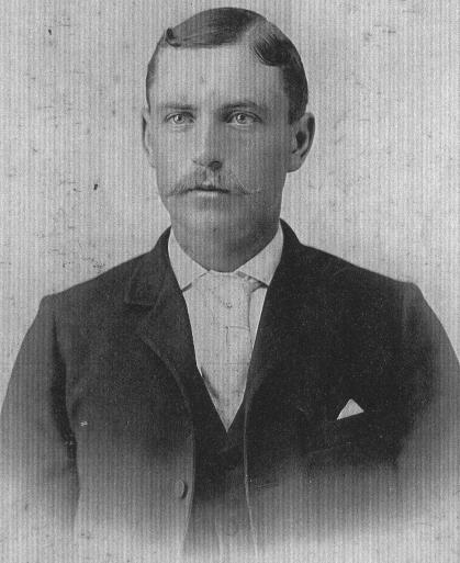
Charles Ottesen of Denmark left home early to become a sailor. He eventually ended up in Tacoma where in 1890 he married Mary Neilsen, also of Denmark. In the mid 1890s they moved to Juneau. Around 1900 (some sources say “prior to 1898”), Charles staked several mining claims around Funter Bay (some sources misspell his name as Otterson or Patterson). Both Charles and Mary lived and worked at Funter Bay and in Juneau, commuting back and forth in a sailing sloop. Charles later worked as a caretaker at Funter Bay until the late 1940s. Here’s a photo of the couple at Funter Bay.
Charles Ottesen:
Willis E. Nowell came from a family of miners and mine managers. His father Thomas Nowell came to Alaska in 1885, along with his brothers George and Benjamin, helping to found the the Berners Bay Mining and Milling Co. The Nowell family did some mining elsewhere in the US, and was very active (though not always successful) in Juneau-area mining for several decades, including Berners Bay, Perseverance Gulch, Sheep Creek, Douglas, and other areas. Thomas’ son Willis Nowell Sr. was a prominent violinist, who switched his career to mining after visiting his father in Alaska. He continued to play the violin in Juneau. Willis also became an agent for the Alaska Steamship Company. Willis’ brother Frank was a noted photographer in Alaska. A street in West Juneau is named after the family.
Willis E Nowell with violin:
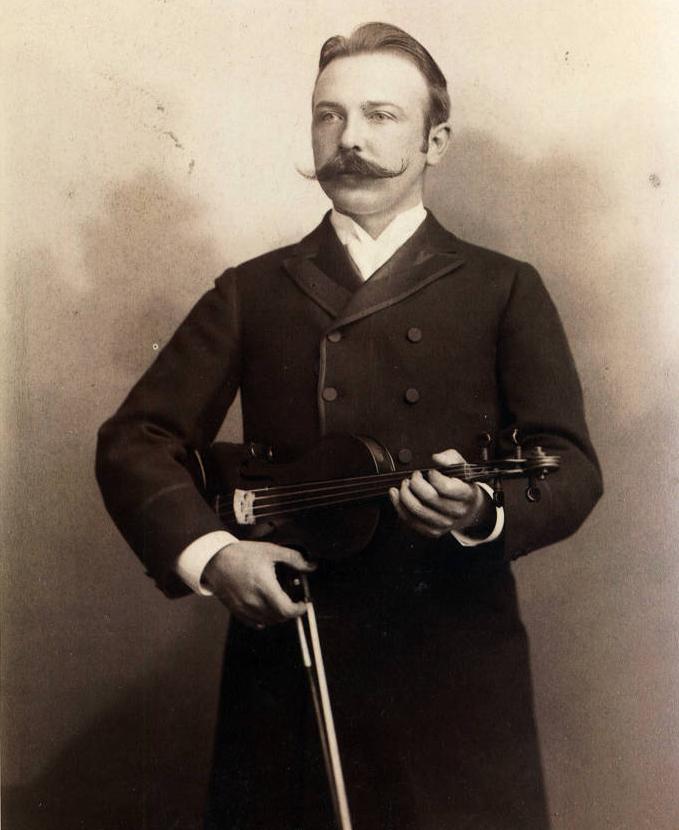
Courtesy of Alaska State Library, Nowell Family Photograph Collection, P402-03
Side note: I am tempted to start calling this blog “Funter Bay, a history of Mustache Enthusiasts”
The Alaska Dano / Nowell-Otteson mine included workings in several locations. Original claims and development occurred near the sandy beach at the South shore of Funter Bay. Later, the claims extended in a long swath to the SE, and included a longer tunnel high on the side of Mount Robert Barron (the apparent goal being to follow a “ledge” or vein, of quartz from its outcrop near the beach to a hoped-for “mother lode” in the mountain). The company built a corduroy road through the swampy muskeg from their beach camp to the base of the mountain, and trails to the various mine workings. They do not appear to have had much mechanization beyond ore carts, some small stationary steam engines, and the tractor for the road. There were no major aerial trams or railroads (It’s possible that there was more equipment which was salvaged when mining wound down). The Dano mine later logged an area of old growth forest near the end of their road, leaving a clearcut which is still visible in infrared aerial photos.

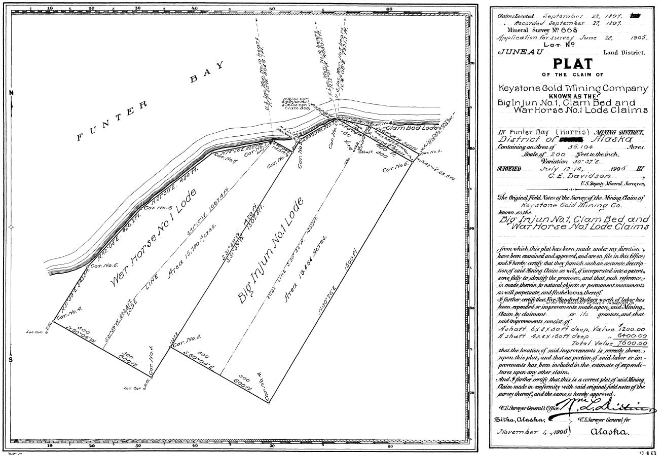
The first claims along the beach were staked by the Keystone Gold Mining Company in 1897. The War Horse Lode, part of Alaska Keystone’s properties, is listed as part of the Dano mine, so it is likely there was some consolidation of claims and mergers of companies (or different companies owned by the same people). There were several companies named “Keystone”in the late 19th and early 20th centuries, I am not entirely sure which, if any, were related. A 1906 government report notes that the Alaska Keystone Company did some development work on the War Horse Mine in 1897 and 1900, including a 48 and a 125′ shaft, and 320ft of drift. Ore was supposedly returning $100 of gold per ton. No work was reported between 1900 and 1906, although the company filed as a “foreign” (out of state) corporation in 1905. Later work on these claims is attributed to the Alaska Dano Mining Co, and the Dano company’s “Little Dandy” Lode was staked across the former War Horse and Big Injun claims of the Keystone company around this time. Also confusing is the appearance in the late 1920s of the “Williams Mine”, which was actually in Hawk Inlet on the other side of Mt. Robert Barron. Some modern-day documents refer to the upper Dano workings as the Williams Mine.
Today, much of the beach property has been patented (made permanent private land, vs a temporary mining claim), and has been subdivided into private cabin lots. (Almost all of the sandy beach area above the high tide line is private property, if you are visiting Funter, please avoid trespassing).
The Dano operation does not appear to have had a permanent dock, relying instead on the smooth sandy beach and protected stream mouth in front of their camp to land boats.
A barge tie-up on the tidal gravel bar at the mouths of Ottesen Creek and Dano Creek. (I previously had this listed as part of a cannery fish trap, but further review of the position, and the tidal location, leads me to believe it was related to the mine):

A general timeline of operations at the Alaska-Dano:
(Context: Joe Juneau and Richard Harris “discovered” (were shown by natives) gold in Juneau in 1880. Mines quickly sprang up including the Treadwell, Perseverance, and other operations nearby. Prospectors soon spread out into the surrounding mountains and islands in search of more gold).
1868: Captain J.W. White of the survey vessel Wayanda notes some promising geology at Funter Bay.
1880: George Pilz (who bankrolled Harris and Juneau) finds some gold at Funter Bay (per Roderick).
1887: Prospectors Richard Willoughby and Aaron Weir (or C. Weir or Ware?) stake some claims at Funter Bay. (per Roderick’s Preliminary History and others).
1889: The Nowell Company bonds some of “Willoughby and Ware’s” claims for $50,000. Nowell spent several thousand on development, backed by an Eastern Company, but one report states that they abandoned the initial dig since the ledge (vein) dried up as it got deeper.
1897: Gold deposit discovered near the sandy beach, War Horse Mine development begins.
Pre-1898: Otteson stakes various claims at South shore of Funter Bay.
1900: Two shafts had been dug (50ft and 125ft), and 320ft of tunnel (This is probably the work of the Keystone Gold Mining Co).
1905: The Keystone Gold Mining Co files as an out of state corporation.
1916: “Otteson Group” of claims staked.
Before 1919: A “good trail” had been built from the bay to the top of Mount Robert Barron, and a 200′ tunnel was driven at an elevation of 1,050 feet.
1919: Geologist J.B. Mertie notes promising quartz outcroppings at the “Nowell Otterson” group of claims.
1920: The Alaska Dano company is formed.
1921: The company reported a large amount of “free gold”. 100′ of tunnel and a winze (angled shaft) had been dug.
By 1922 they had another 250′ of tunnel.
1924 and 25: “A limited amount of development work” was done.
1926: Some prospecting work was done, but no production was reported.
In 1927, Only the minimum work to maintain claims was done.
In 1928, “Prospecting work only” was carried out.
1929: “A little development work” included driving 76 feet of tunnel. The Williams Mine apparently had some leasing discussions with Dano.
1938: Property listed as “Idle”, with “Intermittent development”
1945: Willis Nowell passed away, his family applied to secure his stock in the Alaska-Dano mine.
1955: Charles Ottesen passed away.
1960s: Fred Eastaugh became involved with the property.
1968-69, the Dano company did some logging.
A 1981 report mentions that 265ft of tunnel was dug after 1900, and that only 100oz of gold was produced (some documents indicate that more was run through a neighboring mill under contract, and the output would be higher if listed seperately)
1991: Fred Eastaugh listed as president of the Alaska Dano Mines Co.
1994: Some surface mapping and sampling performed.
1996: “Alaska Dano Claimants” performed limited sampling and re-staked claims on federal land adjacent to the patented claims.
It appears the Dano’s investment money dried up during the 1920s and never really reappeared. The major workings completed included a 400′ tunnel, several shorter tunnels, some relatively shallow shafts, various open cuts, the road, timber clearcut, and other minor work.
Despite apparently limited returns, activity never quite stopped at the Dano claims. After the big gold finds in the Juneau area, prospectors were always hoping to find the “next big thing”, even into the 80s and 90s. The Greens Creek Mine across Mt. Robert Barron turned out to be the “next big mine” of recent times, and more recently the Berner’s Bay mines have begun reopening. Today, there is renewed interest in some other area mines, as gold prices continue to rise. Mining companies continually poke at the Juneau mines hoping to get approval to re-open. Dano maintained most of their claims, and continued doing development work to meet the maintenance requirements. The logging operation may have been an attempt to make more profit from the property outside of mining.
Present-day remains:
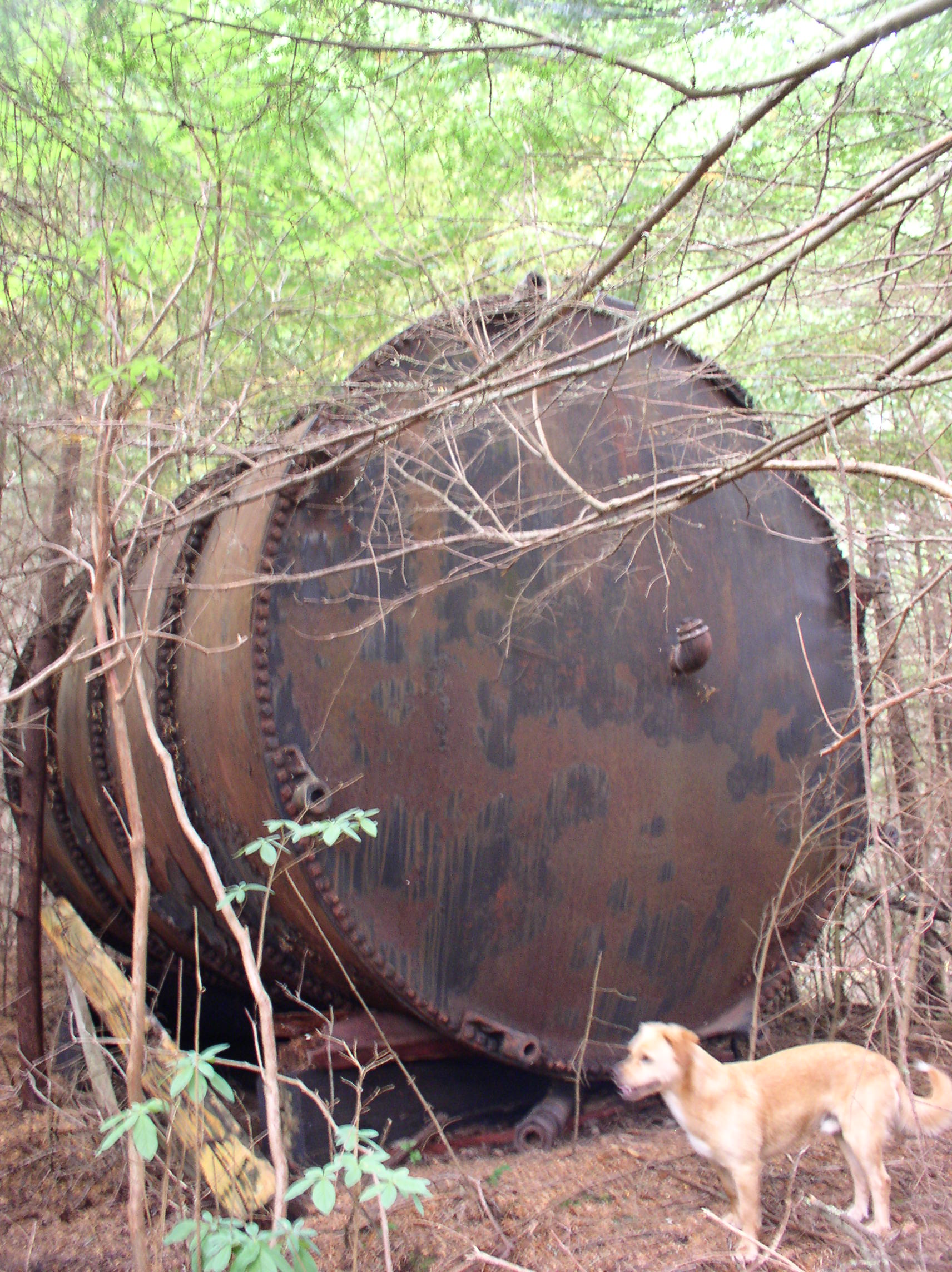
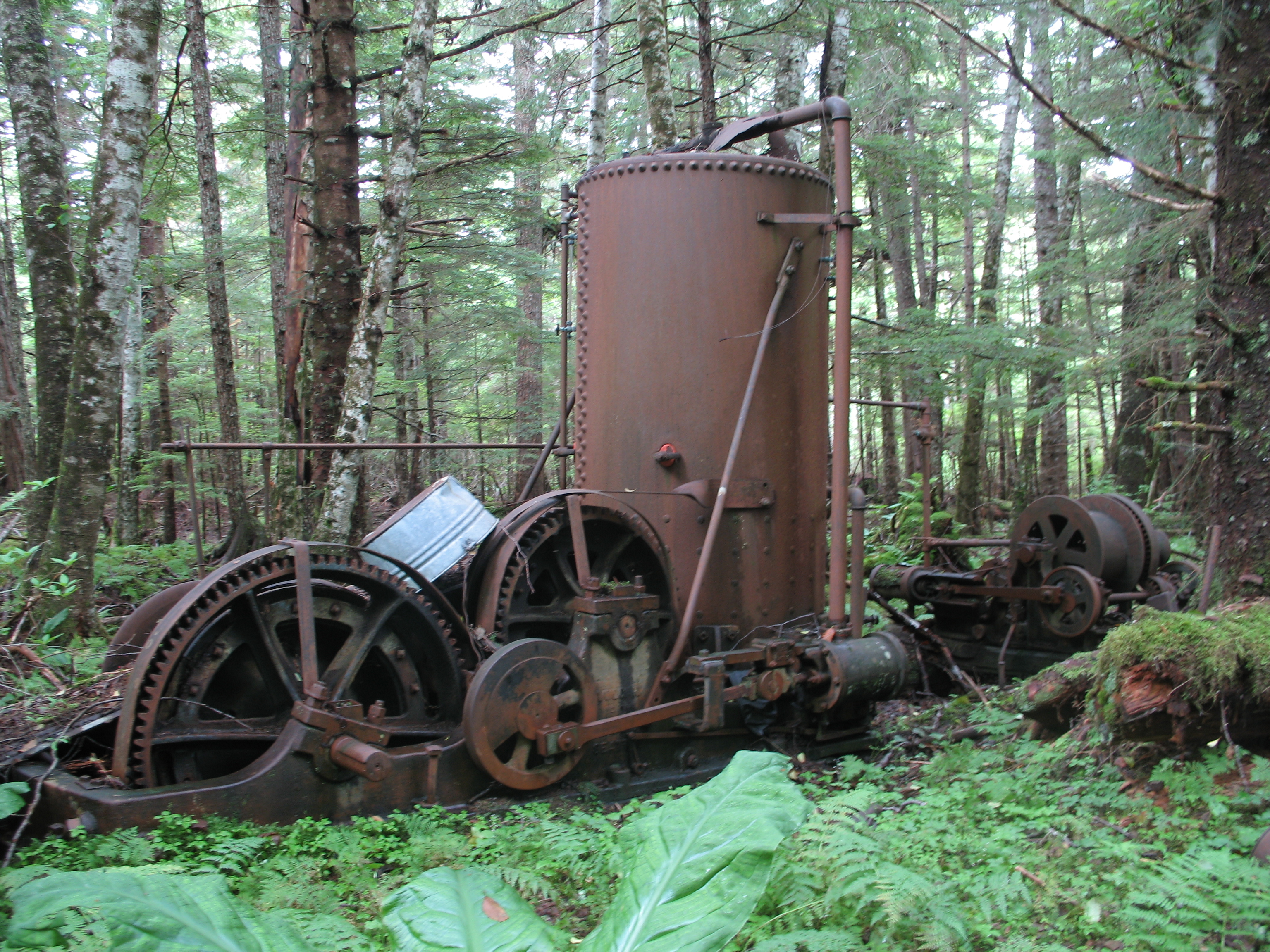
There are still a few remains of the Dano camp near the beach. Early work included a few open cuts, shafts, and tunnels. The most prominent remaining feature is the steam boiler which probably powered their shaft hoists and possibly other equipment.
Directly in front of the boiler is a semi-collapsed shaft, with a few logs over it and a metal pipe leading down into it (probably for a dewatering pump). Some of this wood might be the remains of a small headframe:

Another shaft nearby. This one has been made “safe” in the time-honored tradition of Western mining: Throw some bed frames over it and call it a day:
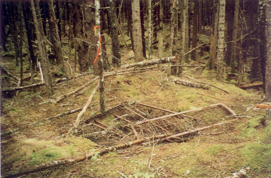
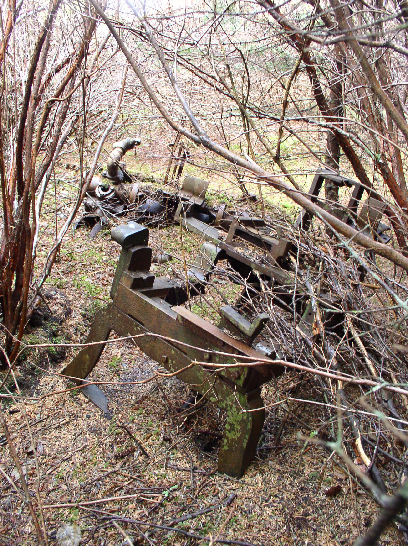
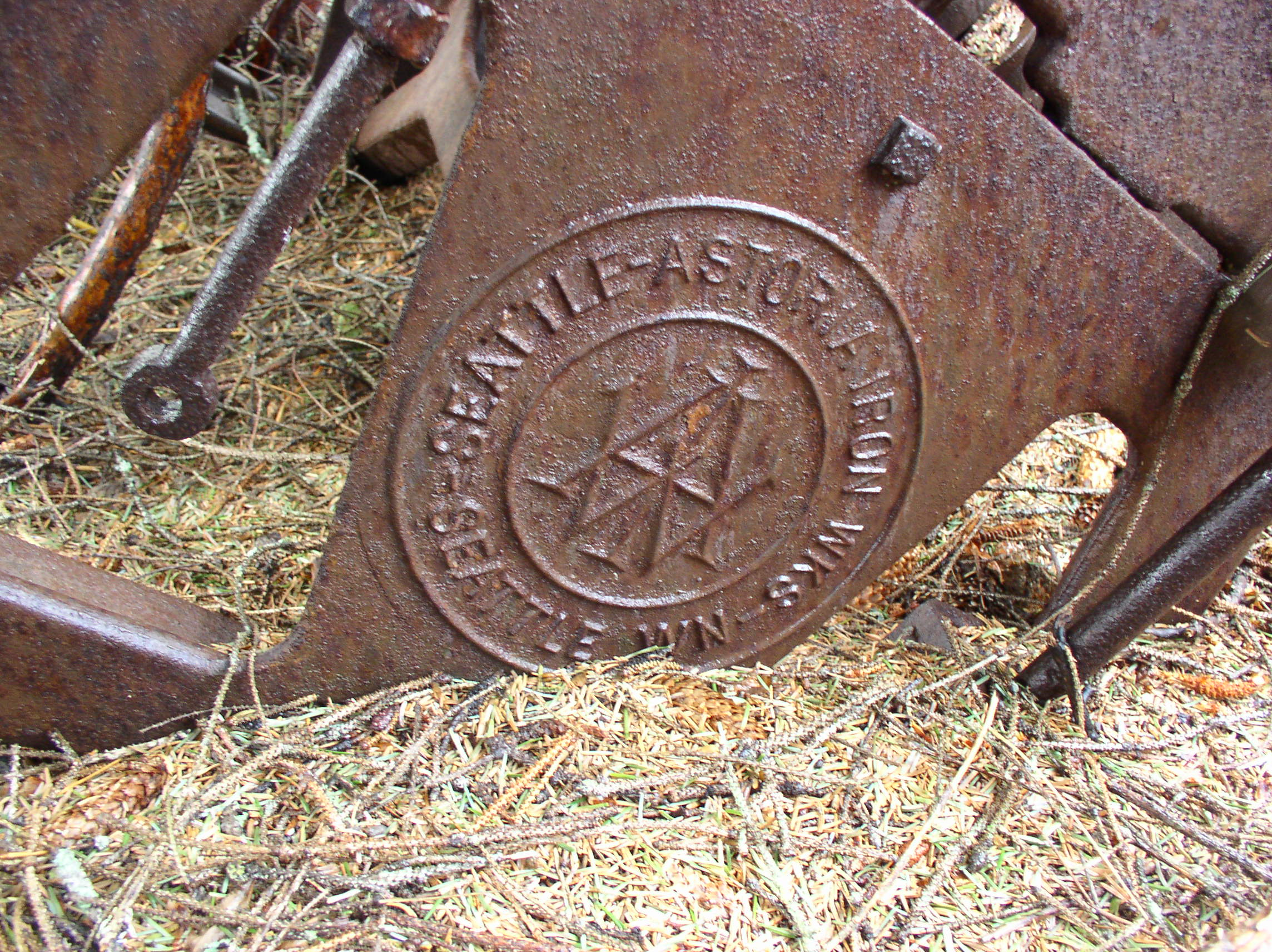
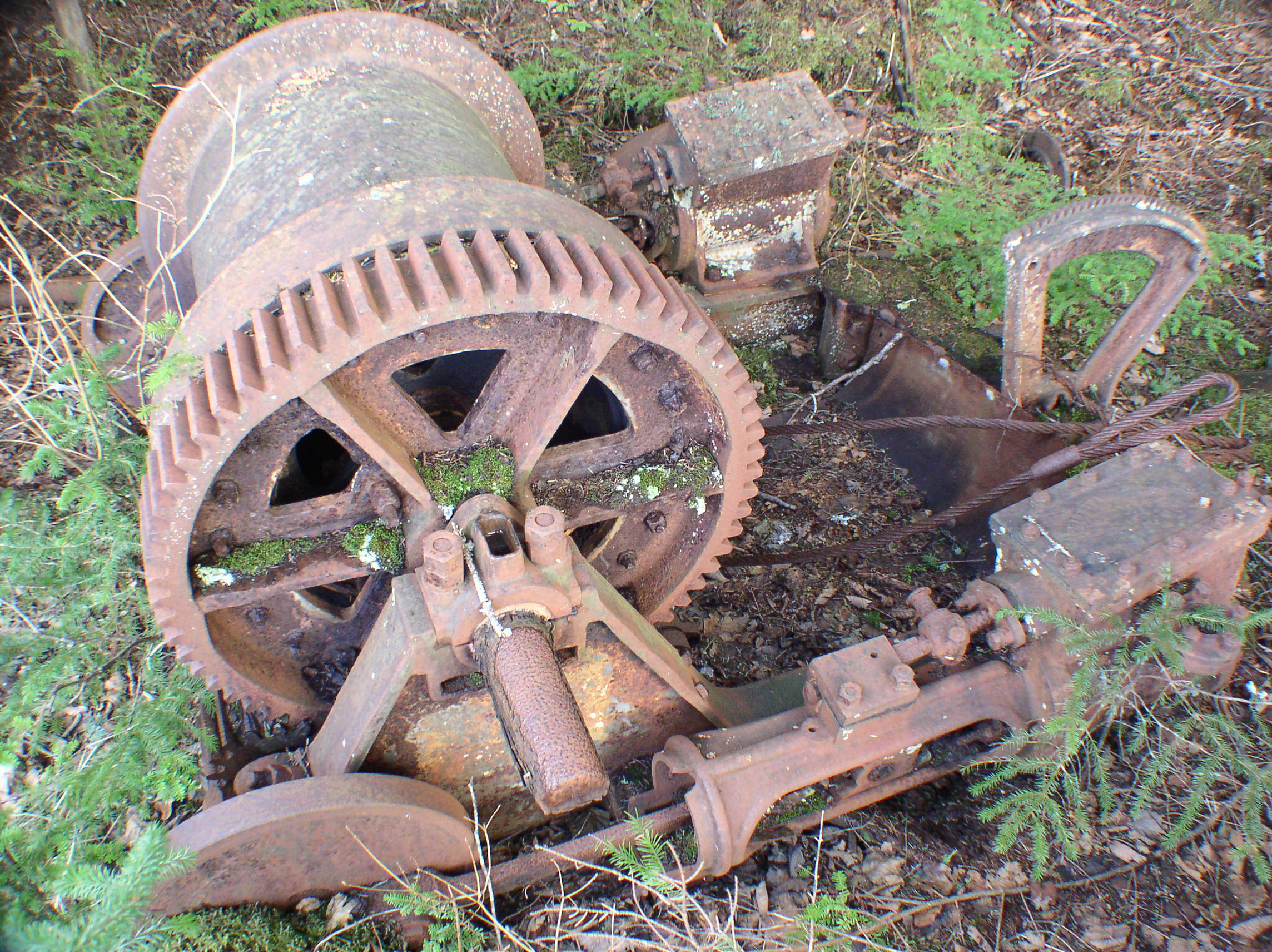
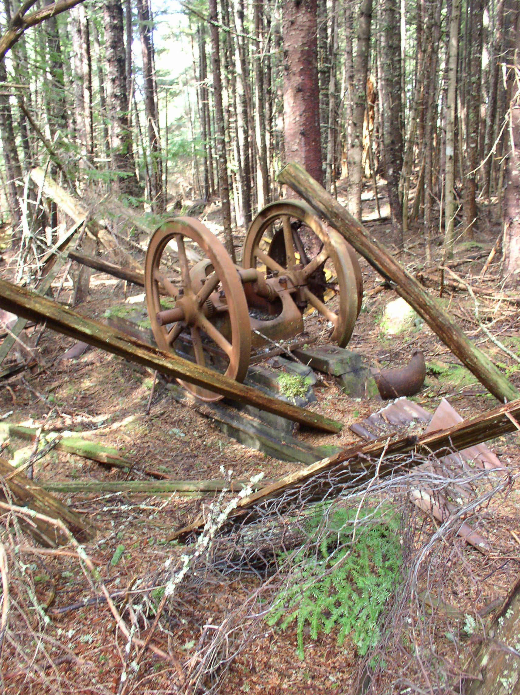
Part of a winch found nearby, which may or may not be related to one of the shafts (it could also be part of a boat):

Shorelines around Funter Bay tend to come in “benches” that show where the sea level used to be. This is not due to sea level dropping, but the land rising! After the glaciers retreated, the ground tended to “bounce back“, and raise a bit. Travelling inland from the water, you would generally observe a 10′ dropoff just below extreme low-tide line, a 10′ bluff a little above extreme high-tide line, and another 10′ bluff back in the woods where the old high tide line was (you can find clamshells near the back bluff that aren’t old enough to be fossils, showing that the change was fairly “recent”).
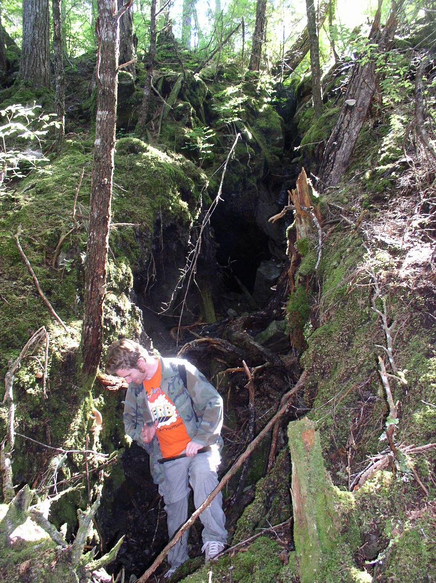
Below is a tunnel into the back bench behind the Dano beach camp. It was fairly unstable and flooded, I would not recommend going into this (or any) tunnel:
Eventually, the near-shore deposits either proved marginal, or the difficulty of digging shafts near sea level caused the miners to move farther back from the shore. The Dano claims stretch all the way to the top of Mount Robert Barron, and I believe there are some small shafts very high on the mountainside (At the “two shafts” lode).
Dano claims (shaded), and tractor trail to the base of Mt. Robert Barron:

The main adit, was located closer to the base of the mountain, next to a small waterfall on Dano Creek. The corduroy road up to this mine is marked on various topo maps as a trail, a tractor trail, or a road. Likely the mine used a gas crawler tractor to haul supplies and equipment up to the adit from the beach.
Part of the Dano mine’s corduroy road:

A bridge on the Dano road over a small stream:
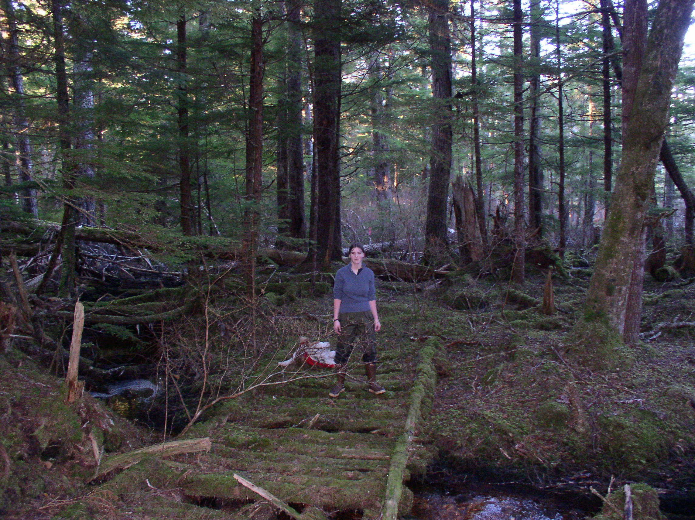
Not much is left of the road, most of the corduroy has rotted back into the ground cover. It’s still possible to follow it with some bushwhacking, but it’s not really a useful or passable trail. Beavers have dammed up parts of the muskeg along the way, flooding the route of the former road in a few places.
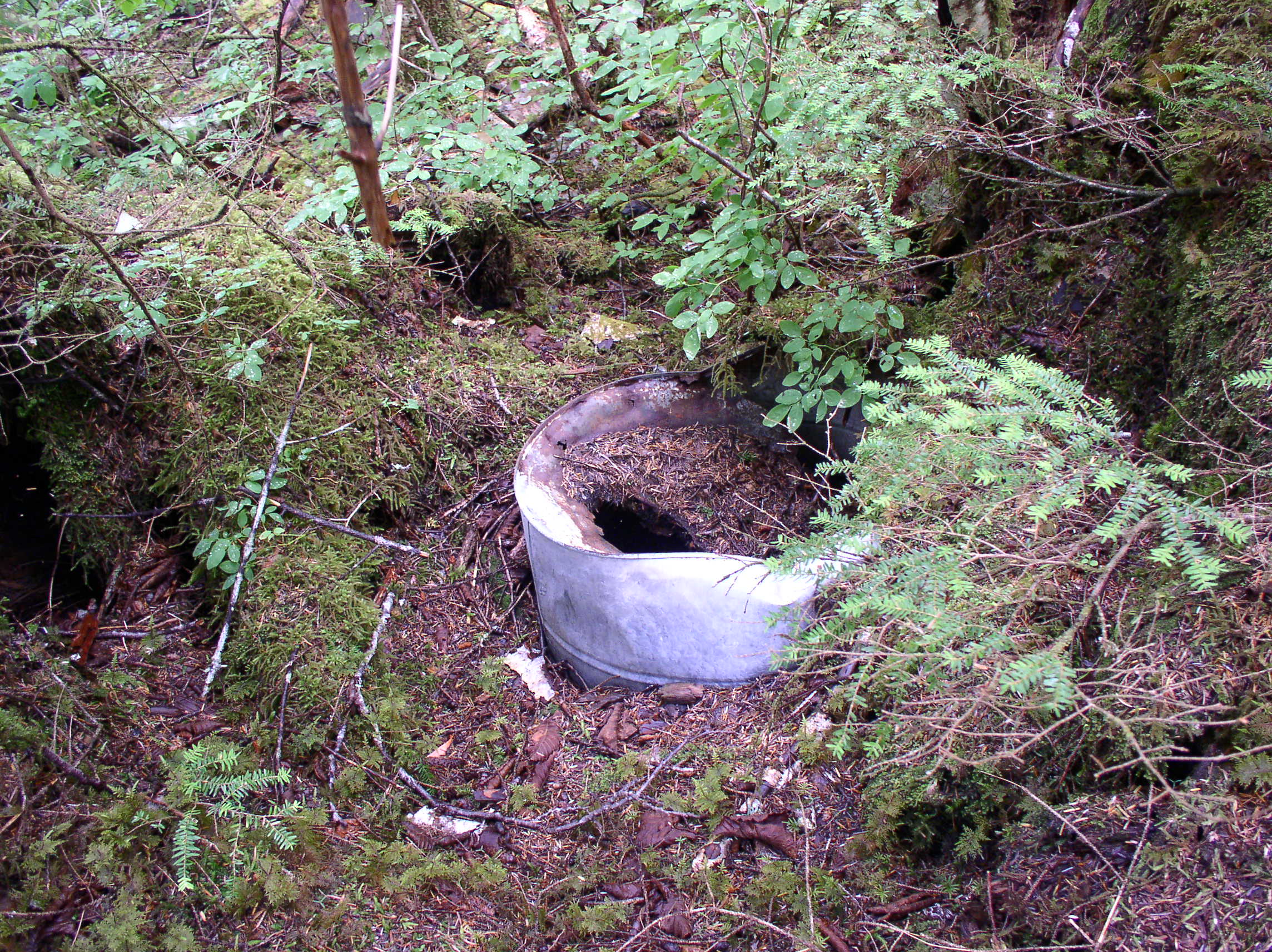
Higher on the mountain, a few more signs of the Dano Mine are visible. This is a cabin site near the mine’s upper tunnel (sometimes referred to as the Otteson Mine). There’s not much left of the cabin aside from some logs, metal bits, and stove parts.


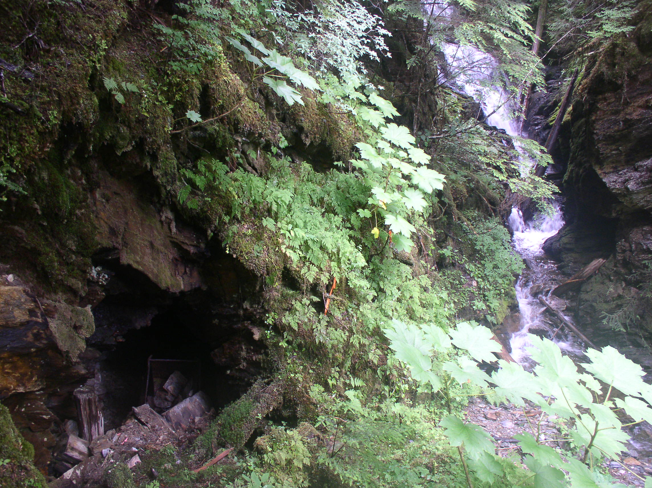
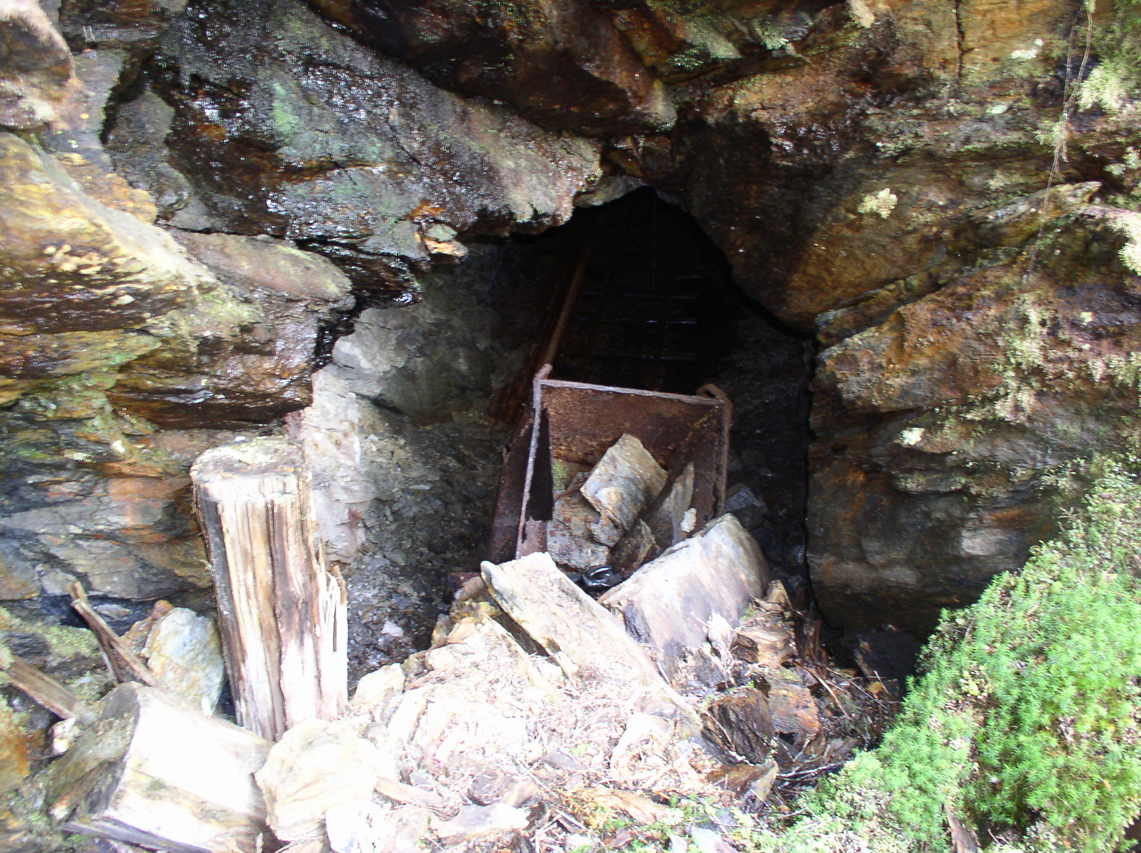
The mine adit (tunnel entrance) is immediately adjacent to Dano Creek. Mines in Southeast tend to be damp due to the high humidity and prevalent groundwater, but there is likely even more flow into this tunnel due to the stream. This has probably contributed to some of the collapse near the entrance.
(Note: I do not recommend that you go in any mine workings. They are often dangerous, unstable (as seen below), and many are still private property).
The adit has collapsed somewhat, crushing this ore car:

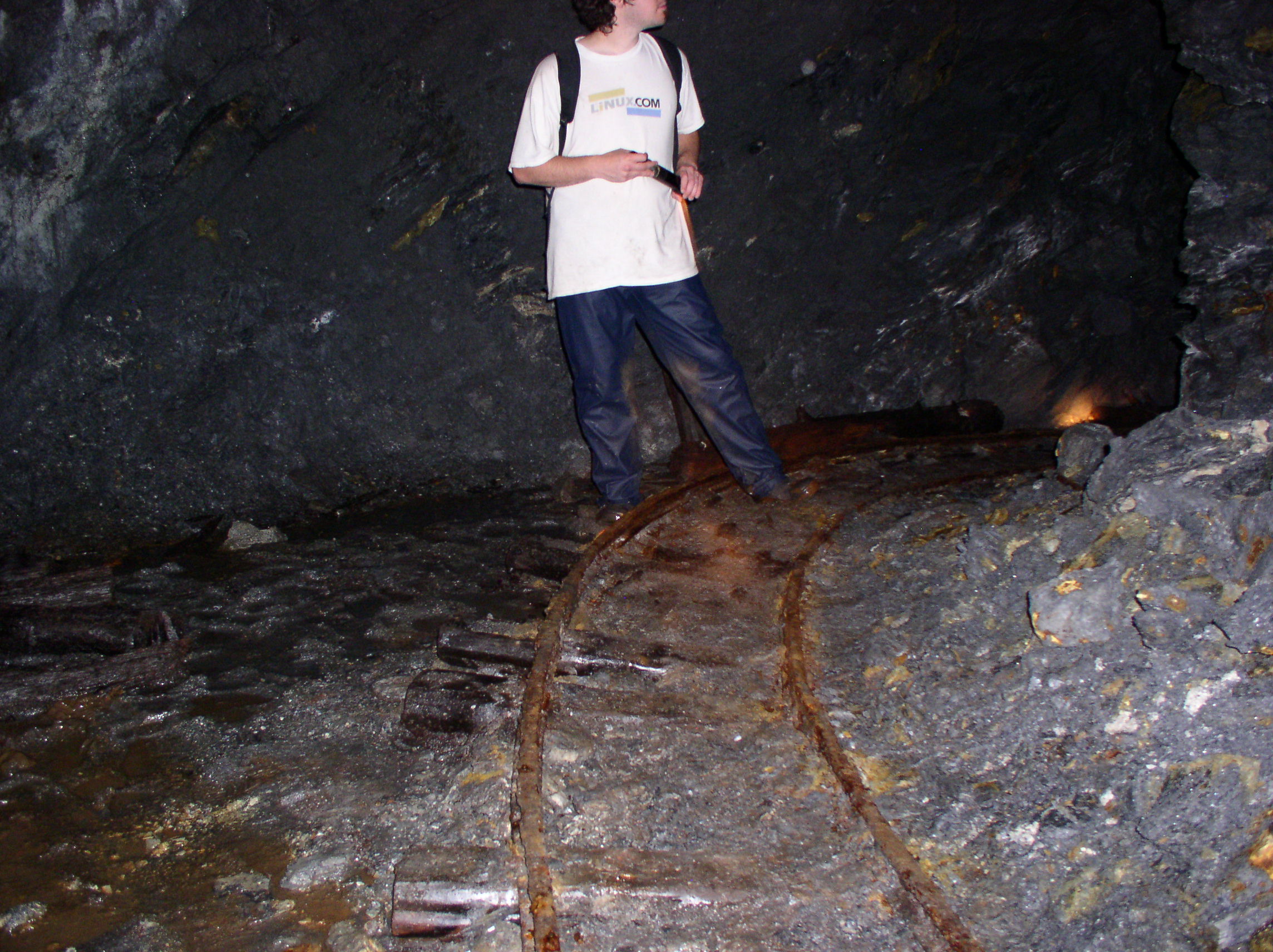
Inside the tunnel, tracks along the floor are still in decent condition, despite the high humidity:


Part of a Dupont dynamite box: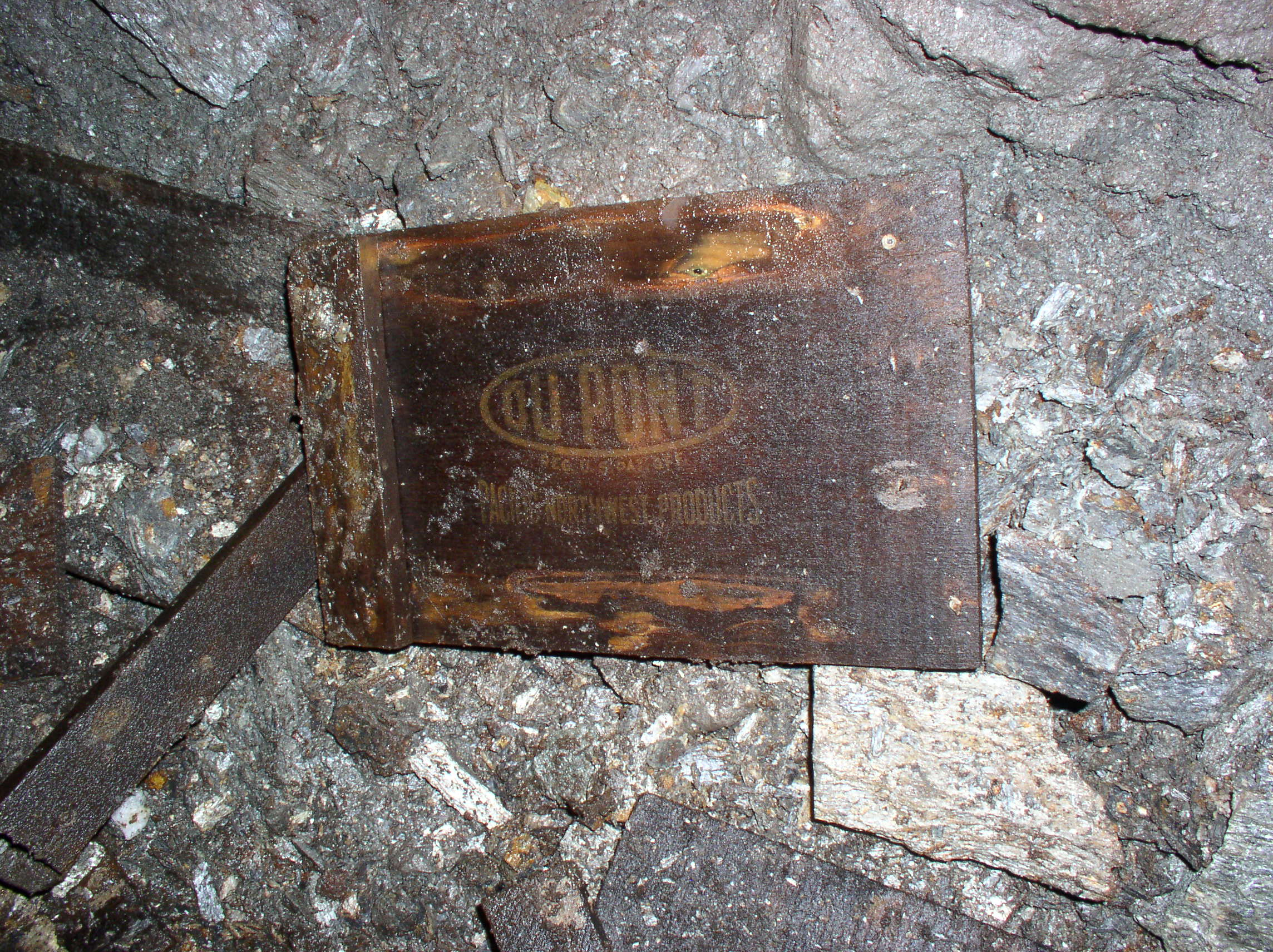
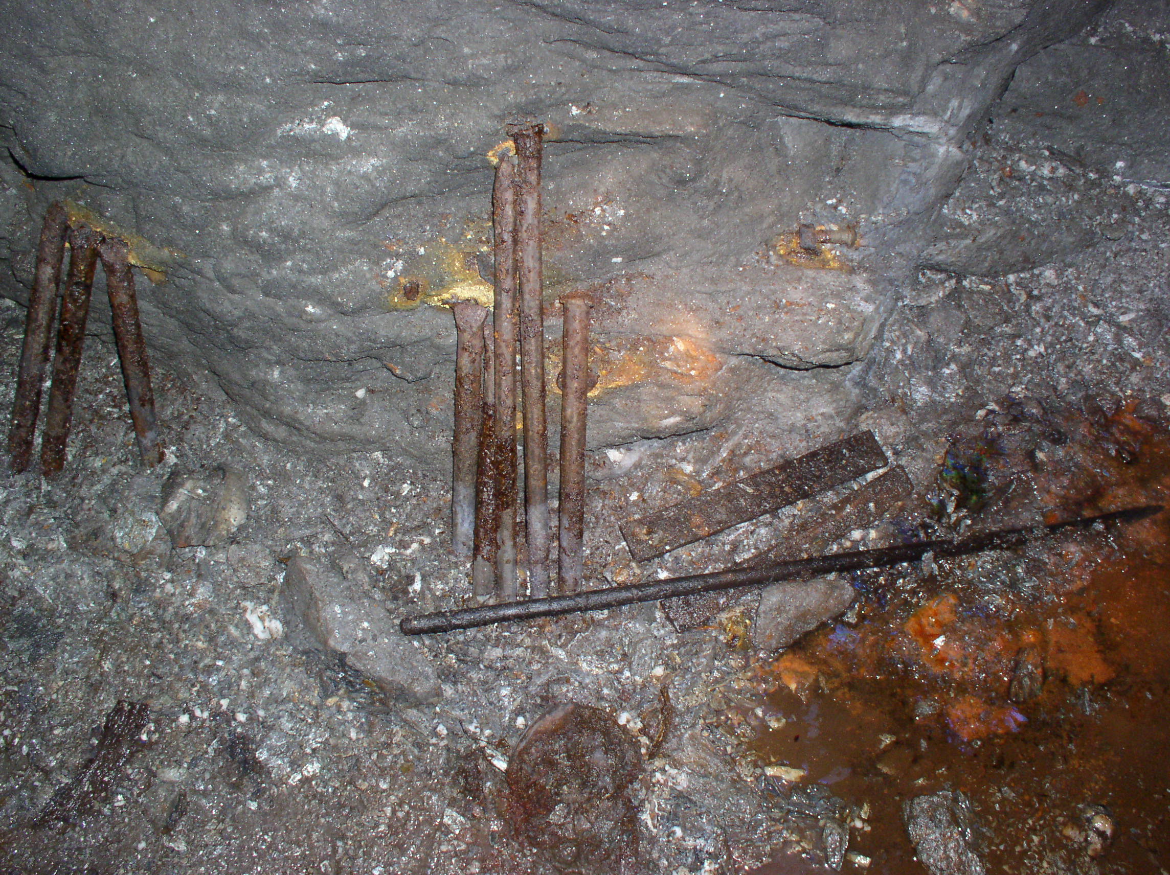
Tools and a rail bending jig (The C-shaped thing):

Drill bits:
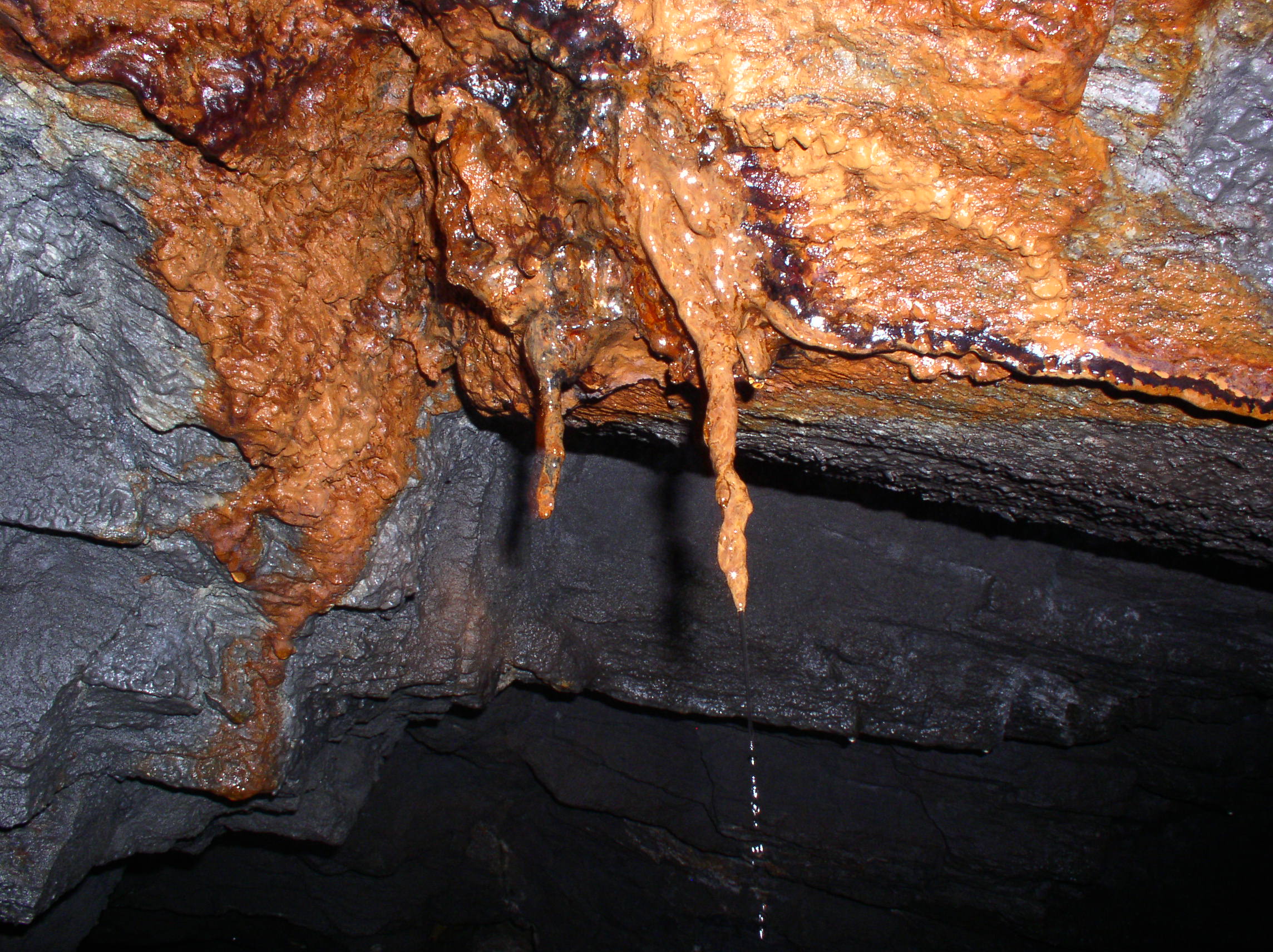
Iron leeching from a metal ore vein with water pouring off an iron stalactite:
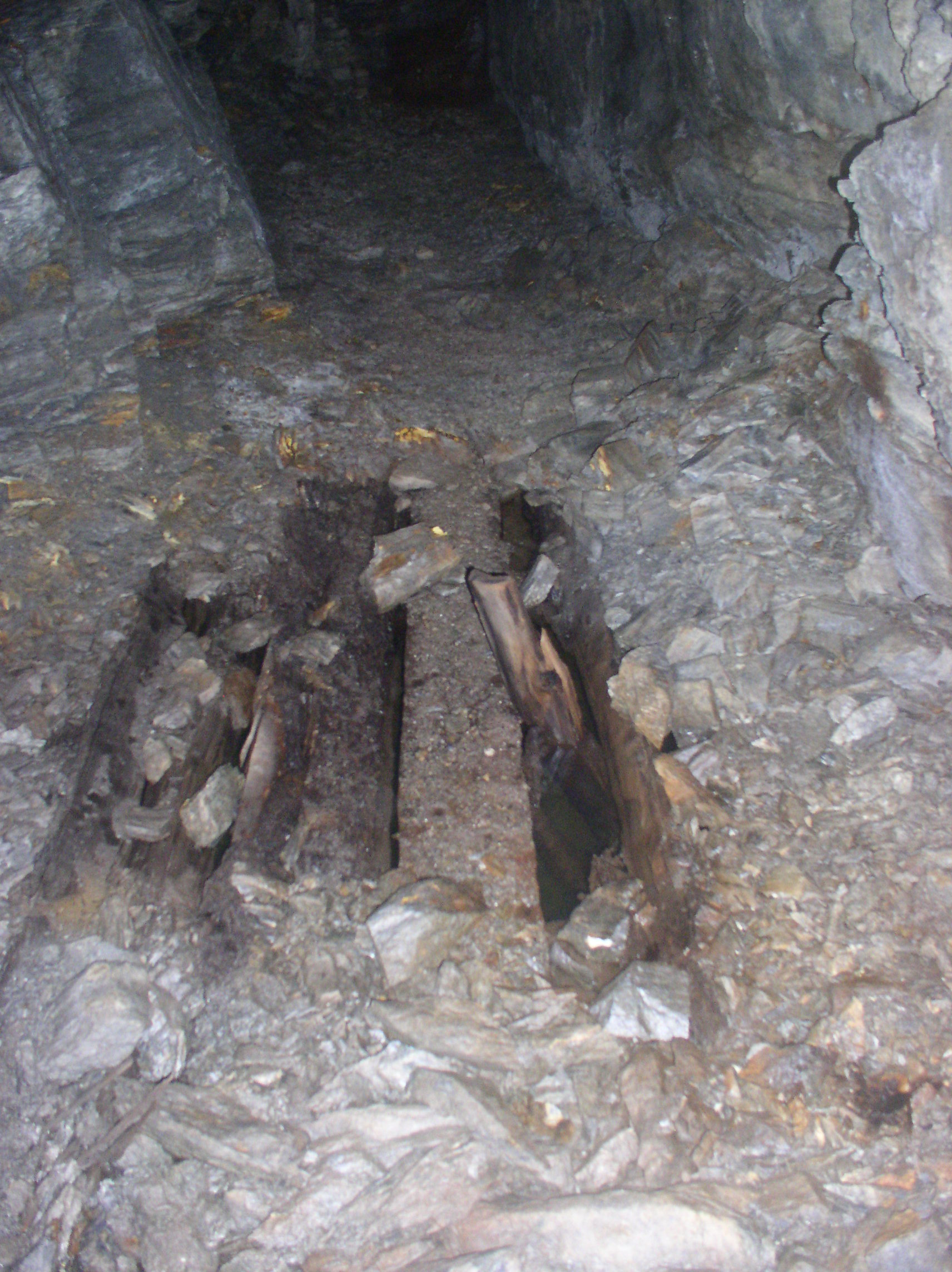
Below is one of the “fun surprises” of old mine tunnels; hidden shafts! You can be walking along, and suddenly the “rock” you think you’re standing on turns out to be a thin layer of mud or dirt over rotten boards and a deep pit. This one is flooded, so at worst you’d get a dunking, but others can drop you into a death trap:
That’s all I have on the Dano mine for now!


 Posted by saveitforparts


