Funter Bay History: Cannery Buildings in the 1970s

May 2, 2013

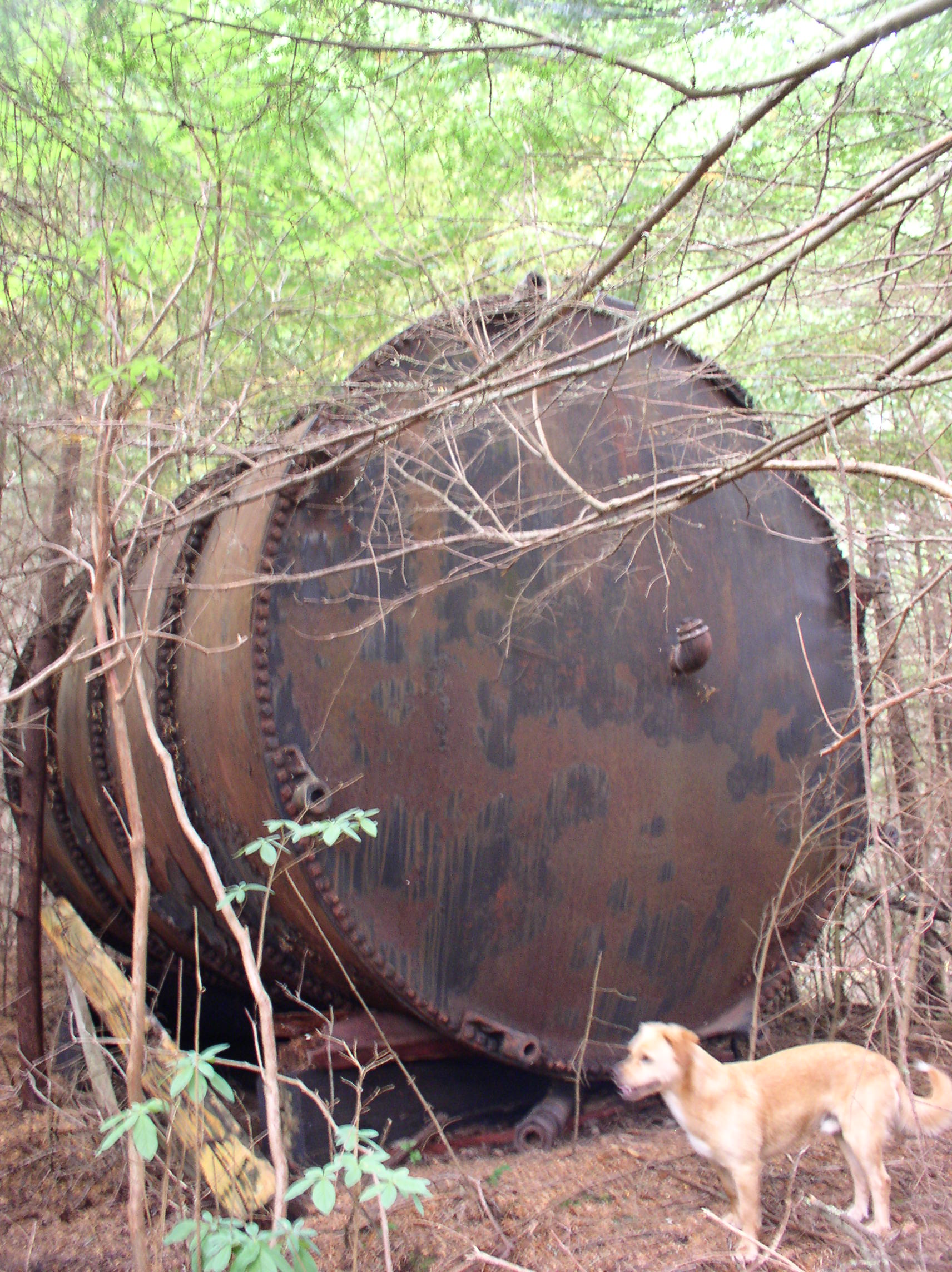
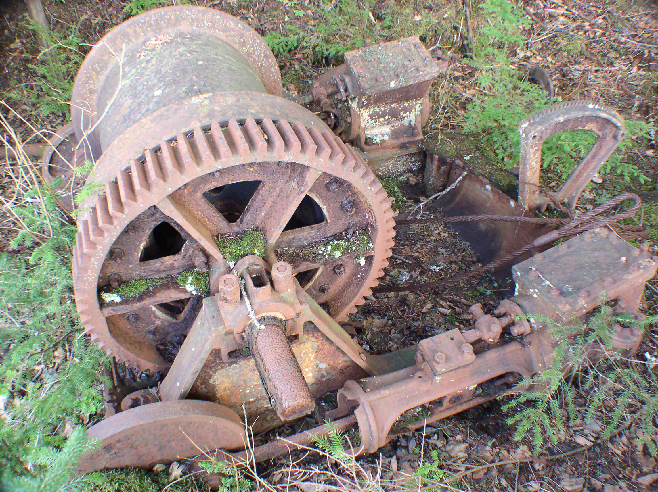
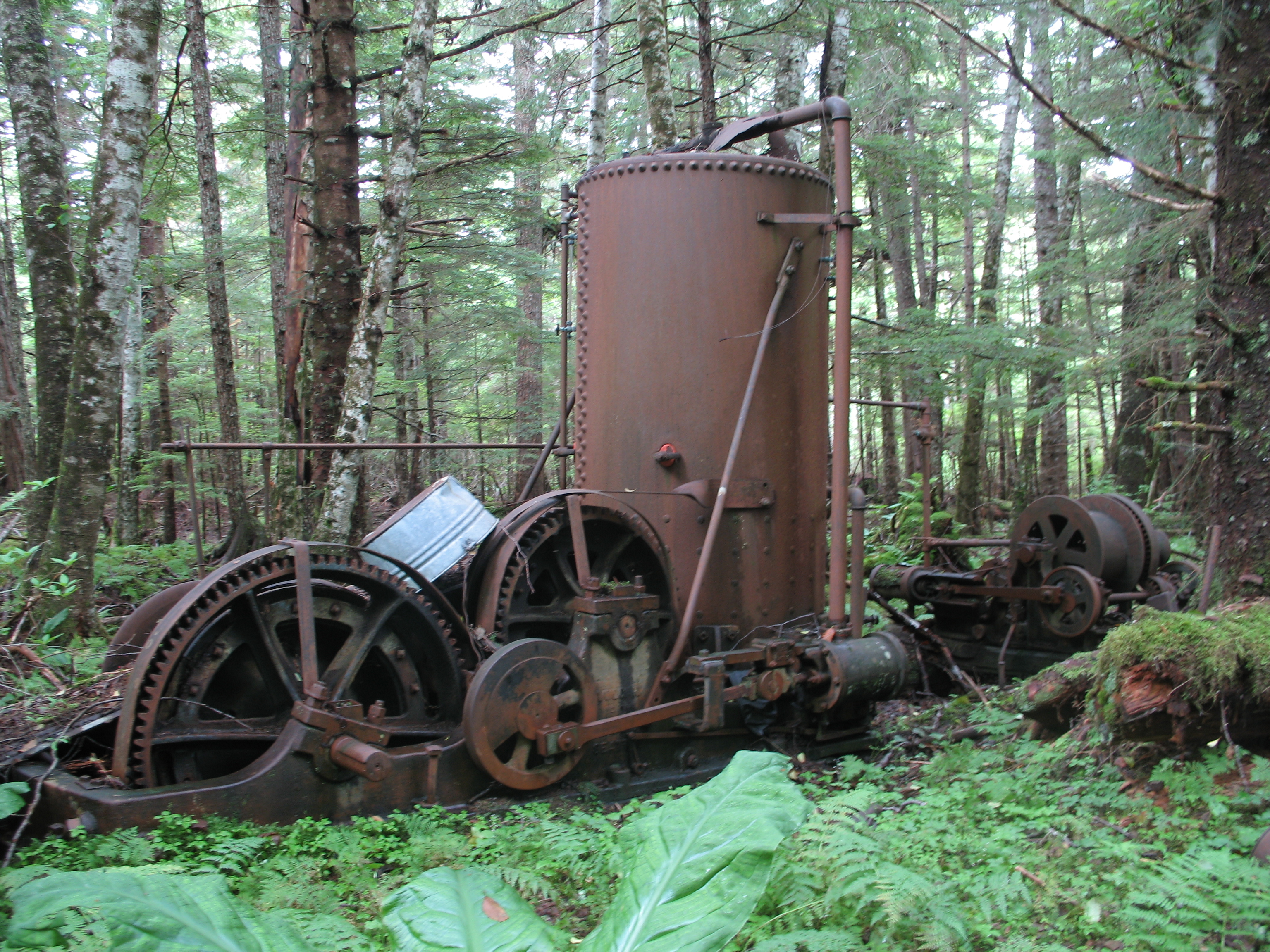
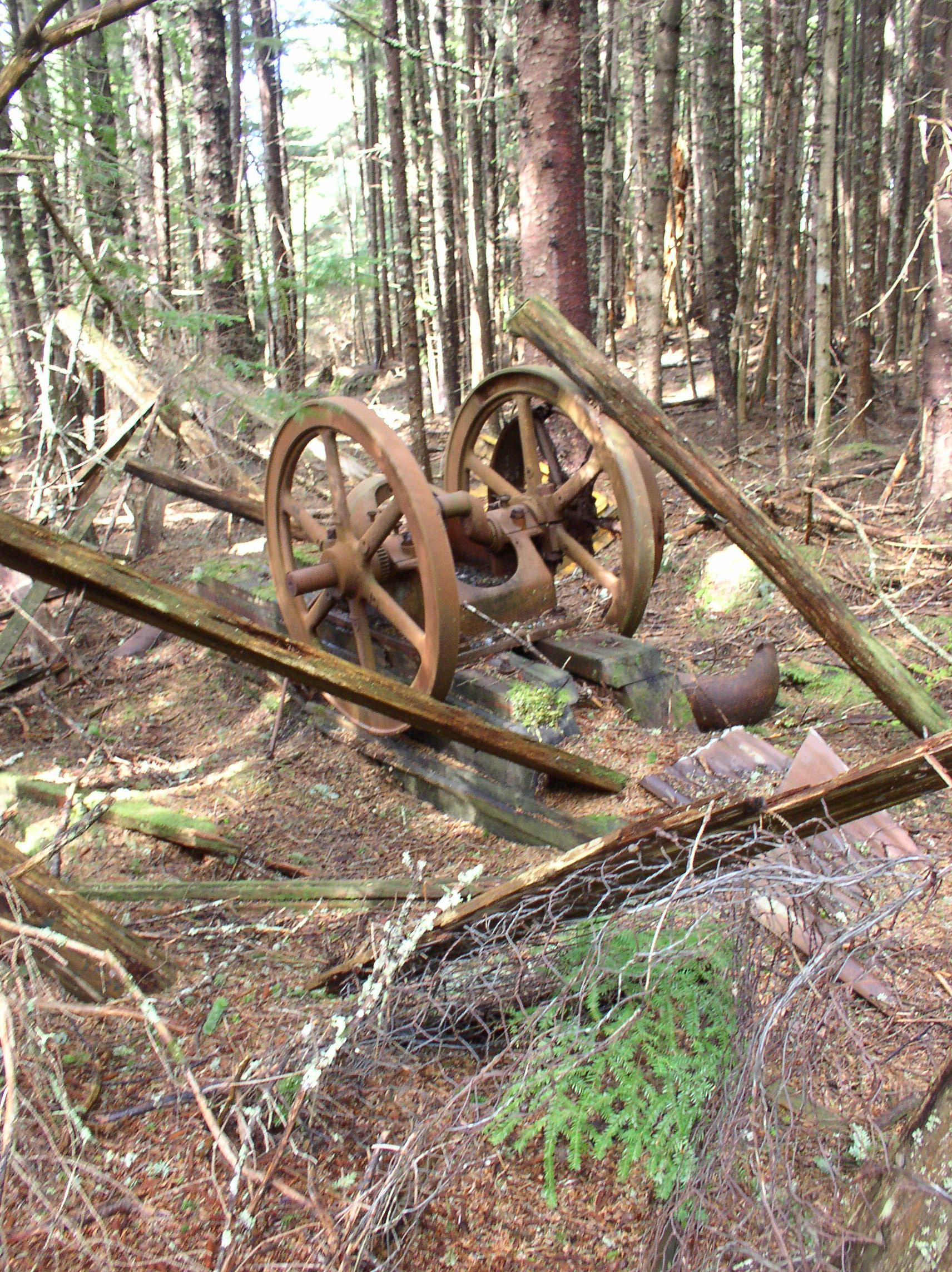
Before detailing the remaining structures at Funter Bay, I would like to note that these are almost all private property. While visitors on yachts are sometimes known for poking through old buildings, this is frowned on by the owners and local residents. Any structures you see from the water are private cabins or residences (even if they look quaint or abandoned). The ramp and boardwalks at the old cannery all lead to private cabins. Residents keep a watchful eye on eachother’s properties, and are naturally curious (some Down South visitors have called us nosy) about any activity in the bay. Any unrecognized boat entering the bay becomes the immediate focus of everyone’s binoculars. If you are visiting Funter Bay, please respect private property and do not trespass on people’s yards or in old buildings. (If you want a place to poke around “old stuff”, I would suggest Scow Bay with its wrecks and steam engines).

That said, here are a few photos documenting the remaining structures at the cannery site. I’m cheating a bit, because the first photos are all my Dad’s from the 1970s, and many of the buildings shown are not, in fact, “remaining” any more. Dad came to Funter Bay on the mail boat Forester in 1972. I’ll further document more of the present-day remains in a future post.

An overview of the cannery in the early 70s, taken from the peak of Mount Robert Barron:

0-web-cannery

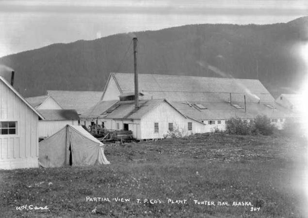
And a view from the water (compare with this photo from 1907 from almost the same angle):

Dad-cannery-2

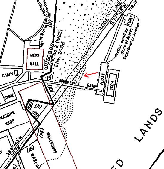
The cannery dock with inset map showing photo location (red arrow). The mess hall is on the right, warehouse on the left:

Dad-cannery-4

mess

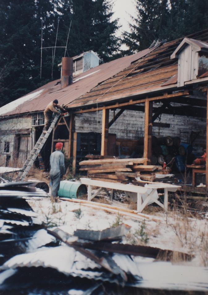
A closer view of the mess hall, taken from the dock approach ramp:

0-web-fnb2

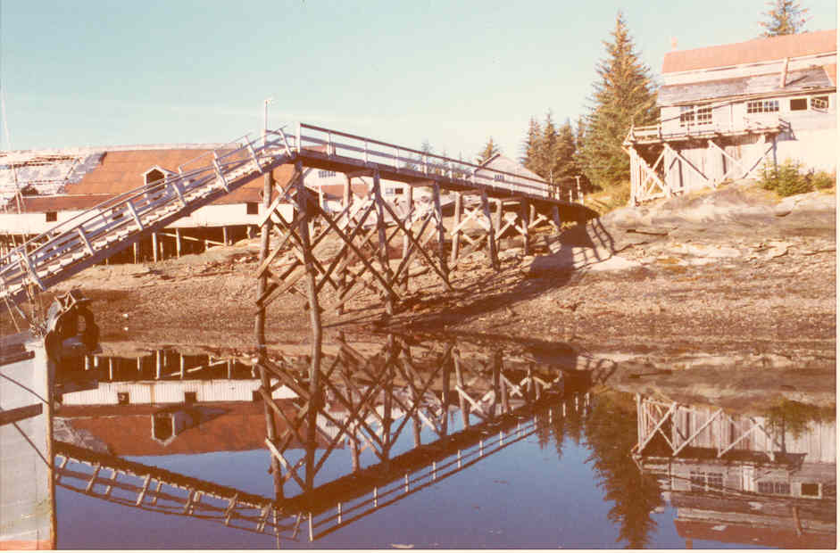
A few views of the main warehouse buildings, which used to extend out on pilings over the bay to form a wharf:

0-web-fnb1  0-web-fnb4 Dad-canneryDad-cannery-1

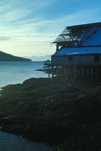
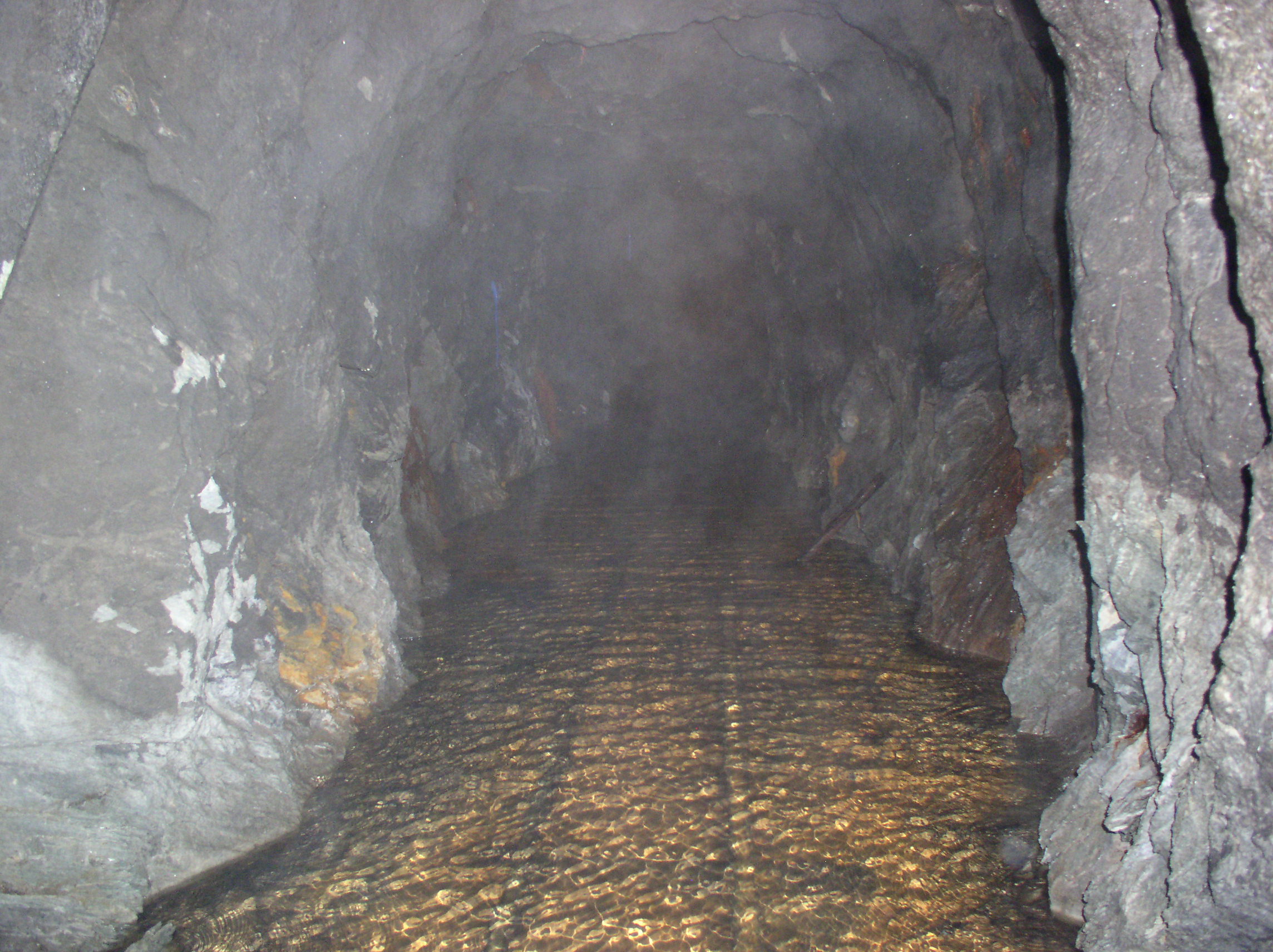
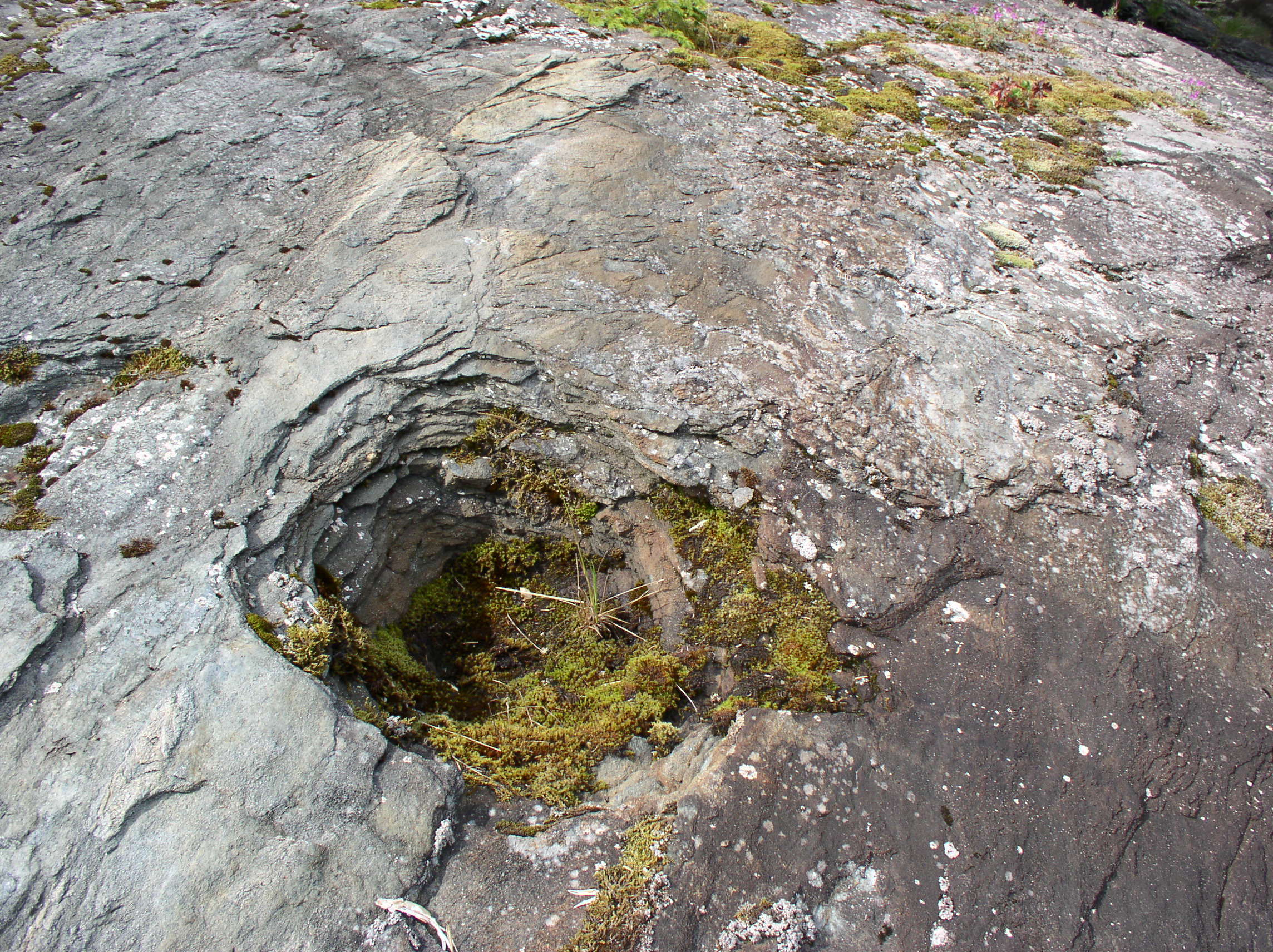
As you can see, the parts extending over the water had suffered a lack of maintenance! The wharf and cannery were built over solid rock outcroppings, which were not good places to drive pilings. In some places you can still see shallow depressions in the rock where workers blasted out sockets to set the pilings into. These pilings were basically resting on top of the rock, held in place by the weight of the structures on top. After a few winter storms, they began coming loose. Constant maintenance would have been required to re-seat them and shore up the buildings, and as soon as that stopped happening, things started falling apart.

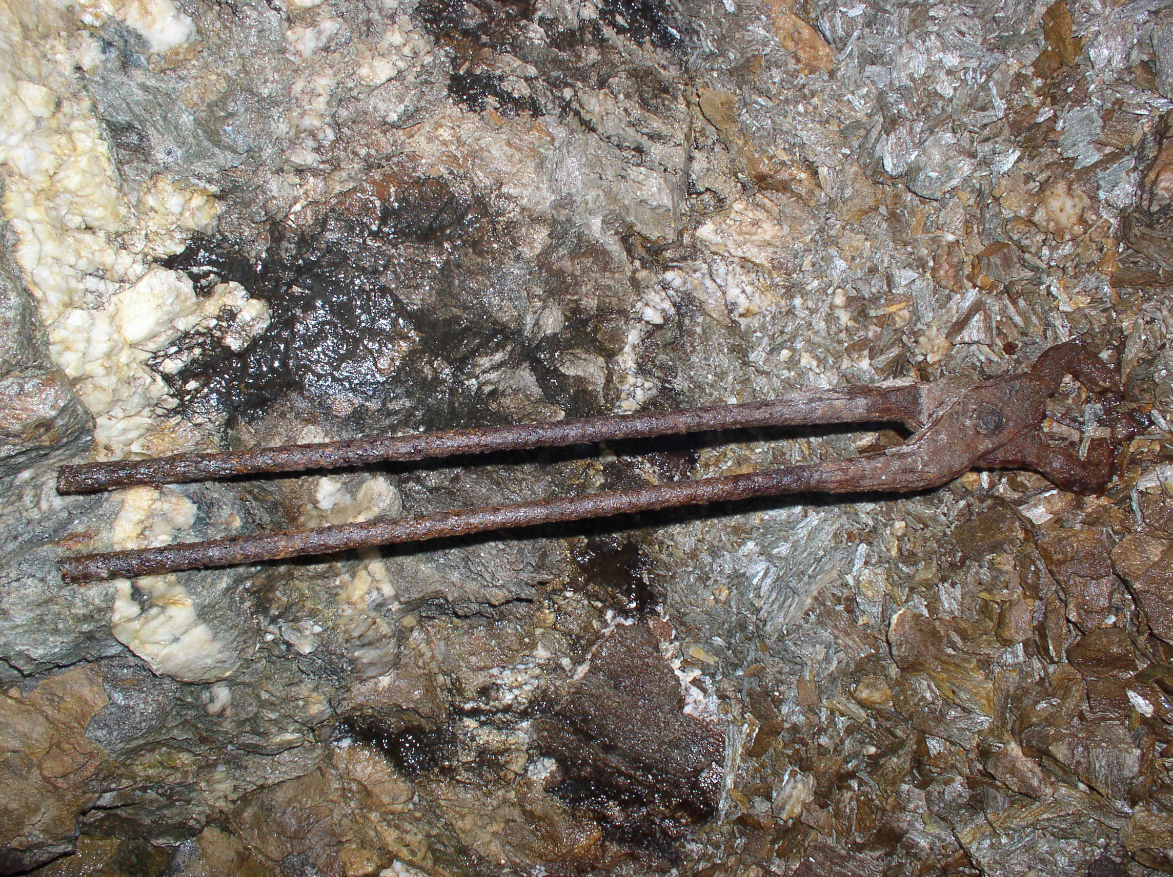
Shallow piling socket blasted into rock:

OLYMPUS DIGITAL CAMERA

Next are a couple photos looking back East at the main cannery building, with the marine way next to it occupied by an old wooden boat. Mount Robert Barron is in the distance.

0-web-fnb30-web-fnb5 cannery

The boat on the marine railroad seems to have reg # 314791 marked on the bow. Unfortunately, the online copies of the Merchant Vessel Registry only go through 1965, when ID numbers were just hitting the 29xxxx range. The current USCG documentation search doesn’t have a record for that number or for any likely derivatives (swapping 7s and 1s, etc).

Here is a view from 1907 similar to the one above, looking towards the cannery from the vicinity of the Watchman’s house:

Cannery view 1907

This is another view of the power house, from the early 1980s:

Dad-cannery-5

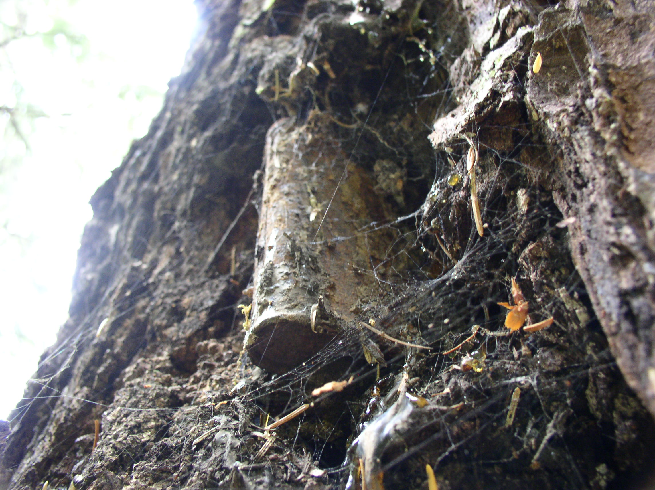
I’m not entirely sure which building this is, possibly the guest house or one of the managers’ cabins.

0-web-fnb6


Funter Bay History – Steam Power & Internal Combustion

April 23, 2013

Most of the industry in Funter Bay required power of some kind, steam was the major power source prior to cheap and reliable internal combustion engines, but early gas and diesel engines began arriving around the turn of the century.

You would think that in the middle of a forest, the best fuel for steam engines would be locally-cut wood, but coal seems to have been used instead (you can still find chunks of coal on the beach in a few places). Whether this was due to the design of the boilers, the thermal properties of spruce, or due to lumber harvesting restrictions, I’m not sure. Oil was also an option for fueling boilers (there was a whale oil plant at Tyee, and early petroleum wells in Southcentral Alaska). One document from the 1920s mentions that Killisnoo coal was preferable to oil as a fuel for steam boilers at Funter Bay. Coal was mined at Harkrader on southern Admiralty Island, near the fish processing plant at Killisnoo (now part of the village of Angoon). Discovered by Russian explorers, used by early Russian and American steam vessels, and mined intermittently until 1929 , this deposit was planned to supply Inside Passage steamships, but seems mostly to have been sold in local communities.

Edit: The main engines at the cannery appear to be gasoline, rather than steam, see below.

Large operations like the Funter Bay cannery had a large central boiler which provided steam for cooking and sterilizing, as well as heat and hot water for the sites.

Cannery power house in the 1980s:

Cannery 4

Some close-ups of the two horizontal stationary gas engines at the cannery. The name plates have wandered away, so I don’t know much about these (Update: Local resident Gordon Harrison has informed me these were Fairbanks-Morse gasoline engines, an early type of low-horsepower (5-10hp) internal combustion engine. These seem to resemble the 1898 designs, so it’s likely that they were original equipment for the cannery when it started in 1902. Some diagrams of similar engines can be seen here):

OLYMPUS DIGITAL CAMERA

OLYMPUS DIGITAL CAMERA

OLYMPUS DIGITAL CAMERA

The two engines would have been located in the machine shop, with the boiler located in the power house.

closeup1

Two large tanks such as this held water for the boiler. On the map above, you can see the tanks located behind the power house. Update: The tank below is in fact the one located behind the pump house on the above map, and was used for oil. The two tanks behind the power house were nearly identical in design.

OLYMPUS DIGITAL CAMERA

Mechanical power from the Fairbanks-Morse engines would be transferred via belts from the engine flywheels to overhead pulleys and shafts (rods), which distributed the power out to various machines (run from other pulleys and belts with a clutch system). Below is a surviving example of some of this overhead equipment in the carpentry shop attic, as viewed from above:

OLYMPUS DIGITAL CAMERA

And below is some of the equipment which would have been operated by this arrangement (I’m not sure specifically what the devices below were, they’re rusted pretty badly and missing a lot of parts):

OLYMPUS DIGITAL CAMERA

OLYMPUS DIGITAL CAMERA

OLYMPUS DIGITAL CAMERA

Away from the main site, there would be smaller gas, diesel, or steam engines with “portable” boilers set up to operate things like winches, hoists, and tools. In this case, “Portable” means something like “You can drag it to a new location in about a week with 20 men and a team of mules”. (I’ll try to come back to the mules in a later post). The following shows a boiler for one of these smaller steam plants:

OLYMPUS DIGITAL CAMERA

And a winch with small steam piston:

OLYMPUS DIGITAL CAMERA

A more packaged power unit was the “Steam Donkey“, a somewhat standardized portable boiler, steam engine, and winch on skids. These could be moved by clearing a road or trail, hauling a cable to a tree or other anchor, and then letting the unit winch itself towards the anchor. Here is a steam donkey that ran a mine tramway:

IMG_1334

Note that there seem to be two piston units associated with this donkey, the heavily-geared one at front, and another unit with a large cable winding drum at the rear. Below is a closeup of the rear unit, which had a steam piston on each side of the central drum:

IMG_1329-2

Update: after looking closely at my photos, I can make out what appears to be “Vulcan Iron Works” of Seattle. Here are some photos of a very similar Vulcan steam donkey, built in 1901.

Here is an early low-horsepower gas engine in the woods near the cannery:

OLYMPUS DIGITAL CAMERA

A smaller and slightly newer (3hp?) gas engine, similar to the ones shown here.

OLYMPUS DIGITAL CAMERA

Thanks to Gordon Harrison for providing some additional details!


Funter Bay History – Mansfield Mine & Other Small Mines

April 17, 2013

OLYMPUS DIGITAL CAMERA

The Mansfield mine (also listed as the Seattle mine) is located at 500ft elevation about 3/4 of a mile from the head of Funter Bay. Discovered in 1908, the claim showed promise of gold, copper, zinc, and lead. A beach camp at the head of the bay still has some barely-visible cabin foundations, locally known as a blacksmith and/or mule-skinner’s cabin. A blazed trail leads up through the woods to the mine site and the ruins of another log cabin.

The prospect has two short tunnels (less than 100′ long), a small amount of railroad track, and one ore car. Transporting the ore car up to the site probably involved disassembling it and using mules to pack the parts to the mine. Inside the cart you can still find an intact pick and drill steels, it’s almost like a history exhibit! More rusty tools were found inside the mine adits. Several open cuts were also in the same area, a narrow ridge of granite with quartz veins cutting through it.

Apparently the claim was promising enough to pack in equipment, but not profitable enough to mechanize or exploit it beyond the small workings.

John at the upper cabin site, one of the cut logs is barely identifiable.:

OLYMPUS DIGITAL CAMERA

The ore cart outside the first adit:OLYMPUS DIGITAL CAMERA

Inside the ore cart, a collection of mining tools:OLYMPUS DIGITAL CAMERA

The first, and longest, adit. The tunnel featured rails along most of its length, and was flooded with about a foot of water:

OLYMPUS DIGITAL CAMERA

OLYMPUS DIGITAL CAMERA

Chris poses at the end of the tunnel. We suspected it might be flooded and didn’t feel like packing waders along, so we used the latest in Alaska fashion accessories: Trash bags and duct tape:

OLYMPUS DIGITAL CAMERA

Iron and calcium deposits on the floor, and the exposed quartz vein in the granite tunnel:

OLYMPUS DIGITAL CAMERA

OLYMPUS DIGITAL CAMERA

The second adit was partly collapsed and much shorter (about 20ft, probably dug around 1916 according to USGS data). This one featured an intact pickaxe (shown in the top photo), and some kind of clamping or plier tool, seen below:  OLYMPUS DIGITAL CAMERA

The mine claim was marked with corners like this: A metal can containing paper with claim information, jammed into a blaze in a tree. The can was pretty well stuck in there, the tree had grown around it a little since it was placed.

OLYMPUS DIGITAL CAMERA

Finding this mine was pretty interesting. Despite having hiked and hunted around the area extensively, I’d never stumbled across it. The trails are overgrown and the tunnels and mine cart are covered with thick brush, so there’s not much to see until you get right on top of it. I first heard of this mine while perusing some old survey documents relating to claims. I was able to locate the original USGS survey monument and derive GPS coordinats for the claim site based on the surveys. We then set out with a PDA running digital topo maps to try to locate the mine. Even with coordinates, it took us some time to find the two tunnels, and we still missed finding some of the open cuts. The GPS also required an external antenna to get a signal through the thick tree coverage.

OLYMPUS DIGITAL CAMERA

Some scenery on the way to the mine:

OLYMPUS DIGITAL CAMERA

View out over Funter Bay from the mine site:

OLYMPUS DIGITAL CAMERA

There were several other small mines near the head of the bay. The Portage prospect, across Bear Breek, was started in 1900 and had a small shaft, tunnel, and trenches, but did not reach profitable ore. I have heard there is some machinery still visible at this site. The “Bear Creek” placer claim of 1967 was just downstream of this, and was probably a local resident’s gold-panning spot.

On the back side of the pass, facing Juneau, was another “Bear Creek” claim, this one for Tremolite asbestos. Around 1928, a Juneau resident named Augustus DeRoux discovered asbestos while searching for gold and copper. The Alaska Asbestos Co built a road from the beach around 1930 and apparently started a “rail tram”, but abandoned it when the USGS found the deposit not worthwhile.

asbestos asbestos2


Another dredge update

January 23, 2013

I received another email from the state of AK regarding the dredges. It seems these were in fact on private land and no oversight or government involvement was required to scrap them. It sounds like Tri-Mountain metals can continue scrapping historic sites if they’re all privately owned. If they want to work with the BLM in the future, as the ADN article stated, then hopefully there will be more attention paid to historic status of their targets.

Dear Mr. Emerson,

Your email was forwarded to our office following its receipt and review by the BLM Fairbanks District Office.  Upon our preliminary review, it appears that both of the dredges that you reference in your email below (F.E. Company Dredge No. 5 [AHRS #LIV-00111] and F.E. Company Dredge No. 6 [AHRS #FAI-00222]) were located on private land and privately owned.  As you point out, in 2004, the F.E. Company Dredge No. 5 was listed on the National Register, which is our Nation’s official list of historic places worthy of preservation.  We agree that the loss of these important historic properties is unfortunate.

At present, our office reviews and provides recommendations to avoid, minimize, or mitigate impacts to the State’s significant historic properties when there is a specific State or Federal action that has the potential to affect them.  If a private owner/operator takes an action, the action is located on private land, and it does not involve any Federal or State oversight, permitting, authorizations, etc., a review by our office is not required.  While we often work with private operators/landowners in an effort to protect significant sites, some may choose not to do so.

We would be happy to answer any additional questions that you may have about the State and Federal review processes that our office participates in.

Best regards,
Shina

Shina duVall, RPA
Archaeologist, Review and Compliance Coordinator
Alaska State Historic Preservation Office / Office of History and Archaeology


Dredge scrapping updates

January 11, 2013

Here’s a quick update to yesterday’s post. After reading the Anchorage Daily News article, it seemed that the Bureau of Land Management was working with Tri Metal International to procure dredges and other mining equipment for scrap metal, as the article states “The company is also pursuing abandoned mining equipment and machinery via the Bureau of Land Management.” A poster on the AKmining forum also had the impression that the BLM owned the dredges.

I tried contacting the Fairbanks office of the BLM, but their online form was broken. Eventually I found a few email addresses and sent essentially the same thing that I posted here, CCing the main contact from the National Register of Historic Places (NRHP) website. Here’s what I got back, apparently the BLM was not involved in the dredge removal:

BLM_AK_FDO_GeneralDelivery to Gabe:

Mr. Emerson — Thanks for your message about the gold dredges. I talked with the archeologists in our office and learned that the two dredges in question were not on BLM-managed public lands at the time of their removal. The BLM was not involved in dismantling or removing the dredges, and we have no information on who undertook the project or why they did  so. At the archeologists’ recommendation, I am forwarding your message to Mark Rollins at the Alaska DNR Office of History and Archaeology. He may be able to shed more light on what happened.

I’m sorry you had problems using the BLM-Alaska contact page. I’ll look into that problem and get it fixed.

Please let me know if I can be of further assistance. — Craig McCaa

Craig McCaa
Public Affairs Specialist
BLM Fairbanks District Office

——————————————————————————————————————-

Paul Lusignan (NPS NRHP) to Gabe

Gabe,

You may want to direct your concerns to both the Alaska State Historic Preservation Officer and the Federal Preservation Officer for BLM.  Under Section 106 of the National Historic Preservation Act (NHPA), federal agencies have to evaluate the impact of their actions on properties listed in or determined eligible for listing in the National Register of Historic Places prior to proceeding with their projects.  Federal agencies consult with the State Historic Preservation Officers (SHPO) and interested members of the public regarding the identification of historic sites and ways to mitigate or lessen the potential negative impacts of their actions.  It is not always possible to stop federal projects, but at least there is a process for considering alternatives.
It may be that BLM and the SHPO did consult on this project under the provisions of Section 106, as one of the articles did note an agreement was reached with the state to document elements of the project.   The Federal and State Preservation offices will be better able to discuss their specific actions.
Paul R. Lusignan

Historian
National Register of Historic Places
National Park Service

(Paul also included contacts for the BLM and SHPO)

So, while Tri Metal may be soliciting scrap metal sources from the BLM in the future, it appears that they sourced the two Fairbanks dredges some other way, perhaps directly from the owners? It’s still disappointing that they’re gone, and I’m still disappointed in the BLM for demolishing the Jack Wade dredge, but it doesn’t sound like they’re on a systematic dredge hunt at the moment!
I’ll be interested to hear if their archeologist has any more information, and I’m still waiting to see what else Tri Metal gets their hands on…

Scrapping History for Fun and (no) Profit

January 9, 2013

I was saddened to learn that <someone> has begun demolishing historic sites in Alaska and selling them for scrap metal. And they’re not even making a profit on it! (Update: I initially thought the Bureau of Land Management was doing this, but after emailing them, they’ve stated that they weren’t involved).

As reported in the Anchorage Daily News on November 15th of 2012, a “Test Shipment” of scrap to South Korea included “Two gold dredges from Fairbanks” (http://www.adn.com/2012/11/15/2694098/new-international-export-at-port.html)

Here’s a video version of the article released by the MatSu Borough: http://www.youtube.com/watch?v=gLl-fPHfCKQ

As some background (click for Wikipedia article), gold dredges are large mining machines, designed to float along streams and scoop up gold-bearing gravel (placer gold). There were once 8 of them in the Fairbanks area, with this recent destruction there are only 4 remaining.

I happen to be familiar with both the dredges that were scrapped, The Fairbanks Exploration Company’s #5 and #6. Dredge Number 5 is (was?) on the National Register of Historic Places: http://pdfhost.focus.nps.gov/docs/NRHP/Text/04000186.pdf
Here are some photos from the National Historic Register.

Here is a historic video of #6 being moved from one mining area to another: http://vilda.alaska.edu/cdm/singleitem/collection/cdmg11/id/6910/rec/15

Some more recent photos on Flickr:
F.E. Co Dredge #5: http://www.flickr.com/photos/45622415@N06/sets/72157622883552541/with/4187941367/
F.E. Co Dredge #6: http://www.flickr.com/photos/45622415@N06/sets/72157622901922769/with/4195297437/

Maybe these dredges weren’t as popular or well-known as the ones you can drive right up to, but they had their share of visitors. I’ve hiked out to both of the dredges in question (I’m not sure who owned the land at the time, the trails to the dredges were not signed or marked when I visited. I did hear that someone later put up a “no trespassing” sign at Dredge #5 after it became popular with geocachers) (Update: the BLM says that they don’t own or manage the land). I enjoyed seeing these somewhat forgotten mining relics in-situ, as they were left at the end of mining work, with trees growing up through them and wildlife inhabiting the interior.  It felt like a much more authentic experience than queing up with a group of Florida tourists to visit some sanitized, OSHA-approved, restored commercial attraction (No offense to the owners of Dredge #8, but I always preferred the rusty abandoned dredges and never got around to visiting their touristy one). I particularly liked the journals of dredge movements, weather, and other comments written on the interior walls with chalk by workers in the 1930s. All of which is gone now. It isn’t even a win for the environment, looking at recent aerial photos, I see that whoever pulled the dredges out bulldozed their way through and generally tore up the areas, leaving landscapes that look more like a gravel pit than the quiet 2nd-growth forest that used to surround these machines.

before-after
Dredge #5 site before and after. Click for full size.

Here’s one of my own photos of #5:

Here is another another article about the BLM’s destruction of a dredge near Chicken in 2007, Apparently it wasn’t safe enough to leave just lying around, someone could need a tetanus shot just from looking at it! Plus, without gift shops, these abandoned dredges clearly aren’t doing anything useful for the economy. The Jack Wade dredge at Chicken was listed in the Historic American Buildings Survey / Historic American Engineering Record: http://www.loc.gov/pictures/collection/hh/item/ak0198/

Here is some local discussion of the destroyed Fairbanks dredges. Unfortunately, some of the photo links don’t work.
http://www.akmining.com/forums/showthread.php/1749-Another-One-Bites-The-Dust?s=312222970e925115bbd86194e425b141

It’s depressing to think that these historic landmarks have no value other than as scrap. In fact, they barely have any scrap value at all, as the ADN mentions that they were destroyed and sold at a loss, just to see if it’s feasible to transport something on a ship from one place to another (hint: I’m pretty sure people have been doing that for a couple centuries now).

“Working on the effort nearly 2.5 years, Syed Hussain is a managing partner of Tri Metal International LLC. Two international buyers of scrap metal for Japan and South Korea traveled to Port MacKenzie Saturday to observe the loading effort, and were very pleased, Hussain said. Breaking into the global competition has had its hurdles, he said. He said he is losing money on this shipment just to prove to the scrap industry that it can be done.” (From Anchorage Daily News)

The ADN article goes on to state that Tri Metal International is working with the BLM to acquire more “abandoned mining equipment and machinery”. I have to wonder what historic properties they’ll set their eyes on next? Maybe they could just go through the National Historic Register and use it as a hit list, I see a few properties on there that are probably rich in scrap metal! Maybe Nome’s iconic ghost train, or the giant Igloo hotel in Igloo City, or all those rusty mini-submarines and artillery cannons the Japanese left in the Aleutians. Sure, people like to take pictures of those things, but none of them are on OSHA-approved museum-curated tour routes with gift shops and quick bus access to cruise ships, so they’d probably be more valuable as scrap exports, right? (I think the Igloo is mostly cement, but maybe someone could crush it up and use it to fill potholes or something).

(Original post updated based on info received from the BLM and National Park Service)


Budget cuts

November 6, 2011

I recently heard that the National Mine Map Repository, the Federal office in charge of collecting and archiving mine maps, was being slated for “realignment” (or more specifically, the parent Office of Surface Mining (OSM) is being considered for such). This possibly involves merging it with another agency, absorbing it’s functions into another office, or closing it altogether.

While I’m usually in favor of cuts to government spending, and I know everyone has their own pet programs that they swear are vital to truth, justice and the American way, cutting the NMMR seems particularly ill-advised. A program to document forgotten underground spaces may not seem important to you… until you realize you live above such an underground space. Off the top of my head, I can think of several cities and towns with mines beneath them. Detroit, Tulsa, Cleveland, St. Louis, Pittsburgh, Springfield, etc.

And here are some examples of what happens when builders, drillers, local officials, and the public don’t realize what’s under them:

Lake Peigneur, Louisiana, 1980: an oil well drilled through a lake into a salt mine, flooding the mine and creating a massive whirlpool, destroying the mine, the oil well, 65 acres of land, and altering the biology and chemistry of the lake: http://en.wikipedia.org/wiki/Lake_Peigneur

Lake Peigneur: The Swirling Vortex of Doom


Quecreek Mine, Pennsylvania: Miners in an active tunnel accidentally drill into an abandoned, flooded mine, causing the active mine to flood and necessitating a dramatic rescue:
http://pittsburgh.about.com/cs/pictures/l/bl_quecreek_1.htm
http://www.quecreekrescue.org/

Centralia, PA: A garbage fire worked its way into underground coal mines and remained burning for decades, eventually resulting in the evacuation and destruction of an entire town: http://www.offroaders.com/album/centralia/405_Report.htm

And on a more personal note for people living above mines, here are a few results from Googling “mine subsidence” and “Mine collapse”:
http://www.dep.state.pa.us/MSI/WhatIsMS.html

After hearing of the possible changes facing the NMMR, I wrote the following letter to my congresspeople. I’m also trying to find contacts more directly involved in the process to forward my concerns to.

      I would like to express my concern over a possible management re-alignment of the National Mine Map Repository, part of the Office of Surface Mining. As you may be aware, the NMMR collects, archives, and distributes maps of underground mines across the United States. To my knowledge, no other agency, public or private, has a similar mission. I am concerned that a possible merger with the BLM or other agency may de-fund or eliminate the NMMR, which would negatively impact public and industry safety.
      The NMMR provides an important resource for many different interest groups, including government agencies, private companies, and the public. Anyone building a structure or road in a historic mining area needs to know what subsurface hazards exist. Map availability is also important for the mining industry, as abandoned or forgotten workings can become flooded, filled with dangerous gas, or otherwise interfere with active workings, as occurred at the Quecreek mine in 2002. Failure to properly identify and locate underground voids from mining can, and does, result in property damage, injuries or deaths, and contamination of water resources. When workers become trapped or individuals become lost or injured in a mine, accurate maps are vital for fast and safe rescues. In the most extreme cases, ignorance of mine locations has resulted in widespread destruction, such as the coal mine fire in Centralia, PA and Louisiana’s Lake Peigneur incident of 1980.
       I have personally used the National Mine Map Repository on several occasions, both in a professional and personal setting. I have also donated materials to the NMMR that I come across in the course of my work. In the real estate field, knowing the location of underground mines is crucial for due diligence, environmental assessments, and property valuation. While hunting and hiking recreationally, I have on occasion used the NMMR to locate hazardous areas which are not marked or fenced. I know all too well the scenario of encountering an open mine shaft or collapsed area in the midst of thick brush. I have personally observed unmarked mine shafts “sealed” with everything from old box springs, to plastic tarps covered in dirt, to rotting logs, all of which need only an unsuspecting person to walk across them to create a tragedy.
       As I mentioned, I do not know of another agency providing services similar to the NMMR. In my experience, state and local knowledge is patchy at best, and policy on abandoned mines varies widely by location and agency. If the NMMR is de-funded or shut down, what will be the alternative for collecting, preserving, and distributing these maps? Private mining companies have no incentive to preserve or publicize maps once a mine is shut down, and may be hesitant to share proprietary information. Very old mine maps may exist only in private collections, decaying or being discarded over time. Local agencies usually have little to no funding for this issue. Local libraries and museums may collect some maps, but are difficult and time-consuming to use. The NMMR provides a standard one-stop location for mine maps that is accessible to anyone, collects documents from a wide range of sources, and is fast, easy, and effective in responding to data requests.
      I urge you to support the continued operation and funding of the National Mine Map Repository. This is a vitally important agency serving everyone from state and local governments, to industry, to the public, and its loss would be detrimental to the safety of many workers, property owners, and businesses.

I think I’ll try to find some photos of some of those dodgy mine-sealing techniques if I can dig them out of my files!