Funter Bay History: Scow Bay Part II

June 10, 2013

I realized that I have a large number of photos from Scow Bay, so I’ve decided to follow up on one of my earliest Funter Bay History posts with more information on that location.

Scow Bay is one of the few parts of Funter Bay history that are publicly accessible. This side of the bay lies within the Funter Bay State Marine Park. Again, please note that the adjacent former cannery site is mostly private property. Also note that the Scow Bay area features extensive tide flats, keep an eye on the tides if you plan to land a boat here, or you may find it high and dry!

Slipway pilings at Scow Bay:
0a-scowbay

The name of one of the scows, which were large enough to require official documentation as Merchant Vessels:
OLYMPUS DIGITAL CAMERA

From the 1965 Merchant Vessel Registry on the above scow:

A.P.F. No 22 (wood) Barge, No 168899. 41tons gross/net. 61.1ft long, 18ft breadth, 4.4ft depth. Built 1924 in Houghton, WA for freight service. Owned by P.E. Harris Inc of Washington, home port Juneau.

The carved “H” seems to have slipped in between the P and F sometime after the official numbering, I’m not sure what it means. The other scows had equally imaginative names, like the No 19, No 20, etc.

Here are some more views of these scows in operation in 1908. The wooden boards surrounding the top would have increased their load capacity:
Funter Bay Cannery2 1908
Courtesy of the Alaska State Library, William R Norton collection, P226-446

scows2
Courtesy of the Alaska State Library, William R Norton collection, P226-445

Two more views of the slipways, you can see some of the remaining top rails on the right, now home to small gardens of saplings:
OLYMPUS DIGITAL CAMERA

OLYMPUS DIGITAL CAMERA

Here is a diagram of the scow slipways from a cannery of similar vintage. Typically there would be one main ramp leading from the water up to the woods above high-tide, and then scows would be pulled sideways onto parallel tracks for storage. At Funter they seem to have had multiple parallel tracks to the water, rather than side-tracks.

scow survey

Some of the collapsed top-rails that made up the storage tracks of the slipways, and one of the braided steel cables running back to the winch engine:
OLYMPUS DIGITAL CAMERA

A spool that would have held steel cable (also known as an Alaskan patio table!):
OLYMPUS DIGITAL CAMERA

Parallel rows of pilings leading from tideflats to the woods:
OLYMPUS DIGITAL CAMERA

Closeup of a scow hull. The red paint was probably a copper-based anti-fouling bottom paint (to prevent barnacles and other marine life from growing on the wood):
OLYMPUS DIGITAL CAMERA

This picture shows how the scows have rotted into and through the rails they once sat on. In some cases, the pilings that held up the rails are now poking up through the rotten wooden hulls. A scow (on the left) has settled to ground level, while a rail is seen falling off its posts on the right:
OLYMPUS DIGITAL CAMERA

That’s it for now!


Funter Bay History: Trapping & Fur Farming

June 7, 2013

Fur-bearing animals have long been an important part of the Alaskan economy, and an iconic part of Alaska history. The image of the lone trapper in the wilderness is often a symbol of Alaskan life. Fur farmers institutionalized the production of furs, and helped prevent extinction from overtrapping. Alaska fur farming began with Russian settlement, and furs were assumed to be the most valuable resource in Alaska when it was purchased by the US. Fur sales met with varying amounts of success depending on the economy and styles of different periods, but boomed during the 1920s. The Alaska State Library has a collection of photos related to fox farming. Both fur farming and trapping coexisted and are still around today, although there are no active fur farms in Alaska at present.

fur coat

Sarah Crawford Isto has a great history of Alaska Fur Farming; “The Fur Farms of Alaska: Two Centuries of History and a Forgotten Stampede“. Her book goes into much more detail and has much more history than I can cover here. Sarah was quite helpful in straightening out some of my information.

Another good source is Larry Roberts’ Southeast Alaska Fur Farm Database. Larry was also a great help in answering questions and providing extra information.

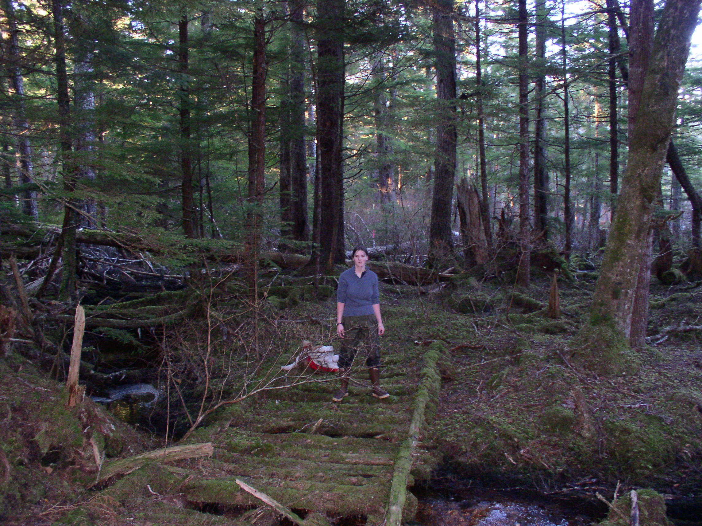
Many trappers probably worked in the Funter Bay area at various times. They would have mainly been seeking various Mustelids, including mink, marten, and weasels/ermine. Foxes are not native to Admiralty Island. River otter could also be trapped, and sea otter were hunted from boats (sea otter harvest was made illegal in 1911, but today there is a subsistence exemption for Natives). While I have not found much specific information on local trappers, the Bayers notecards mentions an S.P. “Bud” May, a  Funter Bay trapper who went missing in 1937. Tlingit natives from Hoonah are noted as trapping mink and marten at Funter Bay, although at least one source speculates that marten could have been introduced to the island by fur farmers.

As a side note on animal behavior: the small mustelids are quite bold, and will sometimes come into houses or approach humans out of curiosity. By contrast, otters seem to have learned to fear kayaks (the traditional hunting boat), but will ignore larger power boats. River otters and mink like to use skiffs and docks as dining areas and/or bathrooms, and are often the source of smelly things found in your boat in the morning. River otters will also sometimes try to drown dogs, they attempt to call or tease the dog into the water where they can get on its head.

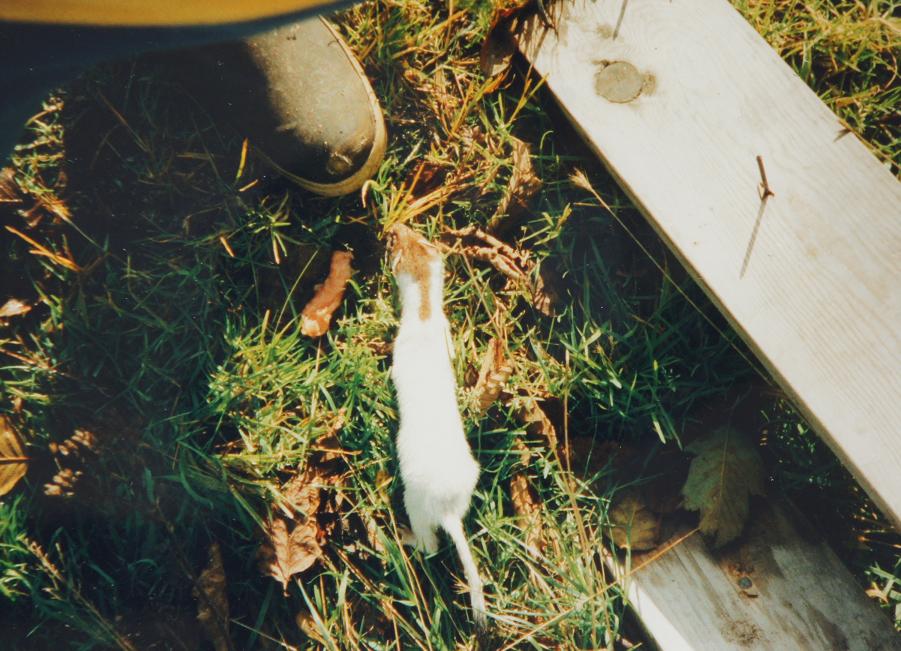
A curious weasel (partly in its winter ermine coat) examines someone’s foot at Funter:
Weasel 2

A marten visiting the bird feeder at Funter:marten

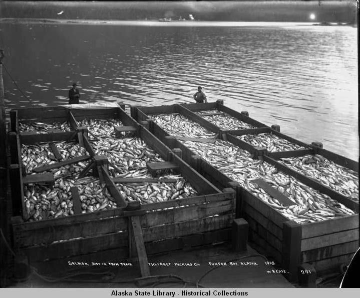
Large fox farms often involved leaving breeding pairs on an island, where the ocean served as a natural fence while the stock increased. Caretakers would sometimes live on the island to ensure the foxes stayed fed, healthy, and undisturbed by poachers. Pens and fenced enclosures were used with mink, which were more adept at swimming. Smaller backyard fox farms had pens if they were on a larger island or the mainland, and pens became more common in later years once researchers learned of parasite issues with free-range stock. Isloated island farms often let the foxes find their own food on the beach or in bird nests, but most farmers supplemented the diet with fish, wild game, and cereals. Farmers would sometimes buy fish byproducts such as heads and guts from local canneries (and some would reportedly rob fish traps for fox food). Fish could be salted or smoked to keep over the winter. Sarah Isto’s book mentions salted fish heads being used as fox feed, but also mentions that foxes preferred “freshened” fish with the salt rinsed out. Various experiments to introduce rodents onto islands usually met with failure as early as Russian farming days, but this didn’t stop farmers and the government from trying.

fox

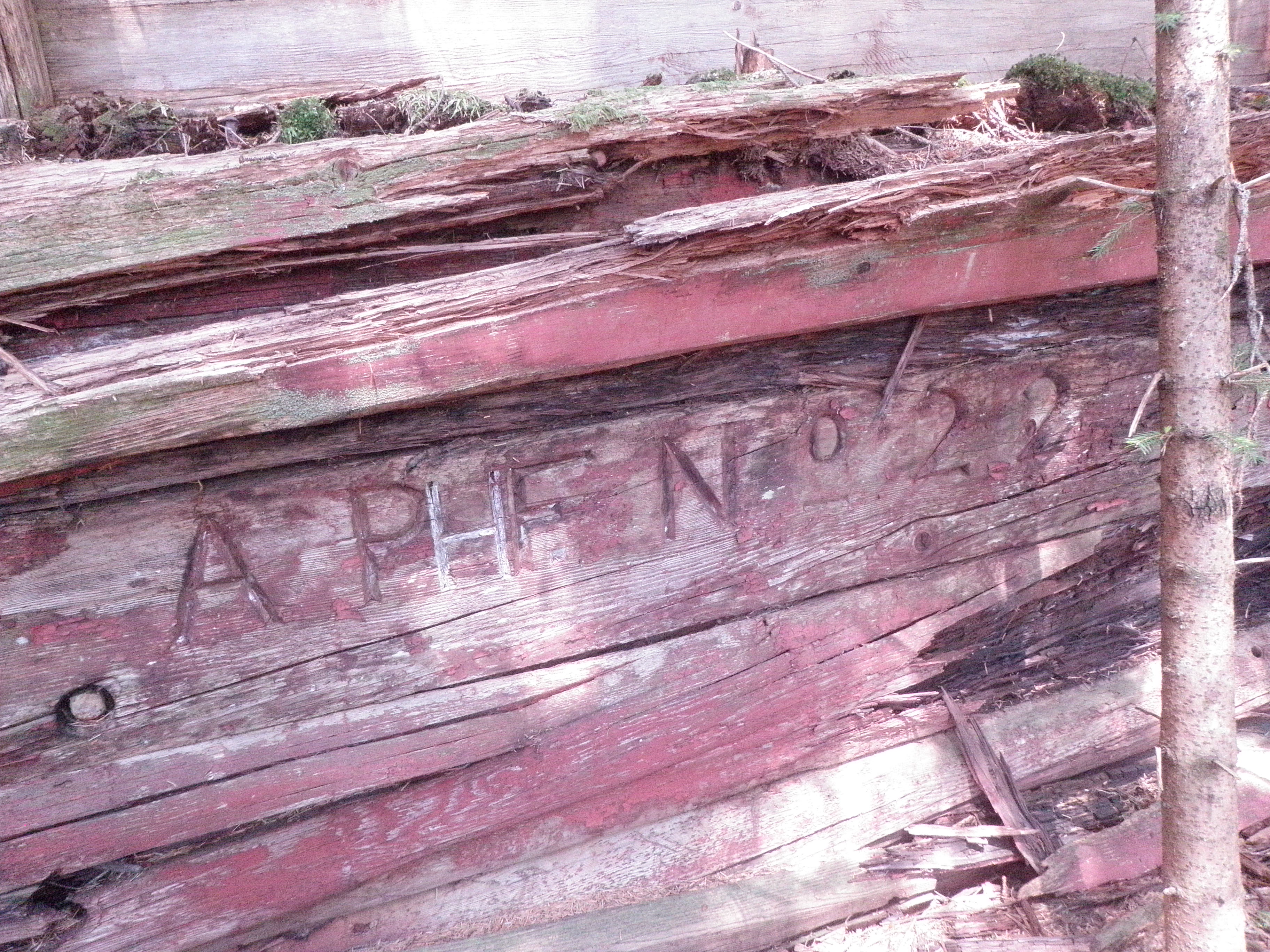
Several possible fur farms have been identified around Funter Bay, although official documentation is scarce. Fox farms would likely have used blue foxes, as silver foxes were harder to raise. Some farmers had only a few breeding pairs and harvested only a few pelts each year. Backyard fur farming was often a side project for people who worked other seasonal jobs such as fishing, mining, or cannery labor in the summer.

The farms at Funter may or may not have been entirely legal. Small-time operators sometimes squatted without sanctioned land rights, and neglected to get a government permit. Other “farmers” live-trapped animals in the summer (or poached them from legitimate farms) and penned them until winter when their coats were thickest. Still others used fur farms as a front for the other big moneymaker of the 1920s: moonshining (more on this later).

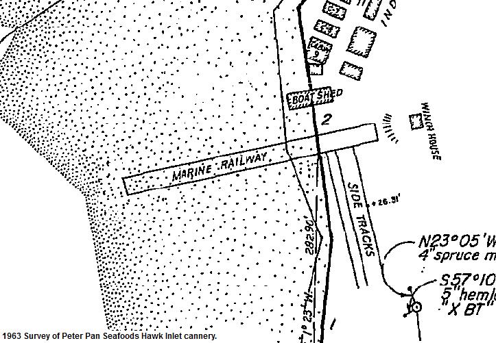
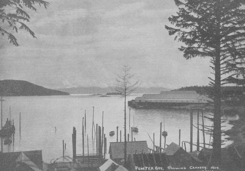
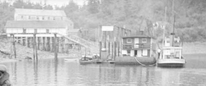
One potential farm is at the cannery, with pens located behind the workers’ houses. I have sometimes heard this referred to as a fox farm. The other, referred to as a mink farm, was located behind Harvey Smith’s property in Crab Cove. That site has some fencing and a trash midden at the site of a former cabin.

foxy

A fur farm belonging to a Pat Kelly is listed at Funter in the SE Alaska fur farm database. His farm, record JUN-30, is shown near the cannery and listed as keeping mink and marten in pens around 1924. The Kinky Bayers notes list a Capt. Pat Kelly of the vessel A.R.B. 10 operating around Juneau in 1958. Bayers also lists a Pat Kelly serving as mate aboard the steamship Glymont of the Nelson Line in 1933. A Pat Kelly from Wrangell was arrested at Prince Rupert, BC in May of 1934 for stealing furs and the gas boat T-1957 from Stanley Jekell. Stanley had his own run-ins with the law, being charged with poaching deer in 1935.

I am not sure if these are all the same Pat Kelly, but there are common threads between them. Capt. A. J. “Pat” Kelly appears to have been a fish buyer for the A.R. Brueger Packing Co of Wrangell in the 1950s. The A.R.B 10 is in the merchant vessel registry as a 62′ wood fishing boat, owned by A.J. Kelly of Wrangell. It was formerly the No. 3145, built for the US Navy in Philadelphia in 1923. It sank in 1959 at Lituya Bay. This book mentions that Pat and Elsie Kelly were fish buyers.

Neil (or Neal) C. Gallagher had a fox farm at Point Couverden across Lynn Canal, and received mail at Funter Bay. He is listed as raising blue fox in pens prior to 1924. His wife was reportedly Mary Joyce. (Larry Roberts compiled most of the Gallagher information, and notes that the details are confusing. I’ve used the Bayers notes to fill in some more). Neil’s brothers Con (or Don) and Phillip R Gallagher were also involved with this fur farm, as was a person named Pat Mulvaney. Con Gallagher Sr, father of “Neal, Phil, and Con Jr”, is reported as building the first pile-driven fish trap in Southeast Alaska for the Alaska Packer’s Association of Excursion Inlet in 1900. “Neal Gallagher” was in trouble with the law for rum-running in 1925 and again in 1928, and a Don Gallagher was evicted from Excursion Inlet for bootlegging during WWII.

Some of the Gallaghers’ fox farming partners were Michael and Lylia Whalen. After Neil’s death, Mary reportedly sold her 1/6 share to Lylia for $1, and the Whalens sold the Point Couverden farm to August Goodman in 1928. Goodman abandoned it in 1934. Their farm, JUN-17, was noted as using several islands, probably on the East side of Couverden, South of Howard Bay.  Elizabeth Goodman (1919-1999) was the daughter of August and Isobel Goodman.

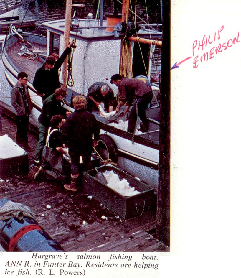
Several Funter Bay residents had formerly been involved in fur farming. Lazzette Ohman grew up on a fox farm near Petersburg in the 1920s, and her stepfather owned a small fox farm in Juneau later that decade. Harold F. Hargrave, the caretaker of the Funter Bay cannery in the 1940s and onward, is listed as owning fur farm JUN-24 on Douglas Island between 1937-1940.

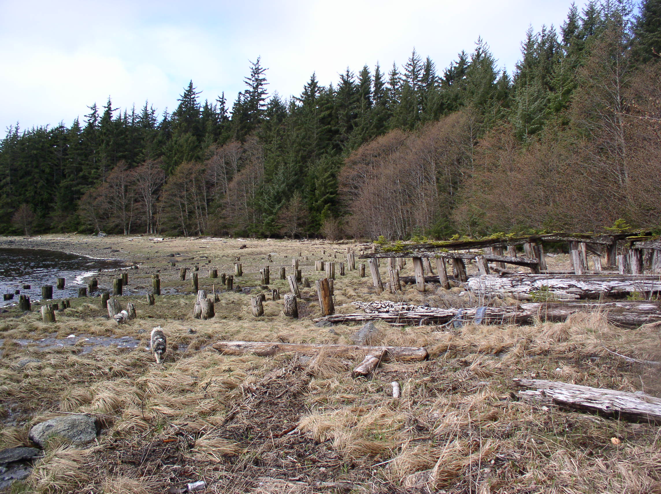
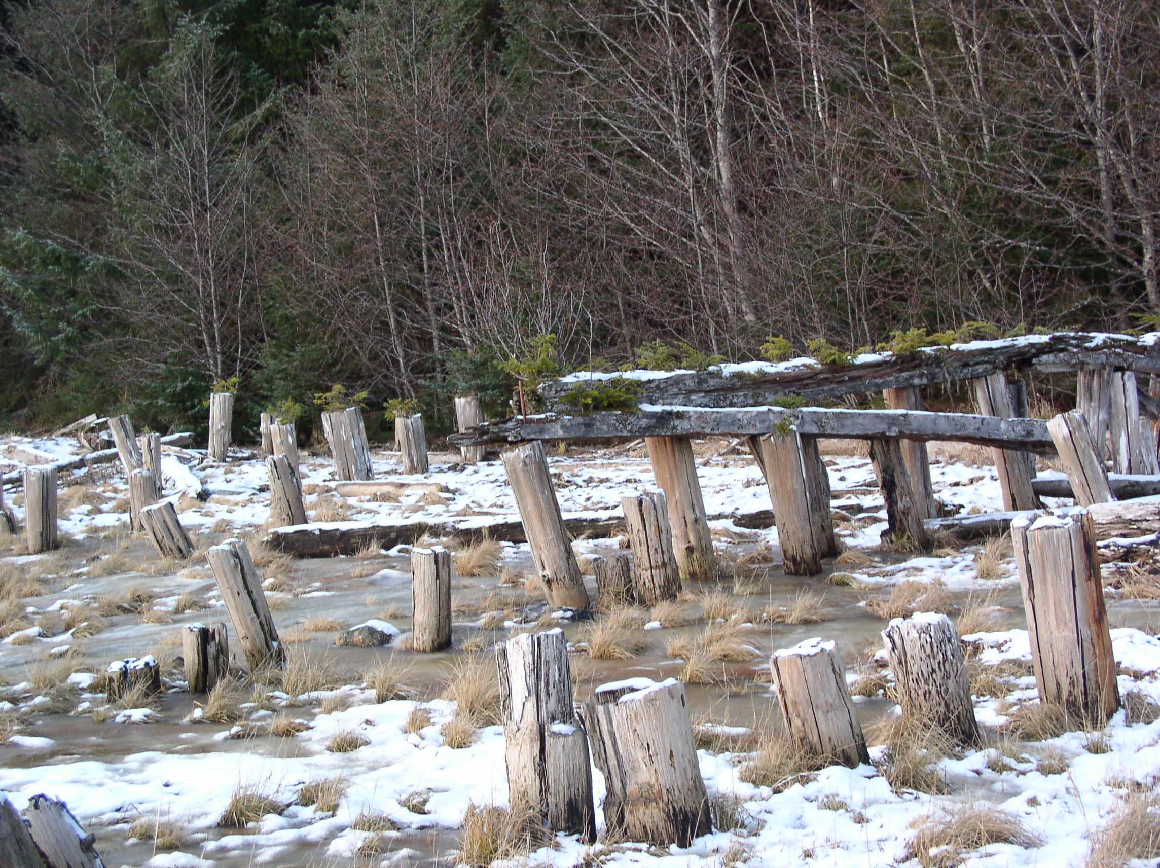
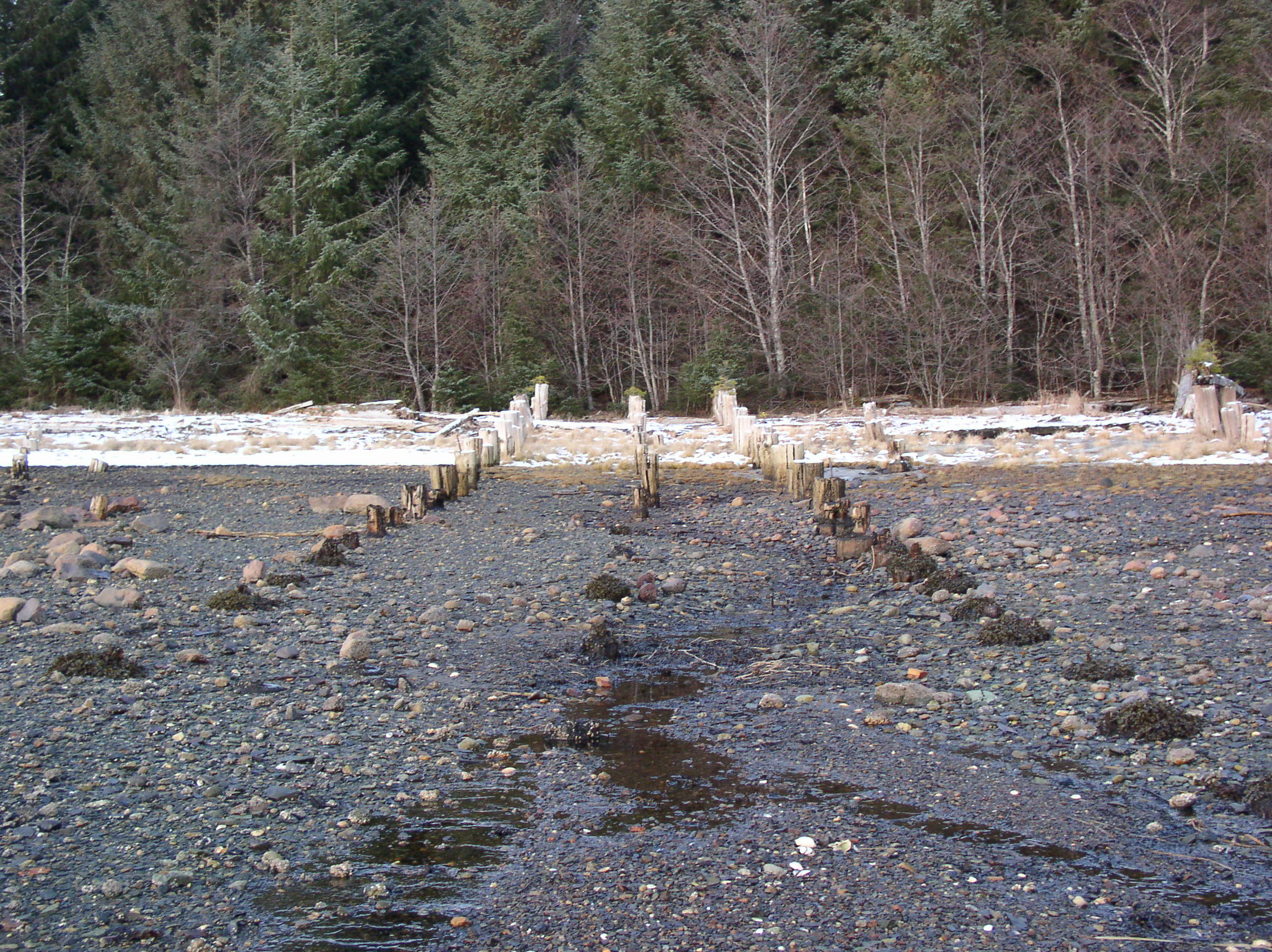
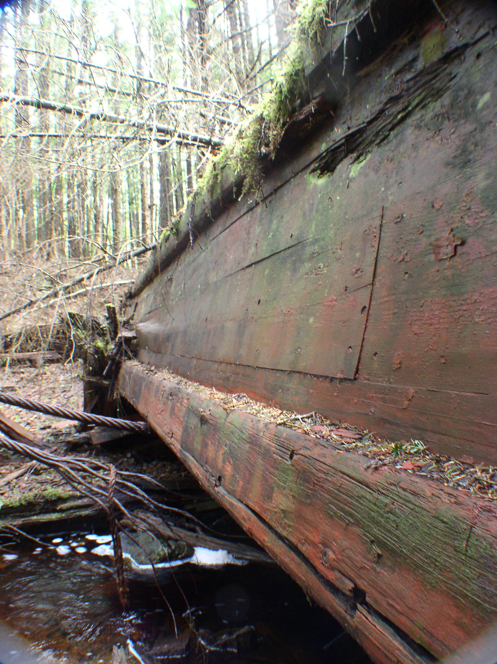
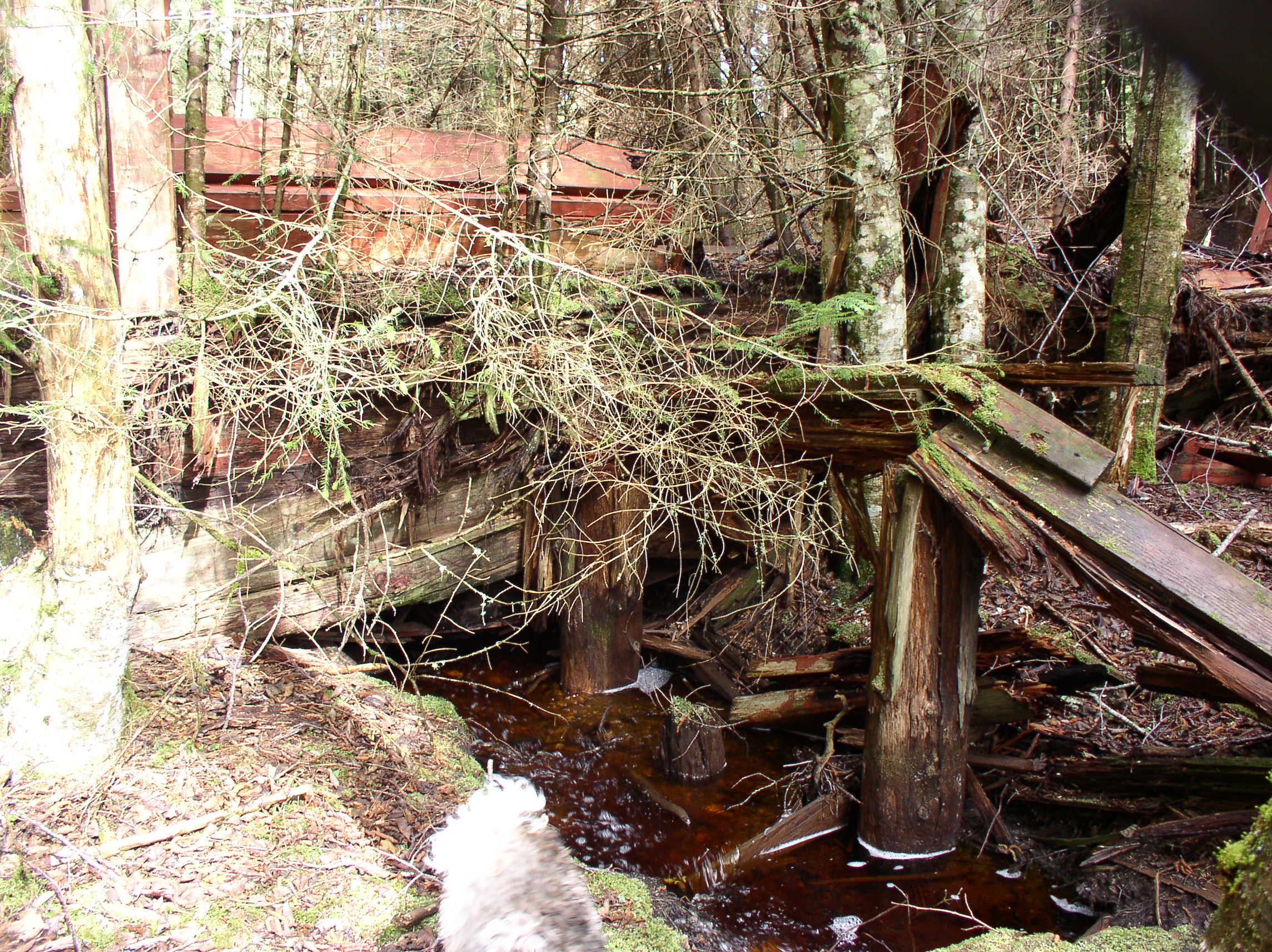
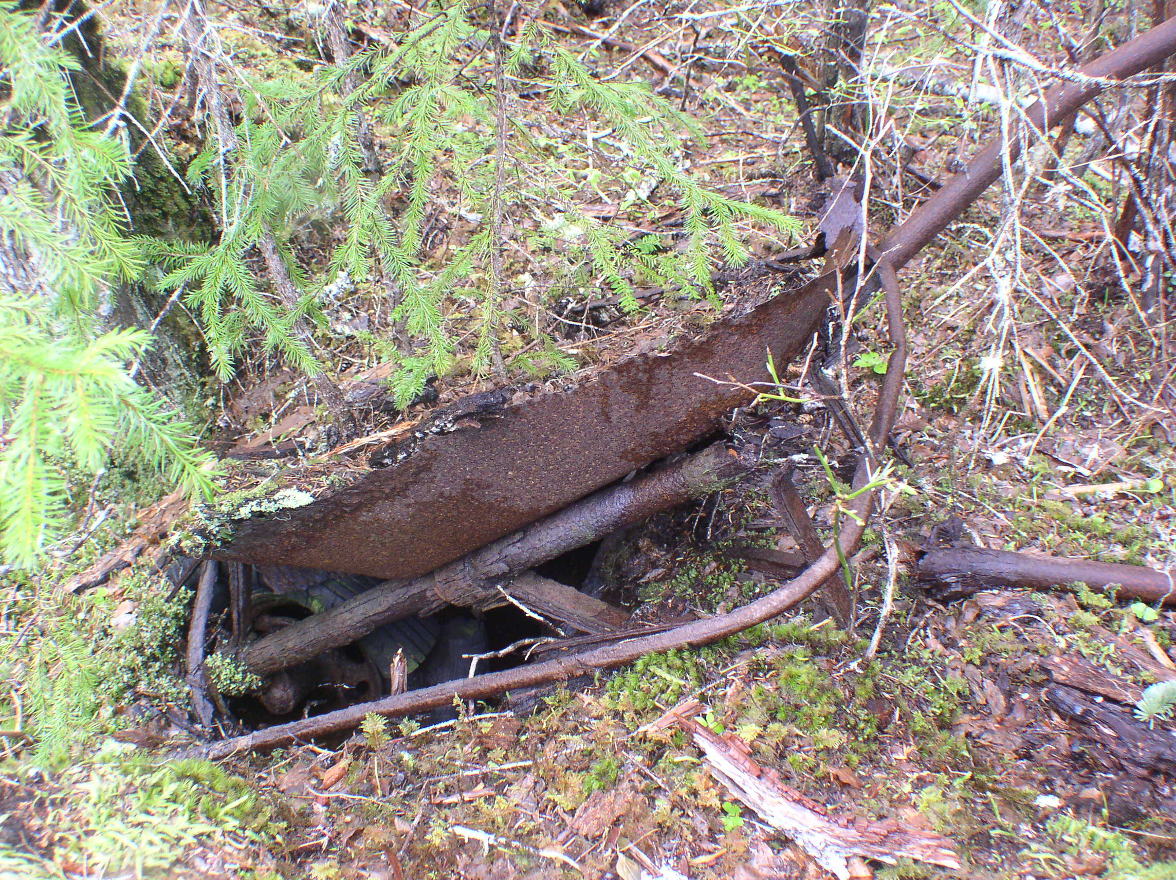
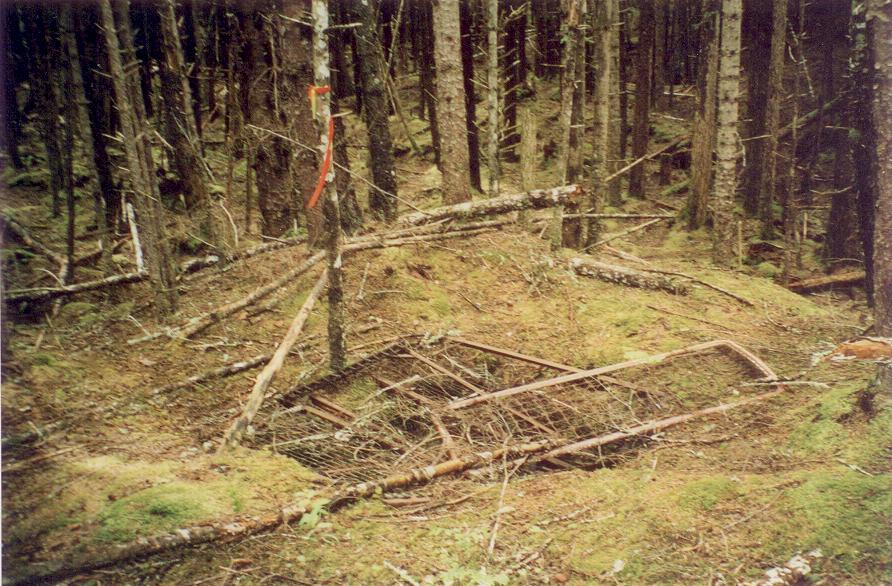
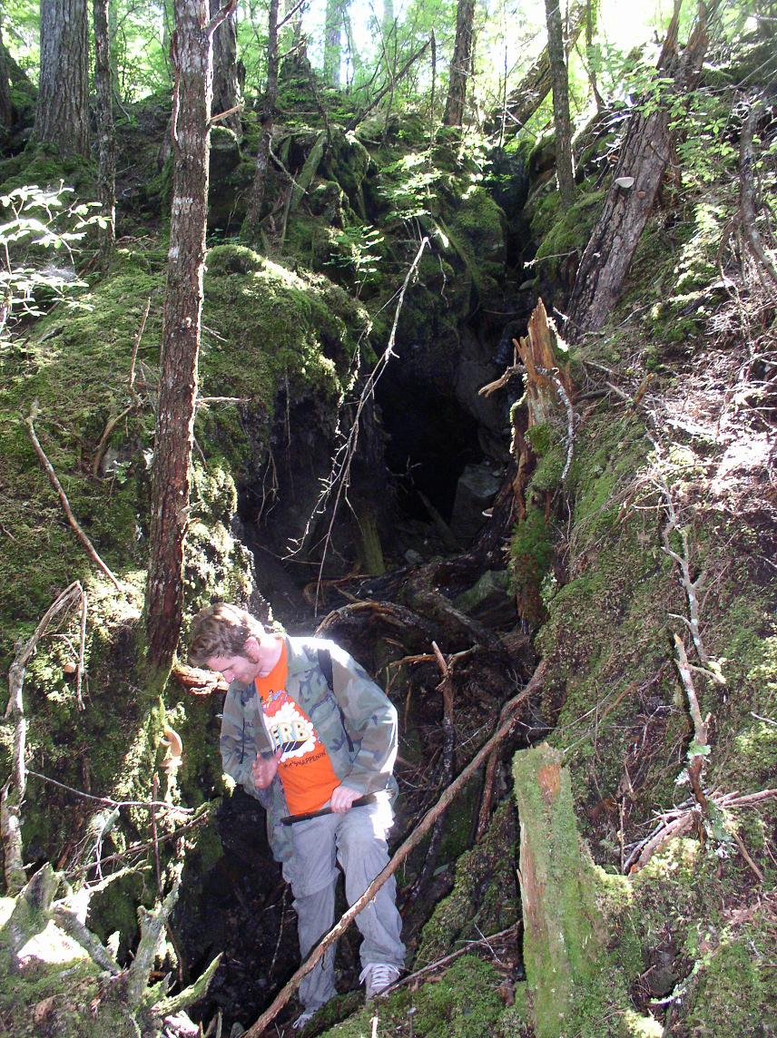
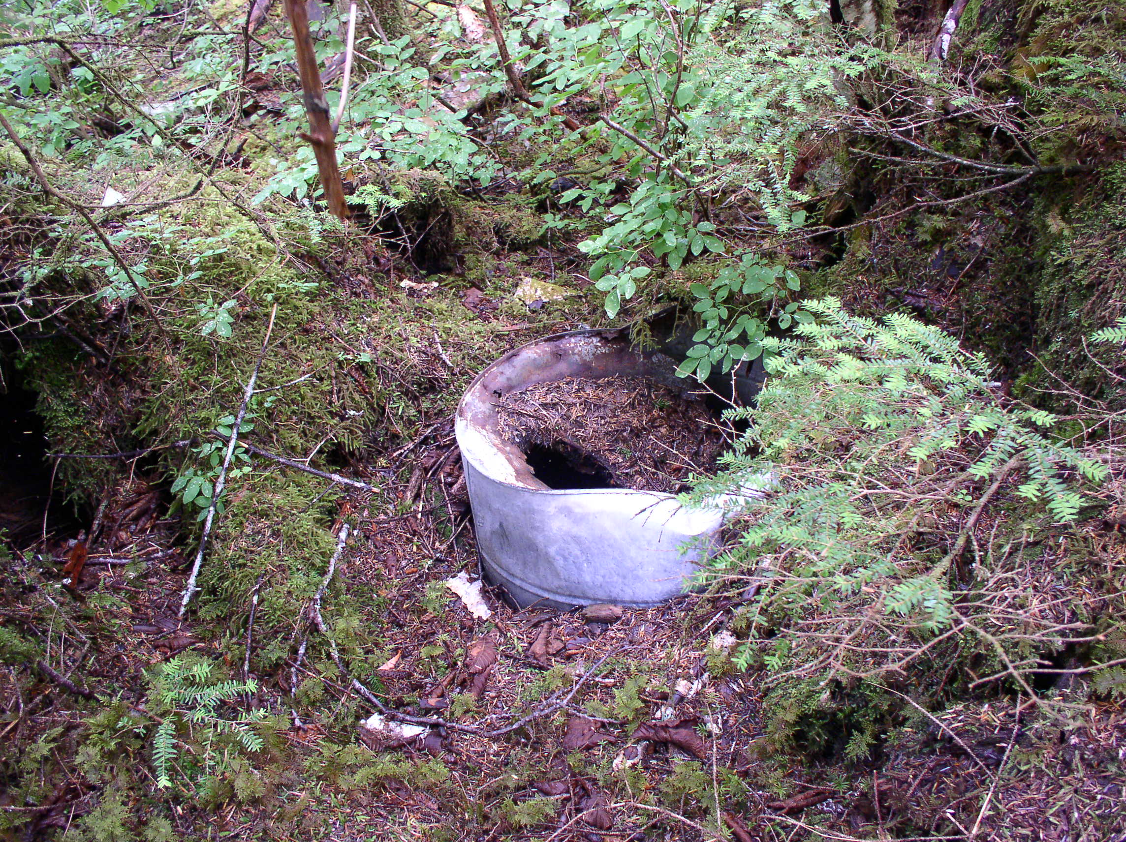
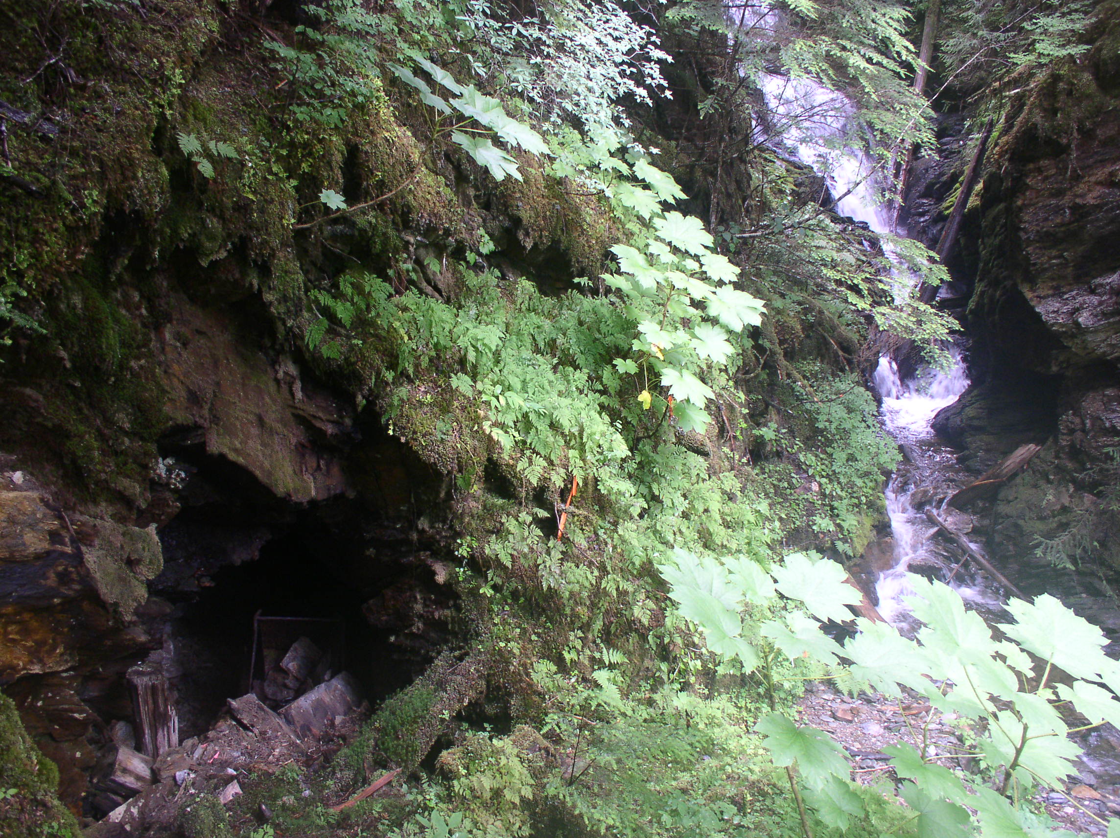
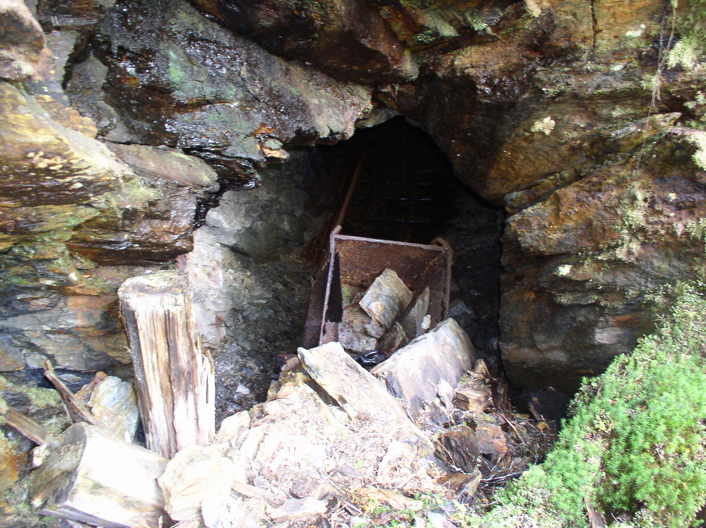
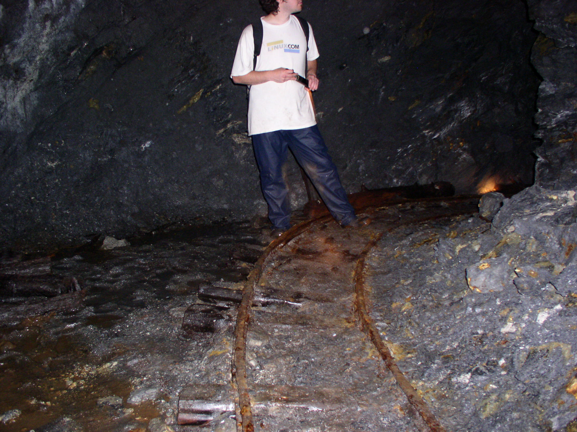
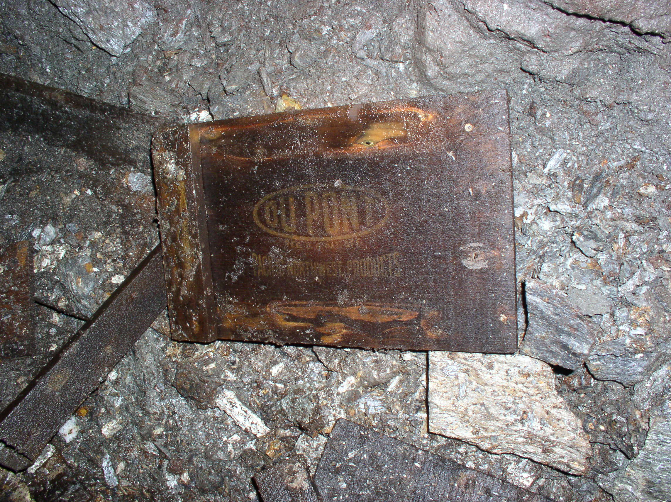
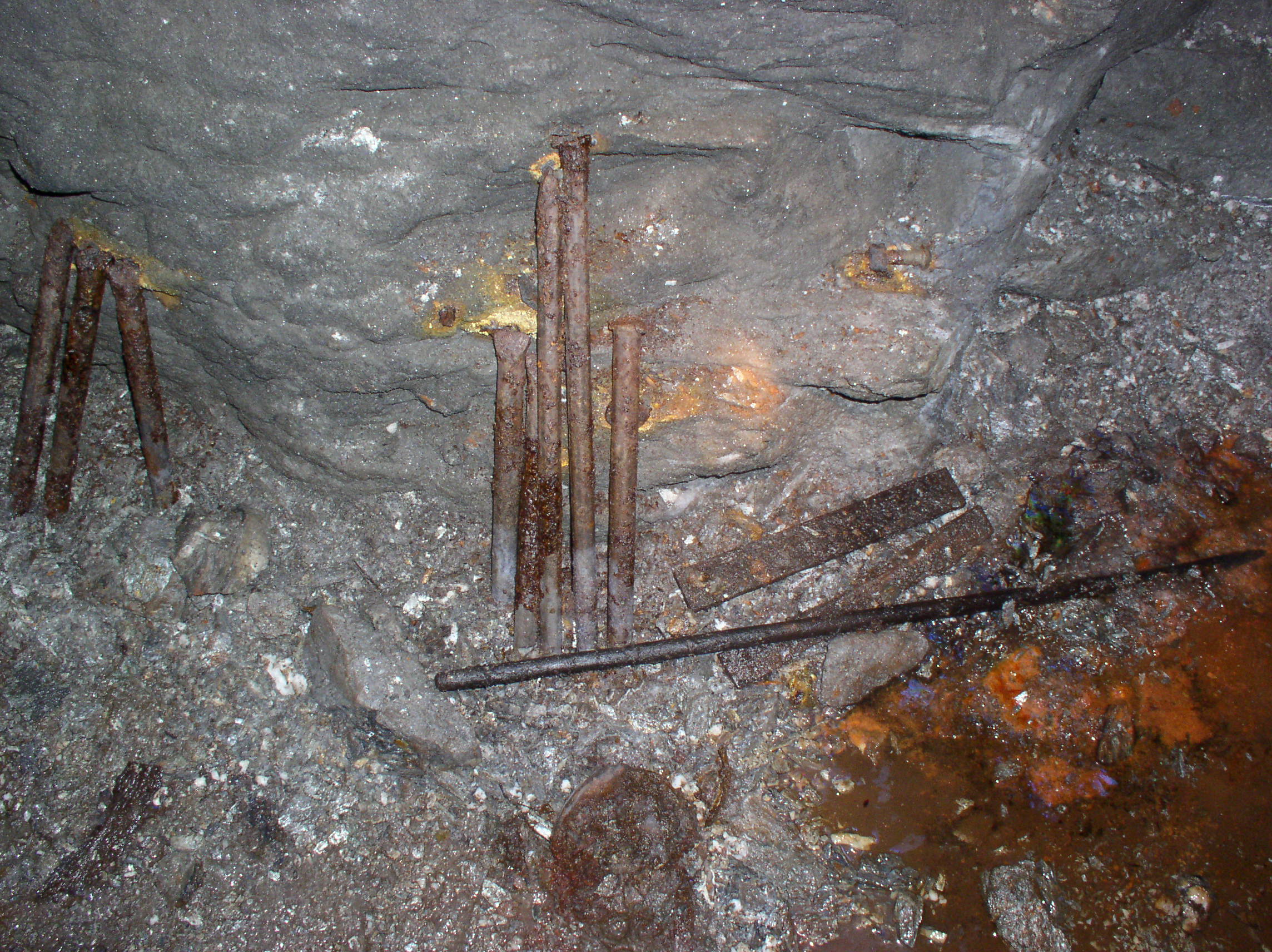
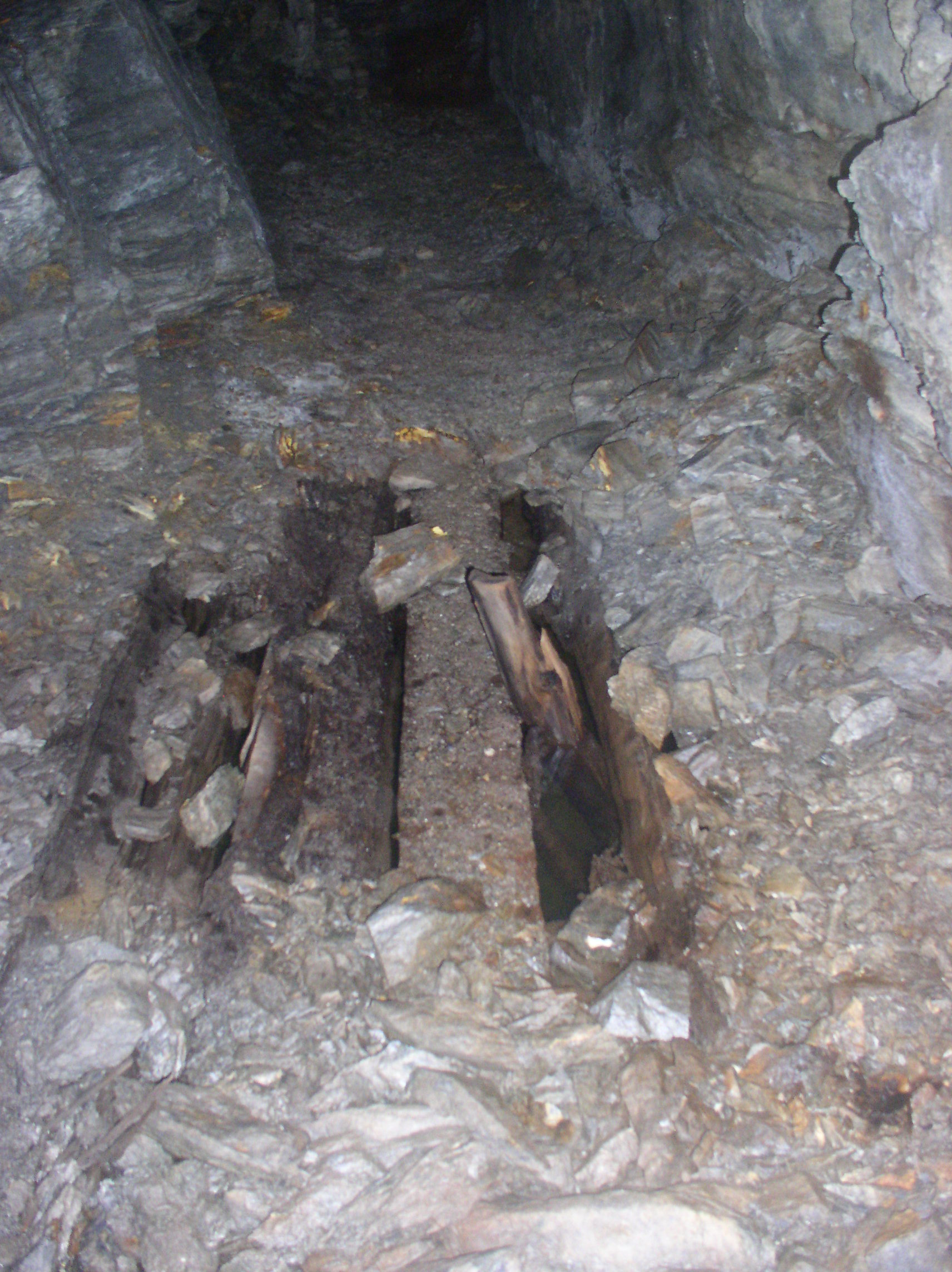
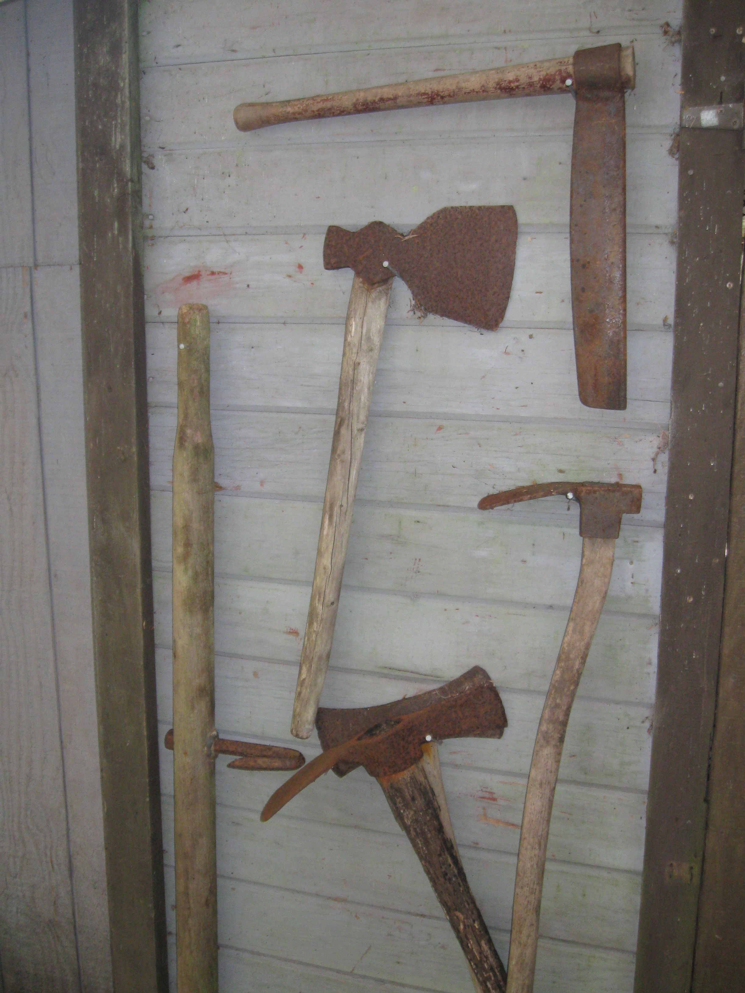
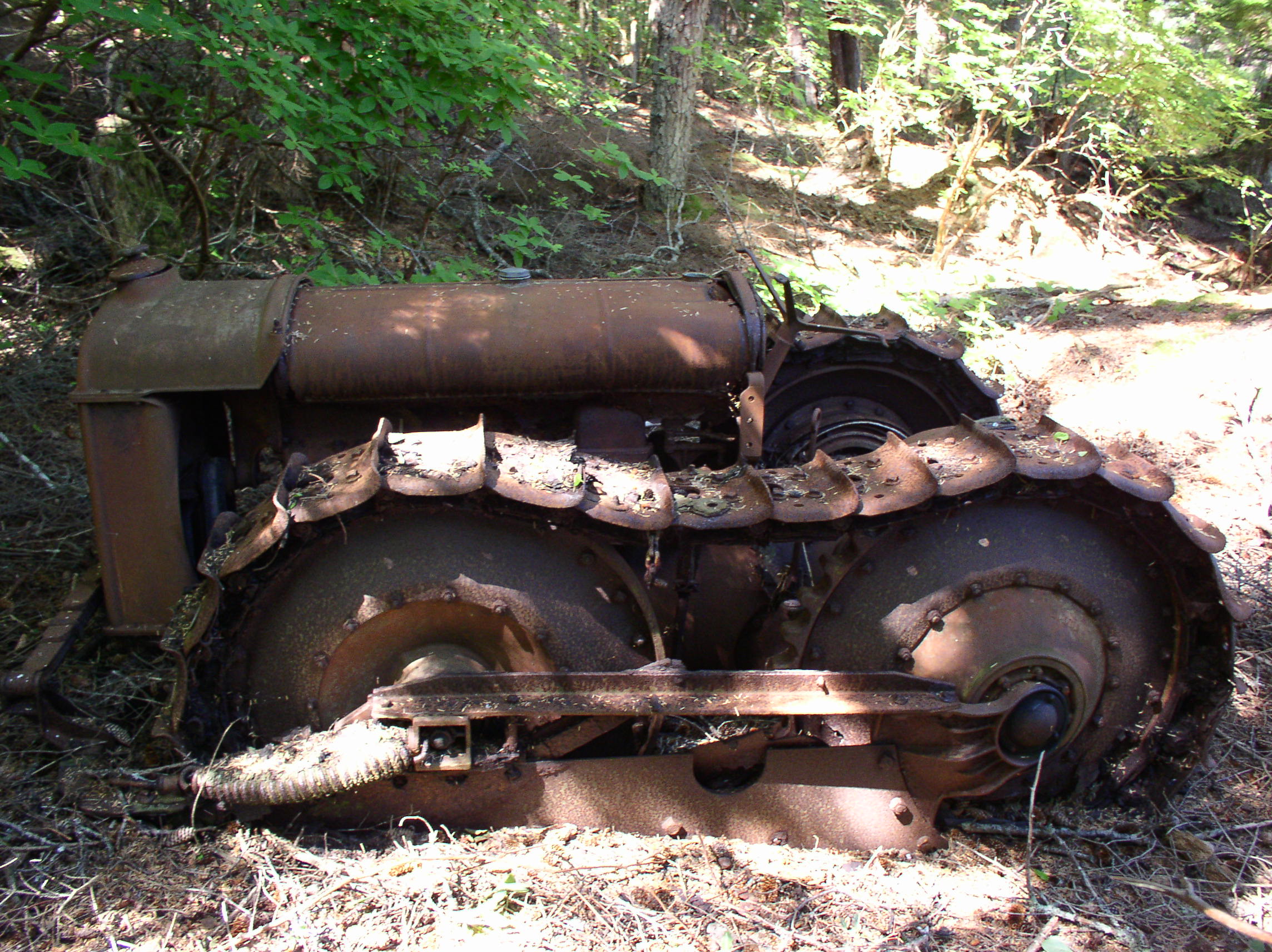
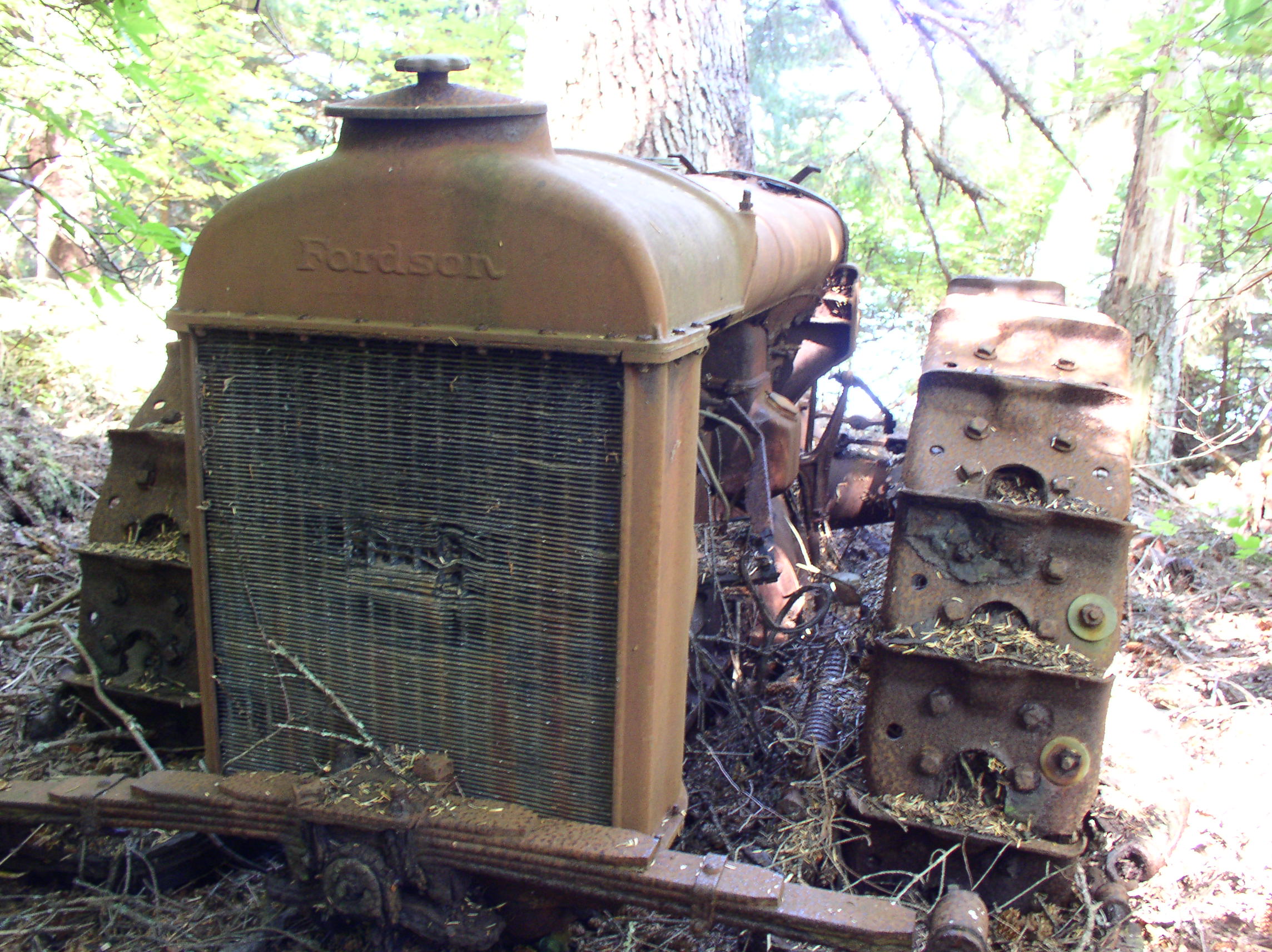
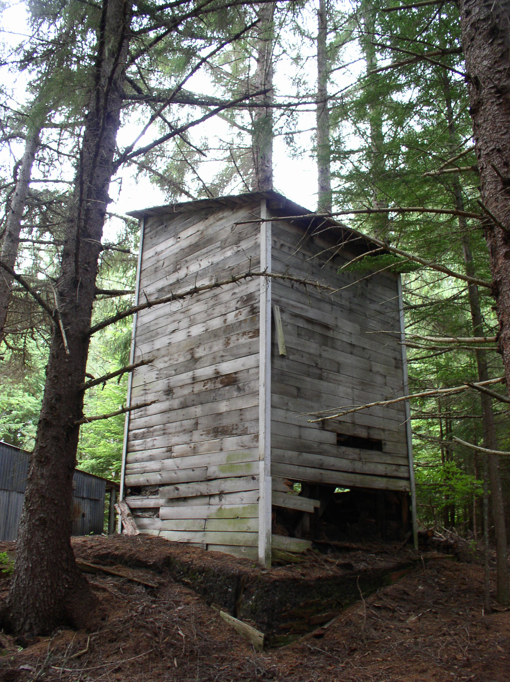
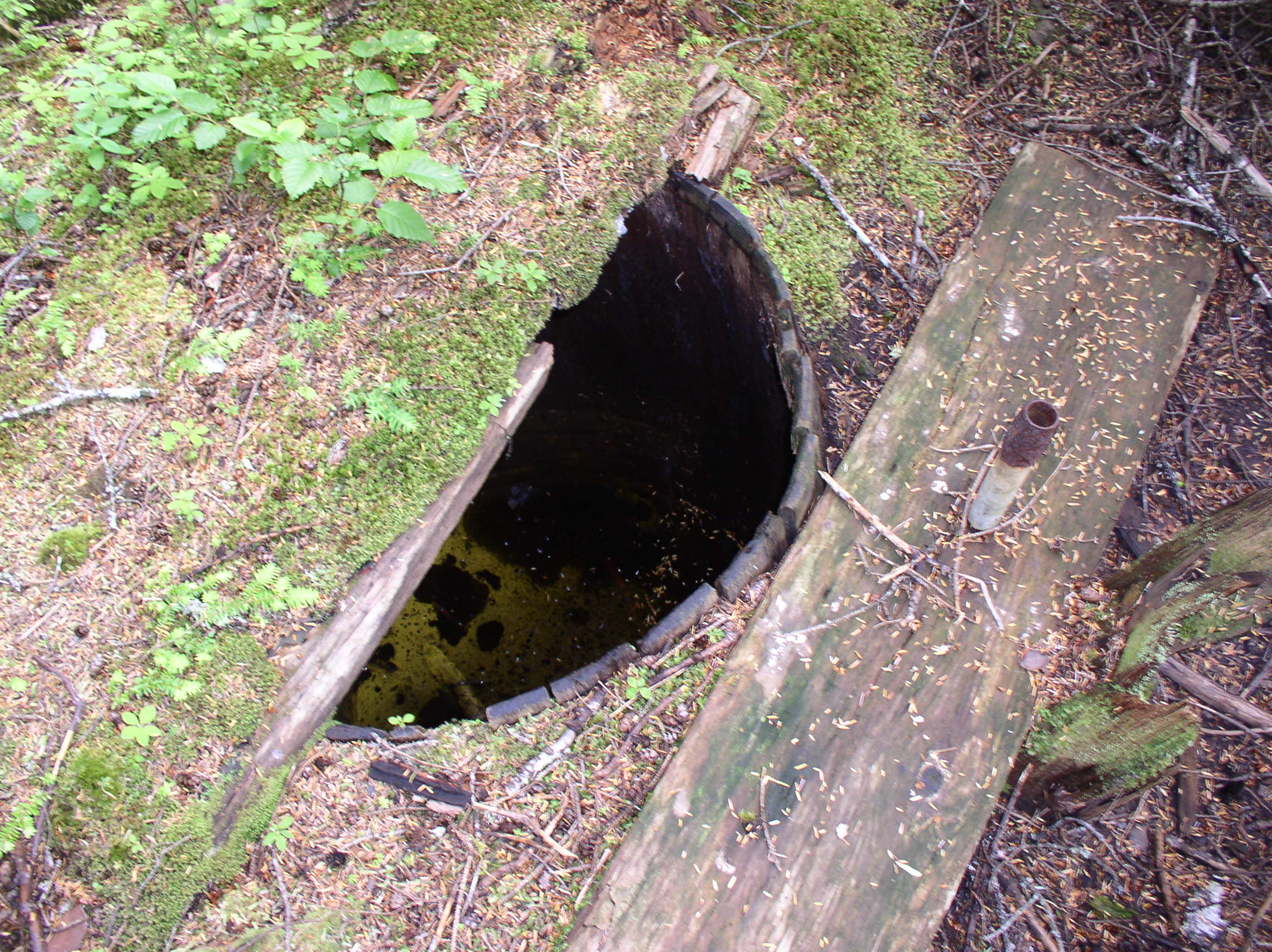
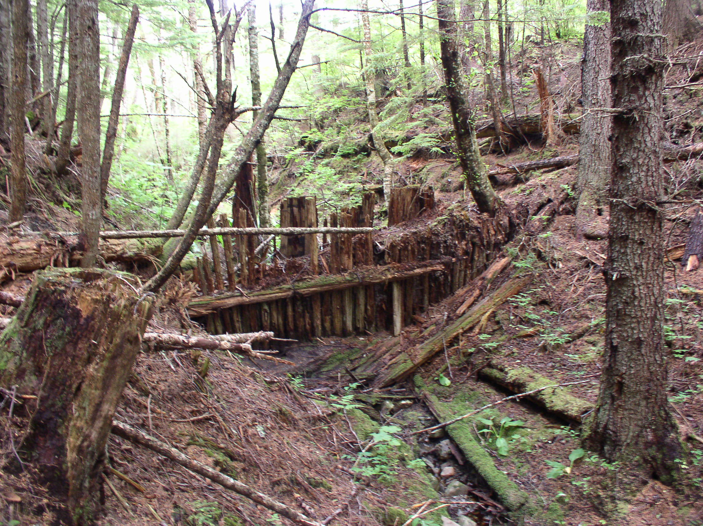
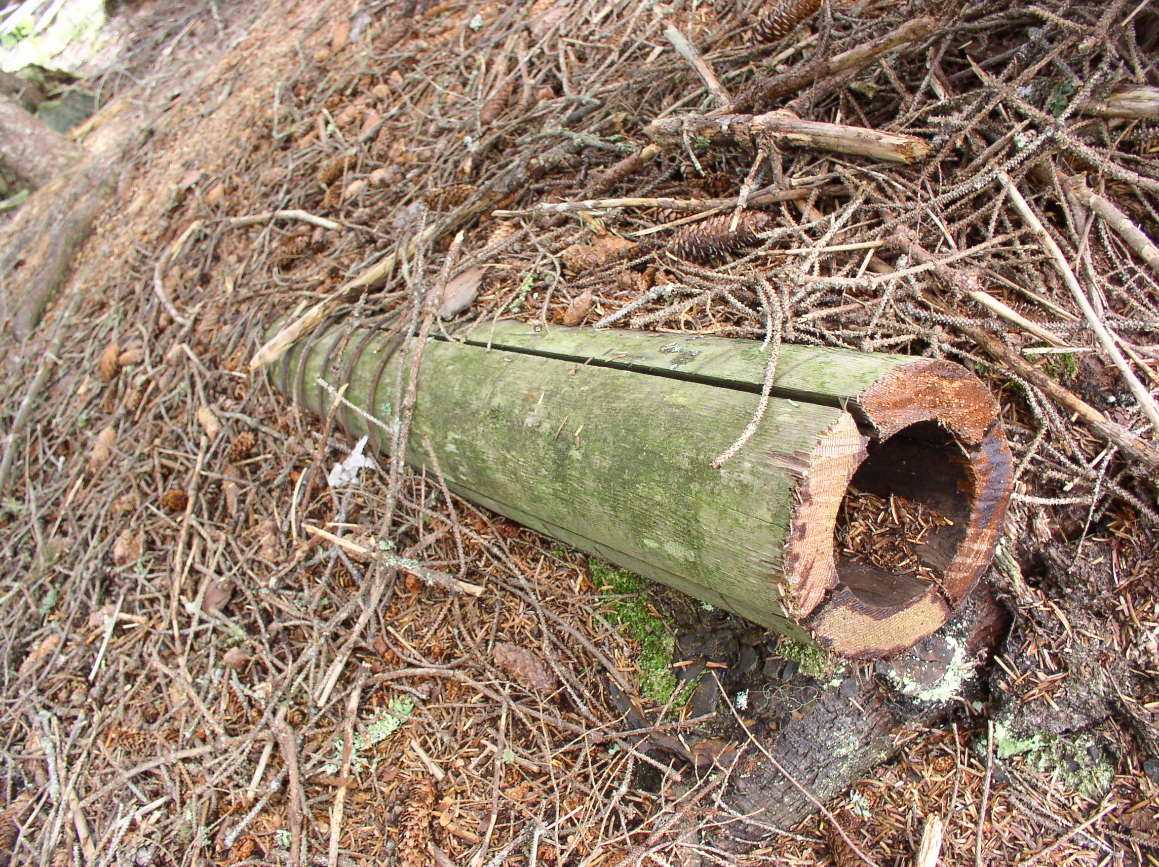
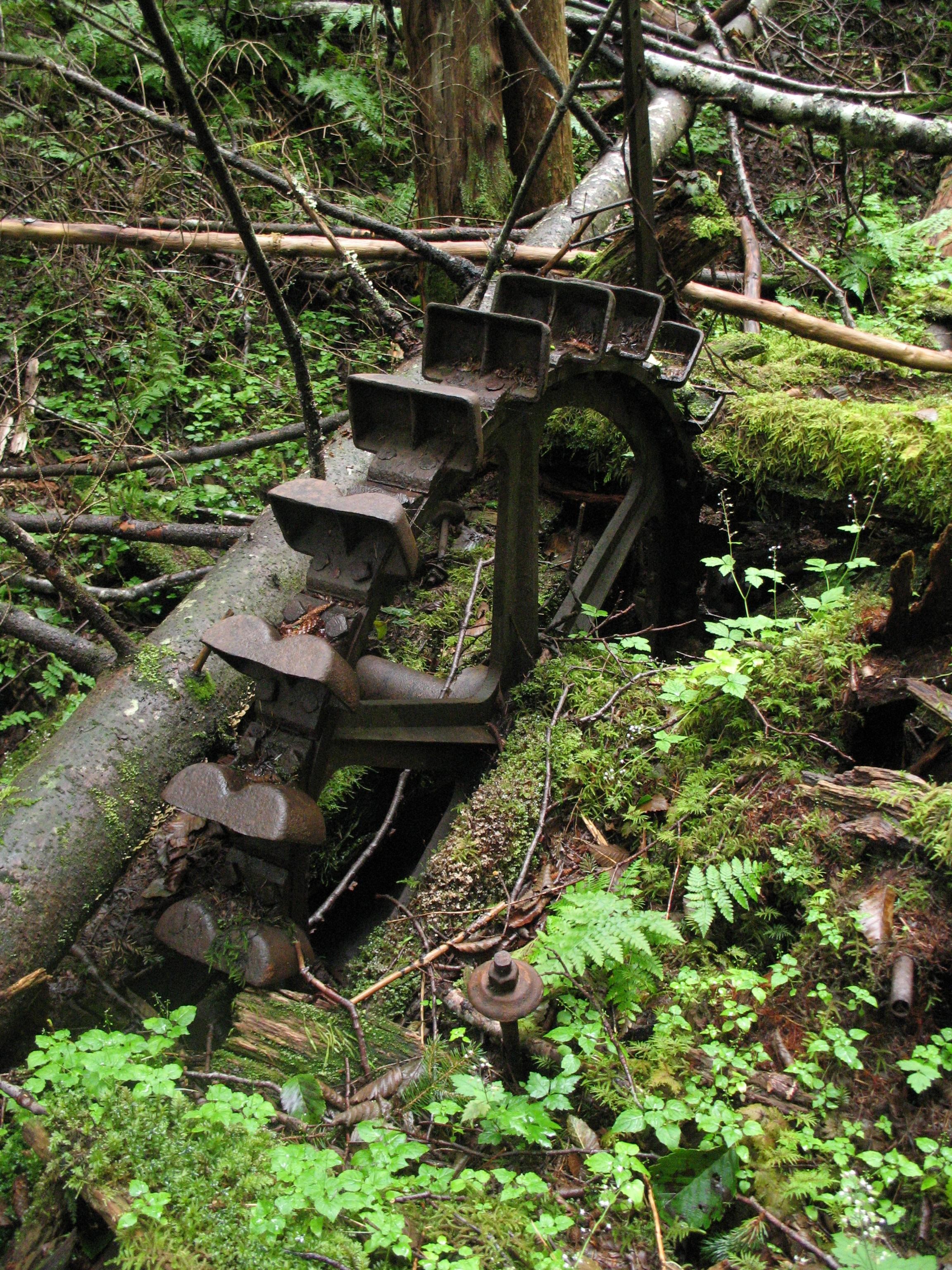
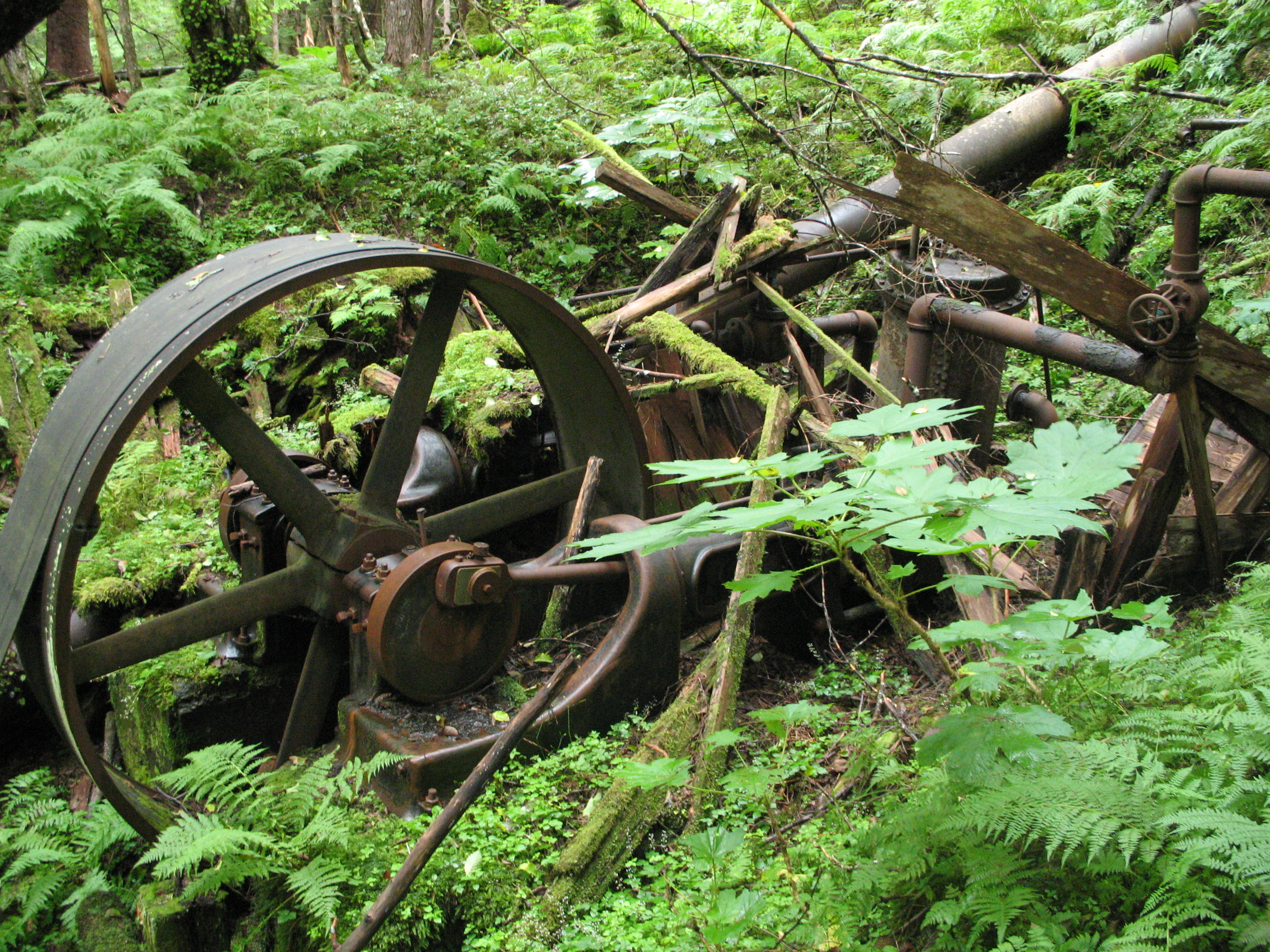
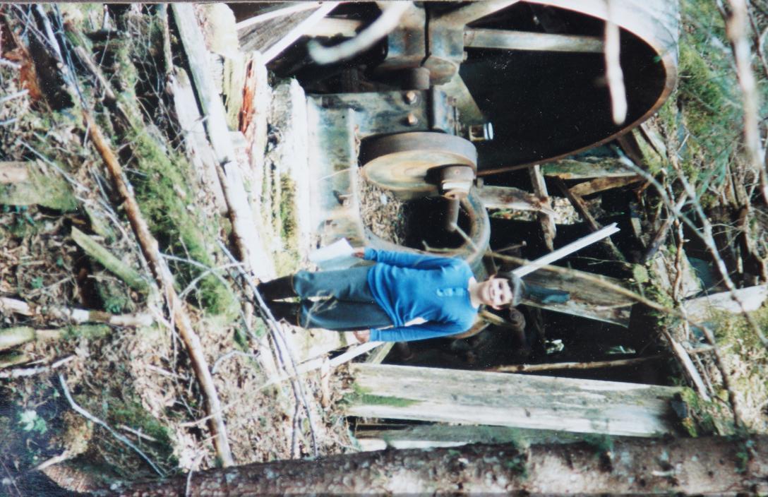
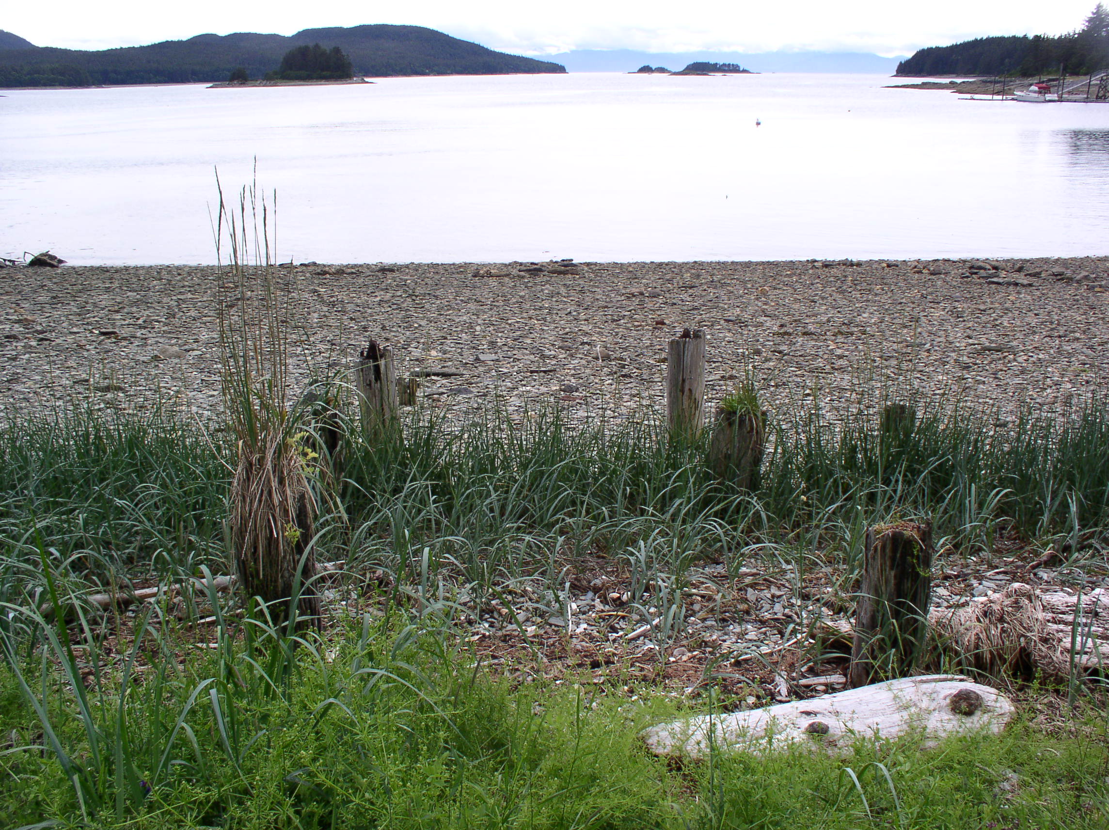
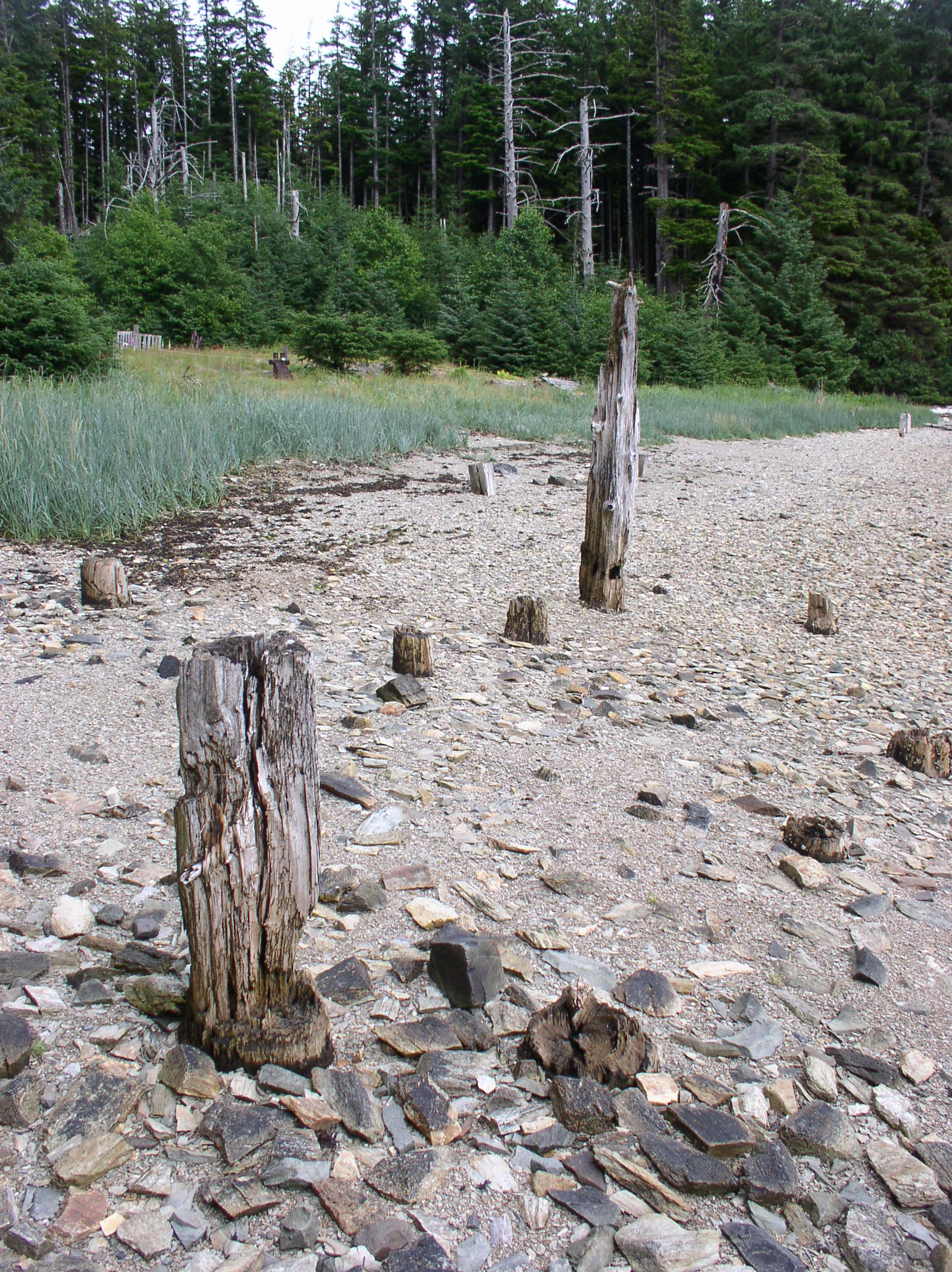
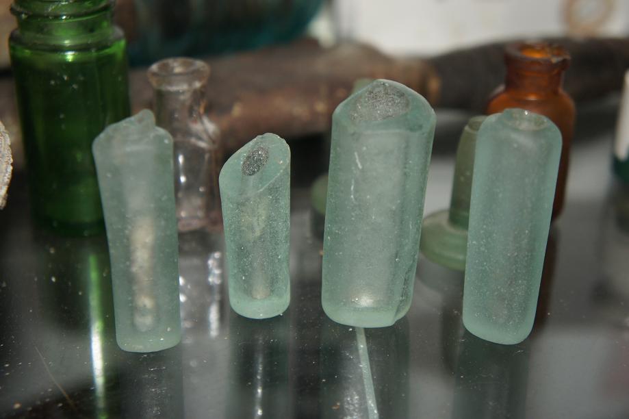
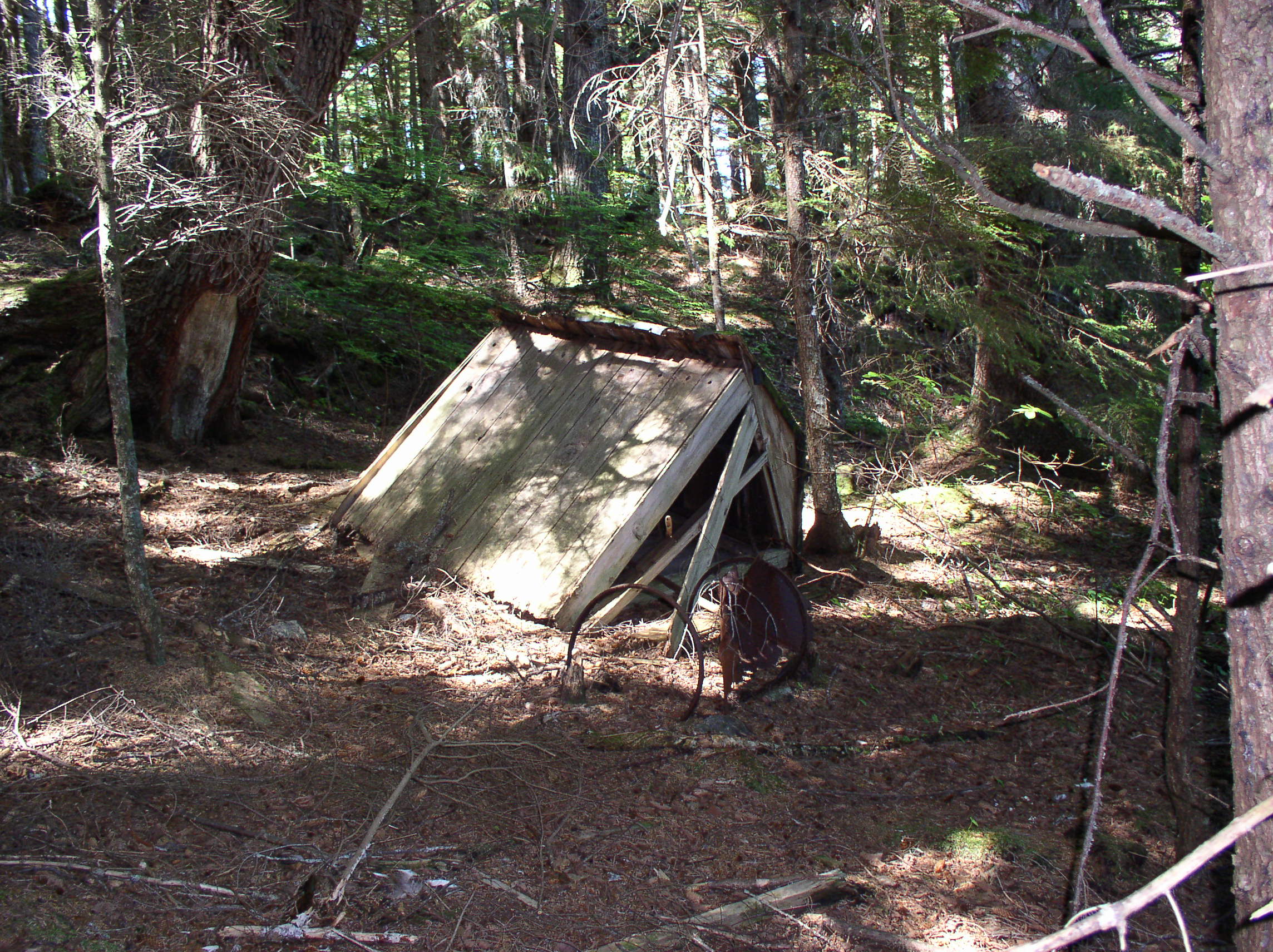
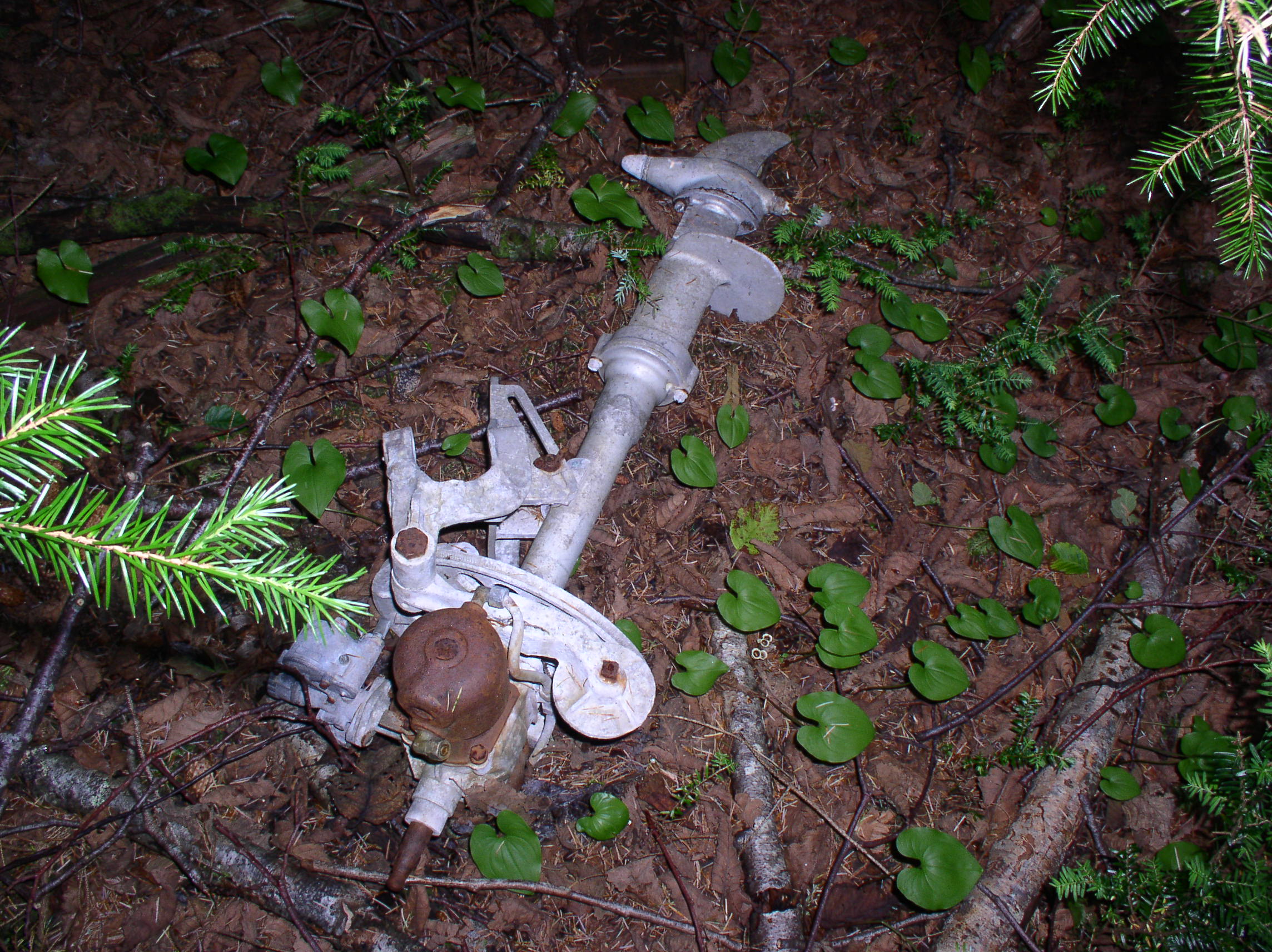
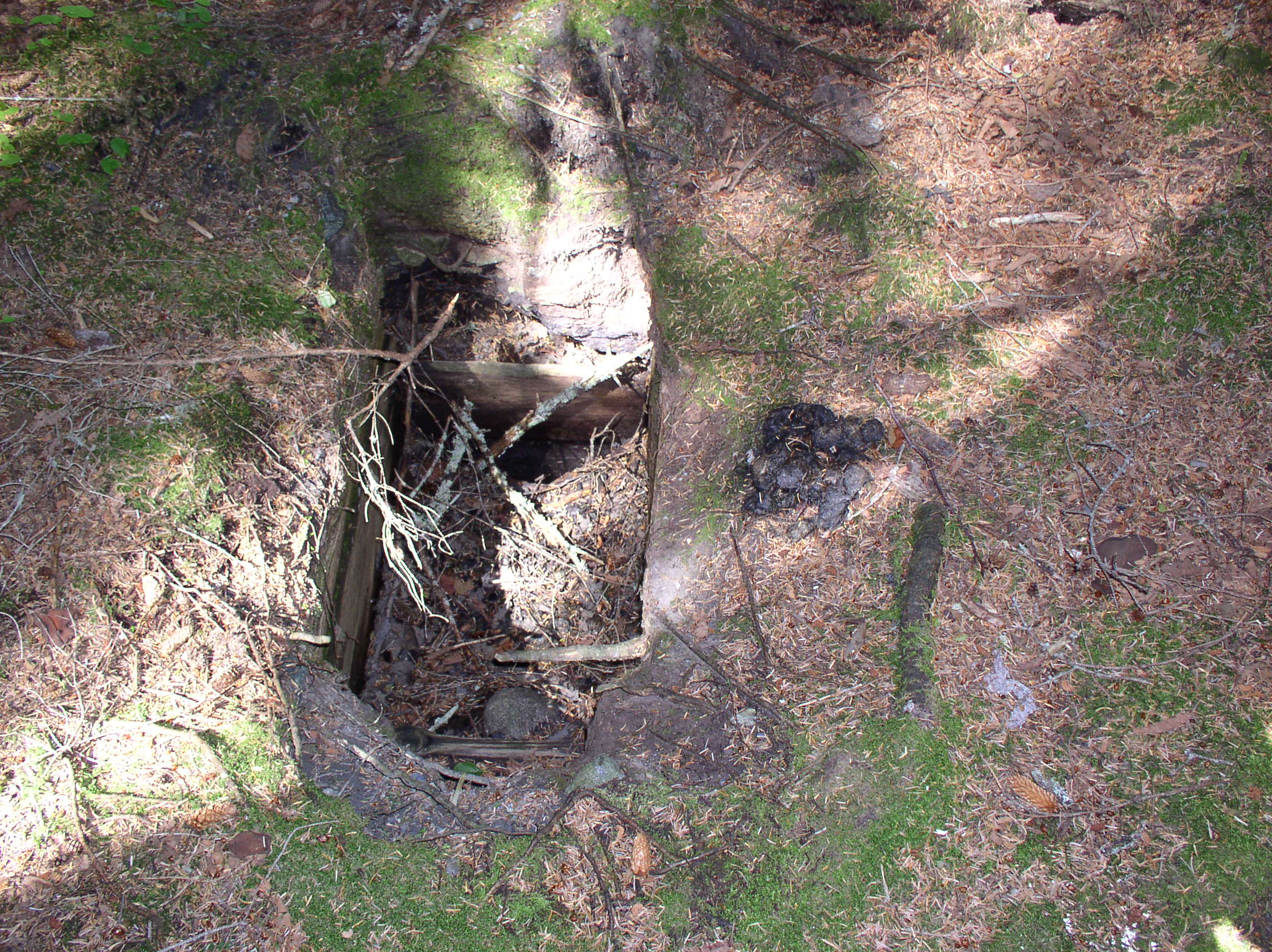
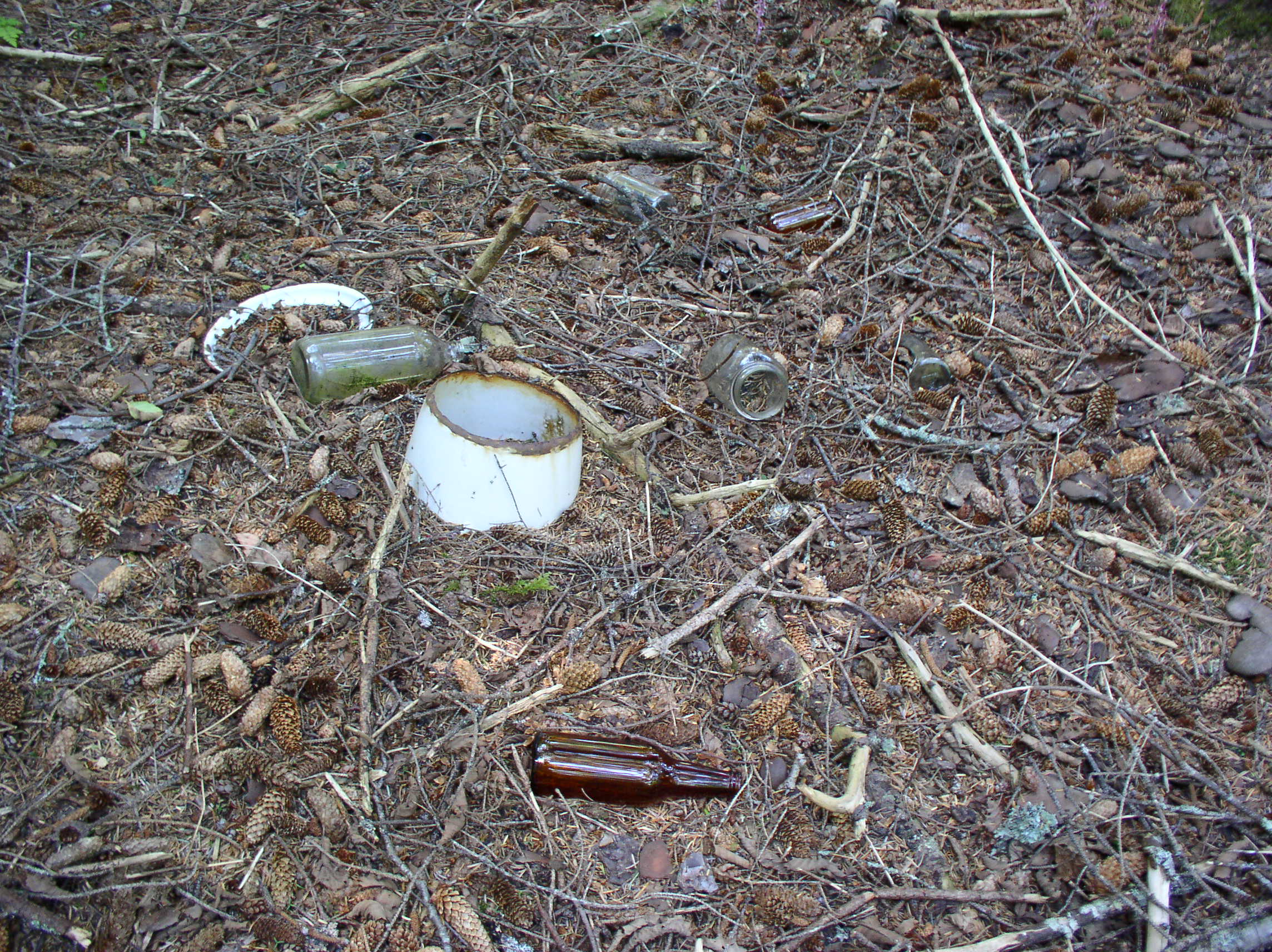
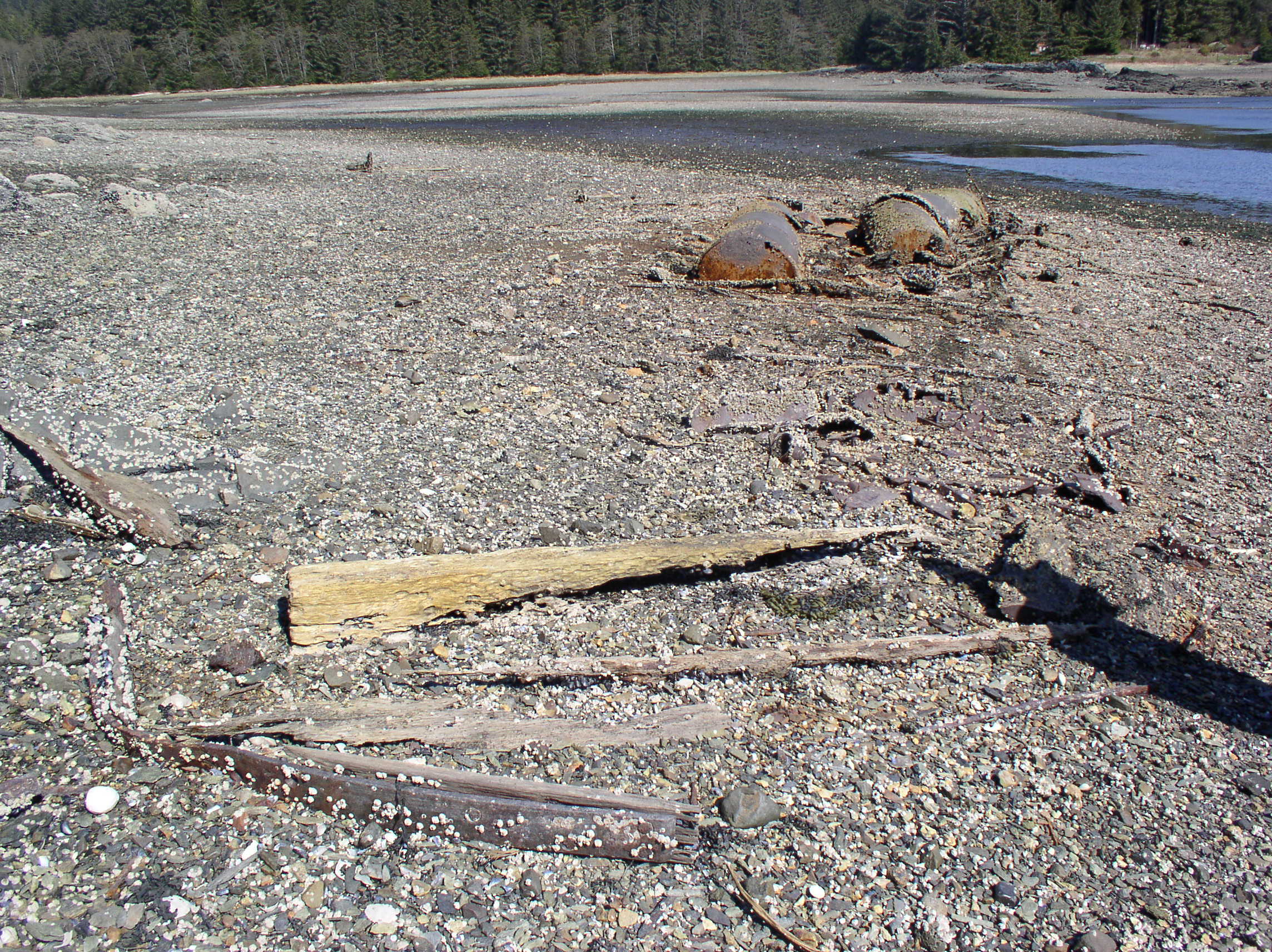
Today there is not much left of the fur farms at Funter Bay, aside from some wire fencing, cabin ruins, and a few artifacts.

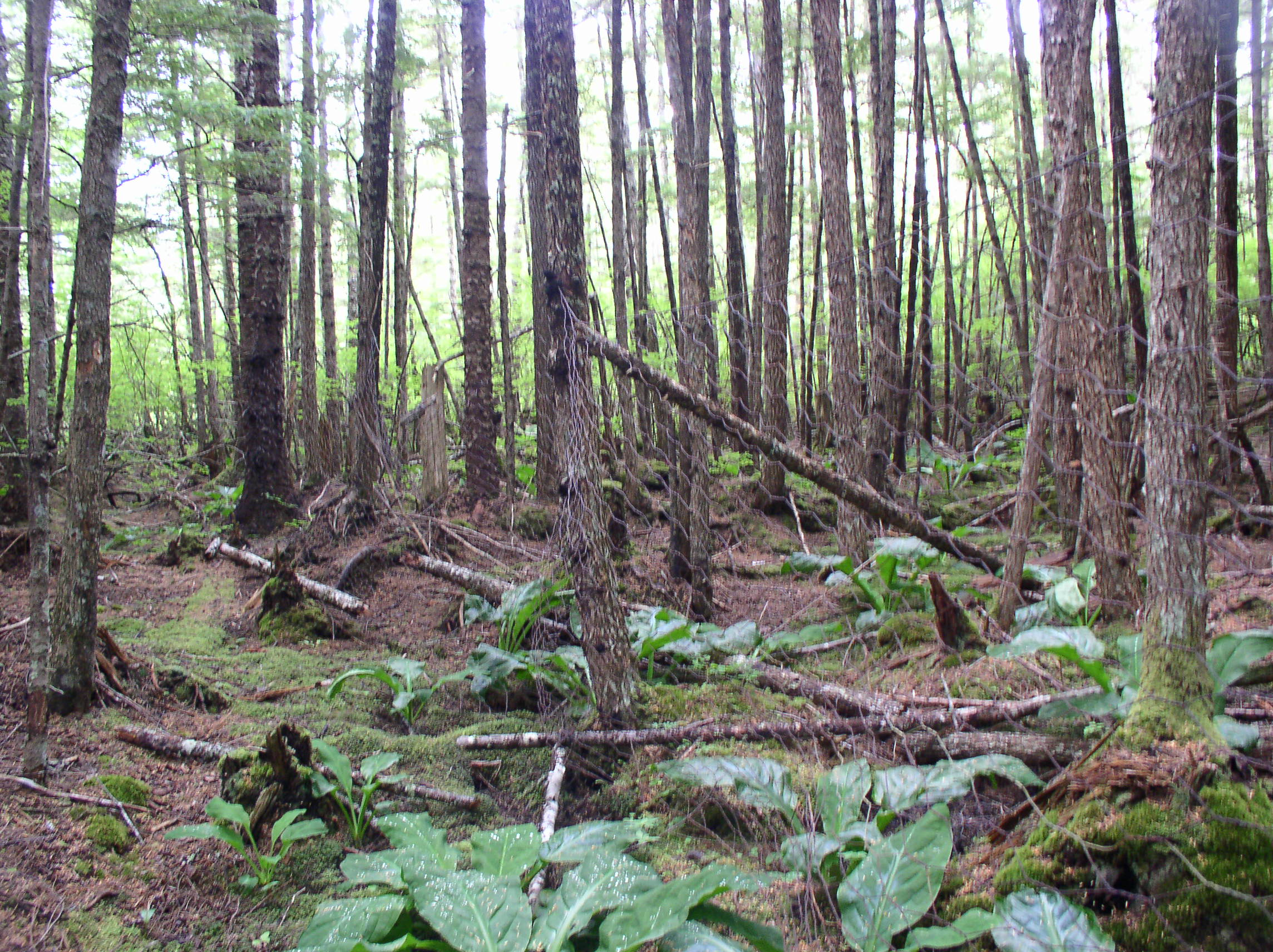
Chicken wire fencing stapled around trees at the Crab Cove fur farm:OLYMPUS DIGITAL CAMERA

Fencing behind the cannery in an area reported to be a fox farm:OLYMPUS DIGITAL CAMERA

A wheelbarrow at the former cannery fur farm, possibly used to haul fish to feed the animals:
OLYMPUS DIGITAL CAMERA

Another fence near the cannery, this one with actual cut fence post, angle braces, and sections going underground to prevent critters from digging under (I realize these aren’t the most exciting photos, chickenwire on trees doesn’t provide much contrast!):
OLYMPUS DIGITAL CAMERA

Today, mink, marten, and weasels are all common around Funter Bay. As noted, some populations may have been introduced or escaped from farms. While foxes escaped from farms periodically, they were unable to survive on only a foraging diet. Blue and silver foxes are not indigenous to Southeast, and farmers had to provide significant dietary supplements to keep their stock healthy.

Another introduced species, red squirrels, seem to have been transplanted to Admiralty Island in an effort to aid fur farming, and have become an invasive nuisance animal. State and Federal wildlife agencies occasionally transplanted animals, including squirrels, marten, and others.  Local information indicates that the US Forest Service introduced red squirrels onto Admiralty Island in the 1930s as a cheap food source for foxes (I am not sure why they thought this was a good idea, squirrels are better climbers and would easily evade free-range foxes, and a farmer would have to shoot or trap a large number of squirrels to feed their stock). One source claims red squirrels arrived on Admiralty in the 1970s. Another claims they appeared in the late 1940s. This paper quotes the USDA Forest Service as saying red squirrels were released on Admiralty in the 1930s, and claims they are “not invasive”. Red squirrels were also released on Prince of Wales Island, but seem to have been out-competed by indigenous flying squirrels. While locals have long recognized red squirrels (aka wood rats or tree rats) as a non-native nuisance animal, official studies have finally begun to classify them as an invasive species. Squirrels are a major predator of local birds (mostly the eggs) and an annoyance to human residents (they steal insulation and chew wiring).  The Forest Service and ADF&G seem to claim no direct knowledge of their mysterious appearance on Admiralty Island.

Larry Roberts of the Alaskan Fur Farm Database was very helpful in compiling this information, both by email and with copies of his research materials. He is interested in sharing fur farming information with other researchers and the public. His contact information is below:
Larry D. Roberts
P.O. Box 4381
Grand Junction, CO 81502
970-640-7418

rockingrroberts@netscape.net

Sarah Isto was also very helpful with additional information on this topic.

References used for this writeup include:

Roberts, Larry D. Preliminary Select Bibliography in Relation to Historic Alaska Fur Farming. 1 May 2013. Grand Junction, CO.

Roberts, Larry D. “Search Database.” Historic Southeast Alaska Fur Farming. N.p., n.d. Web. 28 May 2013. <http://rockingr.com/home/search-alaskan-fur-farm-database/&gt;.

Roberts, Larry D. Place Names. N.d. A Preliminary Biographical Index to Historic Southeast Alaska Fur Farming; Second Edition. Grand Junction, CO.

Roberts, Larry D. Companies and Individuals. Mar. 2013. A Preliminary Biographical Index to Historic Southeast Alaska Fur Farming; Second Edition. Grand Junction, CO.

Isto, Sarah Crawford. The Fur Farms of Alaska: Two Centuries of History and a Forgotten Stampede. Fairbanks: University of Alaska, 2012. Print.

Ohman, Lazzette. Reflections: A Pioneer Alaskan’s Personal History from the Gold Rush of ’89 to 1980. N.p.: Vantage, 1988. Print.

“Fur Farming.” Wikipedia. Wikimedia Foundation, 07 Sept. 2013. Web. 1 Jun 2013. <http://en.wikipedia.org/wiki/Fur_farming&gt;.

Goldshmidt, Walter Rochs, and Theodore H. Haas. Haa Aani, Our Land: Tlingit and Haida Land Rights and Use. N.p.: University of Washington, 1946.

Bayers, Lloyd H. Captain Lloyd H. “Kinky” Bayers Collection, 1898-1967. N.d. Archival Collection MS 10. Alaska State Library Historical Collections, Juneau, AK.

The Black Fox Magazine & Modern Mink Breeder Vol 6 (1922).
American Fox and Fur Farmer (1922).
American Fox and Fur Farmer Vol 1 (1921).
“Obituaries from End of the Trail.” Obituary for A. R. Brueger. Alaska Magazine, June 1963. Web.  <http://www.alaskaobits.org/obituaries/view.cfm/A-R-Brueger/id/225&gt;.
Good, Warren. “South East Alaska Shipwrecks ” Alaska Shipwrecks. Web.  <http://alaskashipwreck.com/&gt;.
George, Marilyn Jordan. Following the Alaskan Dream. [Petersburg, Alaska]: M.J. George, 1999.
“Obituaries.” Charlie George Sharclane. Juneau Empire, 9 Jan. 2000. Web. <http://juneauempire.com/stories/010900/Com_sharobit.html&gt;.

Alaska Department of Fish and Game. Division of Wildlife Conservation. Game Transplants in Alaska; Technical Bulletin #4. By Thomas W. Paul. 2nd ed. Juneau: n.p., 2009. Print.

United States Forest Service. Alaska Region. Assessment of Invasive Species in Alaska and Its National Forests. By Barbara Schrader and Paul Hennon. N.p.: n.p., 2005. Web. <http://www.fs.usda.gov/Internet/FSE_DOCUMENTS/stelprdb5269749.pdf&gt;.

MacDonald, Stephen O., and Joseph A. Cook. “The Land Mammal Fauna of Southeast Alaska.” The Canadian Field-Naturalist 110.4 (1996): 571-98. Web.

Aubry, Keith Baker., William J. . Zielinski, Martin George. Raphael, Gilbert Proulx, and Steven William. Buskirk. Biology and Conservation of Martens, Sables, and Fishers a New Synthesis. Ithaca [N.Y.: Comstock Pub. Associates/Cornell UP, 2012.


More Funter Bay Fishermen

June 5, 2013

Here are a few more commercial fishermen (and women) who I’ve come across while researching Funter Bay. This is to follow up on my previous post.

Funter Bay has been used as a landmark or boundary point for various fishing regulations through the years.

Pete Hobson, a Tlingit man from Angoon, reportedly died at Funter Bay in 1930 while on the seiner Myrtle. He was mentioned in my previous Funter Bay Fishermen post, it was implied that he owned the Myrtle, and in 1924 he pulled two trollers off the rocks at Funter.

The troller Ada-May was listed as visiting Funter Bay in 1942. She was a 31ft gas fishing boat built in Ketchikan in 1924, belonging to James Paddock of Juneau. (The Ada May was also busted for bootlegging in 1930 off Point Retreat, with Ed Hibler and Scotty & Mrs. Boyce on board).

Max & Ann Dorman lived at Funter around 1943. They had moved to Sitka in the 1970s and were described as retired trollers who lived at Funter and at Elfin Cove. They had the vessel Pal in 1937.

“Bell” and “Al” Schramen fished the boat Aurora, and Bess and Chet Kimmerly had the boat Bess Chet, fishing around Funter Bay. (Per Lazzette Ohman). Aurora is listed as a 38′ fishing boat built in Bellingham in 1948. Bess-Chet was a 37′ fishing boat built in 1957 in Tacoma.

In 1954 the troller Helen was found beached at Funter Bay by the crew of the Mabel CGeorge J. Harju, 48, of Juneau was found dead at the Helen‘s wheel of an apparent heart attack. (per Pacific Fisherman Handbook, Vol 52).

Cora and Curly Warnock were Funter Bay residents (Per Lazzette Ohman). I’m not sure if they fished, they may have been hunting guides.

An “officious and profane resident” fishermen in Funter Bay was reported in 1973. There are probably several people this could have been! (This is sometimes the attitude towards “yachty” boats, fishermen usually don’t want “tourists” tying up next to them due to conflicting schedules, or just general cussedness).
profane

I’ll probably have another fishing update in the future, but to wrap this one up, here’s a picture from Alaska Geographic magazine with my Dad on Harold Hargrave’s boat. Thanks to Richard Powers of the Whaler’s Cove Lodge for giving me permission to use his photo! This was from the Summer 1973 issue  (Vol 1, No 3, “Admiralty…Island in Contention”).
Dad 1973


Funter Bay History – Dano Mine

May 27, 2013

The Alaska Dano Mining Co (aka Alaska Dano Mines Co, merged with Keystone Gold Mining Co) operated a medium-size mine at the South shore of Funter during the first third of the 20th century. Charles Otteson and Willis. E. Nowell were the chief developers of this mine. Some of the claims were apparently located by local prospector Richard Willoughby (more on him here).

dano closeup

Charles Ottesen of Denmark left home early to become a sailor. He eventually ended up in Tacoma where in 1890 he married Mary Neilsen, also of Denmark. In the mid 1890s they moved to Juneau. Around 1900 (some sources say “prior to 1898”), Charles staked several mining claims around Funter Bay (some sources misspell his name as Otterson or Patterson). Both Charles and Mary lived and worked at Funter Bay and in Juneau, commuting back and forth in a sailing sloop. Charles later worked as a caretaker at Funter Bay until the late 1940s. Here’s a photo of the couple at Funter Bay.

Charles Ottesen:
Ottesen

Willis E. Nowell came from a family of miners and mine managers. His father Thomas Nowell came to Alaska in 1885, along with his brothers George and Benjamin, helping to found the the Berners Bay Mining and Milling Co. The Nowell family did some mining elsewhere in the US, and was very active (though not always successful) in Juneau-area mining for several decades, including Berners Bay, Perseverance Gulch, Sheep Creek, Douglas, and other areas. Thomas’ son Willis Nowell Sr. was a prominent violinist, who switched his career to mining after visiting his father in Alaska. He continued to play the violin in Juneau. Willis also became an agent for the Alaska Steamship Company. Willis’ brother Frank was a noted photographer in Alaska. A street in West Juneau is named after the family.

Willis E Nowell with violin:
willis nowell
Courtesy of Alaska State Library, Nowell Family Photograph Collection, P402-03

Side note: I am tempted to start calling this blog “Funter Bay, a history of Mustache Enthusiasts”

The Alaska Dano / Nowell-Otteson mine included workings in several locations. Original claims and development occurred near the sandy beach at the South shore of Funter Bay. Later, the claims extended in a long swath to the SE, and included a longer tunnel high on the side of Mount Robert Barron (the apparent goal being to follow a “ledge” or vein, of quartz from its outcrop near the beach to a hoped-for “mother lode” in the mountain). The company built a corduroy road through the swampy muskeg from their beach camp to the base of the mountain, and trails to the various mine workings. They do not appear to have had much mechanization beyond ore carts, some small stationary steam engines, and the tractor for the road.  There were no major aerial trams or railroads (It’s possible that there was more equipment which was salvaged when mining wound down). The Dano mine later logged an area of old growth forest near the end of their road, leaving a clearcut which is still visible in infrared aerial photos.

Funter claims 1921

The first claims along the beach were staked by the Keystone Gold Mining Company in 1897. The War Horse Lode, part of Alaska Keystone’s properties, is listed as part of the Dano mine, so it is likely there was some consolidation of claims and mergers of companies (or different companies owned by the same people). There were several companies named “Keystone”in the late 19th and early 20th centuries, I am not entirely sure which, if any, were related. A 1906 government report notes that the Alaska Keystone Company did some development work on the War Horse Mine in 1897 and 1900, including a 48 and a 125′ shaft, and 320ft of drift. Ore was supposedly returning $100 of gold per ton. No work was reported between 1900 and 1906, although the company filed as a “foreign” (out of state) corporation in 1905. Later work on these claims is attributed to the Alaska Dano Mining Co, and the Dano company’s “Little Dandy” Lode was staked across the former War Horse and Big Injun claims of the Keystone company around this time. Also confusing is the appearance in the late 1920s of the “Williams Mine”, which was actually in Hawk Inlet on the other side of Mt. Robert Barron. Some modern-day documents refer to the upper Dano workings as the Williams Mine.

Keystone

Today, much of the beach property has been patented (made permanent private land, vs a temporary mining claim), and has been subdivided into private cabin lots. (Almost all of the sandy beach area above the high tide line is private property, if you are visiting Funter, please avoid trespassing).

The Dano operation does not appear to have had a permanent dock, relying instead on the smooth sandy beach and protected stream mouth in front of their camp to land boats.

A barge tie-up on the tidal gravel bar at the mouths of Ottesen Creek and Dano Creek. (I previously had this listed as part of a cannery fish trap, but further review of the position, and the tidal location, leads me to believe it was related to the mine):
Pilings

dano 1921

A general timeline of operations at the Alaska-Dano:

(Context: Joe Juneau and Richard Harris “discovered” (were shown by natives) gold in Juneau in 1880. Mines quickly sprang up including the Treadwell, Perseverance, and other operations nearby. Prospectors soon spread out into the surrounding mountains and islands in search of more gold).

1868: Captain J.W. White of the survey vessel Wayanda notes some promising geology at Funter Bay.
1880:
George Pilz (who bankrolled Harris and Juneau) finds some gold at Funter Bay (per Roderick).
1887:
Prospectors Richard Willoughby and Aaron Weir (or C. Weir or Ware?) stake some claims at Funter Bay. (per Roderick’s Preliminary History and others).
1889:
The Nowell Company bonds some of “Willoughby and Ware’s” claims for $50,000. Nowell spent several thousand on development, backed by an Eastern Company, but one report states that they abandoned the initial dig since the ledge (vein) dried up as it got deeper.
1897
: Gold deposit discovered near the sandy beach, War Horse Mine development begins.
Pre-1898: Otteson stakes various claims at South shore of Funter Bay.
1900: Two shafts had been dug (50ft and 125ft), and 320ft of tunnel (This is probably the work of the Keystone Gold Mining Co).
1905: The Keystone Gold Mining Co files as an out of state corporation.
1916: “Otteson Group” of claims staked.
Before 1919: A “good trail” had been built from the bay to the top of Mount Robert Barron, and a 200′ tunnel was driven at an elevation of 1,050 feet.
1919: Geologist J.B. Mertie notes promising quartz outcroppings at the “Nowell Otterson” group of claims.
1920: The Alaska Dano company is formed.
1921: The company reported a large amount of “free gold”. 100′ of tunnel and a winze (angled shaft) had been dug.
By 1922 they had another 250′ of tunnel.
1924 and 25: “A limited amount of development work” was done.
1926: Some prospecting work was done, but no production was reported.
In 1927, Only the minimum work to maintain claims was done.
In 1928, “Prospecting work only” was carried out.
1929: “A little development work” included driving 76 feet of tunnel. The Williams Mine apparently had some leasing discussions with Dano.
1938: Property listed as “Idle”, with “Intermittent development”
1945: Willis Nowell passed away, his family applied to secure his stock in the Alaska-Dano mine.
1955: Charles Ottesen passed away.
1960s: Fred Eastaugh became involved with the property.
1968-69, the Dano company did some logging.
A 1981 report mentions that 265ft of tunnel was dug after 1900, and that only 100oz of gold was produced (some documents indicate that more was run through a neighboring mill under contract, and the output would be higher if listed seperately)
1991: Fred Eastaugh listed as president of the Alaska Dano Mines Co.
1994: Some surface mapping and sampling performed.
1996: “Alaska Dano Claimants” performed limited sampling and re-staked claims on federal land adjacent to the patented claims.

It appears the Dano’s investment money dried up during the 1920s and never really reappeared. The major workings completed included a 400′ tunnel, several shorter tunnels, some relatively shallow shafts, various open cuts, the road, timber clearcut, and other minor work.

Despite apparently limited returns, activity never quite stopped at the Dano claims. After the big gold finds in the Juneau area, prospectors were always hoping to find the “next big thing”, even into the 80s and 90s. The Greens Creek Mine across Mt. Robert Barron turned out to be the “next big mine” of recent times, and more recently the Berner’s Bay mines have begun reopening. Today, there is renewed interest in some other area mines, as gold prices continue to rise. Mining companies continually poke at the Juneau mines hoping to get approval to re-open. Dano maintained most of their claims, and continued doing development work to meet the maintenance requirements. The logging operation may have been an attempt to make more profit from the property outside of mining.

Present-day remains:

There are still a few remains of the Dano camp near the beach. Early work included a few open cuts, shafts, and tunnels. The most prominent remaining feature is the steam boiler which probably powered their shaft hoists and possibly other equipment.

Directly in front of the boiler is a semi-collapsed shaft, with a few logs over it and a metal pipe leading down into it (probably for a dewatering pump). Some of this wood might be the remains of a small headframe:

0a-dano-shaft-boiler

Another shaft nearby. This one has been made “safe” in the time-honored tradition of Western mining: Throw some bed frames over it and call it a day:

0a-dano-shaft2

Part of a winch found nearby, which may or may not be related to one of the shafts (it could also be part of a boat):

OLYMPUS DIGITAL CAMERA

Shorelines around Funter Bay tend to come in “benches” that show where the sea level used to be. This is not due to sea level dropping, but the land rising! After the glaciers retreated, the ground tended to “bounce back“, and raise a bit. Travelling inland from the water, you would generally observe a 10′ dropoff just below extreme low-tide line, a 10′ bluff a little above extreme high-tide line, and another 10′ bluff back in the woods where the old high tide line was (you can find clamshells near the back bluff that aren’t old enough to be fossils, showing that the change was fairly “recent”).

Below is a tunnel into the back bench behind the Dano beach camp. It was fairly unstable and flooded, I would not recommend going into this (or any) tunnel:

OLYMPUS DIGITAL CAMERA

Eventually, the near-shore deposits either proved marginal, or the difficulty of digging shafts near sea level caused the miners to move farther back from the shore. The Dano claims stretch all the way to the top of Mount Robert Barron, and I believe there are some small shafts very high on the mountainside (At the “two shafts” lode).

Dano claims (shaded), and tractor trail to the base of Mt. Robert Barron:

OLYMPUS DIGITAL CAMERA

The main adit, was located closer to the base of the mountain, next to a small waterfall on Dano Creek. The corduroy road up to this mine is marked on various topo maps as a trail, a tractor trail, or a road. Likely the mine used a gas crawler tractor to haul supplies and equipment up to the adit from the beach.

Part of the Dano mine’s corduroy road:

OLYMPUS DIGITAL CAMERA

A bridge on the Dano road over a small stream:
OLYMPUS DIGITAL CAMERA

Not much is left of the road, most of the corduroy has rotted back into the ground cover. It’s still possible to follow it with some bushwhacking, but it’s not really a useful or passable trail. Beavers have dammed up parts of the muskeg along the way, flooding the route of the former road in a few places.

Higher on the mountain, a few more signs of the Dano Mine are visible. This is a cabin site near the mine’s upper tunnel (sometimes referred to as the Otteson Mine). There’s not much left of the cabin aside from some logs, metal bits, and stove parts.

OLYMPUS DIGITAL CAMERA OLYMPUS DIGITAL CAMERA OLYMPUS DIGITAL CAMERA

The mine adit (tunnel entrance) is immediately adjacent to Dano Creek. Mines in Southeast tend to be damp due to the high humidity and prevalent groundwater, but there is likely even more flow into this tunnel due to the stream. This has probably contributed to some of the collapse near the entrance.

(Note: I do not recommend that you go in any mine workings. They are often dangerous, unstable (as seen below), and many are still private property).

OLYMPUS DIGITAL CAMERA

The adit has collapsed somewhat, crushing this ore car:

OLYMPUS DIGITAL CAMERA

OLYMPUS DIGITAL CAMERA

Inside the tunnel, tracks along the floor are still in decent condition, despite the high humidity:

OLYMPUS DIGITAL CAMERA OLYMPUS DIGITAL CAMERAOLYMPUS DIGITAL CAMERA

Part of a Dupont dynamite box:OLYMPUS DIGITAL CAMERA

Tools and a rail bending jig (The C-shaped thing):

OLYMPUS DIGITAL CAMERA

Drill bits:

OLYMPUS DIGITAL CAMERA

Iron leeching from a metal ore vein with water pouring off an iron stalactite:

OLYMPUS DIGITAL CAMERA

Below is one of the “fun surprises” of old mine tunnels; hidden shafts! You can be walking along, and suddenly the “rock” you think you’re standing on turns out to be a thin layer of mud or dirt over rotten boards and a deep pit. This one is flooded, so at worst you’d get a dunking, but others can drop you into a death trap:

OLYMPUS DIGITAL CAMERA

That’s all I have on the Dano mine for now!


Funter Bay History: Assorted Cannery Things

May 24, 2013

During my research on Funter Bay, I’ve come across a few bits and pieces that slipped through the cracks of earlier posts. Rather than going back and shoehorning them in, I figured I’d combine some of them into a mini-update. I’ll probably have more of these as more stuff shows up.

Here is a can of Peasant Brand pink salmon, packed at Funter Bay around 1909. This was found in an attic. Much thanks to Brian Mahaney for giving me permission to post his photos! His flickr page can be found here.
Peasant Can 1 medium Peasant Can 2 medium

Note that the label art has changed slightly since the 1906 trademark filing (mentioned in an earlier post):
Peasant Brand 1906

An advertisement for the Thlinket Packing Co’s brands from 1906, which appeared in various magazines such as Pacific Fisherman:

ad 1909

An advertisement from 1918, only slightly changed from the above:TP Co Ad 1918

As posted before, here is the 1907 can label for the “Buster” Brand, featuring Cannery owner Barron’s son Robert:
busterbrand

By the 1950s, the new owners (P.E. Harris Co) were still carrying the Buster brand, but the label had changed (Red, often with blue, seems to have been the standard color for most canned salmon of that time period:
Buster1950s

The Suwanee brand seems to have gone to the New England Packing Co. Here’s a mid-century example of that label.

Here’s a great write-up on Alaska salmon cans, from the Alaska State Musem.

Moving away from cans and back to land ownership, below is an early draft of the survey for J. T. Barron’s “Mining Claim”. In 1901 he already had a water line and pipe at the property which was to become the cannery. He also had a small “Open Cut” prospect which was the basis of the mineral claim (although as mentioned, no actual mining was ever done).
1901 Irvington

And finally, here are some more bits and pieces of Funter cannery trivia:

The cannery tender Anna Barron had a new tail shaft (prop shaft) installed in August of 1916. James Murphy was the chief engineer on the steamer.

A 1918 news article reported that the first “C-O Engine” (Crude Oil engine) in Alaska had been installed in the cannery tender Barron F of Funter Bay. C-O engines predated diesel and could run on anything from used motor oil to butter!  More on the Barron F is here.

The cannery tender Fairweather, belonging to the P.E. Harris Co, sank at Cordwood Creek on July 18, 1930. Captain C. Nesset was in command, but one of the deckhands was steering, and the vessel hit a rock when he fell asleep at the wheel. Captain J.V. Davis refloated the vessel and towed it to Funter Bay for repairs the next day. (P.E. Harris bought the Funter Bay cannery in 1941).

The Anna Barron rammed the tug Henry Finch while docking at Douglas near midnight on July 22, 1930. There was some damage to the tug.

A 1932 report mentioned that there were two canneries at Funter Bay. They may have been referring to the fish buying station as a cannery, or they could have meant the saltery.


Funter Bay History: Logging

May 23, 2013

While Northern Admiralty Island was never clearcut on an industrial scale the way the central section was, there have been occasional timber harvests in the Funter Bay area. Industrial logging was both helped and hindered by regulatory issues; creation of the Tongass National Forest in 1907 added some forest protections, but the Forest Service also earmarked large parts of National Forest to become foreign pulp exports. Private landowners had a few more options for local-use and some export harvests. General information and statistics on Alaskan logging is available here and here. A basic timeline of logging and timber regulation in Southeast Alaska in the 20th century is available here.

Handlogging tools at Funter Bay:
IMG_2159

Early hand-logging operations in the 19th and early 20th century supplied logs for fish traps and pilings, shipping crates for canned salmon, wood for cannery and mine construction, and possibly fuel (although coal was more common as a fuel for steam boilers, possibly due to the high sap content of local spruce adversely affecting machinery). Most hand-logging operations were based from boats, the loggers would cut trees very close to the shoreline where they would fall into the water, then they would be tied into rafts and towed to lumber mills at Juneau and Douglas. Today there would not be much evidence of this forest-edge harvesting, but the practice probably explains why photos from the early 20th century show very few trees on the small islands in Funter Bay. These islands are heavily re-forested today, they would have been convenient places to cut old-growth spruce and float it away.

station

Despite the abundance of timber, some businesses imported lumber for construction, including the Funter Bay cannery (which brought in California Redwood beams), and other local buildings which were pre-fabricated and shipped up as packages. Certain woods like pine, and especially redwood, are more rot-resistant than the local spruce, and buildings made out of such woods have lasted longer in the damp environment. Spruce pilings driven near the shore or used as building footings were often soaked in tar to make them last longer.

Part of a shipping address stamped on lumber brought in from down south in the early 20th century:
OLYMPUS DIGITAL CAMERA

Barry Roderick’s “Preliminary History of Admiralty Island” mentions a single cable-logging operation on the island in 1905 (where logs would be hooked to a cable and pulled or zip-lined to the beach). Later operations would have been more mechanized, with tractors and engines used to haul logs from stands of timber deeper in the woods. Of special interest were the old-growth cedar trees, prized for their rot resistance.

In 1911, the US Forest Service decided that clearcutting (AKA “Clean Cutting”) was the best method, supposedly it would allow sunlight to reach the forest floor and make new trees grow faster (in reality, clearcutting just creates big jungles of berry bushes, destroys wildlife habitat, and leaves the soil unprotected to wash away into salmon streams).

Sawmill equipment was delivered to Funter Bay in 1918 by the steamer Admiral Goodrich, probably for one of the mines. A 40hp steam-powered sawmill was reported in 1920.

In 1922 the Alaska Gastineau mine in Juneau purchased timber rights on Admiralty Island, but the sale was cancelled due to financing issues.

logging

After WWII, the Forest Service attempted to entice pulp mill operations to Southeast Alaska. There were also some attempts to cut spruce for plywood and export full logs overseas, but most development seems to be devoted to grinding up the trees for pulp. These operations were heavily subsidized by the government, and still claimed to be operating at a loss. Local rumor has it that Japanese investors are stockpiling logs to sell back to the US once we’ve clearcut everything.

The Keelers who had a cabin near Clear Point (and possibly one at Hawk Inlet?) did some logging. The uncle-nephew team purchased a large two-man chainsaw. Unfortunately, the younger man was killed when one of the first trees they cut tree fell on him.

In the 1960s, local resident Ray Martin had a plan to log old-growth cedar from between the creeks at Crab Cove. His idea involved building a railroad from a dock at “The Point” up to the old-growth cedar stands between the creeks. The cedars would have been used for telephone poles. Ray apparently had many “get rich” schemes that never took off, and the logging operation was no different. He eventually landed in some legal trouble due to a shady stock deal with a company in Juneau.

The biggest logging project at Funter Bay was run by the Alaska Dano Mining Co in conjunction with Gary Lumber Co of Juneau. Spruce (and some Hemlock) was harvested from approximately 30-35 acres on and near Dano’s mining claims around 1969. Sources indicate that it was around 1.8 million board feet, mainly for export.  In 1971, the US BLM transferred 33 acres to the state in the section which was logged, this could have been related to Dano’s operation, but I am not sure.  The clearing resulting from Dano’s logging is still visible in satellite imagery, although its a much smaller scar than those left by the bigger industrial logging operations elsewhere on Admiralty Island.

Dano clearcut and logging road, 10 years after the timber harvest (color infrared image showing different vegetation types):
clearcut

A Forest Service memo notes a timber sale of 222mbf (million board feet) in the Funter Bay area in 1969. That volume of timber would indicate an area of roughly 500 acres, much larger than the Dano clearcut. The appraisal price was 3 times higher than the average for Southeast Alaska, which could mean that cedar was the target rather than spruce. This could be related to Ray Martin’s plan, or to a late-60s plan to bring a large pulp mill to Juneau and clearcut the surrounding forests.

Today there are the remains of a piledriver at The Point, but I am not sure if this is specifically related to Ray Martin’s logging scheme, or simply left over from something else.

The other remains of Ray’s logging scheme include a mobile logging arch left on his property (which became our home). When my parents expanded our house, the arch was too heavy to move, so Dad incorporated it into the foundation of the deck!

OLYMPUS DIGITAL CAMERA OLYMPUS DIGITAL CAMERA

A logging arch would be used in conjunction with a tractor, to raise one end of a log and then drag it somewhere for loading. Here’s a model of one. Here is a page showing logging arches in use. Here is a photo of a logging arch being used to assemble a log raft on an Alaskan beach.

Dad believes this was Ray’s tractor, a Fordson made by the Ford Motor Company in Detroit:

OLYMPUS DIGITAL CAMERA

OLYMPUS DIGITAL CAMERA OLYMPUS DIGITAL CAMERA OLYMPUS DIGITAL CAMERA

Fordson tractors were quite popular in Alaska. It also seems to have been somewhat common to turn them into small railway locomotives, everywhere from Nome to New Zealand.

Here’s a Fordson-based locomotive in Nome, AK:
Nome Alaska, Iron

Here’s the low-budget model, with the rail made of logs (a “pole road”) and the wheels apparently just big flanged rims. And here’s a whole bunch more. A salt mining company once built a monorail using Fordson tractor motors!

Here is a mention of another small railroad in Southeast Alaska, with a Fordson locomotive. That site also had a Fordson-powered sawmill:
fordson

Ray Martin had a marine railway at the property, which included some tracks leading from the beach up to the house, and some wheels and axles. This would have been used to haul his boat out for storage and repairs, but maybe he planned to build his own logging railroad using some of this equipment as a starting point? By the 1950s, mines in Southeast Alaska were switching from railways and tramways to gravel roads, and surplus rail equipment would probably have been available cheaply.


Funter Bay History – Water & Hydropower

May 22, 2013

The availability of water often determined where an industry (such as a mill or cannery) was located. It also determined when the industry could operate. If streams were frozen, the boilers and water turbines could not run. Canneries needed large amounts of water for the packing and cleaning processes. Mines needed water for milling operations. In an era of wood buildings and few safety regulations, water was vital for fire protection. Fortunately for these industries, Southeast Alaska has a more than adequate supply of “liquid sunshine”, and water is usually plentiful year-round (it rains more than it snows in the winter). Storage of water ensured that supplies were consistent during the few dry periods. Several sources mention that the Funter Bay cannery closed around 1931 due to a lack of water. Photos and documents show operations at the cannery into the mid-1950s, but these could have been non-packing activities like trap maintenance.

Below is the base of a large wooden water tank at the cannery:

OLYMPUS DIGITAL CAMERA

Another water tank, this one elevated in a wooden tower to provide pressure. I believe this tower was for tap water at cannery residences, it was located between the Superintendent’s house, the Watchman’s house, and the Guest house (I’ve also heard the Guest House referred to as a school).

OLYMPUS DIGITAL CAMERA

OLYMPUS DIGITAL CAMERA

I remember when the front of the tower still had stairs on it, that you could walk up without falling through… I’m actually wondering how much is left of the tower today, it’s been a few years since these photos were taken.

The tank is labeled as “Pump House” on the 1964 map. It probably had a pump to raise water into the tank.

closeup2

Probably one of the first bathtubs in Funter Bay! Salvaged from the Superintendent’s house (which was half-collapsed by the 1970s), this found a new life in our bathroom:

Bathtub

A smaller cistern (basically a buried wooden barrel). In swampy muskeg these could be (and still are) used as collection points and filters, just bury a drum with some holes in it, and run a pipe out:

OLYMPUS DIGITAL CAMERA

The cannery was not located directly on a stream, so the tanks were supplied by a network of ditches, small dams, and pipes. Below is an example of a simple wood stave dam near the cannery, made from locally-cut timber:

OLYMPUS DIGITAL CAMERA

A ditch at the cannery. This may actually have been a drainage ditch to get rid of excess water, all the rain could make the ground mushy and damage foundations (note the rusty metal pipe bisecting the ditch):

OLYMPUS DIGITAL CAMERA

Several cannery pipelines were made from redwood staves. Redwood is a naturally rot-resistant timber that was cheaper and held up much better than steel in the rainforest (you can still find salvaged redwood pipes in use for gutters and drains around the bay!). One of these pipelines ran for over a mile, reaching Nimrod Creek near a muskeg known as Pipeline Meadow. The pipes were constructed of four redwood pieces slotted together, and banded with steel wire to hold them together. You can find these pipes all through the woods, in many cases the steel banding has rusted away, but the pipes are still watertight! Apparently this type of pipe is still made, and in all sizes. Until I started researching it, I had assumed it was a historical curiosity.

OLYMPUS DIGITAL CAMERA

A cutaway section of redwood pipe. Note how there is some slight surface rot, but the interior of the pipe looks brand new:

OLYMPUS DIGITAL CAMERA

Water Power:

In addition to supplying boilers, canning systems, kitchens, baths, etc, water was also used directly to generate power in several places. At the base of Mount Robert Barron is a large Pelton wheel, driving an air compressor and electric generator to charge battery-powered mine locomotives. Water was collected in ditches from a bench partway up the mountain, and funneled into a pipeline dropping steeply down the side.

The 1917 Territorial Mine Inspector’s Report states that the compressor house was constructed between July and December of that year. 307 feet of 22-inch steel pipe, 185 feet of 10-inch, 300 feet of 8-inch, and 300 feet of 6-inch pipe were laid to furnish power to the compressor, a 24x18x14 Chicago Pneumatic unit rated at 1400 cubic feet, with a 5-inch Pelton wheel. In 1919 it was reported that the compressor was powered by a 6-inch stream of water with 500ft of head, and could run 12 pneumatic drills.

Below is the Pelton wheel:

IMG_1369_2

This compressor ran air tools and supplied fresh air to mine workings. Below, you can see the incoming water pipe (upper right), flywheel with belt from the Pelton wheel, compressor piston (lower center), and compressed air pipe (right side).

IMG_1364

Compressor with slightly more of the surrounding building intact, when I was younger:
SONY DSC

Here’s a video of an old Pelton Wheel in action.

Here’s one of the tools powered by compressed air, a jackleg mining drill: IMG_1360

Hydropower is still a very efficient and environmentally friendly way of generating power in Southeast Alaska. Most of Juneau’s electricity comes from several hydropower plants (including a few originally built to serve mines in the area). Small hydro turbines supply power to cabins and homes in the area as well.

There have occasionally been studies to determine a reliable year-round power supply for industry at Funter Bay. In the 1930s there were some proposals to build a hydroelectric plant at Lake Kathleen, 30 miles south of Funter Bay, and run powerlines to the mines at Funter (Philip Smith, Metal Industry of Alaska in 1933)

A 1979 study by the Army Corps of Engineers examined Funter Bay and several other SE communities for hydroelectric potential. The study does not seem to have been done with much rigor or serious effort, as the authors note they merely “flew over” some of the potential sites, and then apparently drew some maps based on wishful thinking (for example, they seem to hope that the Dano Mine’s long-abandoned road could be re-used for access to a power plant). Actually, this study may have had more thought put into it than Juneau’s water supply, which operates on the technique of “plug up some mine tunnels and drink what leaks out“, and seems to still be planned and designed mainly on bar napkins. Eventually the USACE study got around to realizing that existing diesel generators were cheaper for tiny communities like Funter, compared to the cost of building and maintaining a dam, power plant, and power lines (Funter Bay is listed in the study has having a year-round population of 14, and a seasonal population of 25).

Hydro1


Funter Bay History: Saltery

May 21, 2013

Part of the Thlinket Packing Co’s cannery included a fish saltery. Soaking fish in salt brine or packing them in dry salt was an older preservation method than canning. Although an apparent step backwards in the progress of fish packing, salted fish would have been cheaper to process and package than canned fish, and allowed the cannery to reach other markets at a lower cost (mainly Japan, but possibly Europe as well). Salted fish was also sold to local fox farms for winter feed.

By the time the cannery closed, the saltery was located in a small cove adjacent to the main property. Initially this site was used by Tlingit natives who worked at the cannery and fished in the area. After the rise of imported seasonal labor, employment of local natives seems to have declined.

“Native Fish Camp”  looking towards the cannery, 1905:
Native Camp at Funter
Courtesty of UW Freshwater and Marine Image Bank.

A similar view from 2002:
OLYMPUS DIGITAL CAMERA

View of the same area from the water, 1915. Note the canoes and small boats:
Summer fishing village
Courtesy of Alaska State Library, Clarence L Andrews Collection, P45-0124

The cannery was salting fish as early as 1905, or perhaps sooner, as mentioned in a publication from that year.

salt

Fish were packed into large (~100 gallon) wooden barrels called “tierces” filled with salt, which dessicated them and prevented decay while they were shipped overseas. Apparently a “tierce” was a unit of measurement which varied depending on what you were measuring (a tierce of wine was 42 gallons). This document describes the salting and packing process, which involved pickling 800-1000lbs of fish in a tierce for some time, then removing and re-packing them in a different percentage of salt and brine. Another term for this is “Mild Curing“. Mild cured kings were often shipped to Europe (mainly Germany) and were further processed by smoking when they reached their destination.

tierce
Courtesy of UW Freshwater and Marine Image Bank.

A large wooden barrel, possibly a tierce, can be seen on the right in this 1907 image from inside the Funter Bay cannery:
tierce2
Courtesy of Alaska Digital Archives, Case & Draper Collection, P39-1002

Leftover tierces can occasionally still be found around Funter Bay, some were used as water tanks or septic tanks at local cabins.

A map of the saltery at the site of the former native fishing camp, from the 1964 land survey (The warehouse, wharf, and float):
saltery

After the cannery closed, Harold and Mary Hargrave lived at the house near the old saltery (more on them in a future post). Unfortunately their property was destroyed in a fire in the early 1980s.

The burned and dead trees from the fire are still visible, with younger spruce trees growing up in amongst them:
OLYMPUS DIGITAL CAMERA

A recent aerial photo of the saltery location (red building is a private cabin):
0a-aerial2

Many pilings and stubs of broken off pilings from the docks and grids are still visible today:
OLYMPUS DIGITAL CAMERA


Funter Bay History – Drugs, Labor, & The Company Store

May 18, 2013

Beachcombing the low-tide regions near old canneries will sometimes reveal tiny glass bottles and fragments of masonry jugs. These relics are reminders of some of the darker social issues of cannery development: drugs and alcohol, often provided by employers to keep workers in debt to the company.

SONY DSC

The tiny bottles held opium, and the masonry jugs held rice wine, both available for purchase at the company store. Opium was common in the Western US, where large populations of Asian migrant workers served mines, canneries, and railroads. Although supposedly banned early in the 20th century, in reality it could be readily purchased and distributed with a special tax stamp. Federal prohibition on Opium went into effect until the mid 1920s, but afterward there were still licensed dealers who paid only a small fee.

Retail Dealer in Opium Tax Stamp for the Truman Drug Company, Warren, Ohio, 1932

The opium bottles from the cannery appear to have held small amounts, and are generally unmarked (I’m not sure if they originally had any sort of paper label). The designs vary, including round and square. The glass tends to be very thick, with a small channel in the center which held the drug. Many of the tops are smashed or broken, I have heard that these were often sealed with a blob of glass, and to open them you would simply break the neck of the bottle.

Neck from a rice wine jug:
00-wine

What an intact rice wine bottle would have looked like:

Chinese Wine Bottle

In the early 20th century, drugs and alcohol were part of the typical cannery’s business plan. The cannery owners had a captive market in their seasonal labor, and workers were already on the hook for room and board, and possibly for transport in the case of migrant workers. Drugs and/or alcohol were another way for the company to recover wage expenses. They held a monopoly on the recreational substances, and could sell them to the workers at a high markup. A report from 1924 details some of these labor abuses, including unsanitary transportation, overpriced food, paycheck scams, etc, which could leave employees in debt to the company at the end of the season. The report also mentions other drugs distributed by cannery bosses, including cocaine and marijuana.

Here is a photo of a bunch more opium bottles, similar to the ones found at Funter.

Pat Roppel has a good article on Opium use. She mentions a case where someone attempted to smuggle Opium via the mail boat Estebeth, a boat which called at Funter Bay and which has been mentioned previously.

One of Roppel’s articles reports the following seasonal supply for a cannery with 238 employees (from 1890):
90lbs of opium at $13.50/lb
40lbs of low grade opium at $7.60/lb
20 cases of Chinese wine
38 cases of gin

This article mentions the “medicinal” use of Opium: with 12-16 hour days of heavy manual labor, it was valuable as a painkiller to keep the workers moving.

While opium and rice wine are often associated with Chinese cannery crews, the workers were not always of one nationality. Canneries employed local Tlingit natives in various positions (in fact, native employees dominated this cannery in the early years). Canneries later brought in Asian laborers from the lower 48 (Chinese, Japanese, and sometimes Korean immigrants). By the 1930s, Filipino and sometimes Mexican employees were more prevalent, along with some Puerto Rican and South American immigrants, often with Chinese managers or labor bosses. The casual racism of the period is obvious from reading contemporary documents and wage scales, white (European) employees received the highest pay and were usually in management positions, Asian laborers received less, and Tlingit workers were paid the least.

indian labor

Even after officially-sanctioned drug use declined, room and board at company towns was still costly for employees. Another article by Pat Roppel mentions a large amount of traditional Chinese food shipped to Alaska by canning companies, which was paid for out of workers paychecks (further details in this document).  The expense of company meals could be mitigated somewhat by fishing and hunting. A 1933 report on Admiralty Island bears complained that cannery workers “seem inclined to kill every bird and wild animal they see”. A law, specifically aimed at cannery workers, banned hunting and nonresident gun ownership without a permit, supposedly as a game-protective measure. Companies employing seasonal workers were probably quite happy to support this law.

Despite modern advances in labor laws and workers rights, recently a law was passed allowing canneries to again deduct room and board from employees pay, even if the resulting paycheck falls below minimum wage.


Funter Bay History: Fish Buying Station

May 17, 2013

Independent fishermen in Funter Bay needed a place to sell their catch and buy supplies (fuel, fresh water, and ice). The local cannery would sometimes buy troll-caught fish, but probably paid a low low price since their own traps produced fish nearly free. Trollers were better off selling salmon which would go iced and fresh to Juneau grocery stores and markets. However, the range of the small fishing boats, and the distance from town where the fish were most often found, usually prevented the fishermen from running directly to Juneau to sell.

To support these markets, various fish sellers and middlemen operated buying stations in locations near the fishing grounds. The station at Funter Bay was probably associated with the Juneau Cold Storage, where they brought fish for storage and sale, and procured ice for sale to fishermen. Packers would run the fish in to the cold storage on a regular basis to keep them fresh.

Unloading fish at the Juneau Cold Storage, 1930s:
Juneau Cold Storage
Courtesy of Alaska State Library, Elite Studio collections, P294-020

Another reason for third-party buyers was fish piracy; fishermen would sometimes steal fish from the cannery traps. Canneries banded together to boycott fish from certain “known pirates”, but independent buyers with their own scows and packers quickly sprang up who would take fish from anyone.

Salmon buyers also operated from floating scows (barges). Today, salmon buying stations usually operate (probably with fewer pirates) from scows, packer boats, and occasionally from docks at small communities like Elfin Cove.

Scow (barge with structure on it) and cannery tender at the Thlinket Packing Co dock, 1942:
scow2
Courtesy of Alaska State Library, Butler/Dale collection, P306-1093.

Funter Bay residents Gunner and Lazette Ohman operated a fish buying scow in the area during the 1950s and 60s, buying fish for Art Berthold of the Fern II.

The land-based fish buying station at Funter Bay was located on Highwater Island, which is only an island when high tide covers the sandbar to it (apparently it is called Crab Island in some govt. docs, although I’ve never heard it called that locally). The station had several buildings on the shore, and a long dock with two ramps, circled in the 1948 aerial photo below:
buying station

This location would not have been completely ideal, as it had no streams or running water, but it was in a very sheltered location that protected the dock from most winds. Trollers would fill up on fresh water from a hose running to a stream elsewhere in the bay.

Another aerial from 1948 (on a different date), showing a boat approaching the fish buying dock (the V-shaped wake in the lower right quarter of the image):
wake

More recently, here is a collapsing shed at the station:
OLYMPUS DIGITAL CAMERA

A small outboard motor abandoned in the woods (I always laugh when I go to some yuppie antique store in the Midwest and they’re selling rusty stuff like this for $300, but now I’m a little worried that someone will go nab the thing and stick it on their yuppie wall):
OLYMPUS DIGITAL CAMERA

The outhouse pit, apparently bears think the spot is a great bathroom as well, as seen by the dark pile to the right:
OLYMPUS DIGITAL CAMERA

More “junk” in the woods, bottles and trash from the 40s and 50s:
OLYMPUS DIGITAL CAMERA

As mentioned before, there is a wrecked boat on the island adjacent to where the dock was sited. It’s locally known as a steam tug, assumed to be a cannery tender, although I’ve not yet been able to find any details on it.
OLYMPUS DIGITAL CAMERA

Coil of cable on the beach, either from the wrecked tug or the fish buying dock:OLYMPUS DIGITAL CAMERA