Funter Bay History: Population

February 14, 2014

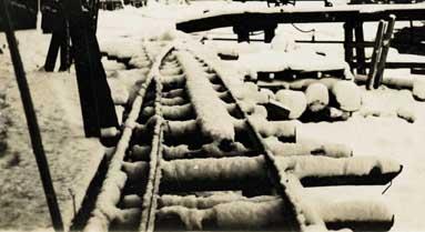
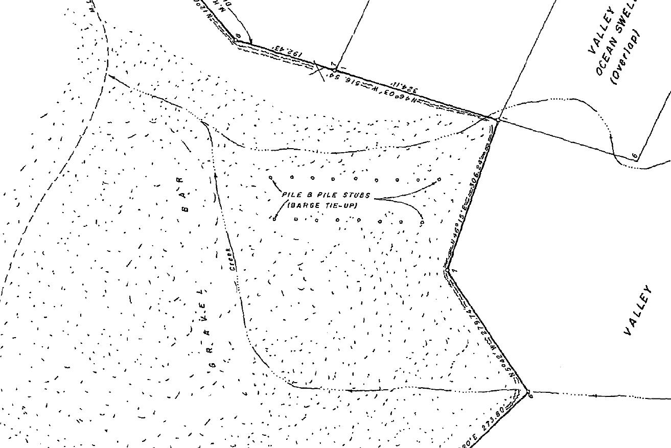
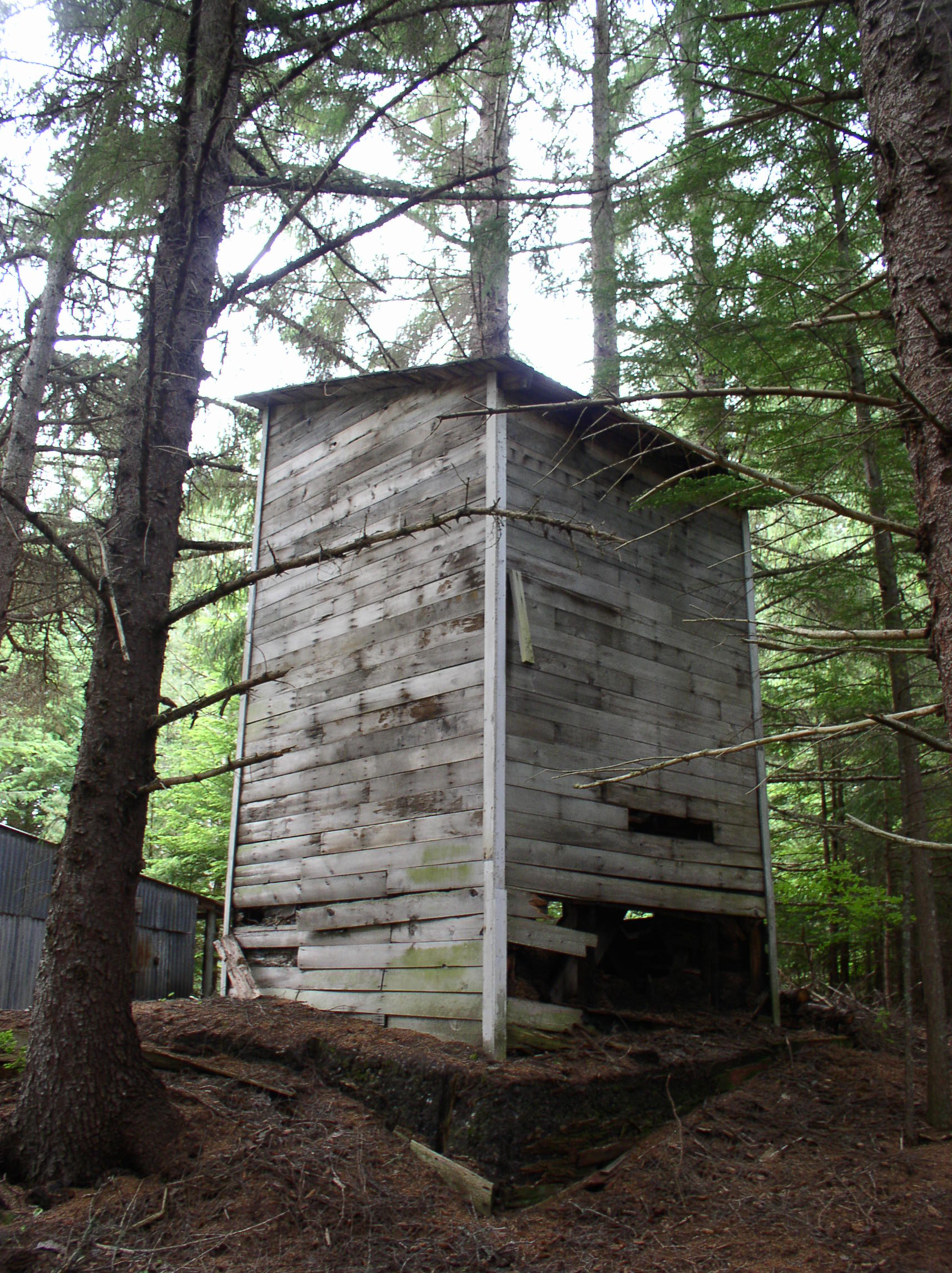
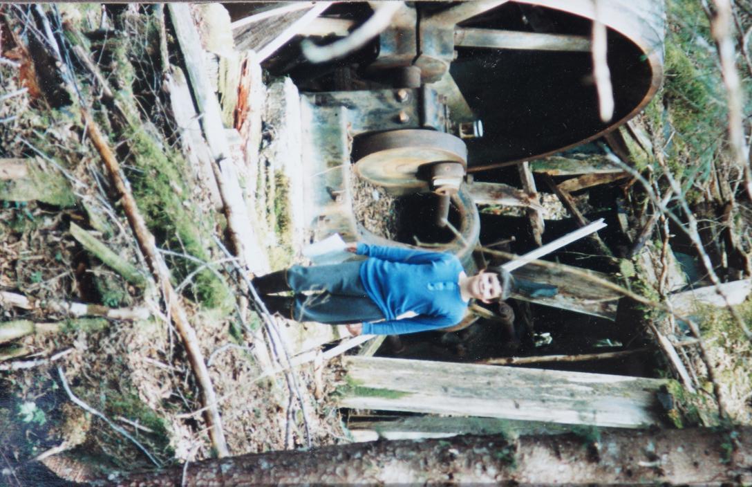
In this edition of Funter Bay History, I’ve compiled some statistics and information regarding the population and economy of the area. Funter Bay has variously been described as a town, a village, a ghost town, or simply a location with a cannery and mines. Knowing some numbers and comparative sizes might help place things in context.

__________________________________

Firstly, some background information. Alaska’s modern community designations differ from many other states. There are several types of municipalities defined for legal and tax purposes, including “Home Rule Cities” and “General Law Cities”, of which there are either first or second class cities. There are also Home Rule and General Law Boroughs (a borough is equivalent to a lower-48 county). Alaska is also unique in having an “Unorganized Borough“, more than half of the state is simply not part of any municipal entity, and thus has no property tax, sales tax, or any services below the state level. Funter Bay has long been a part of the Unorganized Borough. Juneau occasionally attempts to annex Funter Bay, annexation has been fought off by local residents on the grounds that they would pay property tax but would not receive any city services.

Another tricky detail is that some households in Alaska are migratory or seasonal (both in and outside the state). Residency reporting is sometimes based on economic reasons (such as inclusion in a school district or eligibility for Permanent Fund Dividends), and not on a person or family’s most common physical location. A seasonal fishing community may wish to count summer fishermen as part of their population, while those fishermen may report a different place of residence on their taxes. Funter Bay has always had a larger population in the summer, be it Tlingit fish camp residents, cannery workers, seasonal fishermen, or vacationing cabin owners.

Keeping in mind that these numbers may be “fuzzy”, here is some comparison data from the 2010 census. Partly from this document.

Bettles, the smallest “Second Class City”, has a reported population of 12.

Pelican, the smallest “First Class City” has a reported population of 88.

Nenana, the smallest “Home Rule City” has a reported population of 378.

The total population of Alaska in 2010 was 710,231. The three largest cities are Anchorage (291,826), Fairbanks (31,535), and Juneau (31,275). They quickly get a lot smaller.

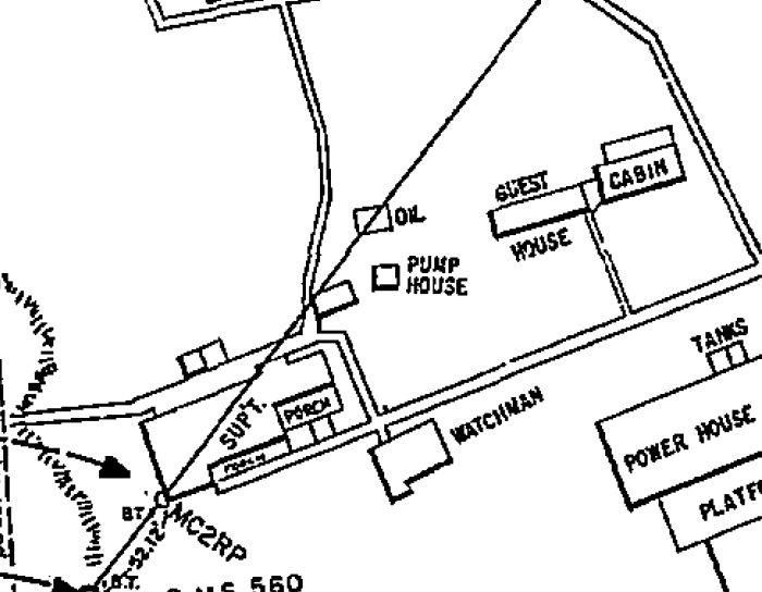
There are also “Census-Designated Places”, along the lines of an unincorporated town in the Lower 48. These communities may have some public facilities, and communities with more than 25 residents receive some state money for utilities and infrastructure. The population may live in a discrete area or be spread out around some center such as a post office or store. Some examples close to Funter Bay are:

Elfin Cove – reported population of  20 in 2010. (This is generally considered a “town” by most locals and population swells to 100+ in the summer). In 1939 Elfin Cove had about 65 residents and was referred to as a “village”.

Excursion Inlet – reported population of 12 in 2010.

Whitestone Logging Camp – reported population of 17 in 2010

__________________________________

Now, on to the numbers for Funter Bay:

The 1890 census listed 25 residents at Funter:1890 Census

A 1903 congressional convention in Juneau solicited delegates from around the state based on population. Funter Bay sent one delegate, the same number as Hoonah, Angoon, and Petersburg. Sitka sent 3, Fairbanks had 4, Juneau itself had 10.

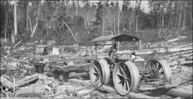
Summer population varied based on the number of workers brought in by the cannery. A 1904 article mentions “30 odd” Chinese employees traveling to Funter Bay to work at the cannery that season (“Chinese for Funter Bay”, Daily Alaska Dispatch (Juneau) 2 May 1904) A 1906 brief in the Dispatch mentions a can-making crew of 73 Chinese workers enroute to Funter Bay. In 1910 the Dispatch reported 84 Chinese workers.

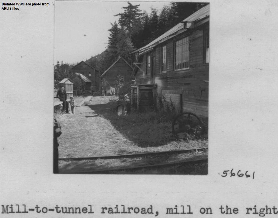
A 1905 article reported an “Indian Village of 400” at Funter Bay, with around 60 native employees working at the cannery. This “village” (also described here) was likely a summer fish camp for Tlingit natives. Some documents refer to it as housing for cannery employees. Various histories report that Funter was used for seasonal subsistence, but was not a permanent village site. Other reports indicate that the “village” or camp site moved around the bay as various white settlers or industries  interacted or interfered with it.  An interview with Elder Dave Wallace stated that there was no village at Funter Bay, but it was a good place for king salmon and berries. It was claimed by the Wooshkeetaan clan, part of the Auk Kwáan, and was called Shakananaxwk’.

Some Tlingit employees at the cannery in 1908 (more here):

TP Co Workers 1908 2

The 1910 US Census shows 70 people at Funter Bay. It was conducted in May when the cannery’s seasonal labor force was on hand. A few people are listed as independent fishermen. The microfilm quality is unfortunately quite poor, so not much else can be determined from it.

In 1912, merchandise valued at $78,933 was shipped to Funter Bay. (Per Alaska 1912 Commerce report, Daily Alaska Dispatch, 1 Feb 1913)

In 1916, the value of merchandise shipped to Funter Bay was $128,471 (Per “Report of Collector of Customs” Daily Alaska Dispatch (Juneau) 18 Feb 1917).

In 1918, the merchandise shipped to Funter totaled $267,697 (DA Dispatch 4 Feb 1919)

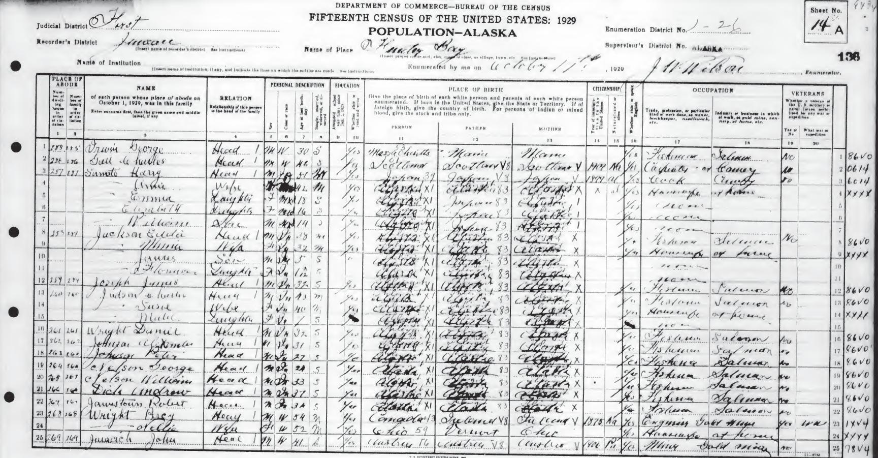
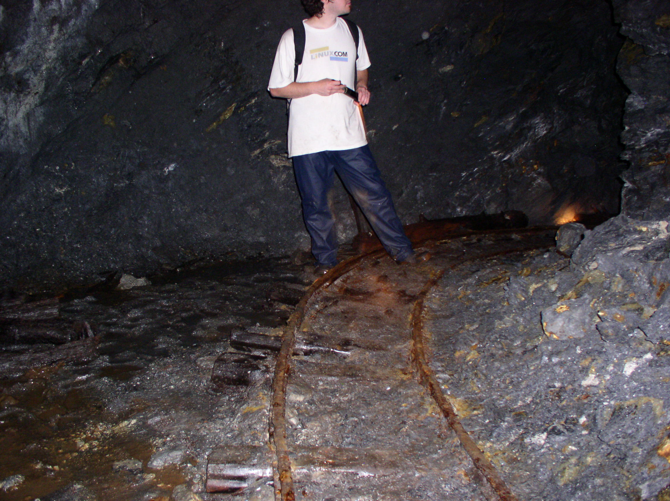
The Census of Oct 11, 1929 found 50 people at Funter Bay. The handwritten notes are somewhat hard to read, but show that approximately 12 residents were fishermen, 11 were miners, one was a logger, one was a mining engineer, and one was a bookkeeper at a mine. The cannery’s seasonal workforce had left for the winter, leaving a cashier at the store, as well as the cook and his family. About 9 women are listed with the occupation “Housewife”, and about 7 children are listed.

1929 Census records for Funter Bay ( 2 pages):
1929 Census Pg 1           1929 Census Pg 2

By 1939, Funter Bay was not being counted as a separate location, but was lumped into the Juneau census area (and later, the rather oddly-drawn Skagway-Angoon-Tenakee census area). The 1940 census reported 98 residents on “Admiralty Islands”, excluding Angoon and Killisnoo, but possibly including Tyee, Gambier Bay, Hawk Inlet, and other canneries.

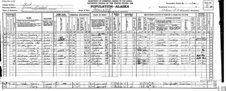
The following 1939 Census records seem to be noted “Funter Bay” on the extreme left, and includes 14 people:

1940

In 1979, Funter Bay reportedly had a year-round population of 14, and a seasonal population of 25.

By the late 1990s the population hovered around 10 year-round residents. (I recall a census taker in 1990 being dropped off by plane and planning to walk around the entire bay, unaware that 90% of the visible cabins were vacant and that the trails shown on maps were no longer passable).

So, depending on the accuracy and reliability of the reporting agencies, Funter Bay has historically had a summer high of between 100-500 residents, and a high winter population of around 50. It has never been a bustling metropolis, but was certainly on a par and occasionally rivaled other established Alaskan communities.


Funter Bay History: Water & Hydropower Part II

December 22, 2013

After previously writing about local water use for industry and power generation at Funter Bay, I came across a few more maps of such projects. The first, below, shows the pipeline from the Thlinket Packing Co cannery to “Nimrod Creek”, near “Pipeline Meadow” (local names). This creek is one of the larger and more reliable water sources convenient to the cannery. The grid lines on the map are old mining claims which have since lapsed. The small pond at the upper right is from a long-existing beaver dam which can still be found today.

pipeline

The Lake Kathleen project was a 1931 proposal to construct a hydroelectric station, fed by water from a tunnel. Power would be used at Funter Bay for an electric smelter.

kathleen

Electricity would have been transmitted to Funter Bay over lines strung along the beach for approximately 30 miles. The power line itself was considered relatively trivial once the necessary permits were acquired to use Tongass National Forest land and the tunnel had been dug. The major choke point would have been the crossing of Hawk Inlet, but this was planned to use a sandbar to build poles partway across the water.

kathleen2

The high flow and storage capacity available at Lake Kathleen outweighed the inconvenience of distance. Precedents for such a project included the Chichagof Mine at Klag Bay, as well as various other power projects around Southeast Alaska. Today many communities in Southeast Alaska rely on distant hydroelectric stations. Ultimately the Lake Kathleen project never materialized, either due to a lack of funding or other issues. Today the Greens Creek mine is located at Hawk Inlet much closer to this lake, but uses an underwater power cable from Juneau instead of local sources. Meanwhile, the Lake Kathleen area has been clearcut from the Cube Cove logging camp.

When large single sources of water were not available or practical to tap, another trick was to connect multiple sources with a lateral ditch. This technique was widely used throughout Alaska, from Nome to Fairbanks to Juneau. Engineers would pick an elevation contour and build a ditch at that level, exactly following the horizontal bends of the hillside while maintaining a slight vertical drop to keep the water flowing. Streams along the route were intercepted and diverted into the ditch, which eventually dumped their combined flow into a pipeline or another (previously smaller) stream where the water was needed. At Funter Bay, ditches and streams were sometimes daisy-chained, with one stream diverted to another, then that (now combined) stream diverted again farther down its course. This took advantage of different optimal contours for each leg.

Ditches were relatively cheap to dig, but had the disadvantage of needing constant maintenance. They were eroded by use, damaged by ice, blocked by fallen trees, and tended to fill in with silt, leaves, and other debris.

An abandoned ditch at Funter Bay, the water has found or made an easier path to the left, with the dry section beyond slowly filling in with organic debris:

ditch2


Alaskan Mine Names

December 12, 2013

I recently came across a large collection of mine names in Alaska. Names containing “Treasure”, “Rich”, “Jumbo”, “Bonanza”, etc are quite popular as a way to entice investors, but here are a few less enticing and perhaps more descriptive mine names!

Bum Cat
Horrible
Waterhole
Holy Moses
Wrongtrail
Troublesome Creek
Wicked Witch
Crazy Mountain
Pipedream
Singin’ Sam’s Rainbow Mine
Problem Gulch
Poor Chance
Slug Gulch
Whistlepig
Chickenlicken
Pooped
The Smell
Moonshine
Whiskey Creek
Smuggler’s Cover
Agony #1 & 2
Aching Back
Bruiser

And of course, a few named after wives, girlfriends, or perhaps local ladies of negotiable affection:

Lucky Lou
Clara Bea
Fanny Gulch
Nancy’s Hope Chest
Pricilla’s Delight
Darling Creek
Sweetheart Ridge
Little Sue
Lucky Nell
Lucky Lady
Maid of Mexico
Busty Belle
Double D Mining Co


Funter Bay History: Tall Tales

October 29, 2013

One of the finest traditions of Alaskan culture is the Tall Tale or “BS Story”. Whether a heroic adventure, unlikely wildlife encounter, lost treasure, or exaggerated fish, Alaskans have made an art of far-fetched claims. These days they’re usually related in person, over the marine radio, or at the bar, but in the old days you could get them printed in the newspaper! Actually, you probably still can in certain less-rigorously-edited publications!

One common “BS” news story in the early 20th century was the ever-popular “Next Treadwell” mine. Newspaper editors knew that attracting outside investors to the state would help grow their small towns’ economies, so almost every mine, no matter how small, was compared favorably to Treadwell (an operation known to be highly profitable). The Sitka Alaskan of Feb 27, 1886 describes deposits in the Funter Bay area as “equally as large and rich [as the “great gold belt of Douglas island”]”. After Treadwell caved in and flooded in 1917, local editors had to come up with more general terms like “the great Juneau mines”.

Of the two Juneau papers at the time, the Daily Alaska Dispatch seemed to talk up Funter Bay the most, although the Daily Record-Miner was also favorably biased towards local mines. The Dispatch referred to Funter Bay as “One of the very best camps in the district” (May 8, 1903), “The best copper proposition in this district” (Apr 16, 1909), and as having “claims which will unquestionably become good producers within a short time” (Oct 15, 1915). A July 31, 1902 article describes a Funter Bay claim “richly impregnated with gold” as well as being “40% copper”, and being “highly mineralized all the way through” and “a great big chunk of the world’s wealth”.

Reading these articles leads one to think that Funter Bay was constantly poised to become a major competitor in the national economy, but the mines referred to in these articles were mostly one or two-man prospects that never got beyond 50ft of tunnel, such as the Mansfield Mine.

Otteson’s Dano mine was also mentioned in the Dispatch, described as having a “big and rich ledge” (3 Aug 1909) and producing “rich gold bearing samples” (27 July 1919). Despite all this richness, the mine did not develop into a major producer. The papers handled such delays in promised wealth with their usual optimism, an 1903 article mentions that barren rock encountered in the first 50ft of a mine at Funter must have been “all cap-rock”, and “a change has taken place… the values in the quartz now are very good”. Any mine which failed or went bankrupt, if mentioned at all, was promptly blamed on the incompetence of the prior managers, and never on the geology of the claim.

Another great tall tale appeared in the Dispatch on Sept 12, 1912.

Explores Unknown Region on Admiralty Island

W. C. Miller Finds Lake and River Alive With Mountain Trout and Tremendous Wall of Ice.
—————————
W.C. Miller, a well known Alaskan who has valuable prospects at Funter Bay, has just returned from an exploration of the “unknown country” of Admiralty Island, and this trip is believed to be the first exploration of that region. The country lies near the center of Admiralty Island, between Hawk Inlet and Seymour Canal. Mr. Miller was accompanied by his nephew, F. E. Koeper.
“The entire territory,” said Mr. Miller, “is worthless to the prospector. We found a little gold, but nothing worth while, except mountain trout.”
At the head of a river Mr. Miller found a lake four miles long and a mile wide, alive with mountain trout of unusually large size. “We had no bait but venison,” said Mr. Miller, “but a crowd of fish entered into competition for the hook as often as Koeper threw it in.” Miller and his companion came back by a shallow river, a hundred feet wide, and this stream was also alive with trout. No salmon were seen, and Mr. Miller believes that on account of the swiftness of the current the salmon are not able to swim a very great distance in it. Mr. Miller named the lake “Isaac Walton Lake” in honor of the great angler.
The explorers found a new glacier with a wall of ice sixty feet high, running along the top of the range for miles. (From Daily Alaska Dispatch, Sept 12, 1912).

For those unfamiliar with the area, Admiralty Island has no glaciers,  and mountain top snow of that thickness is unlikely in September . The size and location of the lake and river are also quite questionable!

On May 25th of 1937, lighthouse keepers at Point Retreat reported that they had seen a “Ragged wild man”. This was said to possibly be Bud May, a trapper from Funter Bay who had been missing for some time. However, a few days later, 65 year old Albert Miles arrived at Point Retreat and claimed that he is not “wild”, he had simply walked there after wrecking his boat near Cordwood Creek. Miles was later ruled to be insane (per Kinky Bayers’ notes).

I might have a few more of these lying around for a later update. If any readers have a contribution I would be glad to publish it! Names can be withheld or changed to protect the guilty!


The Funter Bay Railroad

July 17, 2013

In the first half of the 20th century, Funter Bay had a small railroad running to mine workings at the base of Mt. Robert Barron (originally known as “Funter Mountain”).

rail1

A short mine railroad was first reported in 1895, when a newspaper article described plans for “about 1,000 feet of railroad track” running along the beach to various mine tunnels. This would likely have carried ore carts pushed by hand or pulled by draft animals.

Newspaper reports state that workers began laying 36-inch narrow-gauge rails towards the mountain in 1912. Originally, this track consisted of 4×4 wooden rails, spiked to an existing corduroy wagon road bed. The rails could have had strap iron on top, as did other wooden tramways in the area.  A 1920 inventory of company assets describes the line as 4000′ of 36″ gauge surface tram, and a 1921 map labels it “wooden tramway”. It was elsewhere listed as a “tram road” (many of these terms are used interchangeably in describing small railroads). Initially four ore cars of about 3 tons were used, these had steel wheels and wooden boxes, and were hauled by mules along the wooden track. Although a “locomotive boiler 40hp with 40hp engine” is inventoried in 1920, this seems to have been connected to a sawmill at the time and not related to the tram.

Between 1920 and 1926, the track was upgraded with steel rails, laid on the same corduroy grade in between the existing wooden rails (which had become rotten by that time). The new line was approximately 25″ gauge, and seems to have used 20 or 25lb steel rails (30 tons of 20lb rails were purchased around 1926, along with frogs and switches, to supplement an existing stock of 11 tons of 20 and 25lb rail). Twelve additional all-steel ore cars were purchased second hand from the Gastineau Gold Mining Co in Juneau (which had shut down and begun selling off equipment in 1921). Also in 1926, consulting engineer A. A. Holland recommended that the track be straightened, graded, and ballasted to prevent derailing. Holland suggested that cars should be hauled by cable due to the grade near the mountain, noting that locomotive haulage would require new track to take the steepest part of the hill more gradually.

1926 photos showing wooden rails with and without steel rails laid between them:
Funter Track

Some of Holland’s suggested improvements were implemented over the next few years. A 1928 letter to Governor Ernest Gruening reported construction of a “surface railroad” and purchase of a locomotive and cars. The 1930 stockholder report describes “railroads, 24″ gauge, 20lb rails” and an 8-ton steam locomotive. Within a few years the wooden roadbed was replaced with gravel from mine tailings. The 1931 Annual Report to the company stockholders stated that; “The Railroad Bed leading from the main tunnel to the mill located on the shore, and which was constructed of corduroy, was found too weak for continuous heavy loads and therefore has been ballasted the entire distance with crushed rock derived from the various workings in the main tunnel. New 8″ x 8″ x 9′ long ties have been secured and thus the road made substantial for any load at present under contemplation”. The report also mentions a branch of the railroad along the shore to the wharf.

Beginning in the 1930s, the line is referred to on maps and documents as a railroad, vs a tramway. This distinction may have had two factors behind it. For one, many early tram/railroad lines in Alaska used wooden trestles or ungraded track for their entire length to avoid the cost of permanent gravel grades. The switch from corduroy to graded roadbed at Funter was a significant upgrade. Secondly, the use of a steam locomotive seems to have boosted the status of small operations. Short lines with locomotives were more often called “railroads” while longer horse-drawn lines often remained “tramways”.

The company acquired a used 0-4-0T “Dinky” saddle tank steam locomotive around 1928. It seems to have been built by the Davenport Locomotive Works and was categorized as an 8-ton engine. Unfortunately no identifying marks are left, so the construction number and year are uncertain. It is anecdotally reported to be surplus from the Treadwell mines, which used steam locomotives at least until 1912-1913. Treadwell suffered a collapse in 1917 and finally shut down the last shaft in 1922, then sold the remaining equipment and property to the Alaska Juneau mine in 1928. As the AJ used electric locomotives of different gauge, the surplus steam locomotives were probably made available at bargain rates.

0-4-0T locomotive from Funter Bay:
SONY DSC

The locomotive may have looked something like this when operating.
modified

The total height is about 6′ (Treadwell’s specs called for a 5’7″ maximum clearance). This would have been considered a “contractor’s locomotive”, a type frequently used on temporary track in construction sites, to move dirt or materials around before dump trucks became common. Mines found them convenient due to their light weight and ability to handle uneven, steep, or sharply curving rails. I am not sure if the locomotive had an open cab (as apparently did most of the steam locomotives at Treadwell), or if it had an enclosed or even removable cab (at least one Treadwell locomotive was ordered with a removable cab, and a wooden cab could have been added later). Southeast Alaska’s climate would make at least a roof desirable, other small locomotives in the area had standing-height cabs when there were no clearance restrictions.

Here are some similar locomotive configurations that could have resembled this one:
Davenport locomotive with enclosed cab (larger version than this one).
Small locomotive with open cab.
Similarly sized locomotive (this one a Porter) with low-profile cab.

Such locomotives and light railroad equipment could be mail-ordered new or used from catalogs or classified ads in industry magazines.

ad

Front view of Funter Bay steam locomotive:
SONY DSC

Eventually, the rail line from the beach to the mountain was 4100ft long. A branch of about 1500-2000ft ran parallel to the beach just above high-tide line, connecting older mine workings along the shore. A report from around 1915 mentions “several miles of railroad” running “along the shore and back into the various tunnels”, but this seems a bit optimistic. Below the surface, ore carts were hauled through the tunnels by mules, and later by electric battery locomotives. Several documents mention multiple electric locomotives purchased prior to 1956, including a 3-ton GE. The tunnels along the beach are now collapsed or flooded.

Funter Track 2

Two sizes of rail wheels and axles lying on the beach at Funter Bay, the larger gauge set may have been from the 36″ gauge mule tram:
IMG_1382

Railroad trestle at Funter Bay in the 1920s:

asl_ms247_1_03

Courtesy of Alaska State Library, MS 247 1_02

The following picture shows some track along the beach and what might be a switch:

dual gauge

Courtesy of Alaska State Library, MS 247 1_01

Today the beachfront track is mostly washed out, rusted away, or buried under decades of organic debris which are slowly forming new soil on top of the railway.

rails2

The steam locomotive was used until around 1951, when the owners seem to have decided it was inefficient. I am not sure if it was fueled by wood or coal, but feeding it would have been time consuming either way. The owners attempted to “modernize” the unit by converting it to a Plymouth gasoline engine. Such was sometimes the fate of other steam locomotives in Alaska and elsewhere. An untitled, undated (but probably from 1951 or ’52) note in government files mentions that the conversion cost $1,000. Another note in the file mentions work on a Plymouth engine cowling and head in April 1952. Another sheet mentions that “A steam locomotive for use on the surface tramway was being converted to gasoline power.” and that the $1,000 price tag included “Repairs to locomotive surface and aerial tram (haulage)”.

locomotive conversion

Since the front of the dinky locomotive was cast to the frame, it would have been hard to simply cut the boiler off. The miners used the old standby of Alaska repairs: If you don’t have the right tool, try dynamite! The story goes that they simply blasted the boiler off the frame, resulting in severe cracking to the front casting:

SONY DSC

The gas engine conversion proved to be underpowered; the unit worked on level ground but was unable to make it up the hill between the waterfront branch and the main line to the mountain. The whole rig was abandoned until the early 1970s, when it was salvaged by railroad enthusiast Jim Walsh and moved to Nevada.

A map showing part of the former rail line. The beach section is not shown.

RR map 2

By the late 1950s, maps begin show the line as a road rather than a railroad or tramway, the mine having switched to trucks for transportation. Today there is essentially nothing left of the railroad at Funter Bay. The tracks have all become buried or salvaged for other projects (such as Ray Martin’s marine railroad and planned logging railroad). The land is privately owned and not generally open to visitors.

The locomotive is probably the last major artifact left from this line, and I am greatly appreciative of Jim Walsh’s time and generosity in letting me see it! I am still searching for additional information on this locomotive, such as the construction year, ownership history (Treadwell or otherwise), mechanical specifications, or even old blueprints, but I’ve been unable to track down many details (I spun off another page on small Alaska railroads based on information found during this research). If any readers know of a source for such information, or a possible line of inquiry, I would love to hear about it! As usual, my email address is (replace <AT> with @): gabe <AT> saveitforparts.com


Sidetracked: Obscure Railroads of Alaska

July 9, 2013

So… while researching AK history I accidentally found a whole bunch of forgotten railroads that aren’t well documented (if at all) in official rail histories. Kind of like finding spare change in the couch, but with more rust! I managed to get myself totally distracted from my Funter Bay history, while I typed up a quick list of these lines. I’ve tried to include links to supplementary information, but it’s a work in progress, and any information anyone might have would be appreciated!  Since it’s a long list, I’ve gone ahead and made it a separate page on the site, you can find it at the link below:

https://saveitforparts.wordpress.com/projects/lesser-known-and-obscure-railroads-of-alaska/


Funter Bay History – Dano Mine

May 27, 2013

The Alaska Dano Mining Co (aka Alaska Dano Mines Co, merged with Keystone Gold Mining Co) operated a medium-size mine at the South shore of Funter during the first third of the 20th century. Charles Otteson and Willis. E. Nowell were the chief developers of this mine. Some of the claims were apparently located by local prospector Richard Willoughby (more on him here).

dano closeup

Charles Ottesen of Denmark left home early to become a sailor. He eventually ended up in Tacoma where in 1890 he married Mary Neilsen, also of Denmark. In the mid 1890s they moved to Juneau. Around 1900 (some sources say “prior to 1898”), Charles staked several mining claims around Funter Bay (some sources misspell his name as Otterson or Patterson). Both Charles and Mary lived and worked at Funter Bay and in Juneau, commuting back and forth in a sailing sloop. Charles later worked as a caretaker at Funter Bay until the late 1940s. Here’s a photo of the couple at Funter Bay.

Charles Ottesen:
Ottesen

Willis E. Nowell came from a family of miners and mine managers. His father Thomas Nowell came to Alaska in 1885, along with his brothers George and Benjamin, helping to found the the Berners Bay Mining and Milling Co. The Nowell family did some mining elsewhere in the US, and was very active (though not always successful) in Juneau-area mining for several decades, including Berners Bay, Perseverance Gulch, Sheep Creek, Douglas, and other areas. Thomas’ son Willis Nowell Sr. was a prominent violinist, who switched his career to mining after visiting his father in Alaska. He continued to play the violin in Juneau. Willis also became an agent for the Alaska Steamship Company. Willis’ brother Frank was a noted photographer in Alaska. A street in West Juneau is named after the family.

Willis E Nowell with violin:
willis nowell
Courtesy of Alaska State Library, Nowell Family Photograph Collection, P402-03

Side note: I am tempted to start calling this blog “Funter Bay, a history of Mustache Enthusiasts”

The Alaska Dano / Nowell-Otteson mine included workings in several locations. Original claims and development occurred near the sandy beach at the South shore of Funter Bay. Later, the claims extended in a long swath to the SE, and included a longer tunnel high on the side of Mount Robert Barron (the apparent goal being to follow a “ledge” or vein, of quartz from its outcrop near the beach to a hoped-for “mother lode” in the mountain). The company built a corduroy road through the swampy muskeg from their beach camp to the base of the mountain, and trails to the various mine workings. They do not appear to have had much mechanization beyond ore carts, some small stationary steam engines, and the tractor for the road.  There were no major aerial trams or railroads (It’s possible that there was more equipment which was salvaged when mining wound down). The Dano mine later logged an area of old growth forest near the end of their road, leaving a clearcut which is still visible in infrared aerial photos.

Funter claims 1921

The first claims along the beach were staked by the Keystone Gold Mining Company in 1897. The War Horse Lode, part of Alaska Keystone’s properties, is listed as part of the Dano mine, so it is likely there was some consolidation of claims and mergers of companies (or different companies owned by the same people). There were several companies named “Keystone”in the late 19th and early 20th centuries, I am not entirely sure which, if any, were related. A 1906 government report notes that the Alaska Keystone Company did some development work on the War Horse Mine in 1897 and 1900, including a 48 and a 125′ shaft, and 320ft of drift. Ore was supposedly returning $100 of gold per ton. No work was reported between 1900 and 1906, although the company filed as a “foreign” (out of state) corporation in 1905. Later work on these claims is attributed to the Alaska Dano Mining Co, and the Dano company’s “Little Dandy” Lode was staked across the former War Horse and Big Injun claims of the Keystone company around this time. Also confusing is the appearance in the late 1920s of the “Williams Mine”, which was actually in Hawk Inlet on the other side of Mt. Robert Barron. Some modern-day documents refer to the upper Dano workings as the Williams Mine.

Keystone

Today, much of the beach property has been patented (made permanent private land, vs a temporary mining claim), and has been subdivided into private cabin lots. (Almost all of the sandy beach area above the high tide line is private property, if you are visiting Funter, please avoid trespassing).

The Dano operation does not appear to have had a permanent dock, relying instead on the smooth sandy beach and protected stream mouth in front of their camp to land boats.

A barge tie-up on the tidal gravel bar at the mouths of Ottesen Creek and Dano Creek. (I previously had this listed as part of a cannery fish trap, but further review of the position, and the tidal location, leads me to believe it was related to the mine):
Pilings

dano 1921

A general timeline of operations at the Alaska-Dano:

(Context: Joe Juneau and Richard Harris “discovered” (were shown by natives) gold in Juneau in 1880. Mines quickly sprang up including the Treadwell, Perseverance, and other operations nearby. Prospectors soon spread out into the surrounding mountains and islands in search of more gold).

1868: Captain J.W. White of the survey vessel Wayanda notes some promising geology at Funter Bay.
1880:
George Pilz (who bankrolled Harris and Juneau) finds some gold at Funter Bay (per Roderick).
1887:
Prospectors Richard Willoughby and Aaron Weir (or C. Weir or Ware?) stake some claims at Funter Bay. (per Roderick’s Preliminary History and others).
1889:
The Nowell Company bonds some of “Willoughby and Ware’s” claims for $50,000. Nowell spent several thousand on development, backed by an Eastern Company, but one report states that they abandoned the initial dig since the ledge (vein) dried up as it got deeper.
1897
: Gold deposit discovered near the sandy beach, War Horse Mine development begins.
Pre-1898: Otteson stakes various claims at South shore of Funter Bay.
1900: Two shafts had been dug (50ft and 125ft), and 320ft of tunnel (This is probably the work of the Keystone Gold Mining Co).
1905: The Keystone Gold Mining Co files as an out of state corporation.
1916: “Otteson Group” of claims staked.
Before 1919: A “good trail” had been built from the bay to the top of Mount Robert Barron, and a 200′ tunnel was driven at an elevation of 1,050 feet.
1919: Geologist J.B. Mertie notes promising quartz outcroppings at the “Nowell Otterson” group of claims.
1920: The Alaska Dano company is formed.
1921: The company reported a large amount of “free gold”. 100′ of tunnel and a winze (angled shaft) had been dug.
By 1922 they had another 250′ of tunnel.
1924 and 25: “A limited amount of development work” was done.
1926: Some prospecting work was done, but no production was reported.
In 1927, Only the minimum work to maintain claims was done.
In 1928, “Prospecting work only” was carried out.
1929: “A little development work” included driving 76 feet of tunnel. The Williams Mine apparently had some leasing discussions with Dano.
1938: Property listed as “Idle”, with “Intermittent development”
1945: Willis Nowell passed away, his family applied to secure his stock in the Alaska-Dano mine.
1955: Charles Ottesen passed away.
1960s: Fred Eastaugh became involved with the property.
1968-69, the Dano company did some logging.
A 1981 report mentions that 265ft of tunnel was dug after 1900, and that only 100oz of gold was produced (some documents indicate that more was run through a neighboring mill under contract, and the output would be higher if listed seperately)
1991: Fred Eastaugh listed as president of the Alaska Dano Mines Co.
1994: Some surface mapping and sampling performed.
1996: “Alaska Dano Claimants” performed limited sampling and re-staked claims on federal land adjacent to the patented claims.

It appears the Dano’s investment money dried up during the 1920s and never really reappeared. The major workings completed included a 400′ tunnel, several shorter tunnels, some relatively shallow shafts, various open cuts, the road, timber clearcut, and other minor work.

Despite apparently limited returns, activity never quite stopped at the Dano claims. After the big gold finds in the Juneau area, prospectors were always hoping to find the “next big thing”, even into the 80s and 90s. The Greens Creek Mine across Mt. Robert Barron turned out to be the “next big mine” of recent times, and more recently the Berner’s Bay mines have begun reopening. Today, there is renewed interest in some other area mines, as gold prices continue to rise. Mining companies continually poke at the Juneau mines hoping to get approval to re-open. Dano maintained most of their claims, and continued doing development work to meet the maintenance requirements. The logging operation may have been an attempt to make more profit from the property outside of mining.

Present-day remains:

There are still a few remains of the Dano camp near the beach. Early work included a few open cuts, shafts, and tunnels. The most prominent remaining feature is the steam boiler which probably powered their shaft hoists and possibly other equipment.

Directly in front of the boiler is a semi-collapsed shaft, with a few logs over it and a metal pipe leading down into it (probably for a dewatering pump). Some of this wood might be the remains of a small headframe:

0a-dano-shaft-boiler

Another shaft nearby. This one has been made “safe” in the time-honored tradition of Western mining: Throw some bed frames over it and call it a day:

0a-dano-shaft2

Part of a winch found nearby, which may or may not be related to one of the shafts (it could also be part of a boat):

OLYMPUS DIGITAL CAMERA

Shorelines around Funter Bay tend to come in “benches” that show where the sea level used to be. This is not due to sea level dropping, but the land rising! After the glaciers retreated, the ground tended to “bounce back“, and raise a bit. Travelling inland from the water, you would generally observe a 10′ dropoff just below extreme low-tide line, a 10′ bluff a little above extreme high-tide line, and another 10′ bluff back in the woods where the old high tide line was (you can find clamshells near the back bluff that aren’t old enough to be fossils, showing that the change was fairly “recent”).

Below is a tunnel into the back bench behind the Dano beach camp. It was fairly unstable and flooded, I would not recommend going into this (or any) tunnel:

OLYMPUS DIGITAL CAMERA

Eventually, the near-shore deposits either proved marginal, or the difficulty of digging shafts near sea level caused the miners to move farther back from the shore. The Dano claims stretch all the way to the top of Mount Robert Barron, and I believe there are some small shafts very high on the mountainside (At the “two shafts” lode).

Dano claims (shaded), and tractor trail to the base of Mt. Robert Barron:

OLYMPUS DIGITAL CAMERA

The main adit, was located closer to the base of the mountain, next to a small waterfall on Dano Creek. The corduroy road up to this mine is marked on various topo maps as a trail, a tractor trail, or a road. Likely the mine used a gas crawler tractor to haul supplies and equipment up to the adit from the beach.

Part of the Dano mine’s corduroy road:

OLYMPUS DIGITAL CAMERA

A bridge on the Dano road over a small stream:
OLYMPUS DIGITAL CAMERA

Not much is left of the road, most of the corduroy has rotted back into the ground cover. It’s still possible to follow it with some bushwhacking, but it’s not really a useful or passable trail. Beavers have dammed up parts of the muskeg along the way, flooding the route of the former road in a few places.

Higher on the mountain, a few more signs of the Dano Mine are visible. This is a cabin site near the mine’s upper tunnel (sometimes referred to as the Otteson Mine). There’s not much left of the cabin aside from some logs, metal bits, and stove parts.

OLYMPUS DIGITAL CAMERA OLYMPUS DIGITAL CAMERA OLYMPUS DIGITAL CAMERA

The mine adit (tunnel entrance) is immediately adjacent to Dano Creek. Mines in Southeast tend to be damp due to the high humidity and prevalent groundwater, but there is likely even more flow into this tunnel due to the stream. This has probably contributed to some of the collapse near the entrance.

(Note: I do not recommend that you go in any mine workings. They are often dangerous, unstable (as seen below), and many are still private property).

OLYMPUS DIGITAL CAMERA

The adit has collapsed somewhat, crushing this ore car:

OLYMPUS DIGITAL CAMERA

OLYMPUS DIGITAL CAMERA

Inside the tunnel, tracks along the floor are still in decent condition, despite the high humidity:

OLYMPUS DIGITAL CAMERA OLYMPUS DIGITAL CAMERAOLYMPUS DIGITAL CAMERA

Part of a Dupont dynamite box:OLYMPUS DIGITAL CAMERA

Tools and a rail bending jig (The C-shaped thing):

OLYMPUS DIGITAL CAMERA

Drill bits:

OLYMPUS DIGITAL CAMERA

Iron leeching from a metal ore vein with water pouring off an iron stalactite:

OLYMPUS DIGITAL CAMERA

Below is one of the “fun surprises” of old mine tunnels; hidden shafts! You can be walking along, and suddenly the “rock” you think you’re standing on turns out to be a thin layer of mud or dirt over rotten boards and a deep pit. This one is flooded, so at worst you’d get a dunking, but others can drop you into a death trap:

OLYMPUS DIGITAL CAMERA

That’s all I have on the Dano mine for now!


Funter Bay History: Logging

May 23, 2013

While Northern Admiralty Island was never clearcut on an industrial scale the way the central section was, there have been occasional timber harvests in the Funter Bay area. Industrial logging was both helped and hindered by regulatory issues; creation of the Tongass National Forest in 1907 added some forest protections, but the Forest Service also earmarked large parts of National Forest to become foreign pulp exports. Private landowners had a few more options for local-use and some export harvests. General information and statistics on Alaskan logging is available here and here. A basic timeline of logging and timber regulation in Southeast Alaska in the 20th century is available here.

Handlogging tools at Funter Bay:
IMG_2159

Early hand-logging operations in the 19th and early 20th century supplied logs for fish traps and pilings, shipping crates for canned salmon, wood for cannery and mine construction, and possibly fuel (although coal was more common as a fuel for steam boilers, possibly due to the high sap content of local spruce adversely affecting machinery). Most hand-logging operations were based from boats, the loggers would cut trees very close to the shoreline where they would fall into the water, then they would be tied into rafts and towed to lumber mills at Juneau and Douglas. Today there would not be much evidence of this forest-edge harvesting, but the practice probably explains why photos from the early 20th century show very few trees on the small islands in Funter Bay. These islands are heavily re-forested today, they would have been convenient places to cut old-growth spruce and float it away.

station

Despite the abundance of timber, some businesses imported lumber for construction, including the Funter Bay cannery (which brought in California Redwood beams), and other local buildings which were pre-fabricated and shipped up as packages. Certain woods like pine, and especially redwood, are more rot-resistant than the local spruce, and buildings made out of such woods have lasted longer in the damp environment. Spruce pilings driven near the shore or used as building footings were often soaked in tar to make them last longer.

Part of a shipping address stamped on lumber brought in from down south in the early 20th century:
OLYMPUS DIGITAL CAMERA

Barry Roderick’s “Preliminary History of Admiralty Island” mentions a single cable-logging operation on the island in 1905 (where logs would be hooked to a cable and pulled or zip-lined to the beach). Later operations would have been more mechanized, with tractors and engines used to haul logs from stands of timber deeper in the woods. Of special interest were the old-growth cedar trees, prized for their rot resistance.

In 1911, the US Forest Service decided that clearcutting (AKA “Clean Cutting”) was the best method, supposedly it would allow sunlight to reach the forest floor and make new trees grow faster (in reality, clearcutting just creates big jungles of berry bushes, destroys wildlife habitat, and leaves the soil unprotected to wash away into salmon streams).

Sawmill equipment was delivered to Funter Bay in 1918 by the steamer Admiral Goodrich, probably for one of the mines. A 40hp steam-powered sawmill was reported in 1920.

In 1922 the Alaska Gastineau mine in Juneau purchased timber rights on Admiralty Island, but the sale was cancelled due to financing issues.

logging

After WWII, the Forest Service attempted to entice pulp mill operations to Southeast Alaska. There were also some attempts to cut spruce for plywood and export full logs overseas, but most development seems to be devoted to grinding up the trees for pulp. These operations were heavily subsidized by the government, and still claimed to be operating at a loss. Local rumor has it that Japanese investors are stockpiling logs to sell back to the US once we’ve clearcut everything.

The Keelers who had a cabin near Clear Point (and possibly one at Hawk Inlet?) did some logging. The uncle-nephew team purchased a large two-man chainsaw. Unfortunately, the younger man was killed when one of the first trees they cut tree fell on him.

In the 1960s, local resident Ray Martin had a plan to log old-growth cedar from between the creeks at Crab Cove. His idea involved building a railroad from a dock at “The Point” up to the old-growth cedar stands between the creeks. The cedars would have been used for telephone poles. Ray apparently had many “get rich” schemes that never took off, and the logging operation was no different. He eventually landed in some legal trouble due to a shady stock deal with a company in Juneau.

The biggest logging project at Funter Bay was run by the Alaska Dano Mining Co in conjunction with Gary Lumber Co of Juneau. Spruce (and some Hemlock) was harvested from approximately 30-35 acres on and near Dano’s mining claims around 1969. Sources indicate that it was around 1.8 million board feet, mainly for export.  In 1971, the US BLM transferred 33 acres to the state in the section which was logged, this could have been related to Dano’s operation, but I am not sure.  The clearing resulting from Dano’s logging is still visible in satellite imagery, although its a much smaller scar than those left by the bigger industrial logging operations elsewhere on Admiralty Island.

Dano clearcut and logging road, 10 years after the timber harvest (color infrared image showing different vegetation types):
clearcut

A Forest Service memo notes a timber sale of 222mbf (million board feet) in the Funter Bay area in 1969. That volume of timber would indicate an area of roughly 500 acres, much larger than the Dano clearcut. The appraisal price was 3 times higher than the average for Southeast Alaska, which could mean that cedar was the target rather than spruce. This could be related to Ray Martin’s plan, or to a late-60s plan to bring a large pulp mill to Juneau and clearcut the surrounding forests.

Today there are the remains of a piledriver at The Point, but I am not sure if this is specifically related to Ray Martin’s logging scheme, or simply left over from something else.

The other remains of Ray’s logging scheme include a mobile logging arch left on his property (which became our home). When my parents expanded our house, the arch was too heavy to move, so Dad incorporated it into the foundation of the deck!

OLYMPUS DIGITAL CAMERA OLYMPUS DIGITAL CAMERA

A logging arch would be used in conjunction with a tractor, to raise one end of a log and then drag it somewhere for loading. Here’s a model of one. Here is a page showing logging arches in use. Here is a photo of a logging arch being used to assemble a log raft on an Alaskan beach.

Dad believes this was Ray’s tractor, a Fordson made by the Ford Motor Company in Detroit:

OLYMPUS DIGITAL CAMERA

OLYMPUS DIGITAL CAMERA OLYMPUS DIGITAL CAMERA OLYMPUS DIGITAL CAMERA

Fordson tractors were quite popular in Alaska. It also seems to have been somewhat common to turn them into small railway locomotives, everywhere from Nome to New Zealand.

Here’s a Fordson-based locomotive in Nome, AK:
Nome Alaska, Iron

Here’s the low-budget model, with the rail made of logs (a “pole road”) and the wheels apparently just big flanged rims. And here’s a whole bunch more. A salt mining company once built a monorail using Fordson tractor motors!

Here is a mention of another small railroad in Southeast Alaska, with a Fordson locomotive. That site also had a Fordson-powered sawmill:
fordson

Ray Martin had a marine railway at the property, which included some tracks leading from the beach up to the house, and some wheels and axles. This would have been used to haul his boat out for storage and repairs, but maybe he planned to build his own logging railroad using some of this equipment as a starting point? By the 1950s, mines in Southeast Alaska were switching from railways and tramways to gravel roads, and surplus rail equipment would probably have been available cheaply.


Funter Bay History – Water & Hydropower

May 22, 2013

The availability of water often determined where an industry (such as a mill or cannery) was located. It also determined when the industry could operate. If streams were frozen, the boilers and water turbines could not run. Canneries needed large amounts of water for the packing and cleaning processes. Mines needed water for milling operations. In an era of wood buildings and few safety regulations, water was vital for fire protection. Fortunately for these industries, Southeast Alaska has a more than adequate supply of “liquid sunshine”, and water is usually plentiful year-round (it rains more than it snows in the winter). Storage of water ensured that supplies were consistent during the few dry periods. Several sources mention that the Funter Bay cannery closed around 1931 due to a lack of water. Photos and documents show operations at the cannery into the mid-1950s, but these could have been non-packing activities like trap maintenance.

Below is the base of a large wooden water tank at the cannery:

OLYMPUS DIGITAL CAMERA

Another water tank, this one elevated in a wooden tower to provide pressure. I believe this tower was for tap water at cannery residences, it was located between the Superintendent’s house, the Watchman’s house, and the Guest house (I’ve also heard the Guest House referred to as a school).

OLYMPUS DIGITAL CAMERA

OLYMPUS DIGITAL CAMERA

I remember when the front of the tower still had stairs on it, that you could walk up without falling through… I’m actually wondering how much is left of the tower today, it’s been a few years since these photos were taken.

The tank is labeled as “Pump House” on the 1964 map. It probably had a pump to raise water into the tank.

closeup2

Probably one of the first bathtubs in Funter Bay! Salvaged from the Superintendent’s house (which was half-collapsed by the 1970s), this found a new life in our bathroom:

Bathtub

A smaller cistern (basically a buried wooden barrel). In swampy muskeg these could be (and still are) used as collection points and filters, just bury a drum with some holes in it, and run a pipe out:

OLYMPUS DIGITAL CAMERA

The cannery was not located directly on a stream, so the tanks were supplied by a network of ditches, small dams, and pipes. Below is an example of a simple wood stave dam near the cannery, made from locally-cut timber:

OLYMPUS DIGITAL CAMERA

A ditch at the cannery. This may actually have been a drainage ditch to get rid of excess water, all the rain could make the ground mushy and damage foundations (note the rusty metal pipe bisecting the ditch):

OLYMPUS DIGITAL CAMERA

Several cannery pipelines were made from redwood staves. Redwood is a naturally rot-resistant timber that was cheaper and held up much better than steel in the rainforest (you can still find salvaged redwood pipes in use for gutters and drains around the bay!). One of these pipelines ran for over a mile, reaching Nimrod Creek near a muskeg known as Pipeline Meadow. The pipes were constructed of four redwood pieces slotted together, and banded with steel wire to hold them together. You can find these pipes all through the woods, in many cases the steel banding has rusted away, but the pipes are still watertight! Apparently this type of pipe is still made, and in all sizes. Until I started researching it, I had assumed it was a historical curiosity.

OLYMPUS DIGITAL CAMERA

A cutaway section of redwood pipe. Note how there is some slight surface rot, but the interior of the pipe looks brand new:

OLYMPUS DIGITAL CAMERA

Water Power:

In addition to supplying boilers, canning systems, kitchens, baths, etc, water was also used directly to generate power in several places. At the base of Mount Robert Barron is a large Pelton wheel, driving an air compressor and electric generator to charge battery-powered mine locomotives. Water was collected in ditches from a bench partway up the mountain, and funneled into a pipeline dropping steeply down the side.

The 1917 Territorial Mine Inspector’s Report states that the compressor house was constructed between July and December of that year. 307 feet of 22-inch steel pipe, 185 feet of 10-inch, 300 feet of 8-inch, and 300 feet of 6-inch pipe were laid to furnish power to the compressor, a 24x18x14 Chicago Pneumatic unit rated at 1400 cubic feet, with a 5-inch Pelton wheel. In 1919 it was reported that the compressor was powered by a 6-inch stream of water with 500ft of head, and could run 12 pneumatic drills.

Below is the Pelton wheel:

IMG_1369_2

This compressor ran air tools and supplied fresh air to mine workings. Below, you can see the incoming water pipe (upper right), flywheel with belt from the Pelton wheel, compressor piston (lower center), and compressed air pipe (right side).

IMG_1364

Compressor with slightly more of the surrounding building intact, when I was younger:
SONY DSC

Here’s a video of an old Pelton Wheel in action.

Here’s one of the tools powered by compressed air, a jackleg mining drill: IMG_1360

Hydropower is still a very efficient and environmentally friendly way of generating power in Southeast Alaska. Most of Juneau’s electricity comes from several hydropower plants (including a few originally built to serve mines in the area). Small hydro turbines supply power to cabins and homes in the area as well.

There have occasionally been studies to determine a reliable year-round power supply for industry at Funter Bay. In the 1930s there were some proposals to build a hydroelectric plant at Lake Kathleen, 30 miles south of Funter Bay, and run powerlines to the mines at Funter (Philip Smith, Metal Industry of Alaska in 1933)

A 1979 study by the Army Corps of Engineers examined Funter Bay and several other SE communities for hydroelectric potential. The study does not seem to have been done with much rigor or serious effort, as the authors note they merely “flew over” some of the potential sites, and then apparently drew some maps based on wishful thinking (for example, they seem to hope that the Dano Mine’s long-abandoned road could be re-used for access to a power plant). Actually, this study may have had more thought put into it than Juneau’s water supply, which operates on the technique of “plug up some mine tunnels and drink what leaks out“, and seems to still be planned and designed mainly on bar napkins. Eventually the USACE study got around to realizing that existing diesel generators were cheaper for tiny communities like Funter, compared to the cost of building and maintaining a dam, power plant, and power lines (Funter Bay is listed in the study has having a year-round population of 14, and a seasonal population of 25).

Hydro1


Funter Bay History: Dick Willoughby’s Exploding Raven

May 13, 2013

Richard “Uncle Dick” Willoughby (1832-1902?) AKA “The Professor”, was apparently quite the local character. Known for various pranks and tall tales, he left a lasting impression on the history and geography of Southeast Alaska (he has both a street and an island named after him).

willoughby

Dick had a cabin at Funter Bay and did some prospecting in the area, locating several claims around the bay in 1887 and even starting a small mining company. An apparently successful prospecting method was to carry a metal rod with a carbon tip. Willoughby would prod through the mossy muskeg layer covering much of Admiralty Island, hoping to find shallow bedrock. After some practice, he claimed to be able to tell the difference between quartz and other rocks by feel. Even after selling many of his mining claims, Dick spent much of his later life at Funter Bay.

Willoughby also prospected and explored around Glacier Bay and other parts of Southeast Alaska. Around 1885, he claimed to have photographed a “phantom city” above Muir Glacier. He made some money selling copies and guiding tours to see this supposed mirage (which no one else ever glimpsed, and was later revealed to look remarkably like Bristol, England). The ever-reliable and never-sensationalist Popular Mechanics magazine swallowed the bait with a full article in 1897, although most people list it as an obvious fake. As late as 1928, cruise ship passengers were still looking for the phantom city!

An 1887 Juneau Free Press article claims that Dick Willoughby had dug up “The Devil’s Skeleton”. Willoughby was occasionally mentioned in the papers as finding “monster bones”, as well as various mammoth skeletons, often around Glacier Bay.  He apparently had a “museum” in Juneau where you could “see the elephant” for 50 cents admission.

To get back to the title of this post, below is an anecdote from his time at Funter which appears (with slightly different details) in several period newspapers:

exploding raven

A slightly different version is mentioned here, in which Dick’s cabin at Funter falls victim to the nefarious bird. Who knows how much, if any, truth this story contains!

Chapter 7 of the 1909 book Through The Yukon and Alaska is devoted to Dick Willoughby.

A fairly comprehensive obituary of Mr. Willoughby is here.