Funter Bay History: Communication

March 10, 2014

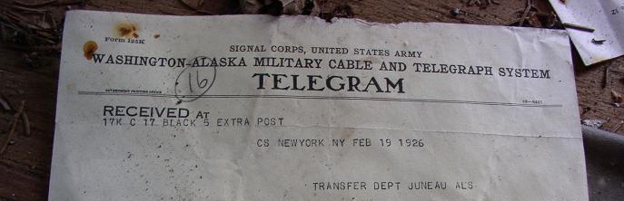
Prior to the 1920s, the quickest way to get a message across Funter Bay was to hop in a boat and row. If it wasn’t as important, you could walk the long way around. For outside communication, mail came several times a week by boat. Telegrams could be sent from Juneau to “Down South” after undersea cables were laid between 1900 and 1904.

OLYMPUS DIGITAL CAMERA

Delayed communication sometimes caused headaches for those trying to do business at Funter Bay. On at least one occasion, people attempting to meet passed each other as one traveled to Juneau and the other to Funter.

“J. J. Foltz, president of the Funter Bay Gold Mining Company left on the last Bonita to visit the property. At the same time Supt. Fox left Funter Bay on a gasoline launch to meet Mr. Foltz in Juneau. “Ships that pass in the night” are responsible for Foltz being at Funter’s Bay and Fox now in Juneau.” Daily Alaska Dispatch (Juneau)  21 May 1903

Juneau newspapers attempted to keep track of the comings and goings of important persons, including their hotel accommodations. This practice seems a bit intrusive in today’s world, but was vitally important for coordinating meetings at the time.

barron

Radios began appearing at Alaskan canneries around 1915, in the form of large base stations. In an earlier post I noted the large twin masts supporting a dipole antenna at the cannery in 1929.

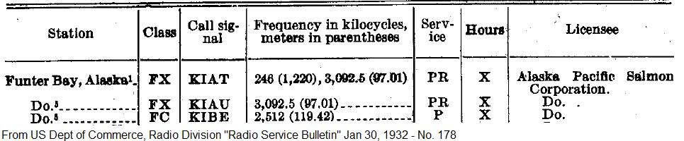
The FCC has some historic radio service bulletins online, listing new stations each year. Others can be found on Google Books. A 1919 list of commercial radio stations includes the “Thinket Pack. Co.” at Funter, Alaska, with call sign of KXK. (Those call letters had been assigned to the steamship Puritan until 1915). Frequencies were 300, 550, and 600kHz. In 1922 it was noted that the radio station at Funter opened for the year on May 11 and closed September 20th. By 1932 the cannery had several call signs listed.

radio
The “PR” service indicates limited public use, while “P” indicates private use only. FX is Fixed Base, and FC is Coast Station.

Smaller shortwave and single sideband equipment gradually made its way into more locations, as seen by the proliferation of call signs licensed to fishing boats between the 1920s and 1940s. Antennas became smaller as frequencies got higher and transmitters more efficient. Eventually many houses and cabins had radios of some sort installed, sometimes bending the FCC’s rules on CB and mobile radio use (as often happened, rules designed for the lower 48 made little sense in Alaska). More modern radio systems associated with Funter Bay are mentioned here.

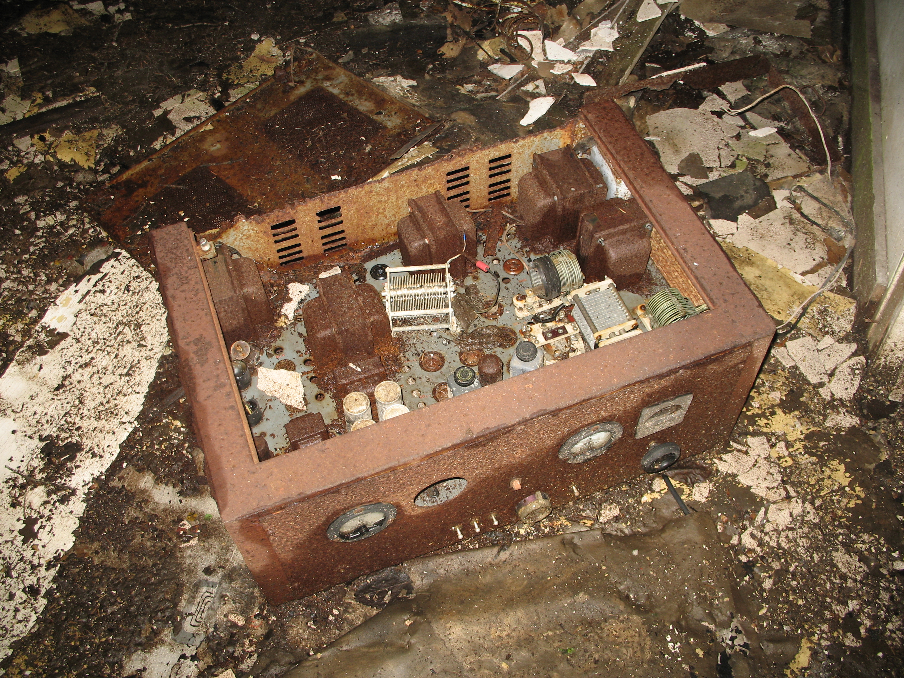
Old vacuum tube radio set:
IMG_1479

The 1930s and 40s brought hand-crank telephones, although these were never a complete network, and only connected a few buildings at each industry (and later, between a few houses with salvaged equipment). The Funter Bay cannery had a number of EE-8 army field telephones, which were likely installed during the Aleut internment. A few older crank phones can also be found in houses around the bay (When I was growing up we had phone lines to 5 houses and a few out-buildings, our “phone number” was three rings).

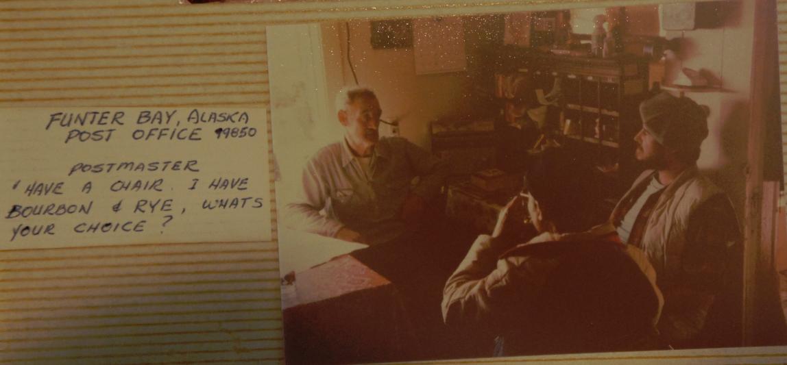
From 1902 until the late 1970s, Funter Bay had a mostly year-round post office. Cannery employees and winter watchmen usually served as postmaster (and public radio operator) and the post office was the social center of the community in the winter.

postmaster

Photo courtesy of Phil Emerson

Mail boats are discussed more in this ridiculously long post.

postmark

I may write more on the postal history of Funter Bay at a later time, I am still collecting information on that subject.

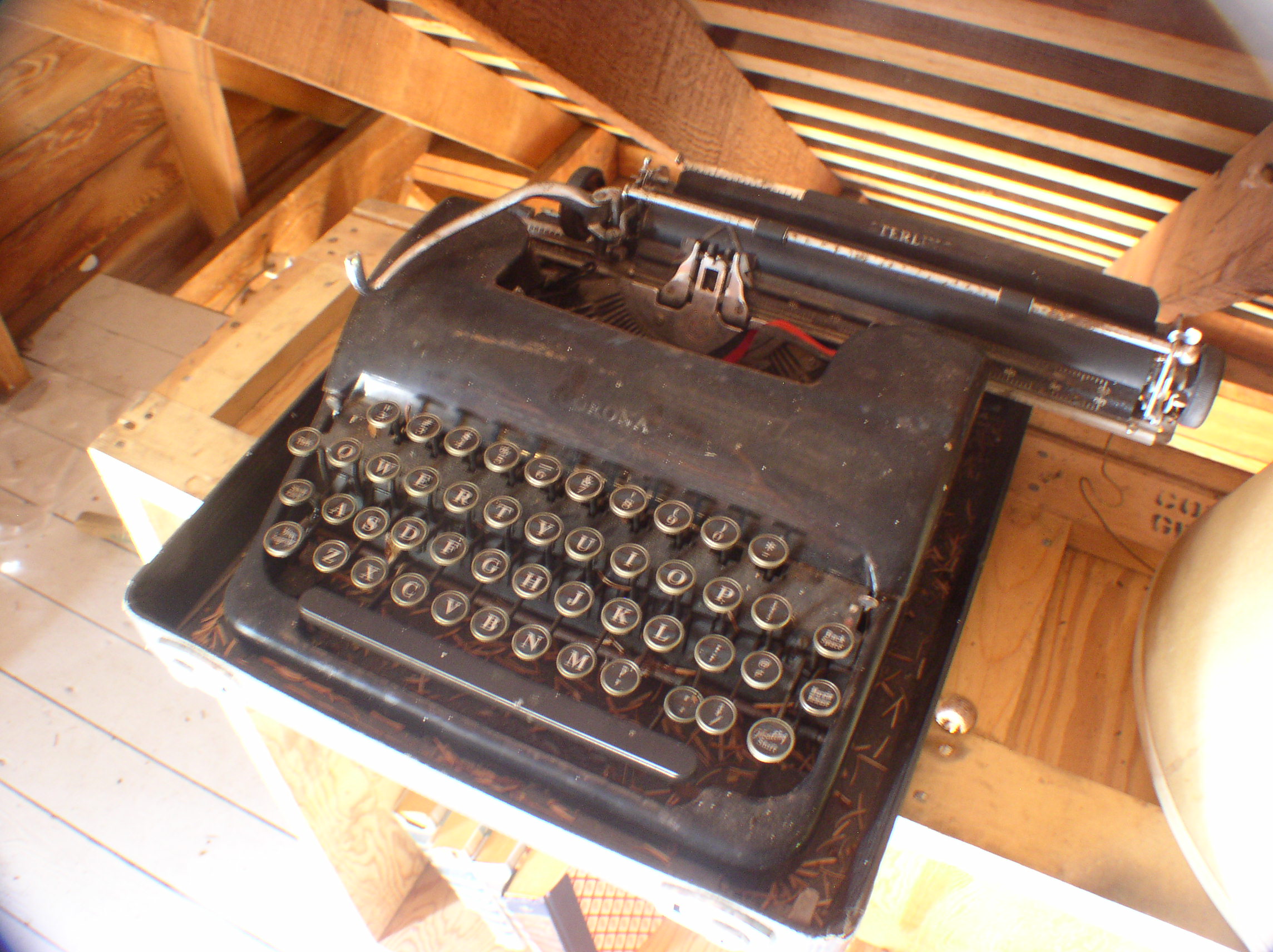
An old typewriter found in an attic at Funter:OLYMPUS DIGITAL CAMERA

Newspapers were also popular, even if they were outdated by the time you got them.  They were entertainment, you could insulate your house with them (shown below), and they’d probably be useful in the outhouse!

OLYMPUS DIGITAL CAMERA


Funter Bay History – 80 Years of Mountain Views

March 9, 2014

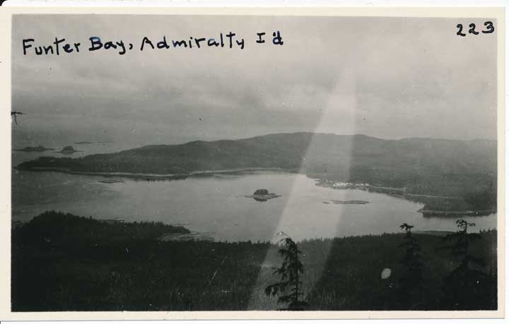
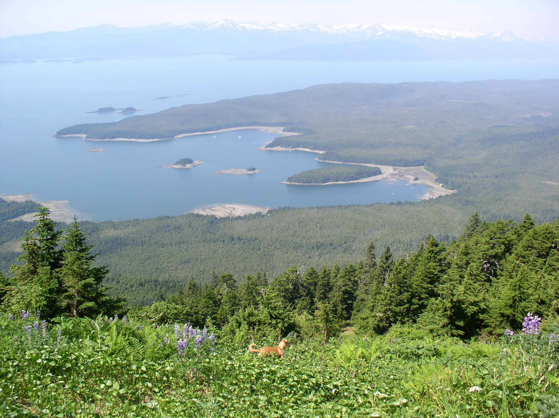
I recently came across a photo of Funter Bay from 1924 taken from Mt. Robert Barron. It fits nicely with the photos taken by my Dad in the 1970s, and the ones I took in the mid 2000s (I have a large panorama of the bay at the bottom of a previous post).

uaa-hmc-0779-APU-223

Funter Bay in 1924. Arthur F. Buddington photographs, Archives and Special Collections, Consortium Library, University of Alaska Anchorage.

Untitled-20

Funter Bay in the 1970s, photo courtesy of Phil Emerson

OLYMPUS DIGITAL CAMERA

Funter Bay in 2004, photo by Gabe Emerson

I’ve zoomed in a bit towards the cannery in all three photos. In all three, that area stands out as the major element of cultural geography. Unfortunately the 1924 photo is not so clear (this post has a nice 1929 aerial). Notable in 1924 is the complete lack of trees on Ledge Island (the small island in front of the cannery). As noted in another post, islands around the bay were a quick and easy place to cut trees and float the logs to where they were wanted.

uaa-crop

Arthur F. Buddington photographs, Archives and Special Collections, Consortium Library, University of Alaska Anchorage.

I’ve shown the 1970s close-up before, alongside more of Dad’s photos, in this post. The missing sections of cannery buildings which overhung the water are fairly evident here.

web-cannery

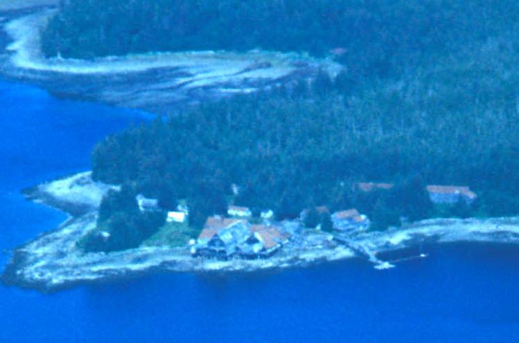
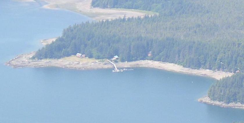
By the 2000s, the only evidence of the cannery is the State-maintained public dock and ramp. The buildings seen below are all modern private structures.

OLYMPUS DIGITAL CAMERA


Funter Bay History: Mt. Robert Barron Repeater

February 25, 2014

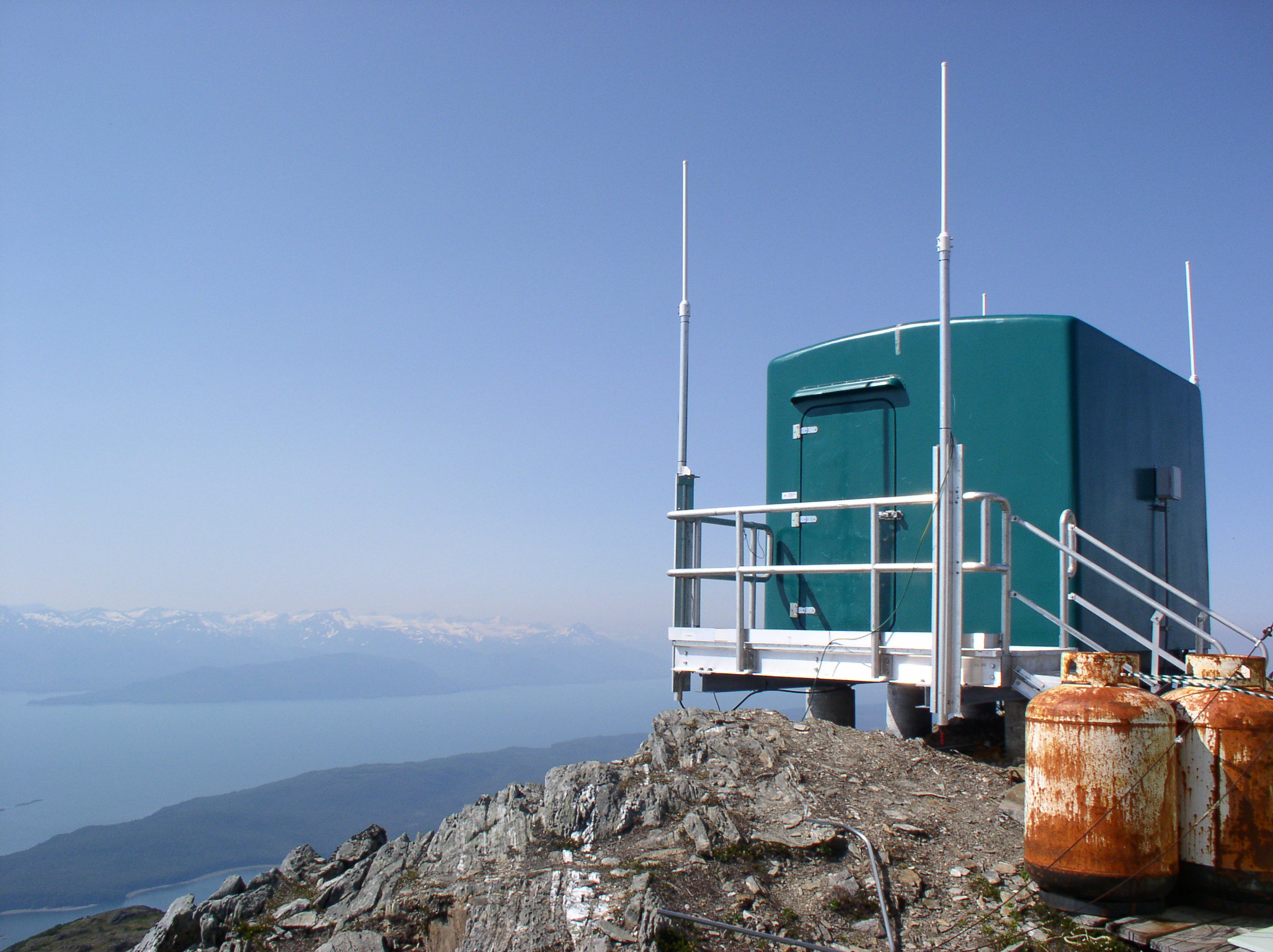
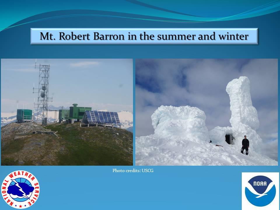
High above Funter Bay on Mt. Robert Barron is a government radio communication site. This unmanned facility rebroadcasts radio traffic for a variety of public and private users. Located at an elevation 3,475ft, the one-acre site is part of the Tongass National Forest and is operated under a lease agreement with the forest service.

OLYMPUS DIGITAL CAMERA

The site was built in the early 1970s as part of the National Distress System. This was designed to improve emergency radio coverage for coastal areas. The original 15ft tower was replaced around 2002 with a 50ft tower to allow more distance between antennas.

OLYMPUS DIGITAL CAMERA

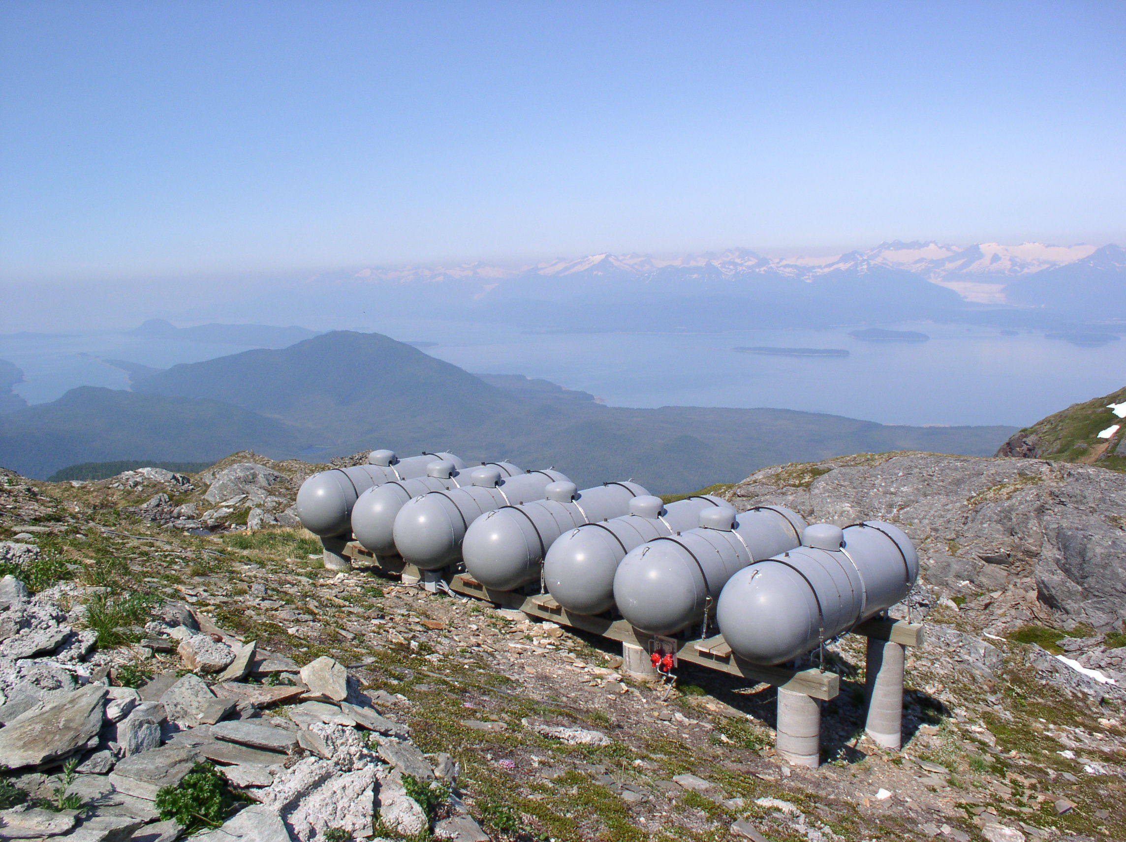
The tower is normally accessed by helicopter from Juneau. The site is powered by propane generators as well as a solar array. One report indicates that this site uses about 3,000 gallons of propane each year, while another states the same amount lasts about two years. A thesis study notes that the site used 11.12kWh/day and cost about $7,200/year in 2001.

OLYMPUS DIGITAL CAMERA

The weather at this site can be extreme, with ice and snow sometimes coating the towers and huts. While most of the radio antennas can transmit through the ice, any broken equipment or maintenance requires personnel to fly out and chop ice from the structures. The power system thesis notes that a wind turbine was installed at a similar site in 1999, but it was destroyed by winds in excess of 160mph.

Barron Ice
(US Coast Guard photo used as Public Domain)

Robert Barron Repeater
(US Coast Guard photo used as Public Domain)

Another photo of the site iced up in 2012 can be seen here. Some photos from 2009 are here.

A video of the site coated in ice in spring of 2013 is here. Another video of the site in ice-free condition from January 2014 is here.

Some more views from the summit:

IMG_1193 OLYMPUS DIGITAL CAMERA OLYMPUS DIGITAL CAMERA

There used to be a snow gauge installed lower on the mountain. This was a wooden structure with height markings, which could be read by passing aircraft or possibly by binoculars from the weather station at the cannery. The gauge has fallen apart, but a few wooden pieces with orange and black markings can be found.

OLYMPUS DIGITAL CAMERA

Radio services at the Mt. Robert Barron site include:

-NOAA Weather Radio channel 3. Callsign KZZ87 on 162.450mhz.

-Aeronautical Remote Communication Outlet (flight information repeater) on 121.1mhz

-Aeronautical Remote Comm Air/Ground (Flight Center repeater) on 133.9mhz

-Radio Comm Link Terminal (Aircraft Flight Data) on 941.825mhz (formerly 943.525).

-State of Alaska Public Safety Pool – KNIR245 on 155.415mhz

-Coast Guard marine VHF “High Level Site” (normally monitoring channel 16, also capable of channels 6, 12, 13, 21A, 22A, and 81A).

-Temsco Helicopter Service – WPKI643 on 151.775mhz

-Amatuer 2m repeater NL7B on 145.400mhz

-Forest Service / Fire – 171.575mhz

-City and Borough of Juneau – Microwave Industrial / Business Pool – 952.38125 Path Frequency.

Alaska Power & Telephone Microwave Industrial / Business Pool (the telephone system for many small communities). Various frequencies.

Several cellular and telecom companies currently hold or have held licenses involving Robert Baron Peak. There is not a cell tower here, but various companies use bandwidth on the microwave repeaters to hit other stations and cell towers around Southeast.

And finally, a very large panorama of Funter Bay from partway up the mountain, make sure to click it to get the full size!

??????????????????????


Funter Bay History: Population

February 14, 2014

In this edition of Funter Bay History, I’ve compiled some statistics and information regarding the population and economy of the area. Funter Bay has variously been described as a town, a village, a ghost town, or simply a location with a cannery and mines. Knowing some numbers and comparative sizes might help place things in context.

__________________________________

Firstly, some background information. Alaska’s modern community designations differ from many other states. There are several types of municipalities defined for legal and tax purposes, including “Home Rule Cities” and “General Law Cities”, of which there are either first or second class cities. There are also Home Rule and General Law Boroughs (a borough is equivalent to a lower-48 county). Alaska is also unique in having an “Unorganized Borough“, more than half of the state is simply not part of any municipal entity, and thus has no property tax, sales tax, or any services below the state level. Funter Bay has long been a part of the Unorganized Borough. Juneau occasionally attempts to annex Funter Bay, annexation has been fought off by local residents on the grounds that they would pay property tax but would not receive any city services.

Another tricky detail is that some households in Alaska are migratory or seasonal (both in and outside the state). Residency reporting is sometimes based on economic reasons (such as inclusion in a school district or eligibility for Permanent Fund Dividends), and not on a person or family’s most common physical location. A seasonal fishing community may wish to count summer fishermen as part of their population, while those fishermen may report a different place of residence on their taxes. Funter Bay has always had a larger population in the summer, be it Tlingit fish camp residents, cannery workers, seasonal fishermen, or vacationing cabin owners.

Keeping in mind that these numbers may be “fuzzy”, here is some comparison data from the 2010 census. Partly from this document.

Bettles, the smallest “Second Class City”, has a reported population of 12.

Pelican, the smallest “First Class City” has a reported population of 88.

Nenana, the smallest “Home Rule City” has a reported population of 378.

The total population of Alaska in 2010 was 710,231. The three largest cities are Anchorage (291,826), Fairbanks (31,535), and Juneau (31,275). They quickly get a lot smaller.

There are also “Census-Designated Places”, along the lines of an unincorporated town in the Lower 48. These communities may have some public facilities, and communities with more than 25 residents receive some state money for utilities and infrastructure. The population may live in a discrete area or be spread out around some center such as a post office or store. Some examples close to Funter Bay are:

Elfin Cove – reported population of  20 in 2010. (This is generally considered a “town” by most locals and population swells to 100+ in the summer). In 1939 Elfin Cove had about 65 residents and was referred to as a “village”.

Excursion Inlet – reported population of 12 in 2010.

Whitestone Logging Camp – reported population of 17 in 2010

__________________________________

Now, on to the numbers for Funter Bay:

The 1890 census listed 25 residents at Funter:1890 Census

A 1903 congressional convention in Juneau solicited delegates from around the state based on population. Funter Bay sent one delegate, the same number as Hoonah, Angoon, and Petersburg. Sitka sent 3, Fairbanks had 4, Juneau itself had 10.

Summer population varied based on the number of workers brought in by the cannery. A 1904 article mentions “30 odd” Chinese employees traveling to Funter Bay to work at the cannery that season (“Chinese for Funter Bay”, Daily Alaska Dispatch (Juneau) 2 May 1904) A 1906 brief in the Dispatch mentions a can-making crew of 73 Chinese workers enroute to Funter Bay. In 1910 the Dispatch reported 84 Chinese workers.

A 1905 article reported an “Indian Village of 400” at Funter Bay, with around 60 native employees working at the cannery. This “village” (also described here) was likely a summer fish camp for Tlingit natives. Some documents refer to it as housing for cannery employees. Various histories report that Funter was used for seasonal subsistence, but was not a permanent village site. Other reports indicate that the “village” or camp site moved around the bay as various white settlers or industries  interacted or interfered with it.  An interview with Elder Dave Wallace stated that there was no village at Funter Bay, but it was a good place for king salmon and berries. It was claimed by the Wooshkeetaan clan, part of the Auk Kwáan, and was called Shakananaxwk’.

Some Tlingit employees at the cannery in 1908 (more here):

TP Co Workers 1908 2

The 1910 US Census shows 70 people at Funter Bay. It was conducted in May when the cannery’s seasonal labor force was on hand. A few people are listed as independent fishermen. The microfilm quality is unfortunately quite poor, so not much else can be determined from it.

In 1912, merchandise valued at $78,933 was shipped to Funter Bay. (Per Alaska 1912 Commerce report, Daily Alaska Dispatch, 1 Feb 1913)

In 1916, the value of merchandise shipped to Funter Bay was $128,471 (Per “Report of Collector of Customs” Daily Alaska Dispatch (Juneau) 18 Feb 1917).

In 1918, the merchandise shipped to Funter totaled $267,697 (DA Dispatch 4 Feb 1919)

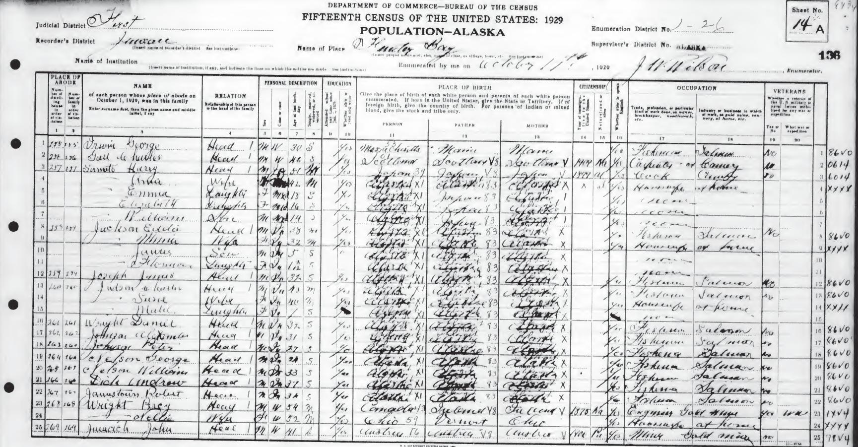
The Census of Oct 11, 1929 found 50 people at Funter Bay. The handwritten notes are somewhat hard to read, but show that approximately 12 residents were fishermen, 11 were miners, one was a logger, one was a mining engineer, and one was a bookkeeper at a mine. The cannery’s seasonal workforce had left for the winter, leaving a cashier at the store, as well as the cook and his family. About 9 women are listed with the occupation “Housewife”, and about 7 children are listed.
1929 Census records for Funter Bay ( 2 pages):
1929 Census Pg 1           1929 Census Pg 2

By 1939, Funter Bay was not being counted as a separate location, but was lumped into the Juneau census area (and later, the rather oddly-drawn Skagway-Angoon-Tenakee census area). The 1940 census reported 98 residents on “Admiralty Islands”, excluding Angoon and Killisnoo, but possibly including Tyee, Gambier Bay, Hawk Inlet, and other canneries.

The following 1939 Census records seem to be noted “Funter Bay” on the extreme left, and includes 14 people:

1940

In 1979, Funter Bay reportedly had a year-round population of 14, and a seasonal population of 25.

By the late 1990s the population hovered around 10 year-round residents. (I recall a census taker in 1990 being dropped off by plane and planning to walk around the entire bay, unaware that 90% of the visible cabins were vacant and that the trails shown on maps were no longer passable).

So, depending on the accuracy and reliability of the reporting agencies, Funter Bay has historically had a summer high of between 100-500 residents, and a high winter population of around 50. It has never been a bustling metropolis, but was certainly on a par and occasionally rivaled other established Alaskan communities.


Blast(s) from the past!

February 7, 2014

No, it’s not more Funter Bay History this time, just some local website archeology! I dug up a few horrifying old versions of this very website, from back when I actually pretended to know what HTML was for and didn’t just coast on WordPress! (I totally recommend WordPress to everyone now, it is way easier!)

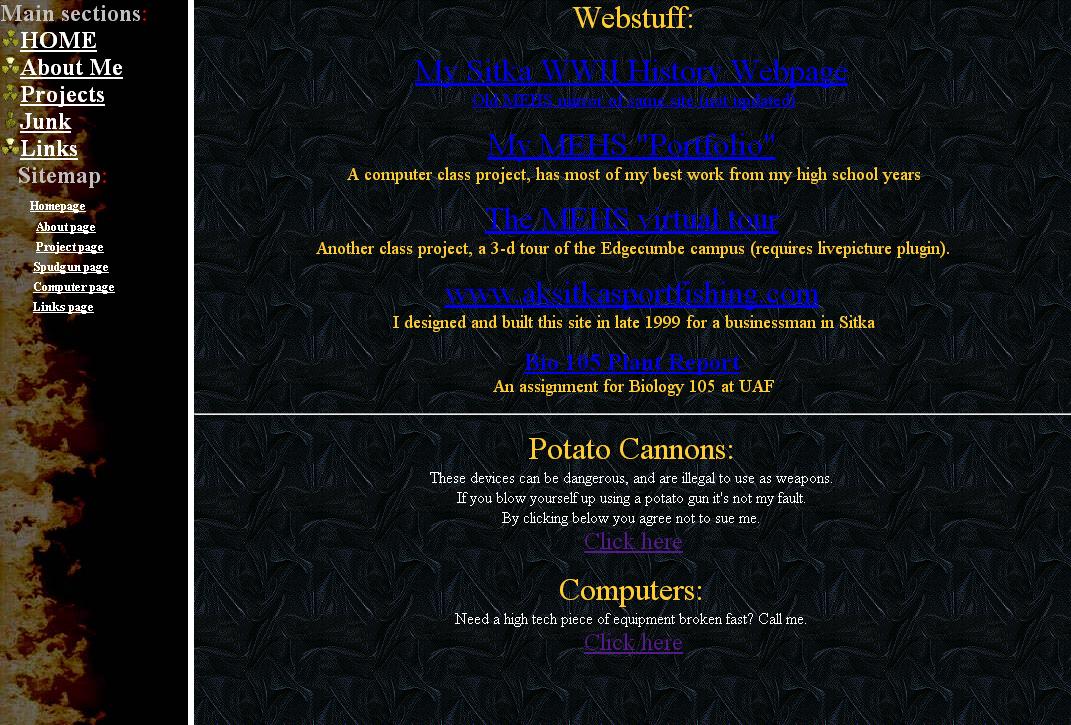
First off, a proto-website, from the murky days of High School.

v0


Those were the days when teachers encouraged you to share far too much personal data! “Hey teenagers, why not put everything about yourselves online! Throw your home address and phone number on there! Why not some high school transcripts? How about your birth certificate, mother’s maiden name, SSN, and blood type? It’s The Wonderful Internet, the more you share the better you’ll network and get jobs and no one would ever misuse such information!”. Even today people are shocked about how much I share about myself online (or at least, they’re shocked that I do it on an old fashioned website and not more quickly and efficiently with Facebook!)

The proto-website “portfolio” never made it onto saveitforparts.com, although I did have it linked until my high school eventually dumped that server in an old WWII hangar like they usually did with old tech (100% true).

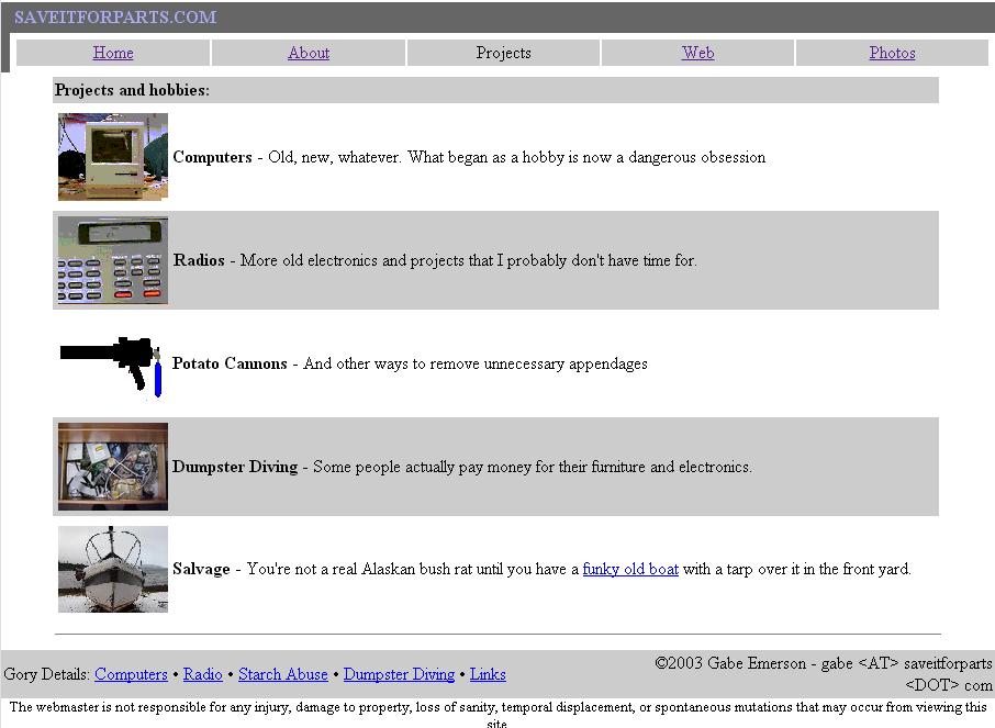
Saveitforparts.com in early 2000 (Oh noes the frames and the animated GIFs they BURN MY EYES!)

v1

It got better pretty quickly, although by late 2000 it kind of looked like a website designed inside a comic book…

v2

By 2003 I seem to have gone with a more toned-down theme:

v3


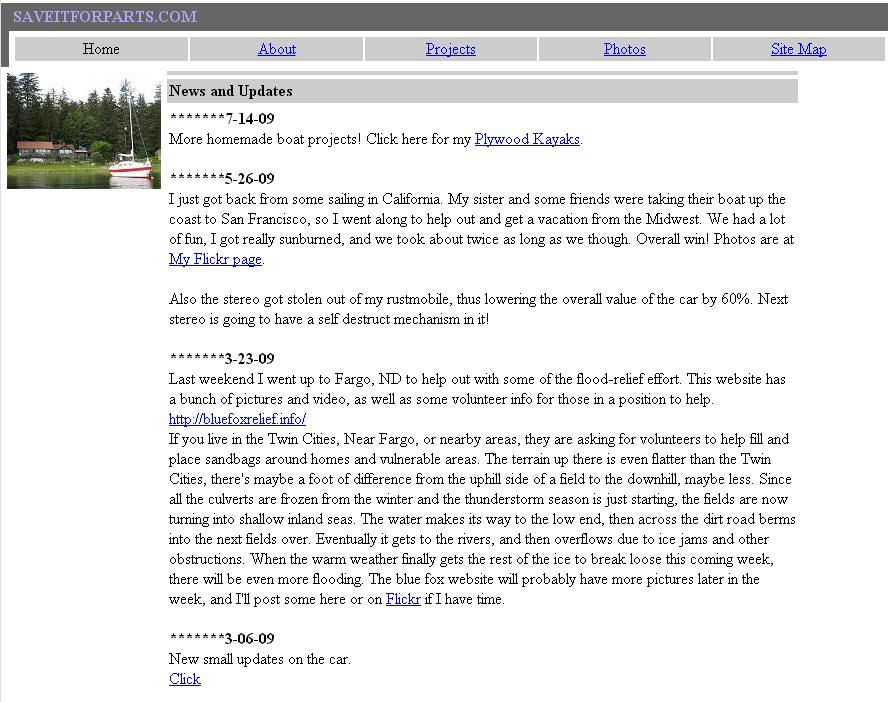
This look remained into at least 2009, by which time I was only a decade or so behind in moving towards this newfangled blogging style thingy.

v4


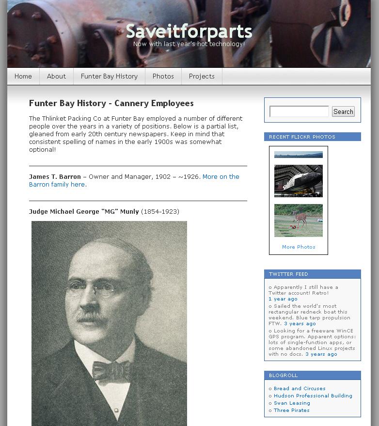
And um… here’s some recursion into the current look so that I can come back to this post in another 14 years and say “Oh noes look at these awful templates and headers! This shouldn’t be on the NeoInterTubes! How could I have been so foolish to share photos of myself and enable identity theft cloning!”

v5


What brings you here?

February 5, 2014

It’s always interesting to look at the search terms that bring someone to a site. For my website I often assume that most of my visitors are friends and family, with maybe a few hobbyists drawn by my projects or research. It turns out there’s a wide range of searches that lead people to saveitforparts.com! Here are a few interesting ones (per my stats page).

“redneck sailboat” (71 visitors)

“free kayak plans plywood” (lots of visitors from variants of this, maybe I should put some actual plans online!)

“bayliner buccaneer 240” (again, lots of traffic from variants, hopefully Pagoo is interesting/useful to these people!)

“rusty 1994 honda accord” / “worlds crappiest car”

“airboat with wheels” (and variants on the small airboat theme)

“dont do drugs” (I have no idea what page matched this, but 6 people got here with this search!)

“messy basement” and “messy garage” (Thanks, Internet. Now I have to clean my place:-P)

“redneck raft”

“is course hero worth it” (No)

“how to steal notes from coursehero” (just Google it, that’s all they do to get content in the first place)

“umn advanced gis geog 5563” (see, this guy knows how to cheat without paying a fee for it!)

“design to withstand mine subsidence” (Your design would have to withstand falling into a massive pit, can your house fly? I would suggest getting a map of your local mines and not building over one. For the price of a custom design you could probably pay for some ground penetrating radar or exploratory drilling on your property instead)

“fishing jokes” (yeah, I have exactly one so far :-P)

“define:rustmobile” (OK)

“potato gun plans” (and some variants, I’m glad the spud guns are at least kinda popular)

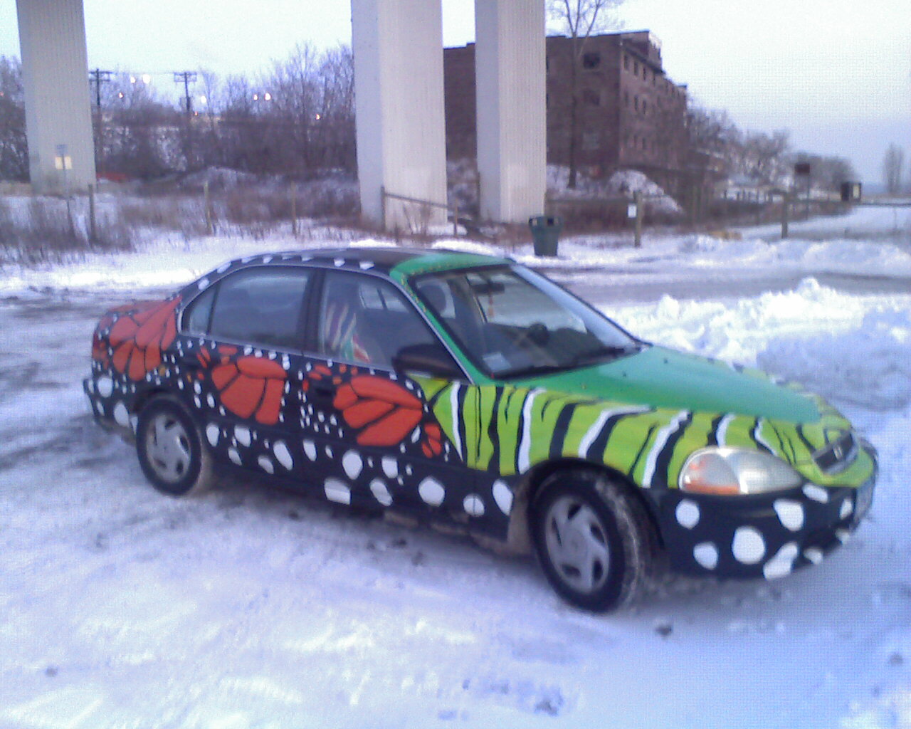
“monarchmobile” (not mine, but I still see it around town sometimes, I passed it on I-94 the other day).

“redneck casemods” (the redneck theme keeps showing up 🙂 )

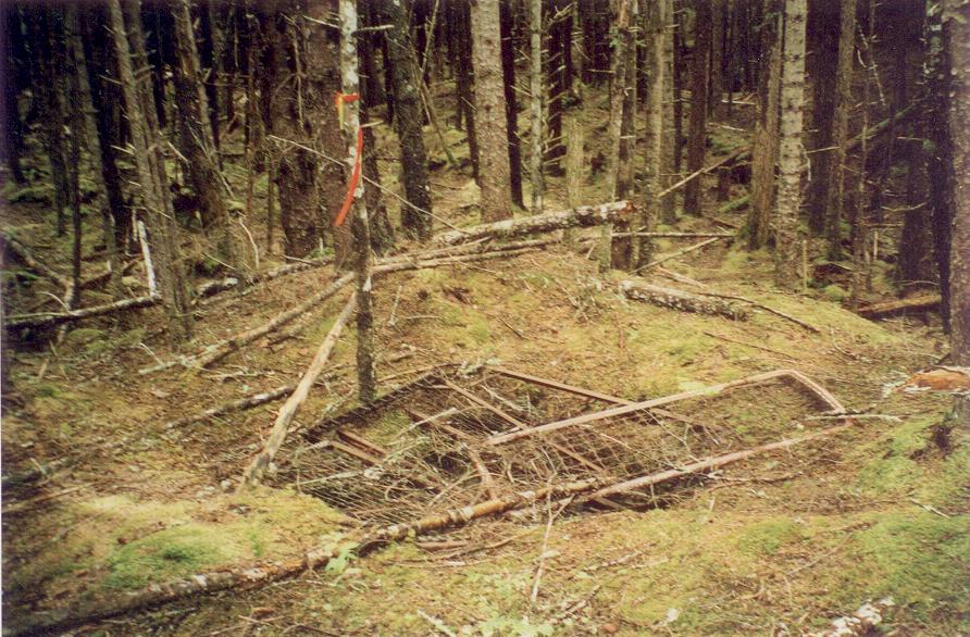
“how are mine shafts filled in” (sometimes with bed springs)

“platja des caragol” (apparently this means “Beach from Snail” in Catalan? Somehow 3 people found my site from this…)

“does a cat like to swim” (sometimes, but experiments are not advisable)


Funter Bay History: Cannery in 1929

January 14, 2014

I recently received an oblique aerial photo from August of 1929, showing the Funter Bay cannery. This is part of a set of Navy survey photos of Alaska. A few other photos from this survey are online, and I hope to find more in archival collections.

(Very large original, click to view full size)1929 Aerial FS T12a

At the time this was taken, the cannery was owned by Sunny Point Packing, and would operate for several more years before ending the main canning operation.

A few things are notable in the photo. The China Bunkhouse is only a foundation to the right of the Filipino Bunkhouse. Both “Oriental Bunkhouses” reportedly burned in 1929, so the Filipino Bunkhouse seen above is probably newly-rebuilt, with the China Bunkhouse in the process of rebuilding. Another notable feature is the long wharf and dolphins extending from the left side of the point. I had not been aware of this wharf’s existence before seeing the  photo. My best guess is it was a fuel delivery wharf serving the bulk oil tank on the point. It would make sense to keep the oil handling facility separate from the fish handling dock. Yet another interesting feature are the two radio masts to the left and behind the Superintendent’s house. These would have supported a dipole wire antenna similar to the type shown here. I am not sure what kind of radio was in use at the time, the 1920s saw the beginning of “High Frequency) (3-30mhz) and voice technology, supplementing low frequency and morse code stations. Some photos and information on a cannery radio operator from Yakutat from around the same time period can be found here. The antenna masts were likely multi-step poles made by lashing logs together, in the same manner as a wooden ship’s mast. This allowed them to reach higher than the surrounding trees.

I’ve zoomed in on the main cannery property and labeled some of the structures below. (The 1960s survey map was helpful with this).

1929 Aerial labeled

And for comparison, I’ve also included an aerial photo from a similar angle, taken in 2008. This is from a modern Alaska-wide aerial surveying project called Alaska Shorezone, a GIS mapping and aerial imagery project covering most of the coast (most photos in that set were taken at low tide, the 1929 image shows a higher tide).

2008 Aerial
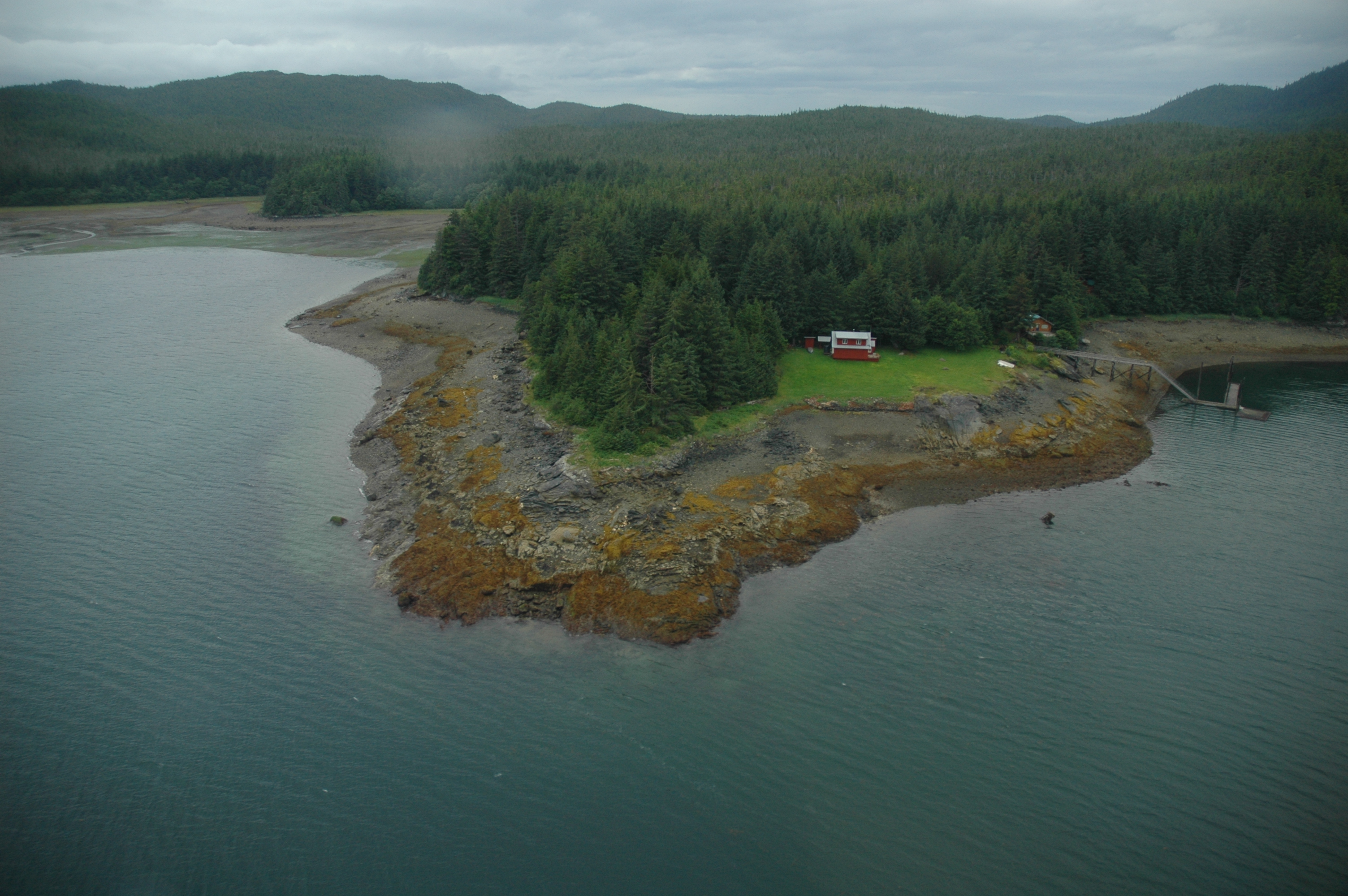
The red house is a modern private residence, located approximately where the power plant stood. The green-roofed house is approximately where the mess hall stood. The only visible remains of the cannery in this photo are the floating dock and approach ramp (which have been updated and had sections replaced since 1929). The regrowth of spruce trees has obscured most of the formerly cleared land at the site.

I am very grateful to Mark Riley, Remote Sensing Coordinator for the Forest Service’s Alaska region, for tracking this down for me! I also received assistance from Shawn Younger, president of the WWII Archives Foundation, with another such photo. I may write about that one later.


Funter Bay History: Water & Hydropower Part II

December 22, 2013

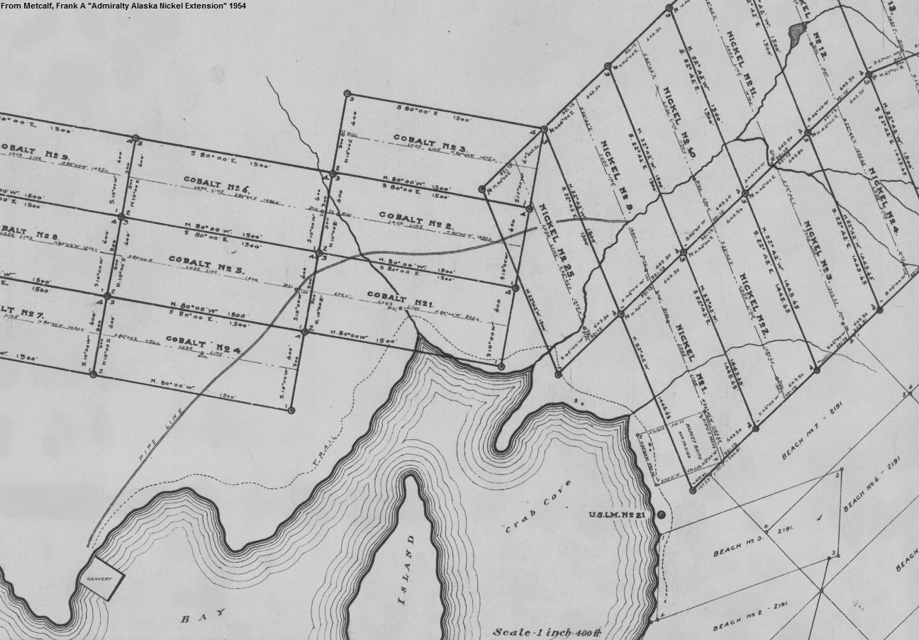
After previously writing about local water use for industry and power generation at Funter Bay, I came across a few more maps of such projects. The first, below, shows the pipeline from the Thlinket Packing Co cannery to “Nimrod Creek”, near “Pipeline Meadow” (local names). This creek is one of the larger and more reliable water sources convenient to the cannery. The grid lines on the map are old mining claims which have since lapsed. The small pond at the upper right is from a long-existing beaver dam which can still be found today.

pipeline

The Lake Kathleen project was a 1931 proposal to construct a hydroelectric station, fed by water from a tunnel. Power would be used at Funter Bay for an electric smelter.

kathleen

Electricity would have been transmitted to Funter Bay over lines strung along the beach for approximately 30 miles. The power line itself was considered relatively trivial once the necessary permits were acquired to use Tongass National Forest land and the tunnel had been dug. The major choke point would have been the crossing of Hawk Inlet, but this was planned to use a sandbar to build poles partway across the water.

kathleen2

The high flow and storage capacity available at Lake Kathleen outweighed the inconvenience of distance. Precedents for such a project included the Chichagof Mine at Klag Bay, as well as various other power projects around Southeast Alaska. Today many communities in Southeast Alaska rely on distant hydroelectric stations. Ultimately the Lake Kathleen project never materialized, either due to a lack of funding or other issues. Today the Greens Creek mine is located at Hawk Inlet much closer to this lake, but uses an underwater power cable from Juneau instead of local sources. Meanwhile, the Lake Kathleen area has been clearcut from the Cube Cove logging camp.

When large single sources of water were not available or practical to tap, another trick was to connect multiple sources with a lateral ditch. This technique was widely used throughout Alaska, from Nome to Fairbanks to Juneau. Engineers would pick an elevation contour and build a ditch at that level, exactly following the horizontal bends of the hillside while maintaining a slight vertical drop to keep the water flowing. Streams along the route were intercepted and diverted into the ditch, which eventually dumped their combined flow into a pipeline or another (previously smaller) stream where the water was needed. At Funter Bay, ditches and streams were sometimes daisy-chained, with one stream diverted to another, then that (now combined) stream diverted again farther down its course. This took advantage of different optimal contours for each leg.

Ditches were relatively cheap to dig, but had the disadvantage of needing constant maintenance. They were eroded by use, damaged by ice, blocked by fallen trees, and tended to fill in with silt, leaves, and other debris.

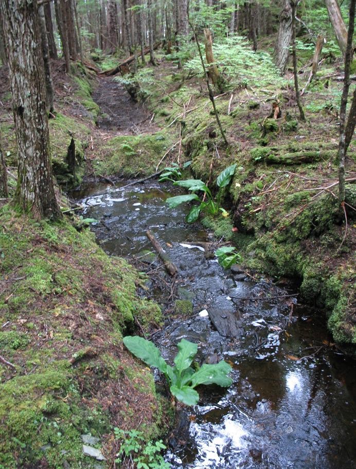
An abandoned ditch at Funter Bay, the water has found or made an easier path to the left, with the dry section beyond slowly filling in with organic debris:

ditch2


Alaskan Mine Names

December 12, 2013

I recently came across a large collection of mine names in Alaska. Names containing “Treasure”, “Rich”, “Jumbo”, “Bonanza”, etc are quite popular as a way to entice investors, but here are a few less enticing and perhaps more descriptive mine names!

Bum Cat
Horrible
Waterhole
Holy Moses
Wrongtrail
Troublesome Creek
Wicked Witch
Crazy Mountain
Pipedream
Singin’ Sam’s Rainbow Mine
Problem Gulch
Poor Chance
Slug Gulch
Whistlepig
Chickenlicken
Pooped
The Smell
Moonshine
Whiskey Creek
Smuggler’s Cover
Agony #1 & 2
Aching Back
Bruiser

And of course, a few named after wives, girlfriends, or perhaps local ladies of negotiable affection:

Lucky Lou
Clara Bea
Fanny Gulch
Nancy’s Hope Chest
Pricilla’s Delight
Darling Creek
Sweetheart Ridge
Little Sue
Lucky Nell
Lucky Lady
Maid of Mexico
Busty Belle
Double D Mining Co


Funter Bay History: Aircraft Mishaps

November 22, 2013

While Southeast Alaskan aviation is generally safe and efficient, the sheer number of planes in the area means there are the occasional accidents. Local preference for paint schemes on aircraft runs towards bright colors “so the search party can find it”. (Bright bottom paint is also popular on boats, so you can be found in case you wind up capsized).

Here is a crashed plane that I visited when I was 5 (I’m in the little blue suit!) The damage looks severe, but everyone walked away. This is a Cessna 206 which was bringing a party of hunters back to Juneau, the pieces were later pulled out by a helicopter.

young-2 young-3

Below are a few more aircraft incidents from the Funter Bay area that I was able to compile from public data:

10/4/1979: An aircraft was reported “spiraling down” in the vicinity of Funter Bay, spotted by the fishing vessel Carol Ann. The Coast Guard and State Police located the crash and recovered three bodies. (Daily Sitka Sentinel)

4/29/1985: Piper 32-300 belonging to LAB became trapped between two snow showers, made emergency landing in Funter Pass. Plane damaged but no injuries: http://aircrashed.com/accident/SEA85LA099.shtml

10/29/1985: Amphibious Cessna 206 crashed at Funter Bay. Wheels failed to retract and plane nosed over during water landing. http://aircrashed.com/accident/SEA86LA019.shtml

11/30/1987: Cessna 206 belonging to Channel Flying took off with tailwind and was pushed into trees by downdraft. No injuries (this is the one I have pictures of).

5/25/1992: Piper 32-300 (Air Excursions of Gustavus) clipped a tree in the Funter pass. Was able to land at Juneau:  http://aircrashed.com/aircraft/aANC92LA079.shtml

8/6/1992: Cessna 207 operated by Alaska Juneau Aeronautics crashed in Funter Pass. Pilot turned to avoid cloud and hit mountain. 2 serious injuries.

2/28/2007: Cessna 207 operated by Wings of Alaska made an emergency landing on a beach at Funter after having engine trouble. The plane ran off the beach and sank, but the pilot and passengers were uninjured. An article and photo are here: http://www.kinyradio.com/juneaunews/archives/week_of_02-28-00/juneau_news_02-28-00.html